webshop.nl
Categorieën
  Sluiten

Meer Hema Maps
Meer Hema Maps in Literatuur boeken

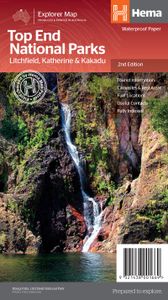
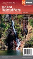
Wegenkaart - landkaart Explorer Map Top End National Parks Kakadu, Lit

0
Mooie, duidelijke kaart van een aantal prachtige natuurparken in het Noorden van Australië. A regional map that features Litchfield (1:160,000), Katherine Gorge and Kakadu (1:350,000) national parks. A Darwin region map is included (1:850,000) along with extensive tourist information for Darwin and the surrounding region, Arnhem Highway to Kakadu, ...

Webshops met dit product

Webshop
Bezorging
Prijs

Anderen bekeken ook

Wegenkaart - landkaart Explorer Map Top End National Parks Kakadu, Lit
Mooie, duidelijke kaart van een aantal prachtige natuurparken in het Noorden van Australië. A regional map that features Litchfield (1:160,000), Katherine Gorge and Kakadu (1:350,000) national parks. A Darwin region map is included (1:850,000) along with extensive tourist information for Darwin and the surrounding region, Arnhem Highway to Kakadu, Mary River, Stuart Highway to Katherine, Litchfield National Park, Katherine Gorge (Nitmiluk) National Park and Kakadu National Park. Also included are national park facility listings in addition to contact details for accommodation and visitor centres in the region.       Key Features  National Parks facility listing Popular tourist routes Campsites & rest areas Tourist information  Key Specifications Edition: 2nd   Publication Date: 01/11/14   Scale: 1:850,000 & 1:160,000   Folded size (WxHxD): 140mm x 250mm x 3mm   Flat size (WxH): 700mm x 1000mm   Weight: 0.09kgs
15,95
Wegenkaart - landkaart Iconic Map Top End and Gulf | Hema Maps
This regional waterproof map of the Top End and Gulf is ideal for discovering the northern parts of Australia's NT by 4WD. It includes a main map of the Darwin region, Judbarra / Gregory National Park, Nhulunbuy, Keep River National Park and Boodjamulla (Lawn Hill) National Park.   There is additional tourist information for Arnhem Land, the Roper River trek, Darwin region, Douglas-Daly district, Nature’s Way, Victoria Highway, Katherine Region and the Stuart Highway Region.   PRODUCT FEATURES   GPS surveyed roads and tracks Fuel stops Self-drive 4WD tracks Camping areas Historic sites Detailed National Park inset maps WHAT'S NEW IN THIS EDITION:   New edition, new layout New cartographic map specifications All inset maps are now provided in a better scale
15,95
Natuurgids Birds and Animals of Australia's Top End | Princeton Univer
One of the most amazing and accessible wildlife-watching destinations on earth, the "Top End" of Australia's Northern Territory is home to incredible birds and animals—from gaudy Red-collared Lorikeets to sinister Estuarine Crocodiles and raucous Black Flying-foxes. With this lavishly illustrated photographic field guide, you will be able to identify the most common creatures and learn about their fascinating biology—from how Agile Wallaby mothers can pause their pregnancies to why Giant Frogs spend half the year buried underground in waterproof cocoons. The Top End stretches from the tropical city of Darwin in the north, to the savannas of Mataranka in the south, and southwest across the vast Victoria River escarpments to the Western Australian border. The region includes some of Australia's most popular and impressive tourist destinations, such as Kakadu, Litchfield, Nitmiluk, and Gregory national parks, and is visited by more than two hundred thousand tourists every year. An essen…
34,95
Wegenkaart - landkaart Explorer Map Mid West Western Australia - West
Mapping of Mid West Western Australia that has camping areas, national parks, fuel supplies and facility symbols marked on the map. On the reverse is region-specific touring information for Wildflower country, Goldfields, Batavia Coast, Geraldton to Kalbarri, Gascoyne and the Outback Coast, Carnarvon and the Blowhole Coast as well as the Great Eastern Highway, with detailed inset maps for Cape Range National Park, Kalbarri National Park, Francois Peron National Park, Kennedy Range National Park and Mount Augustus National Park also included.    Also featured are the Top 10 4WD Tracks, which include the Holland Track, Cave Hill Circuit, Jaurdi Station, Mount Elvire, Mundaring Powerlines Track, Stockyard Gully & Leseur National Park, Greenough River, Steep Point, Peron Peninsula and Kennedy Range National Park. Each track has a grading, map reference, permits and fees, distances, contact details, things to do and warnings.   Top 10 4WD Tracks Inset maps National parks Camping areas Fuel …
13,95
Wegenkaart - landkaart Explorer Map Outback New South Wales Map | Hema
A regional map of outback NSW (1:1,100,000) that ranges from Tamworth in the east to Broken Hill in the west, as well as from Wagga Wagga in the south to past the Queensland border in the north. On the opposite side is extensive information on numerous regions, including visitor, historical and background information. Covered regions include the Broken Hill region, Corner Country, east of Tibooburra, the White Cliffs region, Cobar and surrounds, around Back o'Bourke, Lightning ridge and surrounds, Wentworth region, Balranald, Griffith region, Dubbo and surrounds, Kinchega National Park, Mungo National Park, Sturt National Park and Mutawintji National Park.   Key Features Detailed National Park Maps Tourist information Camping areas Points of interest Folded size (WxHxD): 140mm x 250mm x 3mm   Flat size (WxH): 700mm x 1000mm
15,95
Wegenkaart - landkaart State Guide Map Oregon | National Geographic
Makkelijk leesbare kaart aan 2 zijden bedrukt. De ene kan met informatie en beperkte stadsplattegronden, de andere met de daadwerkelijke kaart. De kaart is geplastificeerd en dus watervast! The front side features an inset of Eugene. The back includes maps and information for Portland and Salem, information for Crater Lake National Park, points of interest, scenic drives, and National Park Service sites in Oregon. National Geographic Guide Maps combine the most reliable road maps available with detailed travel guide information. One side features a detailed state highway map, enhanced with terrain detail and major city insets. The flip side presents tourist, historic, and recreation information, along with color photos, maps, and illustrations. All this folds into a convenient, durable, laminated map perfect for either vacation or business travel.
12,95

Klanten-reviews van Wegenkaart - landkaart Explorer Map Top End National Parks Kakadu, Lit

Er zijn nog geen beoordelingen voor dit productBen jij de eerste die een review plaatst?

Meer over Wegenkaart - landkaart Explorer Map Top End National Parks Kakadu, Lit

Productomschrijving

Mooie, duidelijke kaart van een aantal prachtige natuurparken in het Noorden van Australië. A regional map that features Litchfield (1:160,000), Katherine Gorge and Kakadu (1:350,000) national parks. A Darwin region map is included (1:850,000) along with extensive tourist information for Darwin and the surrounding region, Arnhem Highway to Kakadu, Mary River, Stuart Highway to Katherine, Litchfield National Park, Katherine Gorge (Nitmiluk) National Park and Kakadu National Park. Also included are national park facility listings in addition to contact details for accommodation and visitor centres in the region.       Key Features  National Parks facility listing Popular tourist routes Campsites & rest areas Tourist information  Key Specifications Edition: 2nd   Publication Date: 01/11/14   Scale: 1:850,000 & 1:160,000   Folded size (WxHxD): 140mm x 250mm x 3mm   Flat size (WxH): 700mm x 1000mm   Weight: 0.09kgs

Productspecificaties

Artikelnummer(s)
Brand
Hema Maps

Verken gerelateerde categorieën

Webshop.nl maakt gebruik van cookies. Ga je verder op onze website, ga dan akkoord met het plaatsen van cookies en de verwerking van deze data door ons en vermelde partners.