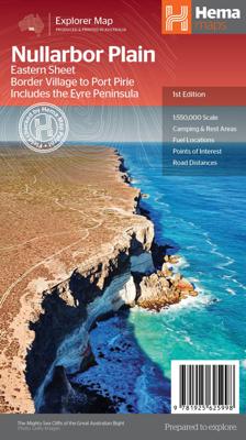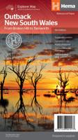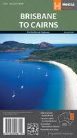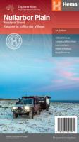
Wegenkaart - landkaart Explorer Map Nullarbor Plain - Eastern Map | Hema Maps

0
This map is part of Hema's new Nullarbor Plain Map Series (East and West) and covers Border Village to Port Pirie including the Eyre Peninsula.    Truly one of the worlds great adventure drives, Australia's semi-arid Nullarbor Plain stretches some 1,256 kilometres (781 miles) via the Eyre Highway and links the cities of Adelaide and Perth (or vice...

Verkopers met dit product

Verkoper
Bezorging
Prijs
DeZwerver.nl logo
DeZwerver.nl
2,95
17,50

Anderen bekeken ook

Nieuw
Wegenkaart - landkaart Explorer Map Nullarbor Plain - Western Map | Hema Maps
This map is part of Hema's new Nullarbor Plain Map Series and covers the area from Kalgoorlie to Border Village and its surrounds.   Truly one of the worlds great adventure drives, Australia's semi-arid Nullarbor Plain stretches some 1,256 kilometres (781 miles) via the Eyre Highway and links the cities of Adelaide and Perth (or vice versa depending on your direction). The length of this journey is so large we needed to stretch it over two maps; East from Port Pirie to Border Village in South Australia and the Western sheet from Border Village to Kalgoorlie.    While all the key sites and facilities along the Eyre Highway are listed this map allows you to broaden your horizon and consider some of the other attractions off the Highway, including; the various Nullarbor caves, iconic beaches across the Great Australian Bight and thousands of kilometres of 4WD tracks (including Old Coach Road (by permit)), all field-checked by the Hema Map Patrol for superior accuracy.   This map combines…
17,50
Nieuw
Wegenkaart - landkaart Great Desert Tracks 4 Map Pack | Hema Maps
Hema’s Great Desert Tracks Map Pack The Great Desert Tracks Map Pack presents Hema's iconic Great Desert Tracks series in a soft and durable map wallet. Explore the arid centre with these comprehensive maps that traverse Australia's desert regions — each map waterproof, tear proof and field-checked by the Hema Map Patrol to ensure the accuracy and detail necessary for desert travel. With complete coverage of the outback region of Australia's centre, the Great Desert Tracks Map Pack is the perfect navigation guide for every desert track and journey throughout Australia.   Included in each map pack:   • Great Desert Tracks Central Sheet     • Great Desert Tracks Eastern Sheet     • Great Desert Tracks Western Sheet     • Great Desert Tracks Simpson Desert     • Map Wallet     Great Desert Tracks Eastern Sheet: Oodnadatta Track, Birdsville Track, Simpson Desert, Strzelecki Track, Corner Country, Broken Hill, Lake Eyre, Plenty Highway, Sandover Highway, Channel Country, Hay …
59,95
Wegenkaart - landkaart Explorer Map North Queensland | Hema Maps
Detailkaart van een deel van Australië. Zeer goed leesbaar, met naast de topografische details veel symbolen waarmee allerhande toeristische zaken worden aangeduid als campsites, nationale parken, attracties, wandelmogelijkheden etc. Covering Australia's beautiful North Queensland. There is alot of town map insets, tourist information, and photographs on the reverse side Touring map of the northern half of Queensland, with enlargements of popular areas, street plans, lists of facilities, etc. The main map extends south to well beyond the Flinders Highway between Townsville and Mount Isa, including Mackay on the coast. The map shows the road network, including minor roads and unsurfaced tracks, plus railways and local airfields/aerodromes. Designated Tourist Routes are highlighted and symbols mark places of interest (many annotated with brief description), historical sites, tourist resorts, youth hostels, etc. Topography is indicated by names of mountain ranges and peaks, as well as by…
17,50
Nieuw
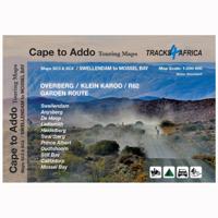
Wegenkaart - landkaart SC3-SC4 Swellendam to Mossel Bay | Tracks4Africa
The Cape to Addo map series covers the southern parts of the Western Cape of South Africa in a series of eight highly detailed maps, printed on four sheets of A1 durable paper.   We start in Cape Town in the west and move along the southern coast through the Overberg, Winelands, Garden Route, Klein Karoo R62, Baviaanskloof to eventually arrive in the Addo National Park up to Gqeberha (Port Elizabeth) in the east.   The maps are highly detailed and well researched. Our map scale is 1:200 000 which allows us to show a lot of detail including minor gravel roads, hiking trails, farm boundaries and points of interest which are relevant to self-drive tourists.   The size of the paper is kept small enough to allow this to be the perfect road tripping map. We use Duraflex paper and print two maps per sheet of A1 paper, making this a four-sheet series. Each map sheet is individually packed in a plastic protective sleeve.   The maps are perfect for day drives, overlanding or just doing road tri…
29,95
Nieuw
Wegenkaart - landkaart 04 Icefields Parkway | Gem Trek Maps
Whether you have a day or a week to spend exploring the sights along the spectacular Icefields Parkway highway, Gem Trek's ICEFIELDS PAKRWAY MAP, a combination map and guide, will help you make the most of your time. Like our much-loved hiking maps, our Icefields Parkway map features detailed cartography and is printed on waterproof and tear-resistant paper.   The Icefields Parkway Map shows all viewpoints, picnic areas, trailheads, campgrounds, hostels, lodges and other services along the Icefields Parkway, while the descriptions in the guide point you to the best of these - the best viewpoints of mountains and lakes, the most interesting points of interest and exhibits, and the best bets for spotting wildlife such as moose, bighorn sheep and mountain goats.   Also included are short descriptions of the ten best walks and day hikes along the Icefields Parkway—from the short stroll to Peyto Lake Viewpoint to the rewarding hike through alpine meadows to Helen Lake.   To make it easier …
13,95
Nieuw
Wandelkaart - Fietskaart - Wegenkaart - landkaart 450 Eastern Crete - Kreta Oost | Terrain maps
Gedetailleerde wegenkaart en wandelkaart met alle kleine wegen, wandelpaden, hoogtelijnen en toeristische informatie aangegeven. Alle tekst is tweetalig in Engels en Grieks en de waterproof kaart is geschikt voor gebruik met GPS. Terrain’s map of Eastern Crete provides travelers with everything they need:  Scale of 100.000, which attributes all the information with clarity and in detail.  Map data processed within a GIS environment, resulting in great accuracy.  Double coordinate system, WGS 84 and ΕΓΣΑ 87, completely compatible with GPS.  It is printed on Polyart material, making it totally waterproof and rip-proof. You can fold it and unfold it a hundred times, fold it in irregular ways, dunk it in the sea or leave it out in the rain. This map is indestructible!  Clear symbols, easily readable fonts, rich colors and excellent arrangement of every element make the map extremely friendly to the user.  Unique wealth of information. Every village, every road (including their dista…
12,50
Nieuw
Wegenkaart - landkaart Iconic Map Top End and Gulf | Hema Maps
This regional waterproof map of the Top End and Gulf is ideal for discovering the northern parts of Australia's NT by 4WD. It includes a main map of the Darwin region, Judbarra / Gregory National Park, Nhulunbuy, Keep River National Park and Boodjamulla (Lawn Hill) National Park.   There is additional tourist information for Arnhem Land, the Roper River trek, Darwin region, Douglas-Daly district, Nature’s Way, Victoria Highway, Katherine Region and the Stuart Highway Region.   PRODUCT FEATURES   GPS surveyed roads and tracks Fuel stops Self-drive 4WD tracks Camping areas Historic sites Detailed National Park inset maps WHAT'S NEW IN THIS EDITION:   New edition, new layout New cartographic map specifications All inset maps are now provided in a better scale
17,50
Nieuw
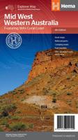
Wegenkaart - landkaart Explorer Map Mid West Western Australia - West Australië | Hema Maps
Mapping of Mid West Western Australia that has camping areas, national parks, fuel supplies and facility symbols marked on the map. On the reverse is region-specific touring information for Wildflower country, Goldfields, Batavia Coast, Geraldton to Kalbarri, Gascoyne and the Outback Coast, Carnarvon and the Blowhole Coast as well as the Great Eastern Highway, with detailed inset maps for Cape Range National Park, Kalbarri National Park, Francois Peron National Park, Kennedy Range National Park and Mount Augustus National Park also included.    Also featured are the Top 10 4WD Tracks, which include the Holland Track, Cave Hill Circuit, Jaurdi Station, Mount Elvire, Mundaring Powerlines Track, Stockyard Gully & Leseur National Park, Greenough River, Steep Point, Peron Peninsula and Kennedy Range National Park. Each track has a grading, map reference, permits and fees, distances, contact details, things to do and warnings.   Top 10 4WD Tracks Inset maps National parks Camping areas Fuel…
17,50
Nieuw
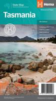
Wegenkaart - landkaart Tasmanië - Tasmania | Hema Maps
Op deze kaart staat Tasmanië in zijn geheel op 1 deel van de kaart. Goede, overzichtelijke, leesbare kaart van het hele eiland. Nationale Parken zijn er goed op te vinden en de afstanden worden weergegeven. Op de achterkant nog deelkaartjes van enkele steden en NP s. The fourth edition of Hema’s Tasmania State Map features Hema’s distinctive and informative maps fully, all of which have been field checked by Hema’s Map Patrol to ensure the best possible accuracy with the latest mapping data.    A fully indexed state map of Tasmania (TAS) at a scale of 1:500,000. Marked on the mapping are national parks, fuel locations as well as camping and rest areas.    The reverse side consists of:   a summary of the key things to see and do broken up into the North West, Launceston, Tamar and the North a table listing of National Parks and Reserves with key features and facilities (such as Camping and Caravan sites, BBQ, toilets and showers) Visitor centre listing Map of the area around Zeehan…
17,50
Nieuw
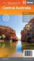
Wegenkaart - landkaart Iconic Map Central Australia - Centraal Australië | Hema Maps
Detailkaart van een deel van Australië. Zeer goed leesbaar, met naast de topografische details veel symbolen waarmee allerhande toeristische zaken worden aangeduid als campsites, nationale parken, attracties, wandelmogelijkheden etc. This waterproof map of the Central Australia region is ideal for discovering some of Australia's most iconic landscapes. The main map covers the area around Alice Springs, including Uluru, Kata Tjuta, West MacDonnell Range, as well as the Simpson Desert and popular tracks such as the Canning Stock Route.   It also features additional information relating to permits, useful contacts and historical context surrounding some of the area's most popular tourist destinations.    PRODUCT FEATURES   GPS surveyed roads and tracks Fuel stops 4WD tracks Camping areas Historic sites Detailed inset maps
17,50

Klanten-reviews van Wegenkaart - landkaart Explorer Map Nullarbor Plain - Eastern Map | Hema Maps

Er zijn nog geen beoordelingen voor dit productBen jij de eerste die een review plaatst?

Meer over Wegenkaart - landkaart Explorer Map Nullarbor Plain - Eastern Map | Hema Maps

Productomschrijving

This map is part of Hema's new Nullarbor Plain Map Series (East and West) and covers Border Village to Port Pirie including the Eyre Peninsula.    Truly one of the worlds great adventure drives, Australia's semi-arid Nullarbor Plain stretches some 1,256 kilometres (781 miles) via the Eyre Highway and links the cities of Adelaide and Perth (or vice versa depending on your direction). The length of this journey is so large we needed to stretch it over two maps; East from Port Pirie to Border Village in South Australia and the Western sheet from Border Village to Kalgoorlie.    While all the key sites and facilities along the Eyre Highway are listed this map allows you to broaden your horizon and consider some of the other attractions off the Highway, including; the various Nullarbor caves, iconic beaches across the Great Australian Bight and thousands of kilometres of 4WD tracks (including Googs Track), all field-checked by the Hema Map Patrol for superior accuracy.   This map combines Hema’s entire database of roads and 4WD tracks with touring points of interest and topographic information. Also included are camping & rest areas, fuel locations,  accommodation, distances and history of the region.   Key Features
  • 4WD tracks (including Googs Track)
  • Camping & rest areas
  • Fuel Locations
  • Road distances
  • Accommodation
  • Caves and Beaches
  • History of the area
Folded size (WxHxD): 140mm x 250mm x 3mm   Flat size (WxH): 1000mm x 700mm


Verken gerelateerde categorieën

Webshop.nl maakt gebruik van cookies. Ga je verder op onze website, ga dan akkoord met het plaatsen van cookies en de verwerking van deze data door ons en vermelde partners.