Productomschrijving
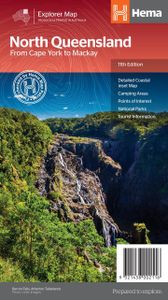
Detailkaart van een deel van Australië. Zeer goed leesbaar, met naast de topografische details veel symbolen waarmee allerhande toeristische zaken worden aangeduid als campsites, nationale parken, attracties, wandelmogelijkheden etc. Covering Australia's beautiful North Queensland. There is alot of town map insets, tourist information, and photographs on the reverse side Touring map of the northern half of Queensland, with enlargements of popular areas, street plans, lists of facilities, etc. The main map extends south to well beyond the Flinders Highway between Townsville and Mount Isa, including Mackay on the coast. The map shows the road network, including minor roads and unsurfaced tracks, plus railways and local airfields/aerodromes. Designated Tourist Routes are highlighted and symbols mark places of interest (many annotated with brief description), historical sites, tourist resorts, youth hostels, etc. Topography is indicated by names of mountain ranges and peaks, as well as by numerous rivers and creeks. National parks and aboriginal lands are highlighted. Along the eastern coast the map shows numerous coral reefs and islands of the Great Barrier Reef. Latitude/longitude grid is drawn at intervals of 1º. On the reverse there are two enlargements: the area around Mackays with the Whitsunday Islands and the coastline of the Tropical North Queensland with the Atherton Tableland, plus plans showing main streets in Cairns, Mt Isa, Mackay and Townsville. The map also contains numerous travel tips and contact addresses, lists of facilities in popular national parks, wildlife areas, state forests and dam recreational areas, and a diagram of the 4WD track/developmental road from Lakeland across the interior of the peninsula to Cape York.

