webshop.nl
Categorieën
  Sluiten

Meer Borch

Wegenkaart - landkaart Europa - Europe | Borch

0
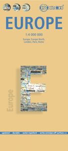
Mooie geplasticieerde kaart van Europa. Deze kaart biedt een goed overzicht van dit continent met detailkaarten.   Our soft-laminated folded map of Europe shows: Europe 1:4 000 000, Europe North 1:5 000 000, the cities of London and Paris 1:15 000, Rome 1:13 000 and their Regions each in 1:700 000. In addition you find the Top 15 sights and airport...

Webshops met dit product

Webshop
Bezorging
Prijs

Anderen bekeken ook

Wegenkaart - landkaart Europa - Europe | Borch
Mooie geplasticieerde kaart van Europa. Deze kaart biedt een goed overzicht van dit continent met detailkaarten.   Our soft-laminated folded map of Europe shows: Europe 1:4 000 000, Europe North 1:5 000 000, the cities of London and Paris 1:15 000, Rome 1:13 000 and their Regions each in 1:700 000. In addition you find the Top 15 sights and airports of this three cities and a map of the European Union with time zones. Borch Maps are easy to fold, durable and water-repellent with a wipeable surface. Borch Maps show hotels, museums, monuments, markets, public transport, top sights and points of interest, overview maps, time zones, and much more...   Covering only 2% of the earth’s surface, Europe is home to almost 740 million people and currently represents the world’s largest economy. About 503 million Europeans reside in the 27 EU member states. Europe is one of the seven continents, even though it is actually just a peninsula of Eurasia. The Ural Mountains and River and the Caspian Se…
11,50
Wegenkaart - landkaart Duitsland | Borch
Mooie geplasticieerde kaart van Duitsland. Deze kaart biedt een goed overzicht van het land met detailkaarten.   Our soft-laminated folded map of Germany shows: Germany North 1:800 000, Germany South 1:800 000, Germany administrative, Europe time zones. Borch Maps are easy to fold, durable and water-repellent with a wipeable surface. Borch Maps show hotels, museums, monuments, markets, public transport, top sights and points of interest, useful statistics, conversion charts for temperatures, weights and measurements, climate charts showing temperatures, sunshine hours, precipitation and humidity, overview maps, time zones, and much more...   The Federal Republic of Germany is situated in Central Europe and is a parliamentary federal republic of 16 states, among them the capital city Berlin counting as a city-state. Germany was a founding member of the European Union, is the largest country of the Union according to population, is counted as one of the modern world powers, is one of the…
11,50
Wegenkaart - landkaart Frankrijk | Borch
Mooie geplasticieerde kaart van Frankrijk. Deze kaart biedt een goed overzicht van het land met detailkaarten. Our soft-laminated folded map of France shows: France North 1:875 000, France South 1:875 000, Corsica 1: 875 000, France administrative, Europe time zones. Borch Maps are easy to fold, durable and water-repellent with a wipeable surface. Borch Maps show hotels, museums, monuments, markets, public transport, top sights and points of interest, useful statistics, conversion charts for temperatures, weights and measurements, climate charts showing temperatures, sunshine hours, precipitation and humidity, overview maps, time zones, and much more...   France, one of the largest countries in Western Europe, is bordered by the English Channel, the North Sea and the Benelux countries to the north. To the East the Rhine river creates a natural border, as do the mountains toward Switzerland and Italy down to the shores and picturesque fishing villages of the Mediterranean coast. The maj…
11,50
Wegenkaart - landkaart Groot - Brittannië | Borch
Mooie geplasticieerde kaart van Groot - Brittanië. Deze kaart biedt een goed overzicht van het land met detailkaarten.   Our soft-laminated folded map of Great Britain shows: Scotland and Northern Ireland 1:800 000, England and Wales 1:800 000, Channel Crossings 1:800 000, Great Britain and Ireland administrative, Europe time zones. Borch Maps are easy to fold, durable and water-repellent with a wipeable surface. Borch Maps show hotels, museums, monuments, markets, public transport, top sights and points of interest, useful statistics, conversion charts for temperatures, weights and measurements, climate charts showing temperatures, sunshine hours, precipitation and humidity, overview maps, time zones, and much more...   "Great Britain", the largest island in Europe, is not one individual country, but the combination of Wales, England and Scotland. It also includes smaller islands such as the Hebrides, the Isle of Wight, Anglesy, the Isles of Scilly as well as the Shetland and Orkney I…
11,50
Wegenkaart - landkaart India Zuid | Borch
Mooie geplasticieerde kaart van het zuiden van india. Deze kaart biedt een goed overzicht van het land met detailkaarten. Our soft-laminated folded map of India South shows: India South 1:3 000 000, Mumbai 1:30 000, Kolkata 1:30 000, Chennai 1:30 000, Hyderabad 1:30 000, Bengaluru 1:30 000, Old Goa 1:15 000, Madurai 1:30 000, Trivandrum 1:30 000, Hampi 1:30 000, Kochi 1:30 000 and India administrative and time zones. Borch maps are easy to fold, durable and water-repellent with a wipeable surface. Borch Maps show hotels, museums, monuments, markets, public transport, top sights and points of interest, useful statistics, conversion charts for temperatures, weights and measurements, climate charts showing temperatures, sunshine hours, precipitation and humidity, overview maps, time zones, and much more...   Southern India, bordered by the Arabian Sea, the Indian Ocean, and the Bay of Bengal, is a culturally diverse region evoking images of colourful, chaotic cities, Ayurveda retreats, dr…
11,50
Wegenkaart - landkaart Kreta - Crete | Borch
Mooie geplasticieerde kaart van Kreta. Deze kaart biedt een goed overzicht van dit eiland met detailkaarten.   Our soft-laminated folded map of Crete shows: Crete (West) 1:200 000, Crete (East) 1:200 000, Iraklio 1:7 000, Agios Nikolaos 1:6 000, Chania 1:10 000, Ierapetra 1:10 000, Rethimno 1:9 000, Samaria Gorge 1:90 000, Sitia 1:7 000 and Gavdos 1:200 000. Borch maps are easy to fold, durable and water-repellent with a wipeable surface. Borch Maps show hotels, museums, monuments, markets, top sights and points of interest, useful statistics, conversion charts for temperatures, weights and measurements, climate charts showing temperatures, sunshine hours, precipitation and humidity, overview maps, time zones, and much more...   Crete is more than just another Greek island, it is the fifth largest island in the Mediterranean Sea and the cradle of ancient Mediterranean civilization. By 2000 B.C. the Minoans had set up a base here for their international trade with the East, North Africa…
11,50

Klanten-reviews van Wegenkaart - landkaart Europa - Europe | Borch

Er zijn nog geen beoordelingen voor dit productBen jij de eerste die een review plaatst?

Meer over Wegenkaart - landkaart Europa - Europe | Borch

Productomschrijving

Mooie geplasticieerde kaart van Europa. Deze kaart biedt een goed overzicht van dit continent met detailkaarten.   Our soft-laminated folded map of Europe shows: Europe 1:4 000 000, Europe North 1:5 000 000, the cities of London and Paris 1:15 000, Rome 1:13 000 and their Regions each in 1:700 000. In addition you find the Top 15 sights and airports of this three cities and a map of the European Union with time zones. Borch Maps are easy to fold, durable and water-repellent with a wipeable surface. Borch Maps show hotels, museums, monuments, markets, public transport, top sights and points of interest, overview maps, time zones, and much more...   Covering only 2% of the earth’s surface, Europe is home to almost 740 million people and currently represents the world’s largest economy. About 503 million Europeans reside in the 27 EU member states. Europe is one of the seven continents, even though it is actually just a peninsula of Eurasia. The Ural Mountains and River and the Caspian Sea separate Europe from Asia to the east. Europe is bordered by the Arctic Ocean to the north, the Atlantic Ocean to the west, the Mediterranean to the south and the Caucasus Mountains and Black Sea on its southeastern perimeter. Europe boasts a diverse array of climatic and geographic regions, languages and cultures, world cities, beautiful countryside and breathtaking sea and mountainscapes.

Productspecificaties

Artikelnummer(s)
Brand
Borch
Webshop.nl maakt gebruik van cookies. Ga je verder op onze website, ga dan akkoord met het plaatsen van cookies en de verwerking van deze data door ons en vermelde partners.