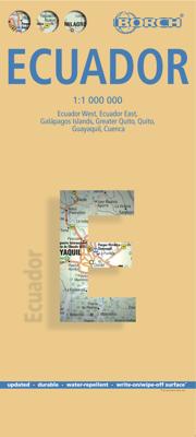
Wegenkaart - landkaart Ecuador | Borch

0
Mooie geplasticieerde kaart van Ecuador. Deze kaart biedt een goed overzicht van het land met detailkaarten.   Our soft-laminated folded map of Ecuador shows: Ecuador West 1:1 000 000, Ecuador Est 1:2 000 000, Galapagos Islands1:1 300 000, Gran Quito 1:100 000, Quito 1:20 000, Cuenca 1:17 000, Guayaquil 1:18 000, Ecuador administrative and times z...

Verkopers met dit product

Verkoper
Bezorging
Prijs
DeZwerver.nl logo
DeZwerver.nl
2,95
11,50

Anderen bekeken ook

Wegenkaart - landkaart Ecuador | Borch
Mooie geplasticieerde kaart van Ecuador. Deze kaart biedt een goed overzicht van het land met detailkaarten.   Our soft-laminated folded map of Ecuador shows: Ecuador West 1:1 000 000, Ecuador Est 1:2 000 000, Galapagos Islands1:1 300 000, Gran Quito 1:100 000, Quito 1:20 000, Cuenca 1:17 000, Guayaquil 1:18 000, Ecuador administrative and times zones. Borch maps are easy to fold, durable and water-repellent with a wipeable surface. Borch Maps show hotels, museums, monuments, markets, public transport, top sights and points of interest, useful statistics, conversion charts for temperatures, weights and measurements, climate charts showing temperatures, sunshine hours, precipitation and humidity, overview maps, time zones, and much more...   Dominated by the towering Andean range, Ecuador is a country of magnificent highlands, dramatic slopes, dense rainforests, fertile lowlands and tranquil sandy beaches. Its immense variety of landscapes and habitats support a unique flora and fauna …
11,50
Wegenkaart - landkaart 3403 Adventure Map Ecuador & Galapagos | National Geographic
Wegenkaart van Galapagos en Ecuador met vermelding van veel bezienswaardigheden, nationale parken en attrakties. Watervast en scheurvast. Juist door deze vermeldingen onderscheidt de kaart zich van andere wegenkaarten. National Geographic's Ecuador and Galapagos Adventure Map is designed to meet the unique needs of adventure travelers—detailed, durable, and accurate. Ecuador and Galapagos includes the locations of thousands of towns and villages, plus a clearly marked road network complete with distances and designations for highways, roads and more.   What sets National Geographic Adventure Maps apart from traditional road maps are the hundreds of points of interest that highlight the diverse, unique, and exotic destinations within Ecuador and the Galapagos islands including national parks and reserves, World Heritage sites, archeological sites, churches, spas, and more.   The front side of the map shows the southern half of Ecuador including the provinces of Zamora, Chinchipe, Loja,…
17,50
Wegenkaart - landkaart Ecuador | ITMB
Duidelijke wegenkaart van Ecuador, aan 2 zijden bedrukt. Met stadsplattegronden van Quito, Guayaquil. Aanduidingen van benzinestations, Nationale parken en bezienswaardigheden. Very detailed, double sided travel map of Ecuador shows road network and physical features. Distances between communities are shown, as well as gas stations outside of major towns. National parks and points of interest are also shown. Includes an inset map of Quito and Environs of Guayaquil as well as a comprehensive place name index. Printed on waterproof synthetic paper suitable for tropical conditions.
13,95
Stadsplattegrond - Wegenkaart - landkaart Quito & Ecuador Central | ITMB
Een degelijke wegenkaart van Ecuador met aanduidingen van o.a. nationale parken, vliegveld, benzinepomp, dirt-roads en kleine plattegrond van hoofdstad. Als overzichtskaart goed te gebruiken. Finally, ITMB releases its long-awaited re-worked map of the wonderful South America city of Quito. The city is squeezed in between mountain ranges and, the entire city stretches from north (on the right-hand side of the map) to the south. The "bottom" of the map is, actually the eastern portion. A regional inset map clarifies the situation. The street network is clearly shown, along with the rapid line bus way and the city's Metro. The Old Town is perhaps the most interesting portion of the city for visitors and is on the left-hand portion of the map. The newer downtown is centered on La Carolina Park on the right-hand side of the map. This is where most of the shopping malls and hotels are located. The old airport is shown in part on the far right, but the new international airport is located f…
13,95
Wegenkaart - landkaart Ecuador | Reise Know-How Verlag
Tweetalige kaart (Engels en Duits) van Ecuador en de Galapagos eilanden. Door ingetekende lengte- en breedtegraden is het gebruik van GPS mogelijk. Met hoogtelijnen en uitgebreid wegennetwerk: daarnaast worden ook de afstanden tussen belangrijke plaatsen duidelijk leesbaar weergegeven. Het kleurgebruik is zodanig dat je een goede indruk krijgt van hoogteverschillen en soorten landschap. Natuurlijk staan de toeristische bezienswaardigheden duidelijk vermeld. Ecuador op schaal 1:650.000 en de Galapagos eilanden op schaal 1: 1.000.000   Gedrukt op water- en scheurvast papier! Polyart is een synthetisch product vrij van giftige stoffen dus duurzaam. Het papier gaat echt lang mee.   Topography is indicated by altitude colouring with numerous spot heights and names of mountain ranges and passes. Salt lakes, swamps, seasonal rivers and glacier are also shown. Detailed presentation of the road network includes minor roads and tracks and railways are also shown.   Internal administrative units…
13,95
Reisgids Ecuador and the Galapagos Islands | Lonely Planet
De perfecte reisgids voor zowel de georganiseerde als de zelfstandige reiziger. Naast een algemene inleiding van het land / streek vol met praktische informatie over hoe je er het beste kunt reizen: slapen, eten, vervoer, excursies ... alles kun je er in vinden. Lonely Planet's local travel experts reveal all you need to know to plan the trip of a lifetime to Ecuador & the Galapagos.   Discover popular and off the beaten track experiences from travelling to the lower Rio Napo into the Amazon jungle to taking a dip in the paradise of a white-sand cove at Puerto Chino, and braving a spiritual cleansing from a curandero (healer) at Parroquia Puerto Limon.   Build a trip to remember with Lonely Planet's Ecuador & the Galapagos Islands travel guide:   Our classic guidebook format provides you with the most comprehensive level of information for planning multi-week trips Updated with an all new structure and design so you can navigate Ecuador & the Galapagos Islands and connect experiences …
24,95
Wegenkaart - landkaart Peru | Borch
Mooie geplasticieerde kaart van Peru. Deze kaart biedt een goed overzicht van het land met detailkaarten.   Our soft-laminated folded map of Peru shows: Peru North 1:1 750 000, Peru South 1:1 750 000, Amazonian Peru 1:2 500 000, Central Lima 1:18 000, Greater Lima 1:150 000, Central Cuzco 1:12 000, Greater Cuzco 1:50 000, Ayacucho 1:20 000, Arequipa 1:17 000, Chan Chan 1:40 000, Trujillo 1:20 000, Sacsayhuaman 1:10 000, Machu Picchu 1:44 000, Peru administrative & time zones. Borch Maps are easy to fold, durable and water-repellent with a wipeable surface. Borch Maps show hotels, museums, monuments, markets, public transport, top sights and points of interest, useful statistics, conversion charts for temperatures, weights and measurements, climate charts showing temperatures, sunshine hours, precipitation and humidity, overview maps, time zones, and much more...   Bordering Brazil, Bolivia, Chile, Colombia, Ecuador and the Pacific Ocean, the Republic of Peru is the cradle of the Inca …
11,50
Wegenkaart - landkaart Brazilië - Brazil | Borch
Mooie geplasticieerde kaart van het Brazilië. Deze kaart biedt een goed overzicht van het land met detailkaarten. Our soft-laminated map of Brazil in the 5th edition includes: Brazil 1:4 000 000, Fernando de Noronha Island 1:4 000 000, Brazil Amazon 1:8 000 000, Brasíiia 1:60 000, Manaus 1:15 000, Rio de Janeiro Center 1:15 000, Rio de Janeiro 1:175 000, Sao Paulo 1:20 000, Fortaleza 1:15 000, Natal 1:22 000, Recife 1:15 000, Salvador 1:14 000, Curitiba, Florianópolis, Porto Alegre each 1: 15 000, Brazil administrative & time zones; interesting statistics: conversion chart for temperatures, weights and measures; climate chart with temperatures, sunshine hours, precipitation and humidity; hotels, museums, markets and much more.   The Federative Republic of Brazil is the fifth largest country in the world, the largest and most populous country and largest economy in South America and the seventh largest economy in the world. Bordered by the Atlantic Ocean to the east, the remaining bord…
11,50
Reisgids Ecuador and Galapagos | Insight Guides
Een rijk geillustreerde reisgids met diepgaande teksten: één van de beste reisgidsen die er bestaan. Eerste deel bestaat uit een beschrijving van de unieke aspecten van de regio, daarna een deel echte reisgids en als afsluiting een deel met praktische informatie. De uitstekende informatie wordt vergezeld van prachtige foto's en heldere kaarten. Niet alleen om mee te nemen, maar ook om vooraf en zelfs achteraf weer in de stemming te komen. This Ecuador & Galápagos guidebook is ideal for travellers seeking inspirational guides and planning a more extended trip. It provides interesting facts about Ecuador & Galápagos's people, history and culture and detailed coverage of the best places to see. This Ecuador & Galápagos travel book has the style of an illustrated magazine to inspire you and give a taste of Ecuador & Galápagos. The book is printed on paper from responsible sources, and verified to meet FSC's strict environmental and social standards.   This Ecuador & Galápagos guideboo…
25,95
Wegenkaart - landkaart Ecuador en Galapagos | Freytag & Berndt
Gedetailleerde, tweezijdige landkaart van Ecuador en de Galapgos eilanden, prima geschikt voor planning en rondtrekken over alle eilanden. De berijdbare wegen zijn goed weergeven, zowel de hoofdwegen als provinciale en lokale wegen; wegnummers worden vermeld. Afstanden tussen plaatsen zijn in kilometers op de kaart ingetekend, daarnaast worden ook op belangrijke plekken benzinepompen gemarkeerd. In het kaartbeeld wordt door middel van schaduw het reliëf weergegeven en soms enkele punten in het landschap met de daadwerkelijke hoogte. Provinciegrenzen zijn goed terug te vinden, nationale parken en reservaten ook. Met allerhande symbolen worden toeristische bezienswaardigheden weergegeven als monumenten, historisch belangrijke plekken en uitzichtpunten. In bepaalde plaatsen zijn hotels en campings te vinden, luchthavens, treinverbindingen en havens vindt u er ook op!
14,95

Klanten-reviews van Wegenkaart - landkaart Ecuador | Borch

Er zijn nog geen beoordelingen voor dit productBen jij de eerste die een review plaatst?

Meer over Wegenkaart - landkaart Ecuador | Borch

Productomschrijving

Mooie geplasticieerde kaart van Ecuador. Deze kaart biedt een goed overzicht van het land met detailkaarten.   Our soft-laminated folded map of Ecuador shows: Ecuador West 1:1 000 000, Ecuador Est 1:2 000 000, Galapagos Islands1:1 300 000, Gran Quito 1:100 000, Quito 1:20 000, Cuenca 1:17 000, Guayaquil 1:18 000, Ecuador administrative and times zones. Borch maps are easy to fold, durable and water-repellent with a wipeable surface. Borch Maps show hotels, museums, monuments, markets, public transport, top sights and points of interest, useful statistics, conversion charts for temperatures, weights and measurements, climate charts showing temperatures, sunshine hours, precipitation and humidity, overview maps, time zones, and much more...   Dominated by the towering Andean range, Ecuador is a country of magnificent highlands, dramatic slopes, dense rainforests, fertile lowlands and tranquil sandy beaches. Its immense variety of landscapes and habitats support a unique flora and fauna comprising a literally unparalleled biodiversity. The highlands north of Quito with its UNESCO heritage listed Old Town are not only famous for their vistas, but also for their colourful markets. The southern highlands contain Ecuador's wildest scenery, dotted with tiny ancient villages. While nature buffs and birdwatchers may want to explore the jungles of the Oriente, the less adventurous may fall in love with the unspoilt beaches and picturesque fishing villages on the Bahía de Manta. One should, if possible, follow the lure of the magnificent Galapagos Islands, 1000 km off the coast.  

Productinformatie

    Verken gerelateerde categorieën

    Webshop.nl maakt gebruik van cookies. Ga je verder op onze website, ga dan akkoord met het plaatsen van cookies en de verwerking van deze data door ons en vermelde partners.