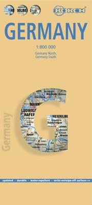
Wegenkaart - landkaart Duitsland | Borch

0
Mooie geplasticieerde kaart van Duitsland. Deze kaart biedt een goed overzicht van het land met detailkaarten.   Our soft-laminated folded map of Germany shows: Germany North 1:800 000, Germany South 1:800 000, Germany administrative, Europe time zones. Borch Maps are easy to fold, durable and water-repellent with a wipeable surface. Borch Maps sh...

Verkopers met dit product

Verkoper
Bezorging
Prijs
DeZwerver.nl logo
DeZwerver.nl
2,95
11,50

Anderen bekeken ook

Nieuw
Wegenkaart - landkaart Frankrijk | Borch
Mooie geplasticieerde kaart van Frankrijk. Deze kaart biedt een goed overzicht van het land met detailkaarten. Our soft-laminated folded map of France shows: France North 1:875 000, France South 1:875 000, Corsica 1: 875 000, France administrative, Europe time zones. Borch Maps are easy to fold, durable and water-repellent with a wipeable surface. Borch Maps show hotels, museums, monuments, markets, public transport, top sights and points of interest, useful statistics, conversion charts for temperatures, weights and measurements, climate charts showing temperatures, sunshine hours, precipitation and humidity, overview maps, time zones, and much more...   France, one of the largest countries in Western Europe, is bordered by the English Channel, the North Sea and the Benelux countries to the north. To the East the Rhine river creates a natural border, as do the mountains toward Switzerland and Italy down to the shores and picturesque fishing villages of the Mediterranean coast. The ma…
11,50
Nieuw
Wegenkaart - landkaart Italië | Borch
Mooie geplasticieerde kaart van Italië. Deze kaart biedt een goed overzicht van het land met detailkaarten.   Our soft-laminated folded map of Italy shows: Italy North, Italy South, Sardinia and Sicily 1:800 000, Italy administrative, Europe time zones. Borch Maps are easy to fold, durable and water-repellent with a wipeable surface. Borch Maps show hotels, museums, monuments, markets, public transport, top sights and points of interest, useful statistics, conversion charts for temperatures, weights and measurements, climate charts showing temperatures, sunshine hours, precipitation and humidity, overview maps, time zones, and much more...   Art, architecture, ancient Rome, Vatican City, San Marino, sculpture, culture, operas and arenas, beaches and mountains, music and dance, friendly and energetic people, delicious food, world-class fashion and design, splendid wines - just a few impressions of the beautiful Italian peninsula. Today Italy is a highly developed country and politicall…
11,50
Nieuw
Wegenkaart - landkaart USA Interstate | Borch
Mooie, overzichtelijke wegenkaart van de snelwegen in Amerika. Handig als je grote afstanden in het land moet afleggen.   Our soft-laminated folded map of the USA in the 9th edition shows: USA West, USA East, Hawaiian Islands, Puerto Rico each 1:4 000 000, Alaska 1:8 000 000, USA administrative & time zones. Borch Maps are easy to fold, durable and water-repellent with a wipeable surface. Borch Maps show hotels, museums, monuments, markets, public transport, top sights and points of interest, useful statistics, conversion charts for temperatures, weights and measurements, climate charts showing temperatures, sunshine hours, precipitation and humidity, overview maps, time zones, and much more...   "Get your motor running, head out on the highway"! The Interstate highway system (officially the "Dwight D. Eisenhower National System of Interstate and Defense Highways") authorized by the Federal Aid Highway Act of 1956 and supported by former US President Eisenhower who had been impressed …
11,50
Nieuw
Wegenkaart - landkaart Belize | Borch
Mooie, geplastificeerde kaart van Belize. Deze kaart biedt een goed overzicht van het land met detailkaarten.   Our soft-laminated folded map of Belize in the 5th edition shows: Belize 1:500 000, Belize City 1:13 000, San Ignacio & Santa Elena 1:25 000, Yucatan Peninsula 1: 2 750 000, Ambergris Caye & Caye Caulker 1:250 000, the Maya sites Altun Ha 1:3 000, Cahal Pech 1:2 500, Caracol 1:7 000, Cerros 1:4 000, El Pilar 1:8 000, Lamanai 1:9 000, Lubaantun 1:5 000, Nim Li Punit 1: 7 000, Xunantunich 1:7 000 and Belize administrative. Borch Maps are easy to fold, durable and water-repellent with a wipeable surface. Borch Maps show hotels, museums, monuments, markets, public transport, top sights and points of interest, useful statistics, conversion charts for temperatures, weights and measurements, climate charts showing temperatures, sunshine hours, precipitation and humidity, overview maps, and much more...   Known as British Honduras until about 1973, Belize is today no longer a Bri…
11,50
Nieuw
Stadsplattegrond Frankfurt am Main | Borch
Borch Frankfurt is een duidelijke, geplastificeerde plattegrond van het centrum met informatie over openbaar vervoer en bezienswaardigheden. Inclusief straatnamenregister.   Our soft-laminated folded map of Frankfurt shows: Frankfurt a. M. 1:12 000, Frankfurt Centre 1:8 250, Greater Frankfurt 1:110 000, public transport Frankfurt, Germany administrative, Top 30 Sights. Borch Maps are easy to fold, durable and water-repellent with a wipeable surface. Borch Maps show hotels, museums, monuments, markets, public transport, top sights and points of interest, useful statistics, conversion charts for temperatures, weights and measurements, climate charts showing temperatures, sunshine hours, precipitation and humidity, overview maps, time zones, and much more...   The modern city of Frankfurt am Main - also known as "Bankfurt", "Mainhattan" or "The Big Äppel" - is Germany's fifth largest city and the country's financial and business center. It is home to the European Central Bank, the German…
9,95
Nieuw
Wegenkaart - landkaart Spanje | Borch
Mooie geplasticieerde kaart van Spanje. Deze kaart biedt een goed overzicht van het land met detailkaarten.   Our soft-laminated folded map of Spain shows: Spain East 1:875 000, Spain West 1: 875 000, Canary Islands 1:1 875 000, Spain administrative and Europe time zones. Borch Maps are easy to fold, durable and water-repellent with a wipeable surface. Borch Maps show hotels, museums, monuments, markets, public transport, top sights and points of interest, useful statistics, conversion charts for temperatures, weights and measurements, climate charts showing temperatures, sunshine hours, precipitation and humidity, overview maps, time zones, and much more...   The Kingdom of Spain is the twelfth-largest economy in the world and was once the leading power and colonial empire in Europe. Spain has suffered its share of wars, invasions, inquisitions, and isolation, contributing to the rich and diverse culture that democratic Spain today represents. Its territory covers the central and eas…
11,50
Nieuw
Wegenkaart - landkaart Europa - Europe | Borch
Mooie geplasticieerde kaart van Europa. Deze kaart biedt een goed overzicht van dit continent met detailkaarten.   Our soft-laminated folded map of Europe shows: Europe 1:4 000 000, Europe North 1:5 000 000, the cities of London and Paris 1:15 000, Rome 1:13 000 and their Regions each in 1:700 000. In addition you find the Top 15 sights and airports of this three cities and a map of the European Union with time zones. Borch Maps are easy to fold, durable and water-repellent with a wipeable surface. Borch Maps show hotels, museums, monuments, markets, public transport, top sights and points of interest, overview maps, time zones, and much more...   Covering only 2% of the earth’s surface, Europe is home to almost 740 million people and currently represents the world’s largest economy. About 503 million Europeans reside in the 27 EU member states. Europe is one of the seven continents, even though it is actually just a peninsula of Eurasia. The Ural Mountains and River and the Caspian S…
11,50
Nieuw
Wegenkaart - landkaart Groot - Brittannië | Borch
Mooie geplasticieerde kaart van Groot - Brittanië. Deze kaart biedt een goed overzicht van het land met detailkaarten.   Our soft-laminated folded map of Great Britain shows: Scotland and Northern Ireland 1:800 000, England and Wales 1:800 000, Channel Crossings 1:800 000, Great Britain and Ireland administrative, Europe time zones. Borch Maps are easy to fold, durable and water-repellent with a wipeable surface. Borch Maps show hotels, museums, monuments, markets, public transport, top sights and points of interest, useful statistics, conversion charts for temperatures, weights and measurements, climate charts showing temperatures, sunshine hours, precipitation and humidity, overview maps, time zones, and much more...   "Great Britain", the largest island in Europe, is not one individual country, but the combination of Wales, England and Scotland. It also includes smaller islands such as the Hebrides, the Isle of Wight, Anglesy, the Isles of Scilly as well as the Shetland and Orkney …
11,50
Nieuw
Wegenkaart - landkaart Kreta - Crete | Borch
Mooie geplasticieerde kaart van Kreta. Deze kaart biedt een goed overzicht van dit eiland met detailkaarten.   Our soft-laminated folded map of Crete shows: Crete (West) 1:200 000, Crete (East) 1:200 000, Iraklio 1:7 000, Agios Nikolaos 1:6 000, Chania 1:10 000, Ierapetra 1:10 000, Rethimno 1:9 000, Samaria Gorge 1:90 000, Sitia 1:7 000 and Gavdos 1:200 000. Borch maps are easy to fold, durable and water-repellent with a wipeable surface. Borch Maps show hotels, museums, monuments, markets, top sights and points of interest, useful statistics, conversion charts for temperatures, weights and measurements, climate charts showing temperatures, sunshine hours, precipitation and humidity, overview maps, time zones, and much more...   Crete is more than just another Greek island, it is the fifth largest island in the Mediterranean Sea and the cradle of ancient Mediterranean civilization. By 2000 B.C. the Minoans had set up a base here for their international trade with the East, North Afric…
11,50
Nieuw
Wegenkaart - landkaart Thailand | Borch
Mooie geplasticieerde kaart van Thailand. Deze kaart biedt een goed overzicht van het land met detailkaarten van o.a. Bangkok, Phuket, Ko Samui. Our soft-laminated folded map of Thailand in the 8th edition shows: Thailand 1:1 500 000, Bangkok 1:22 000, Greater Bangkok 1:125 000, Chiang Mai 1:22 000, Mae Hong Son 1:14 000, Northwest Thailand 1:835 000, Phuket 1:350 000, Ko Samui & Ko Phangan 1:350 000, Thailand administrative & time zones. Borch Maps are easy to fold, durable and water-repellent with a wipeable surface. Borch Maps show hotels, museums, monuments, markets, public transport, top sights and points of interest, useful statistics, conversion charts for temperatures, weights and measurements, climate charts showing temperatures, sunshine hours, precipitation and humidity, overview maps, time zones, and much more...   Thailand - "Country of Liberty" - has every right to its name, as it is the only southeast Asian country never to have been ruled by a western colonial power…
11,50

Klanten-reviews van Wegenkaart - landkaart Duitsland | Borch

Er zijn nog geen beoordelingen voor dit productBen jij de eerste die een review plaatst?

Meer over Wegenkaart - landkaart Duitsland | Borch

Productomschrijving

Mooie geplasticieerde kaart van Duitsland. Deze kaart biedt een goed overzicht van het land met detailkaarten.   Our soft-laminated folded map of Germany shows: Germany North 1:800 000, Germany South 1:800 000, Germany administrative, Europe time zones. Borch Maps are easy to fold, durable and water-repellent with a wipeable surface. Borch Maps show hotels, museums, monuments, markets, public transport, top sights and points of interest, useful statistics, conversion charts for temperatures, weights and measurements, climate charts showing temperatures, sunshine hours, precipitation and humidity, overview maps, time zones, and much more...   The Federal Republic of Germany is situated in Central Europe and is a parliamentary federal republic of 16 states, among them the capital city Berlin counting as a city-state. Germany was a founding member of the European Union, is the largest country of the Union according to population, is counted as one of the modern world powers, is one of the world's leading exporters of goods, the third largest importer of goods, the world's fourth largest economy, with the ninth highest defense expenditure in the world / third highest in the EU. Besides being in the EU, Germany is a member state of the UN, NATO, the G8 and G20, among others. Germany, a country of beautiful landscapes varying from sandy coastal regions to rugged mountains, rolling meadows and great forested areas to meandering riverbeds bordered by vineyards, is also a land of cultural diversity boasting beer and wine festivals, museums of world esteem, romantic villages and towns and busy cities. Germans are conscientious and friendly and are known for their precision, punctuality, cleanliness and technical innovations. A modern beautiful country worth visiting.    

Verken gerelateerde categorieën

Webshop.nl maakt gebruik van cookies. Ga je verder op onze website, ga dan akkoord met het plaatsen van cookies en de verwerking van deze data door ons en vermelde partners.