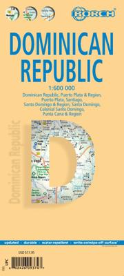
Wegenkaart - landkaart Dominicaanse Republiek | Borch

0
Mooie geplasticieerde kaart van de Dominicaanse Republiek. Deze kaart biedt een goed overzicht van het land met detailkaarten.   Our soft-laminated map of the Dominican Republic includes: Dominican Republic 1:600 000, Puerto Plata & Region 1:250 000, Puerto Plata 1:20 000, Santiago 1:17 500, Santo Domingo & Region 1:250 000, Santo Domingo 1:22 500...

Verkopers met dit product

Verkoper
Bezorging
Prijs
DeZwerver.nl logo
DeZwerver.nl
2,95
11,50

Anderen bekeken ook

Wegenkaart - landkaart Peru | Borch
Mooie geplasticieerde kaart van Peru. Deze kaart biedt een goed overzicht van het land met detailkaarten.   Our soft-laminated folded map of Peru shows: Peru North 1:1 750 000, Peru South 1:1 750 000, Amazonian Peru 1:2 500 000, Central Lima 1:18 000, Greater Lima 1:150 000, Central Cuzco 1:12 000, Greater Cuzco 1:50 000, Ayacucho 1:20 000, Arequipa 1:17 000, Chan Chan 1:40 000, Trujillo 1:20 000, Sacsayhuaman 1:10 000, Machu Picchu 1:44 000, Peru administrative & time zones. Borch Maps are easy to fold, durable and water-repellent with a wipeable surface. Borch Maps show hotels, museums, monuments, markets, public transport, top sights and points of interest, useful statistics, conversion charts for temperatures, weights and measurements, climate charts showing temperatures, sunshine hours, precipitation and humidity, overview maps, time zones, and much more...   Bordering Brazil, Bolivia, Chile, Colombia, Ecuador and the Pacific Ocean, the Republic of Peru is the cradle of the Inca …
11,50
Wegenkaart - landkaart Yucatan | Borch
Mooie geplasticieerde kaart van Yucatan. Deze kaart biedt een goed overzicht van dit deel van Mexico met detailkaarten.   Our soft-laminated map of Yucatan includes: Yucatán 1:1 000 000, Guatemala  North 1:1 000 000, Yucatán Peninsula 1:2 500 000, Campeche 1:10 000, Mérida Centre 1:10 000, Mérida 1:100 000, Cancún & Isla Mujeres 1:100 000, Palenque 1:5 000, Tulúm 1:3 750, Tikal 1:6 200, Uxmal 1:5 500, Chichén-Itzá 1:6 500, Cozumel Island 1:250 000, Mexico administrative & time zones, interesting statistics, conversion chart for temperatures, weights and measures, climate chart with temperatures, sunshine hours, precipitation and humidity, and shows top sights, temples and much more.   The peninsula of Yucatan is located on the easternmost tip of Mexico and faces toward Cuba. After the city states of Chichén Itzá, Uxmal and Labná were founded in ca. 600 B.C. the Mayan civilization, whose mysterious grandeur manifests itself best in the stone pyramid of El Castillo in Chichén Itzá, flou…
11,50
Wegenkaart - landkaart 3102 Adventure Map Dominican Republic | National Geographic
Wegenkaart van Dominicaanse Republiek met vermelding van veel bezienswaardigheden, nationale parken en attrakties. Watervast en scheurvast. Juist door deze vermeldingen onderscheidt de kaart zich van andere wegenkaarten. The Dominican Republic is the second largest nation in the Caribbean, occupying two-thirds of the stunning island of Hispaniola. Visitors can try their hand at windsurfing or kiteboarding, observe humpback whales, go whitewater rafting, or lounge on one of the many sugar-white beaches. The Dominican Republic Adventure Map features Pico Duarte, the highest point in the Caribbean (10,417 feet), as well as detailed map insets of the metropolitan and colonial areas of the capital city, Santo Domingo.   Side one features a large-scale, easy-to-read topographic map of the entire country that includes points of interest and photos throughout.   Side two features information about the Samana Peninsula, Del Este National Park, Lake Enriquillo (at 144 feet below sea level, the …
17,50
Wegenkaart - landkaart Brazilië - Brazil | Borch
Mooie geplasticieerde kaart van het Brazilië. Deze kaart biedt een goed overzicht van het land met detailkaarten. Our soft-laminated map of Brazil in the 5th edition includes: Brazil 1:4 000 000, Fernando de Noronha Island 1:4 000 000, Brazil Amazon 1:8 000 000, Brasíiia 1:60 000, Manaus 1:15 000, Rio de Janeiro Center 1:15 000, Rio de Janeiro 1:175 000, Sao Paulo 1:20 000, Fortaleza 1:15 000, Natal 1:22 000, Recife 1:15 000, Salvador 1:14 000, Curitiba, Florianópolis, Porto Alegre each 1: 15 000, Brazil administrative & time zones; interesting statistics: conversion chart for temperatures, weights and measures; climate chart with temperatures, sunshine hours, precipitation and humidity; hotels, museums, markets and much more.   The Federative Republic of Brazil is the fifth largest country in the world, the largest and most populous country and largest economy in South America and the seventh largest economy in the world. Bordered by the Atlantic Ocean to the east, the remaining bord…
11,50
Wegenkaart - landkaart Chile - Chili | Borch
Mooie geplasticieerde kaart van Chili. Deze kaart biedt een goed overzicht van het land met detailkaarten. Our soft-laminated folded map of Chile shows: Northern Chile, Central Chile, Southern Chile & Patagonia 1:2 000 000, Torres del Paine National Park 1:240 000, Robinson Crusoe Island 1:200 000, Easter Island (Rapa Nui) 1:160 000, Punta Arenas, Antofagasta, Iquique 1:15 000, Valparaiso 1:10 000, Arica 1:16 000, La Serena 1:13 000, Vina del Mar 1:22 000, Santiago 1:20 000 and Chile administrative & time zones. Borch Maps are easy to fold, durable and water-repellent with a wipeable surface. Borch Maps show hotels, museums, monuments, markets, public transport, top sights and points of interest, useful statistics, conversion charts for temperatures, weights and measurements, climate charts showing temperatures, sunshine hours, precipitation and humidity, overview maps, time zones, and much more...   The Republic of Chile is a long and narrow coastal strip on the western side of the S…
11,50
Reisgids Culture Smart! Dominican Republic - Dominicaanse Republiek | Kuperard
De Cultuur Bewust!-gids geeft toeristen en zakenlieden belangrijke informatie met betrekking tot de cultuur van alledag in het land van bestemming. Anders dan in de gebruikelijke reisgidsen wordt de lezer in deze reeks bijgespijkerd op het gebied van omgangsvormen, normen en waarden, hoe zich te gedragen en wat verwacht mag worden op zakelijk en sociaal gebied. Het zijn beknopte zakformaatgidsen met interessante wetenswaardigheden over het dagelijks leven. Een must voor iedereen die naar het buitenland gaat voor vakantie, studie of werk. Occupying the eastern two-thirds of island of Hispaniola, the Dominican Republic has something for almost everyone – except perhaps obsessive perfectionists. If you can relax and go with the flow you will experience a land of great environmental diversity with a rich and varied culture, a turbulent history, some infuriating idiosyncrasies, and a people whose friendliness is legendary. The Dominicans are flamboyant, irrepressible, generous, headstrong,…
14,95
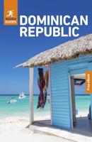
Reisgids The Dominican Republic - Dominicaanse Republiek | Rough Guides
Zeer goede reisgids voor zowel de georganiseerde maar vooral voor de zelfstandige reiziger. Boordevol informatie over reizen, slapen, eten, maar ook musea en cultuur. Voor veel landen meestal completer en beter dan de Lonely Planet ! This in-depth coverage of the Dominican Republic's local attractions, sights, and restaurants takes you to the most rewarding spots—from Santo Domingo to the beaches of Punta Cana—and stunning color photography brings the land to life on the pages.   The locally based Rough Guides author team introduces the best places to stop and explore, and provides reliable insider tips on topics such as driving the roads, taking walking tours, or visiting local landmarks. You'll find special coverage of history, art, architecture, and literature, and detailed information on the best markets and shopping for each area in this fascinating country.   The Rough Guide to the Dominican Republic also unearths the best restaurants, nightlife, and places to stay, from backpac…
24,95
Wegenkaart - landkaart Duitsland | Borch
Mooie geplasticieerde kaart van Duitsland. Deze kaart biedt een goed overzicht van het land met detailkaarten.   Our soft-laminated folded map of Germany shows: Germany North 1:800 000, Germany South 1:800 000, Germany administrative, Europe time zones. Borch Maps are easy to fold, durable and water-repellent with a wipeable surface. Borch Maps show hotels, museums, monuments, markets, public transport, top sights and points of interest, useful statistics, conversion charts for temperatures, weights and measurements, climate charts showing temperatures, sunshine hours, precipitation and humidity, overview maps, time zones, and much more...   The Federal Republic of Germany is situated in Central Europe and is a parliamentary federal republic of 16 states, among them the capital city Berlin counting as a city-state. Germany was a founding member of the European Union, is the largest country of the Union according to population, is counted as one of the modern world powers, is one of th…
11,50
Wegenkaart - landkaart Seychelles - Seychellen | Borch
Mooie geplasticieerde kaart vande Seychellen. Deze kaart biedt een goed overzicht van het land met detailkaarten.   Our soft-laminated folded map of Seychelles shows: Bird Island, Denis, Arid, Fregate 1:25 000, Mahe, Silhouette, Praislin, La Digue, Marianne, Desroches, North 1:50 000, Inner Islands 1:750 000, Seychelles 1:4 500 000, Victoria 1:13 000, Vallée de Mai 1:13 000 and Aldabra, Amirantes, Farquhar 1:2 500 000, Seychelles time zones. Borch Maps are easy to fold, durable and water-repellent with a wipeable surface. Borch Maps show hotels, museums, monuments, markets, public transport, top sights and points of interest, useful statistics, conversion charts for temperatures, weights and measurements, climate charts showing temperatures, sunshine hours, precipitation and humidity, overview maps, time zones, and much more...   The Republic of Seychelles is an archipelago of 115 granitic and coralline islands in the Indian Ocean, located east of Africa and northeast of Madagascar. S…
11,50
Wegenkaart - landkaart Costa Rica | Borch
Mooie geplasticieerde kaart van Costa Rica. Deze kaart biedt een goed overzicht van het land met detailkaarten.   Our soft-laminated folded map of Costa Rica shows: Costa Rica 1:650 000, Cocos Island 1:150 000, San Jose 1:20 000, Meseta Central 1:300 000, Costa Rica administrative and time zones. Borch maps are easy to fold, durable and water-repellent with a wipeable surface. Borch Maps show hotels, museums, monuments, markets, public transport, top sights and points of interest, useful statistics, conversion charts for temperatures, weights and measurements, climate charts showing temperatures, sunshine hours, precipitation and humidity, overview maps, time zones, and much more...   The Republic of Costa Rica ("rich coast") is bordered by Nicaragua, Panama, the Pacific Ocean and the Caribbean Sea. Costa Rica abolished its army in 1949 and is an oasis of peace and tranquility in Central America. Democracy, a policy of neutrality and exemplary environmental standards (approx. 25% of t…
11,50

Klanten-reviews van Wegenkaart - landkaart Dominicaanse Republiek | Borch

Er zijn nog geen beoordelingen voor dit productBen jij de eerste die een review plaatst?

Meer over Wegenkaart - landkaart Dominicaanse Republiek | Borch

Productomschrijving

Mooie geplasticieerde kaart van de Dominicaanse Republiek. Deze kaart biedt een goed overzicht van het land met detailkaarten.   Our soft-laminated map of the Dominican Republic includes: Dominican Republic 1:600 000, Puerto Plata & Region 1:250 000, Puerto Plata 1:20 000, Santiago 1:17 500, Santo Domingo & Region 1:250 000, Santo Domingo 1:22 500, Colonial Santo Domingo 1:10 000, Punta Cana & Region 1:185 000, Dominican Republic administrative / time zones; interesting statistics: conversion chart for temperatures, weights and measures; climate chart with temperatures, sunshine hours, precipitation and humidity; table of distances; hotels, museums, markets, public transport and much more.   Christopher Columbus discovered the island of Hispaniola on December 5th 1492 and founded "La Navidad", said to be the first European settlement in the New World. He became viceroy of Hispaniola and settled in the place where today's capital, Santo Domingo, is situated. During the following centuries, innumerable pirate raids gradually brought the export trade to a standstill, but French colonialists who settled in the west of the island managed to drive them off. Thus, the first independent black republic of the world was founded: République d'Haiti. In 1844 the former Spanish settlers declared their independence from Spain and founded the Dominican Republic. The Dominicans are a very hospitable, open-minded and peace-loving people. Stress and hectic are unknown to them - quite understandable as they are blessed with almost constant holiday temperatures and idyllic surroundings. Travellers are welcome to enjoy the beauty of ca. 1600km (979 miles) of coast, with marvellous palm beaches and snug bays, or the mountains with their lavish profusion of flora and fauna.  

Productinformatie

    Verken gerelateerde categorieën

    Webshop.nl maakt gebruik van cookies. Ga je verder op onze website, ga dan akkoord met het plaatsen van cookies en de verwerking van deze data door ons en vermelde partners.