Wegenkaart - landkaart Dolomiti - Dolomieten - Lago di Garda - Venezia | Tabacco Editrice

0
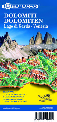
Dolomites – Lake Garda - Venice region of north-eastern Italy on a road map at 1:200,000 from Tabacco with excellent presentation of the topography derived from the publishers’ highly regarded and popular hiking maps, plus on the reverse a panorama drawing of the mountains. Coverage extends from the Austrian border southwards to the A4 motorway in...

Verkopers met dit product

Verkoper
Bezorging
Prijs
DeZwerver.nl logo
DeZwerver.nl
niet bekend
2,95
9,95

Anderen bekeken ook

Wegenkaart - landkaart Dolomiti - Dolomieten - Lago di Garda - Venezia | Tabacco Editrice
Dolomites – Lake Garda - Venice region of north-eastern Italy on a road map at 1:200,000 from Tabacco with excellent presentation of the topography derived from the publishers’ highly regarded and popular hiking maps, plus on the reverse a panorama drawing of the mountains. Coverage extends from the Austrian border southwards to the A4 motorway including the whole of Lake Garda, Verona, Padua and Venice, plus east to Lienz/Pordenone.   The map provides a very clear picture of the region’s landscape through graphic relief for its exposed rocky areas, plus relief shading and contours at 100m intervals, and has plenty of names of individual groups, peaks, valleys, etc. Additional colouring indicates woodlands and boundaries of national parks and other protected areas are marked. Minor roads are drawn without generalizing their course, showing the twists and turns across the mountainous terrain. Driving distances are marked on main and many connecting routes. Railway lines are shown with …
9,95
Wegenkaart - landkaart Südtirol Alto Adige - Dolomiti - Zuid Tirol - Dolomieten | Tabacco Editrice
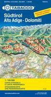
Heel duidelijke wegenkaart van Zuid Tirol. De kaart is goed leesbaar met mooie kleurstellin waardoor goed duidelijk wordt hoe en waar de bergbieden en nationale parken liggen.  The South Tyrol region of north-eastern Italy on a durable, waterproof and tear-resistant road map at 1:150,000 from Tabacco with excellent presentation of the topography derived from the publishers’ highly regarded and popular hiking maps, plus on the reverse a panorama drawing of the mountains. Coverage extends from the Austrian border to just past Trento and Feltre, and west/east from Bormio to well east of Belluno.   The map provides a very clear picture of the region’s landscape through graphic relief for its exposed rocky areas, plus relief shading and contours at 100m intervals, and has plenty of names of individual groups, peaks, valleys, etc. Additional colouring indicates woodlands and boundaries of national parks and other protected areas are marked. Minor roads are drawn without generalizing their c…
12,50
Wandelkaart 010 Sextener Dolomiten - Dolomiti di Sesto | Tabacco Editrice
De beste wandelkaarten voor de Dolomieten. Zeer veel topografische details met secure hoogtelijnen (25 meter interval), helder kleurgebruik en bijna alle Tabacco kaarten hebben een UTM grid (voor GPS toepasbaar).   Daarnaast zijn op deze wandelkaarten wandelroutes ingetekend met nummering gelijk aan markering onderweg aangebracht door de lokale bergsportvereniging. De zwaarte van de routes wordt duidelijk door het verschil in markering. Uiteraard worden de Alta Via routes vermeld en ingetekend, alsmede de Via Ferrata waar je met behulp van stalen ladders verder komt dan de gewone wandelaar.   Als extra informatie worden met symbolen 6 verschillende typen accommodatie aangeduid van berghut, hotel tot camping. Informatie over bushaltes, stoeltjesliften en kabelbanen ook aanwezig.   Plaatsen, bergen en valleien: Toblach / Dobbiaco, Sexten / Sesto, Innichen / San Candido, Sillian, Kartitsch, Außervillgraten, Padola, Niederdorf / Villabassa, Drei Zinnen / Tre Cime, Zwölferkofel / Croda dei…
17,95
Wandelkaart 053 Dolomiti di Brenta | Tabacco Editrice
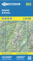
De beste wandelkaarten voor de Dolomieten. Zeer veel topografische details met secure hoogtelijnen (25 meter interval), helder kleurgebruik en bijna alle Tabacco kaarten hebben een UTM grid (voor GPS toepasbaar).   Daarnaast zijn op deze wandelkaarten wandelroutes ingetekend met nummering gelijk aan markering onderweg aangebracht door de lokale bergsportvereniging. De zwaarte van de routes wordt duidelijk door het verschil in markering. Uiteraard worden de Alta Via routes vermeld en ingetekend, alsmede de Via Ferrata waar je met behulp van stalen ladders verder komt dan de gewone wandelaar.   Als extra informatie worden met symbolen 6 verschillende typen accommodatie aangeduid van berghut, hotel tot camping. Bushaltes, stoeltjesliften en kabelbanen ontbreken niet.   Dorpen, bergen en dalen: Mezzana, Madonna di Campiglio, Pinzolo, Strembo, Dimaro, Marilleva, Ossana, Andalo, Molveno, Stenico, Sasso Rosso, Cima Tosa, Cima Brenta, Monte Ranzo, Pietra Grande, Cima Flavona, Cima Laste, Pass…
17,95
Wandelkaart 031 Pragser Dolomiten - Enneberg - Dolomiti di Braies - Marebbe | Tabacco Editrice
De beste wandelkaarten voor de Dolomieten. Zeer veel topografische details met secure hoogtelijnen (25 meter interval), helder kleurgebruik en bijna alle Tabacco kaarten hebben een UTM grid (voor GPS toepasbaar).   Daarnaast zijn op deze wandelkaarten wandelroutes ingetekend met nummering gelijk aan markering onderweg aangebracht door de lokale bergsportvereniging. De zwaarte van de routes wordt duidelijk door het verschil in markering. Uiteraard worden de Alta Via routes vermeld en ingetekend, alsmede de Via Ferrata waar je met behulp van stalen ladders verder komt dan de gewone wandelaar.   Als extra informatie worden met symbolen 6 verschillende typen accommodatie aangeduid van berghut, hotel tot camping. Informatie over bushaltes, stoeltjesliften en kabelbanen ook aanwezig.   Plaatsen, bergen en valleien: Bruneck / Brunico, Marebbe / Enneberg, Prags / Braies, Toblach / Dobbiaco, Rasen / Rasun, Sankt Martin / San Martino, Sankt Lorenzen / San Lorenzo, Seekofel / Croda del Beco, Dür…
17,95
Wandelkaart 06 Val di Fassa e Dolomiti Fassane | Tabacco Editrice
De beste wandelkaarten voor de Dolomieten. Zeer veel topografische details met secure hoogtelijnen (25 meter interval), helder kleurgebruik en bijna alle Tabacco kaarten hebben een UTM grid (voor GPS toepasbaar).   Daarnaast zijn op deze wandelkaarten wandelroutes ingetekend met nummering gelijk aan markering onderweg aangebracht door de lokale bergsportvereniging. De zwaarte van de routes wordt duidelijk door het verschil in markering. Uiteraard worden de Alta Via routes vermeld en ingetekend, alsmede de Via Ferrata waar je met behulp van stalen ladders verder komt dan de gewone wandelaar.   Als extra informatie worden met symbolen 6 verschillende typen accommodatie aangeduid van berghut, hotel tot camping. Informatie over bushaltes, stoeltjesliften en kabelbanen ook aanwezig.   Plaatsen, bergen en valleien: Monzoni, Canazei, Alba, Moena, Seiseralm / Seiser Alm / Alpe di Siusi, Sella, Marmolada / Marmolata, Costabella, Monzoni, Val di San Pellegrino, Latemar, Rosengarten, Langkofel
17,95
Wegenkaart - landkaart Dolomieten / Noordoost-Italië | ITMB
The mountainous northern portion of Italy is one of today’s touristic highlights. This is a new title for ITMB and one that required considerable research to accomplish. It not only shows the roads and rail lines in the region, but hotels, castles/fortresses, museums, and a significant number of footpaths. This is the first new map of this important region, covering from Trento in the south to Sterzing-Vipiteno in the north. It also has a Top Attractions list to assist users. The reverse side is a more general map of northeastern Italy from the Slovenian border west to Brescia and from the Swiss border south to Siena, for the assistance of end users. This side has its own Top Attractions list and an outline of the area covered in better detail that is on the other side of the sheet.
12,50

Klanten-reviews van Wegenkaart - landkaart Dolomiti - Dolomieten - Lago di Garda - Venezia | Tabacco Editrice

Er zijn nog geen beoordelingen voor dit productBen jij de eerste die een review plaatst?

Meer over Wegenkaart - landkaart Dolomiti - Dolomieten - Lago di Garda - Venezia | Tabacco Editrice

Productomschrijving

Dolomites – Lake Garda - Venice region of north-eastern Italy on a road map at 1:200,000 from Tabacco with excellent presentation of the topography derived from the publishers’ highly regarded and popular hiking maps, plus on the reverse a panorama drawing of the mountains. Coverage extends from the Austrian border southwards to the A4 motorway including the whole of Lake Garda, Verona, Padua and Venice, plus east to Lienz/Pordenone.   The map provides a very clear picture of the region’s landscape through graphic relief for its exposed rocky areas, plus relief shading and contours at 100m intervals, and has plenty of names of individual groups, peaks, valleys, etc. Additional colouring indicates woodlands and boundaries of national parks and other protected areas are marked. Minor roads are drawn without generalizing their course, showing the twists and turns across the mountainous terrain. Driving distances are marked on main and many connecting routes. Railway lines are shown with stations and mountain transport lines (cable car lines, chair lifts, etc) are included. The map is designed to present the topography of the region rather than its tourist sights, but it does indicate campsites. Latitude and longitude lines are drawn at 10’ and 20’ respectively. Where appropriate, both Italian and German place names are given. Map legend includes English.   On the reverse is a panorama drawing of the Dolomites, looking northwards from the Po plain and the motorway linking Lake Garda and Venice, with the Austrian and German Alps in the background. Annotated with names of mountain ranges, peaks, valleys, etc, the panorama also shows local town and villages and the region’s road network.

Productinformatie

    Verken gerelateerde categorieën

    Webshop.nl maakt gebruik van cookies. Ga je verder op onze website, ga dan akkoord met het plaatsen van cookies en de verwerking van deze data door ons en vermelde partners.