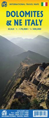
Wegenkaart - landkaart Dolomieten / Noordoost-Italië | ITMB

0
The mountainous northern portion of Italy is one of today’s touristic highlights. This is a new title for ITMB and one that required considerable research to accomplish. It not only shows the roads and rail lines in the region, but hotels, castles/fortresses, museums, and a significant number of footpaths. This is the first new map of this importa...

Verkopers met dit product

Verkoper
Bezorging
Prijs
DeZwerver.nl logo
DeZwerver.nl
2,95
12,50

Anderen bekeken ook

Wegenkaart - landkaart Dolomieten / Noordoost-Italië | ITMB
The mountainous northern portion of Italy is one of today’s touristic highlights. This is a new title for ITMB and one that required considerable research to accomplish. It not only shows the roads and rail lines in the region, but hotels, castles/fortresses, museums, and a significant number of footpaths. This is the first new map of this important region, covering from Trento in the south to Sterzing-Vipiteno in the north. It also has a Top Attractions list to assist users. The reverse side is a more general map of northeastern Italy from the Slovenian border west to Brescia and from the Swiss border south to Siena, for the assistance of end users. This side has its own Top Attractions list and an outline of the area covered in better detail that is on the other side of the sheet.
12,50
Wegenkaart - landkaart Panoramakaart Tirol - Dolomieten - Gardameer | Freytag & Berndt
Tweezijdige panorama kaart van dit berggebied in Tirol, de Dolomieten en het Gardameer: door 3D afbeelding krijg je een mooi overzicht hoe de valleien lopen en de gebergtes liggen ten opzichte van elkaar.   Explore Tyrol and the Dolomites area with this Freytag&Berndt double-sided panoramic map. The best way to plan your trip, prepare your itinerary, and to travel independently in this part of Austria and Italy.    One side shows a road map of Tyrol, Northeast Italy and Southern Bavaria. The other side shows the same area with a panoramic view.    Touristic information: places of interest, nature reserves, scenic views, religious buildings, castles, monuments, ruins, antique sites, airports, camping, youth hostels.    The legend is in English, German, French, Italian, Dutch, Spanish, Czech, Slovak, Polish and Hungarian.
14,95
Wegenkaart - landkaart 3012 Adventure Map India Northeast - Noordoost | National Geographic
Wegenkaart van Noordoost India met vermelding van veel bezienswaardigheden, nationale parken en attrakties. Watervast en scheurvast.   National Geographic's India Northeast Adventure Map is designed to meet the unique needs of adventure travelers with its durability and detailed, accurate information. The map includes the locations of thousands of cities and towns with a user-friendly index, as well as a clearly marked road network complete with distances and designations for highways, major routes and secondary roads.   The India Northeast Adventure Map differs from a traditional road map for it includes hundreds of points of interest that highlight the diverse and unique destinations found in this region. The map features UNESCO World Heritage sites, archaeological sites, wildlife sanctuaries, Hindu and Buddhist temples, forts, ruins, caves and other points of interest, making it an invaluable resource to travelers hoping to experience all the history and culture this part of India …
17,50
Stadsplattegrond Buenos Aires - Argentinië Noordoost | ITMB
A double-sided road map of Buenos Aires and Northeast Argentina.   One side shows a detailed street map of Buenos Aires, with inset maps of subway lines, the Greater Buenos, and a place names index. This plan covers Downtown Buenos Aires, the Jorge Newbery airport, Ciudad Universitaria, and the central station.   Touristic information on the map include:  places of interest museums religious buildings parks cinemas hospitals, post-offices malls police stations   The other side shows Northern Argentina, from Buenos Aires to the south to the borders of Paraguay and Bolivia.    The legend is in English and in Spanish.
13,95
Wegenkaart - landkaart 354 Dolomieten - Trentino - Alto Adige | Michelin
De Michelin kaart is actueel, gedetailleerd, nauwkeurig, praktisch en internationaal.    De Lokale Michelin streekkaart biedt u: nauwkeurige en toeristische informatie over een streek of regio, een plaatsnamenregister om uw route gedetailleerd uit te stippelen, een nog waarheidsgetrouwere weergave van de topografie door het satellietbeeld en een selectie van de mooiste plekken.   From Michelin's yellow Local series of Europe maps comes this map of Dolomites, Trentino, Alto Adige at 1:200 000, showing excellent detail in this region of Italy. The map has the usual excellent road detail characteristic of Michelin maps, with everything from motorways down to rough tracks and footpaths marked out clearly. The number of lanes is indicated on most roads, with intermediate road distances, European route numbers and tolled roads also shown.   The map includes highly detailed relief shading that's derived from satellite photos, with plenty of spot heights also. View points, scenic routes, reli…
10,95
Wegenkaart - landkaart Dolomiti - Dolomieten - Lago di Garda - Venezia | Tabacco Editrice
Dolomites – Lake Garda - Venice region of north-eastern Italy on a road map at 1:200,000 from Tabacco with excellent presentation of the topography derived from the publishers’ highly regarded and popular hiking maps, plus on the reverse a panorama drawing of the mountains. Coverage extends from the Austrian border southwards to the A4 motorway including the whole of Lake Garda, Verona, Padua and Venice, plus east to Lienz/Pordenone.   The map provides a very clear picture of the region’s landscape through graphic relief for its exposed rocky areas, plus relief shading and contours at 100m intervals, and has plenty of names of individual groups, peaks, valleys, etc. Additional colouring indicates woodlands and boundaries of national parks and other protected areas are marked. Minor roads are drawn without generalizing their course, showing the twists and turns across the mountainous terrain. Driving distances are marked on main and many connecting routes. Railway lines are shown with …
9,95
Wegenkaart - landkaart England & Wales - Engeland | ITMB
Een degelijke kaart met aanduidingen van o.a. nationale parken, vliegveld, benzinepompen. ITMB publishes a map of Great Britain, but each portion of GB needs its own map to show roads and attractions in more detail. This is a brilliant map of both England and Wales, showing the entire 'country' in a double-sided format. The place names index is formidable, but England in particular is a series of little villages, so it has been very difficult to decide what to include and what to leave out. This map is showing motorways, divided carriageways, all A & B highways, railway lines, airports, historic sites and touristic attractions, parks and gardens, and just about everything that we could fit on to the page to provide users with a detailed, usable map. We have been able to fit all of southern England/Wales as far north as Chester/Lincoln on side A and with a little overlap, from those cities north to the well over the Scottish border, up to Perth/Dundee filling side B. The Isle of Man an…
13,95
Wegenkaart - landkaart Südtirol Alto Adige - Dolomiti - Zuid Tirol - Dolomieten | Tabacco Editrice
Heel duidelijke wegenkaart van Zuid Tirol. De kaart is goed leesbaar met mooie kleurstellin waardoor goed duidelijk wordt hoe en waar de bergbieden en nationale parken liggen.  The South Tyrol region of north-eastern Italy on a durable, waterproof and tear-resistant road map at 1:150,000 from Tabacco with excellent presentation of the topography derived from the publishers’ highly regarded and popular hiking maps, plus on the reverse a panorama drawing of the mountains. Coverage extends from the Austrian border to just past Trento and Feltre, and west/east from Bormio to well east of Belluno.   The map provides a very clear picture of the region’s landscape through graphic relief for its exposed rocky areas, plus relief shading and contours at 100m intervals, and has plenty of names of individual groups, peaks, valleys, etc. Additional colouring indicates woodlands and boundaries of national parks and other protected areas are marked. Minor roads are drawn without generalizing their c…
12,50
Wegenkaart - landkaart Ierland | ITMB
As technology improves, we are able to produce more detailed maps than was previously possible. Such is the case with Ireland, a part of the world consisting of two countries divided by religion and history. Preparing a map of Ireland as a double-sided map means cutting the island into two geographic portions. Side 1 covers the northern half. This includes the portion known as Northern Ireland, or Ulster, and a fair portion of the Republic of Ireland, or Eire; essentially everything north of Dublin and west to Counties Mayo and Galway. Side 2 covers the southern half of the island from just north of Dublin to the outer tips of County Kerry. It also includes a nice inset map of central Dublin. Naturally, all motorways and roads are included, as are touristic attractions, camping/caravan sites, ferry terminals, and Top Attractions. This is a very detailed travel map of the island, printed on waterproof paper for durability. We had great fun driving around Ireland researching this map. I…
14,95
Wegenkaart - landkaart Idaho, Montana & Wyoming | ITMB
Een degelijke kaart met aanduidingen van o.a. nationale parken, vliegveld, benzinepompen. The northern mountain states of the USA are now the most recent portion of ITMB’s re-mapping of the USA for travel. We had to include a small portion of Washington State and Oregon, due to the shape of Idaho, but the double-sided sheet covers the three states with very little room left over. Side 1 stretches from the Alberta border to Salt Lake City, in Utah, and from west of Spokane to Helena, MT. The 2nd side covers from the Canadian border south to Cheyanne, and is essentially a map of Montana and Wyoming. As such, this is the most detailed map of this region of the USA ever published, and pretty much completes our mapping of the western half of the continental USA. We have also added a new feature – a list of the most popular sites – for those with limited time, showing such well-known features as Glacier National Park and the Buffalo Bill Center of the West. We would be happy to expand this …
13,95

Klanten-reviews van Wegenkaart - landkaart Dolomieten / Noordoost-Italië | ITMB

Er zijn nog geen beoordelingen voor dit productBen jij de eerste die een review plaatst?

Meer over Wegenkaart - landkaart Dolomieten / Noordoost-Italië | ITMB

Productomschrijving

The mountainous northern portion of Italy is one of today’s touristic highlights. This is a new title for ITMB and one that required considerable research to accomplish. It not only shows the roads and rail lines in the region, but hotels, castles/fortresses, museums, and a significant number of footpaths. This is the first new map of this important region, covering from Trento in the south to Sterzing-Vipiteno in the north. It also has a Top Attractions list to assist users. The reverse side is a more general map of northeastern Italy from the Slovenian border west to Brescia and from the Swiss border south to Siena, for the assistance of end users. This side has its own Top Attractions list and an outline of the area covered in better detail that is on the other side of the sheet.

Productinformatie

    Verken gerelateerde categorieën

    Webshop.nl maakt gebruik van cookies. Ga je verder op onze website, ga dan akkoord met het plaatsen van cookies en de verwerking van deze data door ons en vermelde partners.