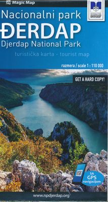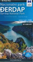
Wegenkaart - landkaart Djerdap National Park - Servië | NPDjerdap.org

0
Goede overzichtskaart van het nationale park Derdap - Djerdap in het noordoosten van Servië aan de Donau. Met symbolen worden de toeristisch belangrijke zake aangeduid. De belangrijkste wandelpaden staan ingetekend en op de achterzijde met een hoogteprofiel meer uitgewerkt.  ...

Verkopers met dit product

Verkoper
Bezorging
Prijs
DeZwerver.nl logo
DeZwerver.nl
2,95
14,95

Anderen bekeken ook

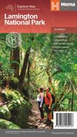
Wegenkaart - landkaart Lamington National Park | Hema Maps
Detailkaart van een deel van Australië. Zeer goed leesbaar, met naast de topografische details veel symbolen waarmee allerhande toeristische zaken worden aangeduid als campsites, nationale parken, attracties, wandelmogelijkheden etc. This map covers the whole area of the park and all the graded walking tracks that start from Binna Burra and O'Reilly's. It has been drawn at a good walking scale of 1:35 000 and shows all points of interest in the park. The walking tracks are shown in different colours on the map and have been broken up into short walks, half day walks and full day walks. A detailed description of each of the walks is shown on the back of the map. Detailed contoured map of the park in southern Queensland on the NSW border. Overprint highlights several hiking routes, from 0.5km to 24km long. Symbols show various facilities in the park, including accommodation, camping areas, viewpoints, places of interest, etc. Enlargements show two areas with main facilities and accommod…
17,50
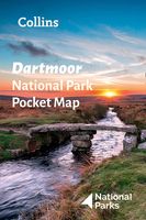
Wegenkaart - landkaart National Park Pocket Map Dartmoor | Collins
Handige kleine kaart van dit Nationaal Park. De kaart geeft een goed en helder overzicht van het gebied met alle plaatsen, doorgaande wandelpaden (alhoewel grof van schaal), bezienswaardigheden etc. Met een register en aanvullende tekst onder de kaart is het een mooi overzicht wat je waar kunt gaan doen. Handy little full colour map of Dartmoor National Park. Detailed mapping and visitor information to the National Park along with a selection of photographs.The perfect way to explore this beautiful area in the South of England. This small map gives a great overview of the Dartmoor National Park.• Clear, detailed mapping• Key park, tourist and travel information• Ideal for planning visits to the National Park• Index to help locate and plan your trip
7,95
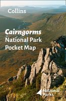
Wegenkaart - landkaart National Park Pocket Map Cairngorms | Collins
Handige kleine kaart van dit Nationaal Park. De kaart geeft een goed en helder overzicht van het gebied met alle plaatsen, doorgaande wandelpaden (alhoewel grof van schaal), bezienswaardigheden etc. Met een register en aanvullende tekst onder de kaart is het een mooi overzicht wat je waar kunt gaan doen. Handy little full colour map of Cairngorms National Park. Detailed mapping and visitor information to the National Park along with a selection of photographs.The perfect way to explore this beautiful area in Scotland. This small map gives a great overview of the Cairngorms National Park.• Clear, detailed mapping• Key park, tourist and travel information• Ideal for planning visits to the National Park• Index to help locate and plan your trip
7,95
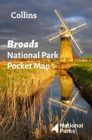
Wegenkaart - landkaart National Park Pocket Map Broads | Collins
Handige kleine kaart van dit Nationaal Park. De kaart geeft een goed en helder overzicht van het gebied met alle plaatsen, doorgaande wandelpaden (alhoewel grof van schaal), bezienswaardigheden etc. Met een register en aanvullende tekst onder de kaart is het een mooi overzicht wat je waar kunt gaan doen. Handy little full colour map of Broads National Park. Detailed mapping and visitor information to the National Park along with a selection of photographs.The perfect way to explore this beautiful area of East Anglia. This small map gives a great overview of the Broads National Park.• Clear, detailed mapping• Key park, tourist and travel information• Ideal for planning visits to the National Park• Index to help locate and plan your trip
7,95
Wegenkaart - landkaart National Park Pocket Map Northumberland | Collins
Handige kleine kaart van dit Nationaal Park. De kaart geeft een goed en helder overzicht van het gebied met alle plaatsen, doorgaande wandelpaden (alhoewel grof van schaal), bezienswaardigheden etc. Met een register en aanvullende tekst onder de kaart is het een mooi overzicht wat je waar kunt gaan doen. Handy little full colour map and guide of Northumberland National Park. Detailed mapping and visitor information to the National Park along with a selection of photographs.   This small map with additional text and photographs gives a great overview of the Northumberland National Park, and is the perfect companion for exploring this beautiful area of Northern England.   Clear, detailed mapping Key park, tourist and travel information Ideal for planning visits to the National Park Index to help locate and plan your trip
7,95
Wegenkaart - landkaart Jasper National Park & Northern Alberta | ITMB
  Jasper National Park kaart, zeer gedetailleerd (schaal 1:250.000) plus op de anderekant van de kaart staat Noord Alberta, schaal 1:1.000.000. Natuurkundige overzichtskaart met veel plaatsen en wegen, spoorlijnen en rivieren, hoogten, lengte- en breedtegraden.   Two words immediately come to my mind if I were to describe Northern Alberta: Oil and Cold. Oil sands could be found relatively easily within the Northern Alberta region. This pushes the Canadian economy forward as gasoline and other petroleum products are becoming higher in demand. Northern Alberta is also about the subzero temperature. The region of Northern Alberta mostly contains very cold, long winters and warm, short summers. Fort McMurray, for example, one of the famous urban communities located in the Wood buffalo municipality, has only a yearly mean temperature of 0.7 degrees Celsius. Nonetheless, Northern Alberta is also a land of recreation activities and wild adventures. On the other side of the Northern Alberta …
13,95
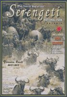
Wegenkaart - landkaart Serengeti National Park | Veronica Roodt
Zeer bijzondere landkaart van het nationaal park Serengeti. Uitermate handig zijn de GPS coördinaten van de meest belangrijke punten als campings of uitzichtpunten. De kaart is gebaseerd op een luchtfoto, waarbij alle details zijn ingetekend. Aan de achterzijde is een overzicht met de meest voorkomende flora en fauna uit het park. Satellite photos as a backdrop which shows an aerial view of the topography Roads that have been tracked and measured by Veronica Roodt personally by means of a GPS. GPS coordinates of all the camps, lodges and important tourist attractions, important road crossings, bridges etc. Photographic animal, bird and plant checklists on the back of the map. All photographs were taken by Veronica whilst doing the field work for the maps. Information on geology, climate, how to get there, what to take, where to stay, road conditions etc.
17,50
Wegenkaart - landkaart Planning Map Yellowstone National Park | Lonely Planet
Handige kaart van dit Nationale Park. Goed te gebruiken als overzichtskaart en planningskaart om voor te bereiden wat je waar kunt doen. Op de ene kant een kaart van het park en op de andere zijde een globale kaart met inzetten van de hoogtepunten. Durable and waterproof, with a handy slipcase and an easy-fold format, Lonely Planet's Yellowstone National Park Planning Map helps you get around with ease. Get more from your map and your trip with images and information about top attractions, itinerary suggestions, a transport guide, planning information, themed lists and practical travel tips. Durable and waterproof Easy-fold format and convenient size Handy slipcase Full color and easy to use Before-you-go info Beautiful imagery Tailored itineraries Can't-miss regional highlights Detailed town index Transport planner Themed lists Covers Yellowstone National Park  
10,95
Wegenkaart - landkaart Hawaii Volcanoes National Park & Big Island | ITMB
Een degelijke kaart met aanduidingen van o.a. nationale parken, vliegveld, benzinepomp, dirt-roads. Als overzichtskaart goed te gebruiken. We didn't suspect, when we started developing this title, that Mauna Loa Volcano would erupt as soon as our map of the national park was printed, but it did! It is on the news every night, and a marvelous touristic attraction. How many of us can ever see a massive eruption of molten lava? Now, we can! (at least, from a safe distance). The national park occupies one side of the map and is the latest in ITMB's series of national parks. By the nature of such parks, we show all the features and elevations, but in this case, we'll add the proviso that heights and lava flows are changing the landscape on a daily basis. Volcanoes are sort of like elephants-they go where they please! The reverse side of the sheet is a map of Big Island, where the park is located. Its name comes from being the largest island in area of all the Hawaiian archipelago. The map …
13,95

Klanten-reviews van Wegenkaart - landkaart Djerdap National Park - Servië | NPDjerdap.org

Er zijn nog geen beoordelingen voor dit productBen jij de eerste die een review plaatst?

Meer over Wegenkaart - landkaart Djerdap National Park - Servië | NPDjerdap.org

Productomschrijving

Goede overzichtskaart van het nationale park Derdap - Djerdap in het noordoosten van Servië aan de Donau. Met symbolen worden de toeristisch belangrijke zake aangeduid. De belangrijkste wandelpaden staan ingetekend en op de achterzijde met een hoogteprofiel meer uitgewerkt.  

Productinformatie

    Verken gerelateerde categorieën

    Webshop.nl maakt gebruik van cookies. Ga je verder op onze website, ga dan akkoord met het plaatsen van cookies en de verwerking van deze data door ons en vermelde partners.