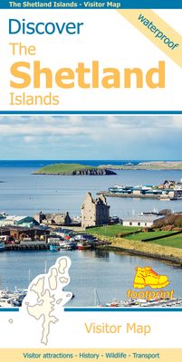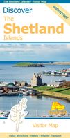
Wegenkaart - landkaart Discover the Shetlands Islands | Footprint maps

0
This map is the perfect companion to take for exploring the Shetland Islands. It is packed with lots of information on where to find the best that this group of islands has to offer visitors.   There is a wide range of wild landscapes: from magnificent coastlines with some of the finest beaches in Europe, to huge sea cliffs framing areas of windsw...

Verkopers met dit product

Verkoper
Bezorging
Prijs
DeZwerver.nl logo
DeZwerver.nl
niet bekend
9,95

Anderen bekeken ook

Wegenkaart - landkaart Discover the Orkney Islands | Footprint maps
A group of islands close to the north coast of Scotland, Orkney has a visible history spanning more than 5500 years. From the world’s best preserved Neolithic settlement at Skara Brae, through numerous Bronze Age stone circles and burial mounds, Iron Age brochs, Medieval churches and cathedrals, to the remains from more recent events during two World Wars, there is almost too much to see.   The scenery is outstanding. A wild coastline (the Old Man of Hoy is one one islands most iconic images) is backed by a surprisingly rich and fertile countryside. From Mainland (the largest and most populated island) ferries run regular services to a further twelve islands (and three more can be reached by causeway). Wildlife is abundant, particularly sea birds and mammals such as seals, dolphins and whales. Most of the islands are low lying with good road networks, making exploring by car, bicycle or foot easy.  
9,95
Wegenkaart - landkaart Spitsbergen Svalbard | ITMB
North of Norway exists one of the northernmost communities in the world, an archipelago of islands called Svalbard in Norwegian, and better known as Spitsbergen in English. Until now, it has only been available in map format from the Norwegian Arctic Institute, and then only with difficulty. Side one shows the various islands as an entity. There is only one town of any size in the islands, called Longyearbyen, although there is a more northerly town called Pyramiden and an isolated community on the west coast called Alesund. This is true high Arctic adventure travel; one does not come here unprepared! Most of the islands are uninhabited and largely ice-covered. Edge Island, for example, is a large nature reserve, and Prins Karl Forland is a national park. We have translated land area names into English and placed the Norwegian names in brackets, but have tried leaving the Norwegian names in place wherever possible to assist with local usage. This is one of those ‘off the beaten path’ …
13,95
Reisgids Travel guides Okinawa & Japan's Southern Islands | Bradt Travel Guides
There’s a whole world in Japan’s Southwest Islands. This brand new guidebook is the first to include all the practical information that visitors to the islands will need. It covers the best of the archipelago’s sites, activities, history, culture and language, as well as providing important practical information for visitors to this rewarding but remote area of Japan. The archipelago’s 1100km stretch, from the southern tip of mainland Japan to Taiwan, makes it geographically and biologically diverse. The landscape includes award-winning beaches, coral reefs, tropical jungles and ancient forests – this guide shows the best way of experiencing them all. Maps of dive sites, snorkel spots, hiking trails and cycle routes are included, as well as local tour operators that can take you there. The islands are also home to many animals including the world’s largest moth, indigenous wild cats, hammerhead sharks, whales and manta rays.   The Southwest Islands are culturally diverse too. Once the…
27,50
Wegenkaart - landkaart Cayman Islands (Kaaiman Eilanden) & Jamaica | ITMB
Een degelijke kaart met aanduidingen van o.a. nationale parken, vliegveld, benzinepomp, dirt-roads en kleine plattegrond van verschillende steden. Als overzichtskaart goed te gebruiken. De kaart is aan twee zijden bedrukt, de ene zijde omvat de Cayman Islands (schaal 1:37.500 en 1:70.000). Op de andere zijde staat de kaart van Jamaica (schaal 1:250.000) en plattegronden van onder andere Kingston. We are pleased to announce the latest new Caribbean map to our growing series. The Caymans, for there are three major islands and numerous little shoals, remains a British colony, like the British Virgin Islands, the Turks and Caicos, and Bermuda. Tourism is the number one industry of the Cayman Islands, with dozens of hotels dotting the beachfronts, especially north of George Town. There are numerous dive sites for viewing tropical fish and we have shown about a hundred on the map, as well as every side street and gas station. One interesting place to visit is Hell, which is a frozen lava er…
13,95
Wandelgids Walking and Trekking in Iceland - IJsland | Cicerone
Wandelgids met beschrijvingen, kaarten en praktische informatie zoals bussen, overnachten, etc. voor meerdaagse wandelroutes en dagwandeltochten op IJsland. A country of extraordinary beauty, Iceland’s incredible variety of volcanic and glacial landscapes makes it a unique destination for walking and trekking holidays. Its three national parks include the mighty Vatnajökull, largest national park in Europe.   The wide range of routes in this book introduce walkers and backpackers to this ‘Land of Ice and Fire’. There are 100 days of walking in this guidebook, stretching over 1722km, split between 49 day walks and 10 multi-stage treks. They climb mountains, cross glaciers, pass lakes and explore coastlines and geothermal areas, and range from easy nature trails to challenging treks. So, there is enough variation to satisfy all kinds of walkers. The routes are spread all around Iceland, grouped into twelve regions. Detailed information is given at the start of each route or trekking sta…
26,95
Reisgids Thailand's Beaches and Islands | Rough Guides
Zeer goede reisgids voor zowel de georganiseerde maar vooral voor de zelfstandige reiziger. Boordevol informatie over reizen, slapen, eten, maar ook musea en cultuur. Voor Europese landen en inmiddels ook voor veel landen buiten Europa meestal completer en beter dan de Lonely Planet ! This practical travel guide to Thailand's Beaches & Islands features detailed factual travel tips and points-of-interest structured lists of all iconic must-see sights as well as some off-the-beaten-track treasures. Our itinerary suggestions and expert author picks of things to see and do will make it a perfect companion both, ahead of your trip and on the ground. This Thailand's Beaches & Islands guide book is packed full of details on how to get there and around, pre-departure information and top time-saving tips, including a visual list of things not to miss. Our colour-coded maps make Thailand's Beaches & Islands easier to navigate while you're there. This guide book to Thailand's Beaches & Islands …
23,95
Reisgids Okinawa and the Ryukyu Islands | Tuttle Publishing
Travel to the most inspiring tropical islands on the planet! Everything you need is in this one convenient Okinawa travel guide—including a large pull-out map.    Okinawa and the Ryukyu Islands is the first comprehensive travel guide to the 150 sub-tropical island chain that stretches across 600 miles from Japan to Taiwan. These are some of the most stunningly beautiful islands in the world!   Trek up active volcanoes, soak in natural hot springs, enjoy pristine white sand beaches, and sample Okinawa's superb homegrown cuisine. Experienced author Robert Walker tells you how to get there, where to go, where to stay and what to do, including: Ferry schedules and flights Lodgings on all inhabited islands Best beaches and surf spots Hikes and nature walks Sights suitable for families with children Historical and cultural landmarks   Along with over 200 color photographs and 40 maps, this book provides essential travel tips to help tourists avoid costly mistakes. It also includes a l…
27,95
Wandelkaart Discover Cairngorms National Park | Footprint maps
Since it was created in 2003 the Cairngorms National Park has provided the ultimate destination for visitors in the UK wanting to experience a unique mixture of wilderness and cultural heritage. At the heart of the Park are the magnificent Cairngorm Mountains, with five of the UK's highest mountains and some of the most impressive corries, it truly is a walker's paradise.   This double sided map and guide is the perfect companion to take when exploring the Cairngorms National Park. It's packed with information on how to get there, what to see and do - and where to go, once you're there.
12,95
Wandelgids The Hebrides - De Hebriden Schotland | Cicerone
This inspirational guide offers 50 varied hiking and backpacking routes on the Scottish Hebrides islands, set out in a large guidebook to be savoured. The hikes highlight all the very best landscapes and scenery to be found on the spectacular islands of the Hebrides, a wonderland for adventurous walkers to return to time and time again. Inspirational guidebook to walking in Scotland's Hebrides islands. 50 adventurous walks on well-known and remote islands; from Syke, Mull, Rum, the Uists and Barra, Ulva, Iona, Eigg and Muck and more besides. Most of the walks provide a full day for experienced walkers, with a few multi-day adventures as well as some shorter routes. The terrain is often rough, rugged and pathless, while waymarking and public transport can, in many places, be hard to find. The challenge of wild walking, and the self-reliance needed to discover the best of the Hebrides, make the islands all the more appealing for adventurous walkers.   The walks also include Hebrides cla…
28,50
Wandelgids Islands of Croatia | Cicerone
This guidebook describes 30 day walks on the islands of the Croatian Adriatic, ranging from short, easy coastal strolls to more challenging, full day outings over rocky ridges and summits, with spectacular views of the Dalmatian coast. Featuring routes on 14 Croatian islands, including the islands of Hvar and Mljet, as well as quieter islands. From short coastal strolls to full-day outings over rocky summits (suitable for all abilities), the walks in this guide cover an island chain of outstanding beauty. From the Kvarner Gulf (south of Rijeka) to southern Dalmatia (west of Dubrovnik), the Croatian islands feature limestone ridges and toothy knolls alternating with olive groves and lush green forest, while coastlines boast sun-drenched beaches and striking cliffs.   A superb network of trails covers the islands, and the views they offer are frequently spectacular. Yet, despite being near tourist hotspots, most see hardly any use. This guide has all the information walkers need to expl…
22,95

Klanten-reviews van Wegenkaart - landkaart Discover the Shetlands Islands | Footprint maps

Er zijn nog geen beoordelingen voor dit productBen jij de eerste die een review plaatst?

Meer over Wegenkaart - landkaart Discover the Shetlands Islands | Footprint maps

Productomschrijving

This map is the perfect companion to take for exploring the Shetland Islands. It is packed with lots of information on where to find the best that this group of islands has to offer visitors.   There is a wide range of wild landscapes: from magnificent coastlines with some of the finest beaches in Europe, to huge sea cliffs framing areas of windswept moorland.   There are also many important historic sites to visit, some of which are world famous spanning the long human occupation of the islands.

Verken gerelateerde categorieën

Webshop.nl maakt gebruik van cookies. Ga je verder op onze website, ga dan akkoord met het plaatsen van cookies en de verwerking van deze data door ons en vermelde partners.