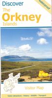
Wegenkaart - landkaart Discover the Orkney Islands | Footprint maps

0
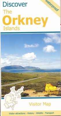
A group of islands close to the north coast of Scotland, Orkney has a visible history spanning more than 5500 years. From the world’s best preserved Neolithic settlement at Skara Brae, through numerous Bronze Age stone circles and burial mounds, Iron Age brochs, Medieval churches and cathedrals, to the remains from more recent events during two Wo...

Verkopers met dit product

Verkoper
Bezorging
Prijs
DeZwerver.nl logo
DeZwerver.nl
2,95
9,95

Anderen bekeken ook

Wegenkaart - landkaart Discover the Orkney Islands | Footprint maps
A group of islands close to the north coast of Scotland, Orkney has a visible history spanning more than 5500 years. From the world’s best preserved Neolithic settlement at Skara Brae, through numerous Bronze Age stone circles and burial mounds, Iron Age brochs, Medieval churches and cathedrals, to the remains from more recent events during two World Wars, there is almost too much to see.   The scenery is outstanding. A wild coastline (the Old Man of Hoy is one one islands most iconic images) is backed by a surprisingly rich and fertile countryside. From Mainland (the largest and most populated island) ferries run regular services to a further twelve islands (and three more can be reached by causeway). Wildlife is abundant, particularly sea birds and mammals such as seals, dolphins and whales. Most of the islands are low lying with good road networks, making exploring by car, bicycle or foot easy.  
9,95
Wegenkaart - landkaart Discover the Shetlands Islands | Footprint maps
This map is the perfect companion to take for exploring the Shetland Islands. It is packed with lots of information on where to find the best that this group of islands has to offer visitors.   There is a wide range of wild landscapes: from magnificent coastlines with some of the finest beaches in Europe, to huge sea cliffs framing areas of windswept moorland.   There are also many important historic sites to visit, some of which are world famous spanning the long human occupation of the islands.
9,95
Wegenkaart - landkaart Orkney Shetland | Philip's Maps
Whether it's the outstanding natural beauty, ancient sites or an activity-packed break calling you, the Philip's leisure and tourist map of Orkney and Shetland is all you need. Places of interest are clearly marked on the easy-to-read mapping - ideal for planning that all-important route.   This double-sided Philip's leisure and tourist map of Orkney and Shetland gives detailed coverage of the islands' road networks at an easy-to-read scale of approximately 2.5 miles to 1 inch. The Orkney Islands are featured on side one of the map, with the Shetland Islands shown on the reverse.   The maps show places of tourist and historic interest, including beaches, castles, camping sites, distilleries, galleries, gardens, golf courses, museums, nature trails, historic sites, sports and entertainment venues. From the ancient settlement of Orkney's Skara Brae and Scapa Flow to the Shetland Museum and Bobby's Bus Shelter, all the top places of interest are featured on each side of the map for Orkne…
11,50
Wandelkaart Discover Cairngorms National Park | Footprint maps
Since it was created in 2003 the Cairngorms National Park has provided the ultimate destination for visitors in the UK wanting to experience a unique mixture of wilderness and cultural heritage. At the heart of the Park are the magnificent Cairngorm Mountains, with five of the UK's highest mountains and some of the most impressive corries, it truly is a walker's paradise.   This double sided map and guide is the perfect companion to take when exploring the Cairngorms National Park. It's packed with information on how to get there, what to see and do - and where to go, once you're there.
12,95
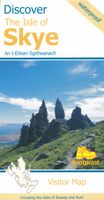
Wegenkaart - landkaart the isle of Skye | Footprint maps
Goede heldere overzichtskaart van het eiland Skye. Als wegenkaart prima te gebruiken, wandelroutes vind je er niet op terug. De wegen staan er duidelijk op ingetekend met wegnmmers en in de steden benzinepompen. Met symbolen veel informatie met mooie plekken om te stoppen, restaurants, campings Visitor map of The Isle of Skye - based on OS data with loads of additional information. 1:110,000. In the Discover series from Footprint maps. Printed on waterproof paper. Includes Raasay, Rona, Scalpay and Soay.
13,95
Wegenkaart - landkaart Hawaiian Islands - Hawaiï | Borch
Mooie geplasticieerde kaart van Hawaiï. Deze kaart biedt een goed overzicht van deze eilanden met detailkaarten.   Our soft-laminated folded map of Hawaii shows: Hawaii (Big Island) 1:400 000, Kilauea Caldera 1:150 000, Hilo 1:70 000, Maui, Molokai / Lanai / Kahoolawe 1:200 000, Wailuku & Kahului 1:35 000, Hawaiian Islands 1:4 000 000, Niihau 1:400 000, Kauai / Oahu 1:200 000, Honolulu & Pearl Harbour 1:26 000, Honolulu Downtown 1:15 500, USA administrative & time zones. Borch Maps are easy to fold, durable and water-repellent with a wipeable surface. Borch Maps show hotels, museums, monuments, markets, public transport, top sights and points of interest, useful statistics, conversion charts for temperatures, weights and measurements, climate charts showing temperatures, sunshine hours, precipitation and humidity, overview maps, time zones, and much more...   Borne of fire and water barely 300 million years ago, the eight islands of the Hawaiian Archipelago together form the 50th US s…
11,50
Spoorwegenkaart - Wegenkaart - landkaart Scotland Far North & Islands Railway & Road | ITMB
Great Britain, by its shape, is difficult to map. The population is dense, the road network intense, and the coastline convoluted. A map of the British Isles shows only the major features. Sectional maps of just England, or Just Wales, make little sense, due to the geographic shape of the island kingdom. Scotland also needs more than one map to show its treasures in sufficient detail. ITMB previously issued Scotland Central and South, and now extends its coverage at 1:300,000 to the sparsely-populated highlands and the isolated Western, Orkney, and Shetland island archipelagos that are usually shrunk to insignificance on most maps, as insets. This double-sided map covers the area from Loch Lochy south of Invergarry to John O’Groats in the north, and from the Western islands of Uist and Lewis to the Moray Firth and Craigellachie in the east. The second side has to duplicate part of the first side in order to extend the artwork further eastward to include Aberdeen and northward to inclu…
13,95
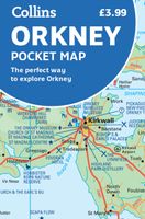
Wegenkaart - landkaart Pocket Map Orkney | Collins
Handy little full colour map of the Orkney Islands in Scotland. Detailed mapping and tourist information for Orkney mainland, Westray, Sanday, Stronsay, Shapinsay, Hoy, South Ronaldsay and the other islands. Excellent value and very detailed for its size. Main features of this map:   • Clear mapping at a scale of 2.7 miles to 1 inch • Tourist attractions located and described • Ideal for touring with sights, places to stay, cafe/restaurant, things to do all on the map • Transport links map showing how to get to and depart the islands • Index to places of interest and place names   Essential for those planning a trip around the Orkney Isles.
7,95
Wegenkaart - landkaart US Virgin Islands & Puerto Rico | ITMB
Puerto Rico: schaal 1:190.000 US Virgin Islands: schaal 1:50.000   We are really pleased with this new edition of Puerto Rico. We spent part of August, 2020, touring the island and geo-referencing its many highways. The island is bigger and more densely road-networked than we thought, so we'll have to complete the job on our next visit, but the roads are now much more precisely shown accurately than was possible before satellite imagery. The map looks great on an Ipad screen as well. The map also shows updated inset maps of San Juan, Ponce, Mayaguez, Aguadilla, and Arecibo. Puerto Rico is part of the United States, so has all the benefits, but is internally self-governing. With this edition we are including a map of the other US colonial territory, the US Virgin Islands. The Danish West Indies was purchased from Denmark in 1917 and is an integral part of the USA, with all its benefits, but is, like Puerto Rico, neither fish nor fowl. It is internally self-governing and a great retirem…
13,95
Wegenkaart - landkaart Virgin Islands - Maagden eilanden | Borch
The soft-laminated map of the Virgin Islands includes: US Virgin Islands 1:80 000, St. Croix 1:80 000, Charlotte Amalie 1:15 000, Charlotte Amalie Historic District 1:7 500, Cruz Bay 1:15 000, Christiansted, Frederiksted 1:15 000, British Virgin Islands 1:80 000, Anegada 1:80 000, Road Town, The Valley (Spanish Town) 1:15 000, Lesser Antilles 1:7 000 000, Virgin Islands administrative / time zones; interesting statistics British / US Virgin Islands: conversion chart for temperatures, weights and measures; climate chart with temperatures, sunshine hours, precipitation and humidity; hotels, museums, markets and much more.   Virgin Islands is the name of two groups of small islands east of Puerto Rico which form the Virgin Islands archipelago. They lie between the Caribbean Sea and the Atlantic Ocean. One of the groups which consists of St. Croix, St. John and St. Thomas islands, together with many nearby islets, is called the U.S. Virgin Islands. The other group including Anegada, Jost …
11,50

Klanten-reviews van Wegenkaart - landkaart Discover the Orkney Islands | Footprint maps

Er zijn nog geen beoordelingen voor dit productBen jij de eerste die een review plaatst?

Meer over Wegenkaart - landkaart Discover the Orkney Islands | Footprint maps

Productomschrijving

A group of islands close to the north coast of Scotland, Orkney has a visible history spanning more than 5500 years. From the world’s best preserved Neolithic settlement at Skara Brae, through numerous Bronze Age stone circles and burial mounds, Iron Age brochs, Medieval churches and cathedrals, to the remains from more recent events during two World Wars, there is almost too much to see.   The scenery is outstanding. A wild coastline (the Old Man of Hoy is one one islands most iconic images) is backed by a surprisingly rich and fertile countryside. From Mainland (the largest and most populated island) ferries run regular services to a further twelve islands (and three more can be reached by causeway). Wildlife is abundant, particularly sea birds and mammals such as seals, dolphins and whales. Most of the islands are low lying with good road networks, making exploring by car, bicycle or foot easy.  

Productinformatie

    Verken gerelateerde categorieën

    Webshop.nl maakt gebruik van cookies. Ga je verder op onze website, ga dan akkoord met het plaatsen van cookies en de verwerking van deze data door ons en vermelde partners.