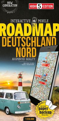
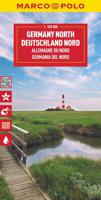
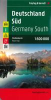
Wegenkaart - landkaart Deutschland Nord - Noord Duitsland | High 5 Edition

0
The first water-resistant roadmap with direct access to useful additional information from the Internet   Northern Germany in a scale of 1:550,000 shown on a practical map; inclusive of the High 5 Edition app technology for calling up additional travel information and many other benefits:   practical format (11.4 x 23.5 cm) it is water-resistant...

Verkopers met dit product

Verkoper
Bezorging
Prijs
DeZwerver.nl logo
DeZwerver.nl
2,95
12,95

Anderen bekeken ook

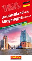
Wegenkaart - landkaart Deutschland Nord - Duitsland Noord | Hallwag
Goede overzichtelijke wegenkaart van de noordelijke helft van Duitsland met register en afstandentabel. The Hallwag road map is a good clear map which includes places of interest marked on the map. The map also includes a distoguide which is an integrated mileage chart on the outer map cover. This allows you to read off more than 2000 distances by using the sliding mileage chart. Detailed touring map of northern Germany extending just south of Koln and Dresden. Separate plans present road access to and main routes across Berlin, Dortmund, Dusseldorf, Bremen, Duisburg/Essen, Leipzig, Dresden, Hamburg, Hanover and Koln
14,50
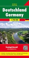
Wegenkaart - landkaart Deutschland - Duitsland | Freytag & Berndt
Gedetailleerde, eenzijdige landkaart van de Duitsland. De berijdbare wegen zijn goed weergeven, zowel de hoofdwegen als provinciale en lokale wegen; wegnummers worden vermeld. Afstanden tussen plaatsen zijn in kilometers op de kaart ingetekend, daarnaast worden ook op belangrijke plekken benzinepompen gemarkeerd. In het kaartbeeld wordt door middel van schaduw het reliëf weergegeven en soms enkele punten in het landschap met de daadwerkelijke hoogte. Provinciegrenzen zijn goed terug te vinden, nationale parken en reservaten ook. Met allerhande symbolen worden toeristische bezienswaardigheden weergegeven als monumenten, historisch belangrijke plekken en uitzichtpunten. In bepaalde plaatsen zijn hotels en campings te vinden, luchthavens, treinverbindingen en havens vindt u er ook op! Germany at 1:700,000 on a large, single-sided road map from Freytag & Berndt, with a separate extensive index booklet listing locations with postcodes and providing street plans of 18 town centres in the co…
14,95
Wegenkaart - landkaart 3312 Adventure Map Germany - Duitsland | National Geographic
Wegenkaart van Duitsland met vermelding van veel bezienswaardigheden, nationale parken en attrakties. Watervast en scheurvast. Juist door deze vermeldingen onderscheidt de kaart zich van andere wegenkaarten. National Geographic's Germany Adventure Map is designed to meet the unique needs of adventure travelers with its durability and accurate information. Each folded map provides global travelers with the perfect combination of detail and perspective, highlighting the area’s terrain and best locations for adventure activities like snorkeling, surfing, fishing, and more. Adventure Maps include hundreds of points of interest that highlight diverse and unique destinations within the country.   The map includes the locations of thousands of cities and towns with a user-friendly index, plus a clearly marked road network complete with distances and designations for major highways, main roads, and tracks and trails for those seeking to explore more remote regions. The front side of the Germa…
17,50
Wegenkaart - landkaart 3011 Adventure Map India | National Geographic
Wegenkaart van India met vermelding van veel bezienswaardigheden, nationale parken en attrakties. Watervast en scheurvast.   National Geographic's India Adventure Map is designed to meet the unique needs of adventure travelers with its durability and detailed, accurate information. The map includes the locations of thousands of cities and towns with a user-friendly index, as well as a clearly marked road network complete with distances and designations for highways, major routes and secondary roads.   The India Adventure Map differs from a traditional road map for it includes hundreds of points of interest that highlight diverse and unique destinations in the region. The map features UNESCO World Heritage sites, national parks, archaeological sites, nature reserves, Hindu and Buddhist temples, and other points of interest, making it an invaluable resource to travelers hoping to experience all the history and culture India has to offer. Additional travel aids include the location of ai…
17,50
Wegenkaart - landkaart Cornwall | Goldeneye
Cornwall Map and Guide of Places to Visit is the ideal guide to the very best of Cornwall. Cornwall remains Britain's Number 1 holiday destination for a week or a fortnight's break. Our Goldeneye Cornwall Leisure Map & Travel Guide has been researched, compiled and published in Cornwall by Cornish locals.   Our team knows Cornwall like no other organisation! Our Cornwall Map & Guide presents Cornwall's multiple attractions in an accessible, easy-to-read and follow, format. In fact, we've been producing this publication for over 30 years and it is firmly part of our DNA. The Cornwall Map and Guide is in the format of a fold-out map and has a detailed visitor map on one side and visitor information on the other: Cornwall Visitor MapAn unbelievably detailed map on one side with lots of additional visitor informationThe ideal scale for touring at 1:126,720 (2 miles to 1 inch)Tourist attractions like beaches & surfing, gardens, harbours & National Trust properties are clearly highlightedCl…
16,50
Wegenkaart - landkaart 3008 Adventure Map China East - Oost | National Geographic
Wegenkaart van Oost China  met vermelding van veel bezienswaardigheden, nationale parken en attrakties. Watervast en scheurvast.   National Geographic's China East Adventure Map is designed to meet the unique needs of adventure travelers with its durability and detailed, accurate information. The map includes the locations of thousands of cities and towns with a user-friendly index, plus a clearly marked road network complete with distances and designations for major highways, major routes and secondary roads. The China Adventure Map is printed in the United States on a durable synthetic paper, making it waterproof, tear-resistant and tough—capable of withstanding the rigors of international travel.   The China East Adventure Map differs from a traditional road map for it includes hundreds of points of interest that highlight diverse and unique destinations in the region. UNESCO World Heritage sites, national parks and reserves, archaeological sites, temples, caves and points of …
17,50
Wegenkaart - landkaart 3014 Adventure Map India South - Zuid | National Geographic
Wegenkaart van Zuid India met vermelding van veel bezienswaardigheden, nationale parken en attrakties. Watervast en scheurvast. National Geographic's India South Adventure Map is designed to meet the unique needs of adventure travelers with its durability and detailed, accurate information. The map includes the locations of thousands of cities and towns with a user-friendly index, as well as a clearly marked road network complete with distances and designations for highways, major routes and secondary roads.   The India South Adventure Map differs from a traditional road map for it includes hundreds of points of interest that highlight the diverse and unique destinations found in this region. The map features UNESCO World Heritage sites, archaeological sites, wildlife sanctuaries, Hindu and Buddhist temples, sacred sites, forts, palaces, ruins, waterfalls, caves and other points of interest, making it an invaluable resource to travelers hoping to experience all the history and culture…
17,50
Wegenkaart - landkaart 3013 Adventure Map India Northwest - Noordwest | National Geographic
Wegenkaart van Noordwest India met vermelding van veel bezienswaardigheden, nationale parken en attrakties. Watervast en scheurvast. National Geographic's India Northwest Adventure Map is designed to meet the unique needs of adventure travelers with its durability and detailed, accurate information. The map includes the locations of thousands of cities and towns with a user-friendly index, as well as a clearly marked road network complete with distances and designations for highways, major routes and secondary roads.   The India Northwest Adventure Map differs from a traditional road map for it includes hundreds of points of interest that highlight diverse and unique destinations in the region. The map features UNESCO World Heritage sites, national parks, archaeological sites, wildlife sanctuaries, Hindu, Buddhist and Sikh temples, forts, palaces and other points of interest, making it an invaluable resource to travelers hoping to experience all the history and culture India has to of…
17,50
Wegenkaart - landkaart Frankreich Nord - Frankrijk Noord | Kümmerly & Frey
Mooie duidelijke wegenkaart van Noord Frankrijk. Met o.a. campings, wegnummers en bezienswaardigheden aangegeven. Die Strassenkarten von Kümmerly+Frey sind beliebte Begleiter bei der Planung einer Reise, unterwegs oder am Ziel. Die "Blauen", wie sie auch genannt werden, zeichnen sich durch ein übersichtliches Kartenbild und eine präzise Kartografie aus. Das Sortiment umfasst weit über 100 aktuelle Strassen- und Reisekarten. Alle Strassenkarten haben eines gemeinsam: Sie sind von bester Schweizer Qualität. Planen und reisen Sie mit einer blauen Strassenkarte von Kümmerly+Frey und Sie werden überrascht sein, wie viel es zu entdecken und zu erleben gibt.  In the Kümmerly+Frey Road Map France (North) at a scale of 1:600,000, you will find everything you need for orientation and inspiration.   The map shows the main areas of interest from Basel, Strasbourg, Metz, Dijon, Bourges, Paris, Le Mans, Rennes, Nantes, Rouen, Lille, Calais, Brest, etc.   Thanks to the clearly marked, easily readabl…
14,75
Wegenkaart - landkaart 3012 Adventure Map India Northeast - Noordoost | National Geographic
Wegenkaart van Noordoost India met vermelding van veel bezienswaardigheden, nationale parken en attrakties. Watervast en scheurvast.   National Geographic's India Northeast Adventure Map is designed to meet the unique needs of adventure travelers with its durability and detailed, accurate information. The map includes the locations of thousands of cities and towns with a user-friendly index, as well as a clearly marked road network complete with distances and designations for highways, major routes and secondary roads.   The India Northeast Adventure Map differs from a traditional road map for it includes hundreds of points of interest that highlight the diverse and unique destinations found in this region. The map features UNESCO World Heritage sites, archaeological sites, wildlife sanctuaries, Hindu and Buddhist temples, forts, ruins, caves and other points of interest, making it an invaluable resource to travelers hoping to experience all the history and culture this part of India …
17,50

Klanten-reviews van Wegenkaart - landkaart Deutschland Nord - Noord Duitsland | High 5 Edition

Er zijn nog geen beoordelingen voor dit productBen jij de eerste die een review plaatst?

Meer over Wegenkaart - landkaart Deutschland Nord - Noord Duitsland | High 5 Edition

Productomschrijving

The first water-resistant roadmap with direct access to useful additional information from the Internet   Northern Germany in a scale of 1:550,000 shown on a practical map; inclusive of the High 5 Edition app technology for calling up additional travel information and many other benefits:  
  • practical format (11.4 x 23.5 cm)
  • it is water-resistant (laminated/cellophane coating)
  • contains a selection of the local index including postal codes; the entire index can be viewed using the QR-code
It doesn’t matter what weather it is used in or how often it is folded, the condition of the “ROADMAP Germany North” will not deteriorate. Roads, ascents, woodland and mountain areas are easily recognisable thanks to the clear layout of the map. There is also a brief informative section about Germany (speed limits, area codes, emergency numbers, etc.)   The “Interactive Mobile ROADMAP Germany North” – a “paper backup” just in case... ... and when used in conjunction with a smartphone, it is a great tool for planning trips.   What’s not on the map is in the app By scanning the section of the map you want with the High 5 Edition app, you can get a lot of useful additional information about major attractions and cities in Northern Germany. The app is based on Augmented Reality technology and is available free of charge from the Apple App store and Google Play store.

Verken gerelateerde categorieën

Webshop.nl maakt gebruik van cookies. Ga je verder op onze website, ga dan akkoord met het plaatsen van cookies en de verwerking van deze data door ons en vermelde partners.