webshop.nl
Categorieën
  Sluiten

Meer Freytag & Berndt
Meer Freytag & Berndt in Reisgidsen & talen boeken

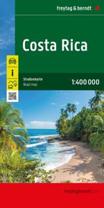
Wegenkaart - landkaart Costa Rica | Freytag & Berndt

Uitstekende landkaart van Costa Rica. Met index, Nationale parken en afstanden in kilometers en register. Goede duidelijke wegenkaart. Wel een grote lap kaart, maar daardoor bestrijkt het een groot gebied. Alle toeristische details staan er op, ook campings worden vermeld. Gedetailleerde, tweezijdige landkaart, prima geschikt voor planning en rondt...
14,95

Webshops met dit product

Webshop
Bezorging
Prijs

Anderen bekeken ook

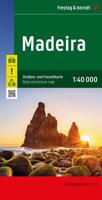
Wandelkaart - Wegenkaart - landkaart Madeira | Freytag & Berndt
Duidelijke kaart met hoofdwegen en kleine wegen. Afstanden zijn gemarkeerd, Schaduwwerking en en bergtekening tonen de hoogte. De Levada's - de kanalen waarlangs uitstekend gewandeld kan worden - staan goed ingetekend. Verder met veel toeristische symbolen voor bezienswaardigheden, campings, nationaal park grenzen, etc. Ingevoegd een simpele kaart van het centrum van Funchal en een inzet van Porto Santo op schaal 1:50.000.   This detailed road map of Madeira is very suitable for planning and traveling around the country. The road network is well represented, both the main roads, provincial and local roads. Road numbers are also clearly stated. Distances between places are marked on the map in kilometers, and gas stations are also marked in important places. Shadow shows the relief and sometimes some points with the actual height. Province borders, national parks and reserves are easy to find. Symbols indicate the location of tourist sites, monuments, historically important places and v…
14,95
Wegenkaart - landkaart 3100 Adventure Map Costa Rica | National Geogra
Zeer gedetailleerde kaart van Costa Rica met stadsplattegrond van de hoofdstad van Costa Rica. Misschien wel de beste kaart! Gedrukt op scheur- en watervast papier. Double-sided, waterproof, tear-resistant and with a street plan of central San José, the NGS Costa Rica Adventure Map was produced in cooperation with the Instituto Geográfico Nacional, Costa Rica’s national survey organization. The country is divided east/west, with a generous overlap between the two sides. Topography is shown by contours at 100m intervals, enhanced by relief shading and spot heights. Along the coast reefs, rocks and shallow water areas are marked. The map indicates various types of vegetation: forests, palm forest, mangrove, and fresh or salt water swamps. Road network includes gravel tracks and indicates roads passable only in summer. Railways and local airstrips are marked, as well as the country’s internal administrative boundaries together with names of the provinces. The map highlights seven differen…
17,50
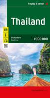
Wegenkaart - landkaart Thailand | Freytag & Berndt
Gedetailleerde, tweezijdige landkaart van Thailand, prima geschikt voor planning en rondtrekken over alle eilanden. De berijdbare wegen zijn goed weergeven, zowel de hoofdwegen als provinciale en lokale wegen; wegnummers worden vermeld. Afstanden tussen plaatsen zijn in kilometers op de kaart ingetekend, daarnaast worden ook op belangrijke plekken benzinepompen gemarkeerd. In het kaartbeeld wordt door middel van schaduw het reliëf weergegeven en soms enkele punten in het landschap met de daadwerkelijke hoogte. Provinciegrenzen zijn goed terug te vinden, nationale parken en reservaten ook. Met allerhande symbolen worden toeristische bezienswaardigheden weergegeven als monumenten, historisch belangrijke plekken en uitzichtpunten. In bepaalde plaatsen zijn hotels en campings te vinden, luchthavens, treinverbindingen en havens vindt u er ook op! Thailand on a large, double-sided, indexed road map from Freytag & Berndt, with clear presentation of the countrys road network, its topography, v…
14,95
Wegenkaart - landkaart Costa Rica | Borch
Mooie geplasticieerde kaart van Costa Rica. Deze kaart biedt een goed overzicht van het land met detailkaarten.   Our soft-laminated folded map of Costa Rica shows: Costa Rica 1:650 000, Cocos Island 1:150 000, San Jose 1:20 000, Meseta Central 1:300 000, Costa Rica administrative and time zones. Borch maps are easy to fold, durable and water-repellent with a wipeable surface. Borch Maps show hotels, museums, monuments, markets, public transport, top sights and points of interest, useful statistics, conversion charts for temperatures, weights and measurements, climate charts showing temperatures, sunshine hours, precipitation and humidity, overview maps, time zones, and much more...   The Republic of Costa Rica ("rich coast") is bordered by Nicaragua, Panama, the Pacific Ocean and the Caribbean Sea. Costa Rica abolished its army in 1949 and is an oasis of peace and tranquility in Central America. Democracy, a policy of neutrality and exemplary environmental standards (approx. 25% of th…
11,50
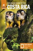
Reisgids Costa Rica | Rough Guides
Zeer goede reisgids voor zowel de georganiseerde maar vooral voor de zelfstandige reiziger. Boordevol informatie over reizen, slapen, eten, maar ook musea en cultuur. Voor veel landen meestal completer en beter dan de Lonely Planet! Practical travel guide to Costa Rica with a free eBook featuring points-of-interest structured lists of all sights and off-the-beaten-track treasures, with detailed colour-coded maps, practical details about what to see and to do in Costa Rica, how to get there and around, pre-departure information, as well as top time-saving tips, like a visual list of things not to miss in Costa Rica, expert author picks and itineraries to help you plan your trip.   The Rough Guide to Costa Rica covers: San José, The Valle Central and the highlands, Limón Province and the Caribbean coast, The Zona Norte, Guanacaste, The Central Pacific and southern Nicoya, The Zona Sur   Inside this travel guide you'll find:   RECOMMENDATIONS FOR EVERY TYPE OF TRAVELLER Experience…
24,95

Klanten-reviews van Wegenkaart - landkaart Costa Rica | Freytag & Berndt

Er zijn nog geen beoordelingen voor dit productBen jij de eerste die een review plaatst?

Meer over Wegenkaart - landkaart Costa Rica | Freytag & Berndt

Productomschrijving

Uitstekende landkaart van Costa Rica. Met index, Nationale parken en afstanden in kilometers en register. Goede duidelijke wegenkaart. Wel een grote lap kaart, maar daardoor bestrijkt het een groot gebied. Alle toeristische details staan er op, ook campings worden vermeld. Gedetailleerde, tweezijdige landkaart, prima geschikt voor planning en rondtrekken. De berijdbare wegen zijn goed weergeven, zowel de hoofdwegen als provinciale en lokale wegen; wegnummers worden vermeld. Afstanden tussen plaatsen zijn in kilometers op de kaart ingetekend, daarnaast worden ook op belangrijke plekken benzinepompen gemarkeerd. In het kaartbeeld wordt door middel van schaduw het reliëf weergegeven en soms enkele punten in het landschap met de daadwerkelijke hoogte. Provinciegrenzen zijn goed terug te vinden, nationale parken en reservaten ook. Met allerhande symbolen worden toeristische bezienswaardigheden weergegeven als monumenten, historisch belangrijke plekken en uitzichtpunten. In bepaalde plaatsen zijn hotels en campings te vinden, luchthavens, treinverbindingen en havens vindt u er ook op!   This detailed road map of Costa Rica is very suitable for planning and traveling around the country. The road network is well represented, both the main roads, provincial and local roads. Road numbers are also clearly stated. Distances between places are marked on the map in kilometers, and gas stations are also marked in important places.   Shadow shows the relief and sometimes some points with the actual height. Province borders, national parks and reserves are easy to find. Symbols indicate the location of tourist sites, monuments, historically important places and viewpoints. In certain places you can find hotels and campsites, airports, train connections and ports.

Productspecificaties

Artikelnummer(s)
Brand
Freytag & Berndt

Verken gerelateerde categorieën

Webshop.nl maakt gebruik van cookies. Ga je verder op onze website, ga dan akkoord met het plaatsen van cookies en de verwerking van deze data door ons en vermelde partners.