Wegenkaart - landkaart Cordillera Cantabrica - Asturias y provincias limitrofes | Adrados Ediciones

0
Gedetailleerde wegenkaart an de Cordillera Cantabrica met hoogtelijnen, hoogte verschillen in kleur en schaduw en UTM coördinaten. Met plaatsnamen index! Cordillera Cantabrica on a detailed road map from the Oviedo based Adrados Ediciones, presenting this mountainous region with contours at 100m intervals, altitude coluring, relief shading and UTM...

Verkopers met dit product

Verkoper
Bezorging
Prijs
DeZwerver.nl logo
DeZwerver.nl
niet bekend
14,95

Anderen bekeken ook

Nieuw
Wandelkaart Picos de Europa National | Adrados Ediciones
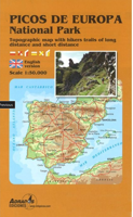
Picos de Europa National Park Short and Long-Distance Trails at 1:50,000 on an excellent, contoured and GPS compatible map from Adrados Ediciones highlighting three hiking routes which can be combined into a Tour of the Picos, plus English language descriptions of the routes and lists of mountain huts and refuges.   The map covers the whole of the National Park area and extends north and west beyond its borders to include Potes and other surrounding villages. Very fine cartography provides an excellent presentation of the terrain through contours at 20m intervals enhanced by relief shading and altitude colouring, numerous spot heights, and plenty of names of peaks and other topographic features. Symbols highlight locations of campsites, mountain huts, refuges and hostels, as well as petrol stations on local roads. The map has a 1-km UTM grid.   A special feature of this map is an overprint highlighting three long-distance hiking routes: a circuit of the western massif, a traverse of t…
14,95
Wandelkaart Macizo de Fuentes Carrionas | Adrados Ediciones
Fuentes Carrionas Massif, just south of the Picos de Europa, on a detailed hiking map from Adrados Ediciones combining coverage at 1:60,000 of the western part of Fuentes Carrionas and Fuentes del Cobre Natural Park with more detailed mapping at 1:25,000 of Peña Prieta Massif. The main map at 1:50,000 has contours at 20m intervals with bold relief shading and altitude colouring. Numerous peaks and other topographical features are named. Hiking, mountain bike and ski trails are highlighted and symbols mark campsites, mountain shelters and cabins, viewpoints, climbing areas, tourist information centres, locations of petrol stations, etc. On the reverse the central part of the main map, the Peña Prieta Massif is shown at 1:25,000 with the excellent cartography used in the publishers’ coverage of the Picos de Europa. Contours are at 10, intervals with additional graphic relief for exposed rocky faces.  
14,95
Wandelkaart Sierra de Gredos | Adrados Ediciones
On one side is a detailed 1:25,000 walking map concentrating on the central sector of the Regional Park around the Almanzor and La Mira peaks. Detailed contours are at 10m intervals, walking trails are marked and springs & refuges are highlighted. On the reverse is a smaller scale map at 1:135,000 extending over a larger area - well beyond the limits of the Regional Park border, to Avila in the extreme north east of the sheet and to Jaraiz de la Vera in the south west. It shows the general topography of the region through contouring, altitude tinting and hill shading, and includes roads and paths with symbols for petrol stations, campsites, refuges and information offices. Map legend and explanatory notes for interpreting the maps are in Spanish only. UTM grid lines are printed over both maps.  
14,95
Wegenkaart - landkaart Chobe | Shell
Zeer bijzondere goede landkaart van Chobe National Park in Botswana. Uitermate handig zijn de GPS coordinaten van de meest belangrijke punten als campings of uitzichtpunten. De kaart is gebaseerd op een luchtfoto, waarbij alle details zijn ingetekend. The map: The Chobe map consists of a complete map of Chobe on the front of the map and there are 5 individual maps of the major tourist areas on the back of the map. These are Chobe river front east, Chobe river front west, Nogatsaa, Savute and a small orientation map. The map was compiled by using satellite images, giving one a birds eye-view of the area. The roads were tracked by means of a GPS and then super-imposed on the photographs. Detailed GPS co-ordinates are supplied for game-drive areas. The Chobe map contains 126 GPS co-ordinates. The four main tourist areas: The Chobe National Park consists of a variety of vegetation types and geological features, offering extreme contrasts and a wide range of wildlife experiences within the…
17,50
Nieuw
Wegenkaart - landkaart Curacao | Kasprowski Maps
Bijzonder gedetailleerde kaart (1:55000) van alleen het eiland Curacao. Zowel de wegen als ook de wandelpaden staan er op vermeld. Stranden, interessante plekken en bovendien de meeste duikplakken staan met diepte helder weergegeven op de kaart. Met stadsplattegrond van Willemstad. The most up-to-date and only complete road map of Curaçao (Scale 1 : 55 000), as well as the entire Willemstad urban area on the reverse, spanning from the international airport to Spanse (Scale 1 : 18 500). Insets of the Willemstad center (Scale 1 : 8 000), Grote Berg (Scale 1 : 6 000), Tera Kora (Scale 1 : 6 000), Barber (Scale 1 : 6 000), and the island Klein Curaçao (Scale 1 : 55 000) are also included. All maps and insets come with thorough street indexes.   The map shows all the island's known roads and streets with their names, displays its many diving sites, and indicates an extensive set of biking routes and hiking trails..   The double-sided map is sold folded, measuring 4 7/8" x 8 7/8" ( 12.5 cm …
18,50
Nieuw
Wegenkaart - landkaart Bonaire | Kasprowski Maps
Bijzonder gedetailleerde kaart (1:40000) van alleen het eiland Bonaire. Zowel de wegen als ook de wandelpaden staan er op vermeld. Stranden, interessante plekken en bovendien de meeste duikplakken staan met diepte helder weergegeven op de kaart. Met stadsplattegrond van Kralendijk. The most up-to-date and only complete road map of Bonaire ( Scale 1 : 28 000 ), as well as the Kralendijk urban area, spanning from Santa Barbara Crowns, through the airport, to Punt Vierkant (Scale 1 : 15 000). An inset of Rincon (Scale 1 : 12 000) is also included. All maps and insets come with thorough street indexes.   All of the official diving sites around Bonaire and Klein Bonaire are displayed, most of them with their GPS locations, as recorded by STINAPA, the island's official conservation foundation.   The map shows all the island's known roads and streets with their names, as well as an extensive set of biking routes and kayaking trails.   The map is sold folded, measuring 5 1/4" x 9 5/8" ( 13.5 …
18,50
Wegenkaart - landkaart 3100 Adventure Map Costa Rica | National Geographic
Zeer gedetailleerde kaart van Costa Rica met stadsplattegrond van de hoofdstad van Costa Rica. Misschien wel de beste kaart! Gedrukt op scheur- en watervast papier. Double-sided, waterproof, tear-resistant and with a street plan of central San José, the NGS Costa Rica Adventure Map was produced in cooperation with the Instituto Geográfico Nacional, Costa Rica’s national survey organization. The country is divided east/west, with a generous overlap between the two sides. Topography is shown by contours at 100m intervals, enhanced by relief shading and spot heights. Along the coast reefs, rocks and shallow water areas are marked. The map indicates various types of vegetation: forests, palm forest, mangrove, and fresh or salt water swamps. Road network includes gravel tracks and indicates roads passable only in summer. Railways and local airstrips are marked, as well as the country’s internal administrative boundaries together with names of the provinces. The map highlights seven differe…
17,50
Wegenkaart - landkaart Trinidad & Tobago | ITMB
This is our newest map for the Caribbean region and essentially replaces the now-defunct Rough Guide map for this country. Trinidad has a chequered history. First ‘discovered’ by Columbus, and named Holy Trinity, its inhabitants were fairly quickly deported as slaves to work in Spanish colonies elsewhere. Sir Walter Raleigh, who was little more than a pirate in spite of later saving England from the Spanish Armada, sacked the only Spanish settlement in 1595. Britain captured the island in 1797, adding Tobago to its administration in 1889. The country’s two claims to fame are the largest Carnival street festival in the world, and having the world’s largest lake of boiling asphalt. Tobago has an amazing history, having changed colonial masters 30 times in a century, as Britain, France, and Spain competed for dominance in the Caribbean. Nowadays, both islands are tourist havens, with delightful caves to explore on Trinidad and scuba diving on Tobago. This is a very detailed map, printed …
13,95
Nieuw
Wegenkaart - landkaart The Andes | ITMB
Een degelijke wegenkaart van de hele Andes met aanduidingen van o.a. nationale parken, vliegveld, Als overzichtskaart goed te gebruiken. We are pleased to be able to re-introduce this important title into our publishing range after a lapse caused by Covid. The Andes mountain chain is the southern extension of the Sierra Nevada chain through Mexico and Central America, which is, in turn the southern extension of the Rocky Mountain chain from Alaska to the Mexican border. The Andes is a magnificent series of high mountains that enters Colombia and spreads southwards through Ecuador and Peru all the way to southern Patagonia. The map is double-sided, with the Northern Andes on one side and the other side divided into two side-by-side maps portraying the Central Andes and the Southern Andes. Thus, the map coverage focuses on the Andes themselves, rather than on all of South America. All of Colombia and Peru are shown, most of Bolivia, all of Chile, and the Patagonian portion of Argentina …
13,95
Nieuw
Wegenkaart - landkaart - Stadsplattegrond San Diego - California south | ITMB
Wegenkaart en stadsplattegrond in een kaart: aan de ene zijde San Diego stadsplattegrond en op de andere kant een kaart van het zuiden van Californië. San Diego on a clear, well presented street plan from ITMB, with a transit system diagram, a road map of the city and its environs, and a street plan of central Tijuana, plus on the reverse a road map of the US/Mexico border region extending east beyond El Paso and within USA north to Las Vegas.   On one side is an indexed street plan of San Diego, covering the city’s central districts (as indicated in our coverage image), including the downtown area, the Old Town for which an enlargement is provided, Balboa Park, University Heights, the Mission Bay Park with the SeaWorld, and the city’s international airport. The plan clearly shows the MTS and other public transit stations, highlights main traffic arteries and indicates one way streets. Also marked are recommended cycle routes. Streets are annotated with selected block numbers for easi…
13,95

Klanten-reviews van Wegenkaart - landkaart Cordillera Cantabrica - Asturias y provincias limitrofes | Adrados Ediciones

Er zijn nog geen beoordelingen voor dit productBen jij de eerste die een review plaatst?

Meer over Wegenkaart - landkaart Cordillera Cantabrica - Asturias y provincias limitrofes | Adrados Ediciones

Productomschrijving

Gedetailleerde wegenkaart an de Cordillera Cantabrica met hoogtelijnen, hoogte verschillen in kleur en schaduw en UTM coördinaten. Met plaatsnamen index!

Cordillera Cantabrica on a detailed road map from the Oviedo based Adrados Ediciones, presenting this mountainous region with contours at 100m intervals, altitude coluring, relief shading and UTM coordinates.

Since the publishers specialize in detailed hiking maps, including the best coverage of the Picos de Europa, the map includes an exceptionally large number of names of peaks, passes, etc. Symbols highlight best rock and ice climbing areas, huts and refuges, campsites, mountain rescue posts and information centres. Along the coast numerous beaches are named.

Road network includes small country roads and tracks. Local railway lines are shown, although not very easy to see on the base map filled with so much information. The map has a 10km UTM grid. Map legend is in Spanish only.

On the reverse is a panorama drawing of the area, looking south from the coast with León and Pontevedra in the background. Numerous towns and villages, as well as peaks of the Cordillera Cantabrica are named. An administrative map of the area shows its division into communes and highlights its many protected areas, accompanied by an index listing, where appropriate, each commune with its highest peak.

Also included is a very extensive list of all the peaks in the Cordillera Cantabrica over 1200m. Accompanying notes are in Spanish only.

Important - please note: All place names are in the local dialect, so Xixon for Gijón, Uvieu for Oviedo, etc. The map is printed on glossy paper and may not withstand repeated folding and unfolding whilst traveling by car, but it is ideal for finding out more about this fascinating region outside its main attraction, the Picos de Europa.

Verken gerelateerde categorieën

Webshop.nl maakt gebruik van cookies. Ga je verder op onze website, ga dan akkoord met het plaatsen van cookies en de verwerking van deze data door ons en vermelde partners.