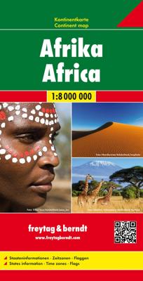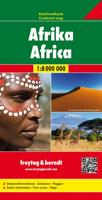
Wegenkaart - landkaart Continentkaart Afrika - Africa | Freytag & Berndt

0
Grote overzichtskaart van het continent waarbij vooral de politieke aspecten getoond worden. De landen hebben verschillende kleuren, grenzen zijn duidelijk weergegeven en de belangrijkste steden en verbindingswegen zijn ingetekend. Ook spoorlijnen zijn er goed op terug te vinden.    De gevouwen éénzijdige kaart is uitgevoerd op stevig papier en vo...

Verkopers met dit product

Verkoper
Bezorging
Prijs
DeZwerver.nl logo
DeZwerver.nl
2,95
18,95

Anderen bekeken ook

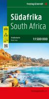
Wegenkaart - landkaart Zuid Afrika - Südafrika | Freytag & Berndt
Goede, gedegen wegenkaart met toeristische informatie, nationale parken en afstanden in kilometers. Met register. Gedetailleerde, eenzijdige landkaart van Zuid Afrika, prima geschikt voor planning en rondtrekken. De berijdbare wegen zijn goed weergeven, zowel de hoofdwegen als provinciale en lokale wegen; wegnummers worden vermeld. Afstanden tussen plaatsen zijn in kilometers op de kaart ingetekend, daarnaast worden ook op belangrijke plekken benzinepompen gemarkeerd. In het kaartbeeld wordt door middel van schaduw het reliëf weergegeven en soms enkele punten in het landschap met de daadwerkelijke hoogte. Provinciegrenzen zijn goed terug te vinden, nationale parken en reservaten ook. Met allerhande symbolen worden toeristische bezienswaardigheden weergegeven als monumenten, historisch belangrijke plekken en uitzichtpunten. In bepaalde plaatsen zijn hotels en campings te vinden, luchthavens, treinverbindingen en havens vindt u er ook op! Very effective relief shading with spot heights …
14,95
Wegenkaart - landkaart Afrika Africa | ITMB
Een degelijke kaart met aanduidingen van o.a. nationale parken, vliegveld, benzinepomp, dirt-roads en kleine plattegrond van hoofdstad. Als overzichtskaart goed te gebruiken. Finally! This is the most innovative map we've published in years! This is the first proper digital data base map of Africa ever published that covers the entire continent from top to bottom and east to west.   The continent of Africa is fascinating. Whether on wishes to visit the continent or just learn more about it, a detailed map is vital, and a good map is hard to find! The first edition of our ITM Africa map sold out in less than two years. We have added a considerable amount of data to this edition of the map, particularly in the northwest portion. One has to be careful not to overload a continental map with too much information, or to show roads so prominently as to obscure too much the map, but one also has to have enough information to make the map useful, readable and attractive. We feel that this edit…
13,95
Wegenkaart - landkaart Africa North - Noord Afrika | ITMB
Een degelijke wegenkaart met aanduidingen van o.a. nationale parken, vliegveld, benzinepomp, dirt-roads. Als overzichtskaart goed te gebruiken. ITMB continues to refine its data base for Africa and introduce new titles that we hope meet market expectations. This map is one of the first of our enhanced scale maps that will gradually become the norm for regional maps of parts of the African continent. This map is also unique in that it does what I do not believe has been attempted before by any publisher - portraying the entire Mediterranean coastline from Morocco to the eastern edge of Egypt in one double-sided map. I admit, current political realities make this map somewhat challenging. One cannot cross, for example, between Morocco and Algeria, and Libya is in such a state of disarray at the moment that it is not practical to visit the country. However, the strength of this title is that it breaks new ground and looks at the countries north of Sahara as a comprehensive entity in grea…
13,95
Wegenkaart - landkaart Africa Southern - zuidelijk Afrika | ITMB
met extra kaarten van Johannesburg - Kapstad - Victoria Falls - Okavango Delta   This map is the updated version of our previous map, which was called Southern Africa, covering the southernmost portion of Africa. It is also the most developed part of the continent, with the densest road network and number of urban areas on the continent. This edition was started a year ago and incorporates an innovative approach to data portrayal by essentially over-lapping our very detailed South Africa artwork over top of the southern Africa artwork. The result is a much more detailed regional map than was possible previously.   Legend Includes: Road by classification, Major Road, Highway, Railway, Ferry, Lake, River, National Park, Beach, Diving, World Heritage, Waterfall, Cave, Monument, Camping Site and much more...
13,95
Wegenkaart - landkaart Western Africa - Afrika westen | ITMB
Een degelijke kaart met aanduidingen van o.a. nationale parken, vliegveld, benzinepomp, dirt-roads en kleine plattegrond van hoofdstad. Als overzichtskaart goed te gebruiken.   This map, at 1:3,400,000 scale is ideal for travellers crossing Africa from Europe to central and southern parts of Africa by land. It covers from the southern tip of Spain through Morocco and western Algeria on one side to Mauritania and the Bight of Benin states of West Africa, as far east as western Nigeria. As a regional map, the detail provided is unsurpassed by any other map of this part of the world. It is the most detailed map to date of the West African states of Guinea, Guinea-Bissau, Liberia, and Sierra Leone. As is always the case with Africa, road information is presented in practical terms of road quality, not road designation. This is a practical map for travellers, so information has been provided with the greatest degree of accuracy possible, given that reliable information can be extremely dif…
13,95

Klanten-reviews van Wegenkaart - landkaart Continentkaart Afrika - Africa | Freytag & Berndt

Er zijn nog geen beoordelingen voor dit productBen jij de eerste die een review plaatst?

Meer over Wegenkaart - landkaart Continentkaart Afrika - Africa | Freytag & Berndt

Productomschrijving

Grote overzichtskaart van het continent waarbij vooral de politieke aspecten getoond worden. De landen hebben verschillende kleuren, grenzen zijn duidelijk weergegeven en de belangrijkste steden en verbindingswegen zijn ingetekend. Ook spoorlijnen zijn er goed op terug te vinden.    De gevouwen éénzijdige kaart is uitgevoerd op stevig papier en voorzien van een plastic laagje.

Productinformatie

    Verken gerelateerde categorieën

    Webshop.nl maakt gebruik van cookies. Ga je verder op onze website, ga dan akkoord met het plaatsen van cookies en de verwerking van deze data door ons en vermelde partners.