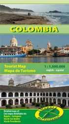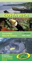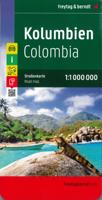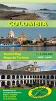
Wegenkaart - landkaart Colombia | Mapas Naturismo

0
Our new Colombia map is ready und its fantastic. It´s the best map of Colombia on the map market. Wiith Detailmaps of: Cartagena 1.20.000 Bogota 1:50.000 Island San Andrés 1.100.000 Island Providencia 1:100.000 Other Highlights are: important and historic sites, museums and other important places all the nature reserves exact distance kilometers, ...

Verkopers met dit product

Verkoper
Bezorging
Prijs
DeZwerver.nl logo
DeZwerver.nl
2,95
11,75

Anderen bekeken ook

Reisgids Colombia | Rough Guides
Zeer goede reisgids voor zowel de georganiseerde maar vooral voor de zelfstandige reiziger. Boordevol informatie over reizen, slapen, eten, maar ook musea en cultuur. Uitputtende bron van informatie, veelal nog completer dan de Lonely Planet. Inleidende informatie over land en cultuur is zeer goed.   This Colombia guidebook is perfect for independent travellers planning a longer trip. It features all of the must-see sights and a wide range of off-the-beaten-track places. It also provides detailed practical information on preparing for a trip and what to do on the ground. And this Colombia travel guidebook is printed on paper from responsible sources, and verified to meet the FSC’s strict environmental and social standards.    This Colombia guidebook covers: Bogotá, North of Bogotá, The Caribbean coast, San Andrés and Providencia, Medellín and the Zona Cafetera, Cali and the southwest, The Pacific coast and Los Llanos, Amazonas.   Inside this Colombia travel book, you’ll find:    A wid…
24,95
Wegenkaart - landkaart 107 Serifos | Road Editions
Gedetailleerde wegenkaart met aanduiding van de wandelwegen, lijst van hotels en toeristische informatie. Voor alle doeleinden een zeer geschikte kaart. The features that make this and every other ROAD island map unique are: *The coastline, hydrography and precision geophysical background based on data provided by the Hellenic Military Geographic Service and electronically processed by us for clarity and legibility. We have highlighted the mountain masses in shades of brown between the contour lines (at 20m intervals on this map) to outline clearly the relief of the island. *The beaches are indicated by a special symbol next to which we have noted their names, as well as all the roads and footpaths leading to them (since most people primarily visit the islands for the beaches!). We have even included a short text in which the island’s best beaches are concisely referred to, to save you going on a wild goose hunt in search of them. *The road network is mapped out with impressive and ex…
9,95
Wegenkaart - landkaart 109 Sifnos | Road Editions
Gedetailleerde wegenkaart met aanduiding van de wandelwegen, lijst van hotels en toeristische informatie. Voor alle doeleinden een zeer geschikte kaart. The features that make this and every other ROAD island map unique are: *The coastline, hydrography and precision geophysical background based on data provided by the Hellenic Military Geographic Service and electronically processed by us for clarity and legibility. We have highlighted the mountain masses in shades of brown between the contour lines (at 20m intervals on this map) to outline clearly the relief of the island. *The beaches are indicated by a special symbol next to which we have noted their names, as well as all the roads and footpaths leading to them (since most people primarily visit the islands for the beaches!). We have even included a short text in which the island’s best beaches are concisely referred to, to save you going on a wild goose hunt in search of them. *The road network is mapped out with impressive and ex…
9,95
Wegenkaart - landkaart 105 Tzia - Kea | Road Editions
Gedetailleerde wegenkaart met aanduiding van de wandelwegen, lijst van hotels en toeristische informatie. Voor alle doeleinden een zeer geschikte kaart. Scheur- en watervast! The features that make this and every other ROAD island map unique are: *The coastline, hydrography and precision geophysical background based on data provided by the Hellenic Military Geographic Service and electronically processed by us for clarity and legibility. We have highlighted the mountain masses in shades of brown between the contour lines (at 100m intervals on this map) to outline clearly the relief of the island. *The beaches are indicated by a special symbol next to which we have noted their names, as well as all the roads and footpaths leading to them (since most people primarily visit the islands for the beaches!). We have even included a short text in which the island’s best beaches are concisely referred to, to save you going on a wild goose hunt in search of them. *The road network is mapped out…
9,95
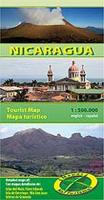
Wegenkaart - landkaart Nicaragua | Mapas Naturismo
Uitstekende wegenkaart van Nicaragua. Zo niet de beste op de markt van de kleine uitgeverij Mapas Naturismo! Met gedetailleerde kaarten van: - Rio San Juan 1:200.000 - Island Ometepe 1:200.000 - Delta Río San Juan 1:10.000 - Big and Little Corn Island, elk 1:75.000 Met ook nog: - belangrijke historische plaatsen - alle nationale parken - afstanden in kilometers, benzine stations en touristische routes - de meest belangrijke volksfeesten De kaart heeft een GPS-Grid!
11,75
Wegenkaart - landkaart Colombia | ITMB
Goede wegenkaart waarbij naast de gebruikelijke zaken als wegen en plaatsen ook veel aandacht is voor de natuurkundige aspecten van het land. Door het kleurgebruik wordt goed duidelijk waar bos, oerwoud, rivieren, meren liggen. Hoogtes zijn zichtbaar door gebruik van verschillende kleuren. Vaak is op de kaart nog een kleine plattegrond van het centrum van de belangrijkste stad te vinden. Colombia is growing in popularity as a travel destination. It is also changing quickly as peace and stability return to a lovely country. We have updated the map to the best of our ability and now have detailed inset maps of Bogota, Medellin, and Cartagena. The border to Ecuador is now an improved crossing. We have printed this updated edition on plastic paper, another improvement, in line with our policy of converting most hot, humid, country maps to plastic.  Legend Includes: Roads by classification, Rivers and Lakes, National Park, Airports, Points of Interests, Mining, Archaeological sites, Beach …
13,95
Wandelkaart - Wegenkaart - landkaart 308 Tinos | Terrain maps
Gedetailleerde wegenkaart en wandelkaart met alle kleine wegen, wandelpaden, hoogtelijnen en toeristische informatie aangegeven. Alle tekst is tweetalig in Engels en Grieks en de waterproof kaart is geschikt voor gebruik met GPS. This is a great map of Tinos because:   •    It is waterproof and rip-proof. You can fold and unfold it a thousand times, fold it in irregular ways, dunk it in the sea or leave it out in the rain. This map is indestructible!    •    It is the first time the island’s entire coastline is mapped. Cartography was done with TERRAIN’s specially equipped and staffed cartographic vessel. This means that you can locate all beaches of the island, down to the tiniest cove! In fact, the special features of every single beach are recorded: whether it is sandy or pebbled, whether it features natural tree shade, water, a beach bar or organized water sports, whether the seabed in front of the beach is sandy or rocky (so that you will know where to anchor).    •    It feature…
12,50

Klanten-reviews van Wegenkaart - landkaart Colombia | Mapas Naturismo

Er zijn nog geen beoordelingen voor dit productBen jij de eerste die een review plaatst?

Meer over Wegenkaart - landkaart Colombia | Mapas Naturismo

Productomschrijving

Our new Colombia map is ready und its fantastic. It´s the best map of Colombia on the map market.

Wiith Detailmaps of:

Cartagena 1.20.000
Bogota 1:50.000
Island San Andrés 1.100.000
Island Providencia 1:100.000
Other Highlights are:

important and historic sites, museums and other important places
all the nature reserves
exact distance kilometers, fuel stations, hotels, panoramic routes for self drivers
The map is GPS-able.

Productinformatie

    Verken gerelateerde categorieën

    Webshop.nl maakt gebruik van cookies. Ga je verder op onze website, ga dan akkoord met het plaatsen van cookies en de verwerking van deze data door ons en vermelde partners.