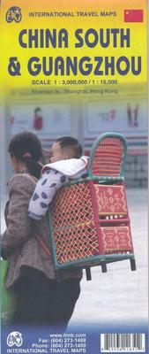
Wegenkaart - landkaart China Zuid & Guangzhou | ITMB

0

Verkopers met dit product

Verkoper
Bezorging
Prijs
DeZwerver.nl logo
DeZwerver.nl
2,95
12,95

Anderen bekeken ook

Wegenkaart - landkaart - Stadsplattegrond China South - Zuid | ITMB
Een degelijke wegenkaart met aanduidingen van o.a. nationale parken, vliegveld, benzinepomp, dirt-roads. Als overzichtskaart goed te gebruiken.   China is a very large country. While our map of the entire country is fine for general travel and sells well, China is too large to show areas in detail. This map concentrates on the part of China from Shanghai south and all the way west to Lhasa and includes Taiwan and Hainan Island. We are not trying to make any sort of political comment here, but geographically, both Tibet and Taiwan fall within the area of coverage and are both included for this reason alone. The map also includes insets of Hong Kong, Guangzhou and Shanghai   Legend Includes: Roads by classification, Points of Interest, National Parks, Airports, Golf Courses, Beaches, Campsites, Waterfalls, Viewpoints, Churches, Surfing/Scuba Diving Spots, Fishing Spots, Hospitals, harbours/Ports, Lighthouses, Museums, Monuments, Caves, Mosques, Mountain Peaks, Botanic Gardens, Wildlife …
13,95
Wegenkaart - landkaart China | ITMB
Een degelijke kaart met aanduidingen van o.a. nationale parken, vliegveld, benzinepomp, dirt-roads en kleine plattegrond van hoofdstad. Als overzichtskaart goed te gebruiken. Tweezijdig, op de ene kant West China en op de andere zijde Oost China. This edition is printed on waterproof, tear-resistant paper, and has a new cover picture showing a portion of the Great Wall. A cursory glance at the map will show an incredible number of motorways. We still show some as being under construction, but updating the road network is now essentially completed. The amazing rapid rail network is now also essentially complete and all such train lines are noted on the map in a red-dashed format. Inset maps of Beijing and Shanghai are shown on side 2, as well as a list of Top Attractions. We continue to show contentious political disputed territories based on practical administrative control, so India's northeast is shown as being under India's control, whereas parts of the northwest are shown under Ch…
13,95
Wegenkaart - landkaart Lissabon & Zuid-Portugal | ITMB
The city of Lisbon is one of the most attractive in Europe. It is an ancient city, but most of its architecture dates from the Victorian era. It has a fascinating number of tram lines, and the trams tend to be an experience worth the trip. One graces our cover. There is no cheaper way to explore this city than to climb aboard and let the rails decide your destination! Coverage extends from the northern and western motorways to the southerly Rio Tejo and the national museum, so shows the city quite comprehensively. Almost half of the map area is of the massive Monsanto Park, one of the largest urban parks in the world. The reverse side is equally important, in that it presents our first-ever map dedicated to showing the charms of the entire country of Portugal. A bit of western Spain is included due to the unevenness of the border, but the map goes from the northernmost tipoff Castelo to the southernmost expanse of the Costa Do Algarve, showing touristic attractions, historic sites, be…
13,95
Wegenkaart - landkaart China eastern half - Oost China | ITMB
China is growing rapidly in touristic interest. Although our map of the entire country is very popular, we felt that China needs more detailed sectional maps to portray its advantages to, frankly, best advantage. This map covers the coastal regions of China, and inland as far as Kunming and Chengdu. It is particularly good at showing China’s rapidly improving network of motorways that are transforming the country at an amazing rate. Inset maps of Beijing, Shanghai, Guangzhou, and Hong Kong are included; printed double-sided on paper. Legend Includes: Roads by classification, distance between points, Great Wall, parks, lakes, rivers, mountains, ports, airports, points of interest, and other information.
13,95

Klanten-reviews van Wegenkaart - landkaart China Zuid & Guangzhou | ITMB

Er zijn nog geen beoordelingen voor dit productBen jij de eerste die een review plaatst?

Meer over Wegenkaart - landkaart China Zuid & Guangzhou | ITMB

Productinformatie

    Verken gerelateerde categorieën

    Webshop.nl maakt gebruik van cookies. Ga je verder op onze website, ga dan akkoord met het plaatsen van cookies en de verwerking van deze data door ons en vermelde partners.