webshop.nl
Categorieën
  Sluiten

Wegenkaart - landkaart China Administrative Map | Gizi Map

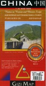
This folded, political map of China shows provinces in different colors. Map features province boundaries, major cities, airports, waterways, ports and the Great Wall. Inset of Pearl River Delta. Legend in 5 languages: English, German, French, Italian, and Chinese. Scale is 1:6.5 million. A basic political map of the country, with colours clearly d...
15,95

Webshops met dit product

Webshop
Bezorging
Prijs

Klanten-reviews van Wegenkaart - landkaart China Administrative Map | Gizi Map

Er zijn nog geen beoordelingen voor dit productBen jij de eerste die een review plaatst?

Meer over Wegenkaart - landkaart China Administrative Map | Gizi Map

Productomschrijving

This folded, political map of China shows provinces in different colors. Map features province boundaries, major cities, airports, waterways, ports and the Great Wall. Inset of Pearl River Delta. Legend in 5 languages: English, German, French, Italian, and Chinese. Scale is 1:6.5 million. A basic political map of the country, with colours clearly distinguishing the provinces. Major towns and rivers are identified and the great wall is marked. Symbols depict airports and ports. Manes are written in Roman and Chinese script. An inset shows Hong Kong and the Pearl River Delta region at 1:1,000,000

Verken gerelateerde categorieën

Webshop.nl maakt gebruik van cookies. Ga je verder op onze website, ga dan akkoord met het plaatsen van cookies en de verwerking van deze data door ons en vermelde partners.