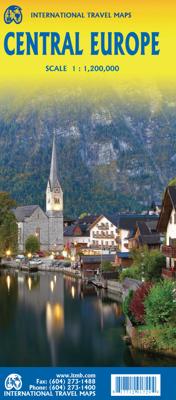
Wegenkaart - landkaart Central Europe - Europa centraal | ITMB

0

Verkopers met dit product

Verkoper
Bezorging
Prijs
DeZwerver.nl logo
DeZwerver.nl
2,95
14,50

Anderen bekeken ook

Wegenkaart - landkaart Africa east & central - Afrika oost en centraal | ITMB
This is the latest map from our growing digital data base on Africa. One side of this map concentrates on the five countries of what is generally known as East Africa - Kenya, Uganda, Tanzania, Rwanda, Burundi, with bits of neighboring countries thrown in. The second side covers what has always been called Central Africa, probably because it was once British Central Africa. This is Zambia,Zimbabwe, and Malawi, with the northern half of Mozambique and the Okavango delta included, as well as a bit of DEM Congo. The map covers a vast portion of the African continent and includes a diverse ethnic and geographic reality. We have tried to categorize roads by condition, but the reality of Africa is that some main roads are in pretty poor condition. Some secondary roads are not shown as being as good as they probably are, but verifying data for Africa is difficult. This is our first map of this part of the world based on GIS Data. As such, it is much more precisely accurate than anything done…
13,95
Wegenkaart - landkaart Japan Central | ITMB
Een degelijke kaart met aanduidingen van o.a. nationale parken, vliegveld, benzinepomp, dirt-roads. Als overzichtskaart goed te gebruiken.   This is a brand new title for ITMB, a double-sided map covering the ‘core’ regions of Japan most visited by tourists exploring Japan. Side 1 covers from Tokyo north to Sendai/Nigata and west to Nagoya. Side two covers all of Japan as far as Hiroshima, with insets of the Osaka/Kobe and Kyoto/Nara regions. Naturally, all touristic attractions are noted.   Legend Includes: Roads by classification, Rivers and Lakes, National Park, Airports, Points of Interests, Highways, Main Roads, Zoos, Fishing, and much more...
13,95
Wegenkaart - landkaart Africa central and south - Afrika zuid en centraal | ITMB
This title is in our series of regional titles for Africa at 1:3,400,000 scale. All of Africa is available as a continental sheet at 1:5M scale and as regional titles at 1:3.8M and 1:3.4M, based on GIS data. This is a milestone for ITMB and the realization of a dream that began in 1993. However, the work is still only in its early stages. This map covers that portion of the continent that old Africa hands always referred to as 'central', meaning the Rhodesias and Nyasaland � now known as Zambia, Malawi, and Zimbabwe.   By its shape, generous portions of the southern portions of DEM Congo, the eastern third of Angola, the northern half of Mozambique, and Botswana's Okavunga Delta are included on the one side. The second side covers South Africa, Lesotho, Swaziland, the rest of Botswana, and southern Namibia in great detail. This is an excellent map for anyone visiting the larger region of the southern third of Africa. As with our other regional titles, this is a work in progress. The n…
13,95
Wegenkaart - landkaart Italy North & Central | ITMB
Italy is a very densely populated country, requiring sectional maps to portray its complex road/rail network in sufficient detail to make sense. This is a brand new title for ITMB, covering the central portion of the peninsula from Naples north to Florence on side one, and includes a large inset map of Sardinia. Side two covers the vast expanse of the north of the country, from the high alpine valleys of D’Aosta and Trentino to the plains of northern Italy and the coastal provinces of the Mediterranean and Adriatic coastlines. The immediate border areas of France and Switzerland are included, but the extensive plate name index covers most of those countries. Motorways (in blue) tend to be toll highways. Multi-lane highways (in magenta) and principal highways (in green) tend to be non-toll. The red lines are ordinary two-lane roadways, and tend to go through villages every kilometer or so and to follow mountainous contours. We spent a week in January, 2020, in the Rome to Naples to Mon…
13,95
Wegenkaart - landkaart Midden Amerika - Central America | ITMB
Een degelijke kaart met aanduidingen van o.a. nationale parken, vliegveld, benzinepomp, dirt-roads. Als overzichtskaart goed te gebruiken. Met Belize, Guatemala, Honduras, El Salvador, Nicaragua, Costa Rica en Panama. Folded color road and travel map. Scale 1:1,100,000. Distinguishes roads ranging from highways (paved/unpaved) to seasonal tracks. Legend includes swamps, glaciers, reefs, active volcanoes, railways, ferry routes, protected areas/national parks, international airports, domestic airports with scheduled services, landing grounds, points of interest, ruins, lighthouses, mines, beaches, gas stations, border crossing points. Includes inset map of Panama Canal Area, Isla del Coco. Extensive index, general information on the listed countries.  
13,95

Klanten-reviews van Wegenkaart - landkaart Central Europe - Europa centraal | ITMB

Er zijn nog geen beoordelingen voor dit productBen jij de eerste die een review plaatst?

Meer over Wegenkaart - landkaart Central Europe - Europa centraal | ITMB

Verken gerelateerde categorieën

Webshop.nl maakt gebruik van cookies. Ga je verder op onze website, ga dan akkoord met het plaatsen van cookies en de verwerking van deze data door ons en vermelde partners.