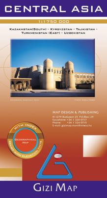
Wegenkaart - landkaart Central Asia - Kazachstan, Uzbekistan, Kirgizië en Tajikistan | Gizi Map

0
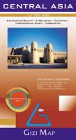
Goede overzichtskaart van Centraal Azië. Met Kazachstan, Uzbekistan, Kirgizië en Tajikistan. Map for Businessmen & Tourists. Kazakhstan (South), Kyrgyzstan, Tajikistan, Turkmenistan (East), Uzbekistan. With Index. Shaded Relief Map...

Verkopers met dit product

Verkoper
Bezorging
Prijs
DeZwerver.nl logo
DeZwerver.nl
2,95
15,95

Anderen bekeken ook

Wegenkaart - landkaart Uzbekistan, Kyrgyzstan, Tajikistan | ITMB
Een degelijke kaart met aanduidingen van o.a. nationale parken, vliegveld, benzinepomp, dirt-roads en kleine plattegrond van hoofdstad. Als overzichtskaart goed te gebruiken.   Finally, our ITMB map of Uzbekistan is back in print! Tourism to the ‘Stans’ is increasing as these former parts of the Soviet Empire find their way in a changing world. This time, we have combined the country with the two other Stans on one side, which makes sense given their shape; then, on the reverse side, we have expanded the artwork to show Kyrgyzstan and Tajikistan to good advantage. The map also includes excellent inset maps of Samarkand, Tashkent, Dushanbe, and Bishkek, which I’m sure all are familiar names. Needless to say, all three countries count as ‘adventure’ travel. Facilities are good in major cities, but roads are of an uncertain quality, and accommodations sparse. Still, this is an exceptionally interesting part of the world. The traditional Great Silk Road passed through this region, and to …
13,95
Wegenkaart - landkaart Centraal-Azië: Oezbekistan, Kirgizië, Turkmenistan en Tajikistan | Reise Know-How Verlag
Wegenkaart - landkaart Oezbekistan, Kirgizië, Turkmenistan en Tajikistan Tweetalige kaart (Engels en Duits). Door ingetekende lengte- en breedtegraden is het gebruik van GPS mogelijk. Met hoogtelijnen en uitgebreid wegennetwerk: daarnaast worden ook de afstanden tussen belangrijke plaatsen duidelijk leesbaar weergegeven. Het kleurgebruik is zodanig dat je een goede indruk krijgt van hoogteverschillen en soorten landschap. Natuurlijk staan de toeristische bezienswaardigheden duidelijk vermeld.   Gedrukt op water- en scheurvast papier! Polyart is een synthetisch product vrij van giftige stoffen dus duurzaam. Het papier gaat echt lang mee.   Topography is indicated by altitude colouring with numerous spot heights and names of mountain ranges and passes. Salt lakes, swamps, seasonal rivers and glacier are also shown. Detailed presentation of the road network includes minor roads and tracks and railways are also shown.   Internal administrative units are presented with their boundaries and…
11,50
Wegenkaart - landkaart Kyrgyzstan and Tajikistan | ITMB
This is a new title for ITMB. The two Central Asian countries of Kyrgyzstan and Tajikistan are rapidly developing a touristic market and we feel that the world needs a good map to reflect their growing importance. The two ‘stans were part of the Soviet empire that fell apart in 1990, creating a dozen new countries. This double-sided map covers Kyrgyzstan on one side, with an inset map of its capital, Bishkek. The main attractions are Osh and Suyab, both ancient market centres on the Silk Road, and Lake Issyk-Kul, the world’s second largest alpine lake. The reverse side concentrates on Tajikistan mountainous country just west of the Himalayas, with an inset of its capital, Dushanbe. Both of these countries should be considered ‘adventure’ destinations.
13,95
Wegenkaart - landkaart Central Asia - Centraal Azië | Gizi Map
Er zijn 2 GIZI kaarten van Centraal Azië: dit is de politiek geografische kaart. Goede wegenkaart - landkaart van Centraal Azië. Zuiden van Kazachstan - Kyrgizië - Tajikistan - oosten van Turkmenistan - Uzbekistan   Centraal Azië  op 1: 1.750.000 van Gizi-kaart op een politieke wegenkaart die een uitstekend beeld geeft van de topografie van het land, markeringen voor de routes van de oude zijderoute, olie- of gasbronnen en pijpleidingen, enz.,    De kaart toont het wegennet, inclusief woestijnsporen, met locaties van grensovergangen en rijafstanden op hoofd- en geselecteerde secundaire routes. Symbolen geven wegen en sporen aan die deel uitmaken van de zijderoute. Spoorlijnen zijn inbegrepen en lokale luchthavens zijn gemarkeerd. Verschillende bezienswaardigheden worden gemarkeerd, waaronder historische bezienswaardigheden en natuurlijke bezienswaardigheden. De kaart toont ook interne administratieve grenzen en namen van de provincies, en olie- of gasbronnen en pijpleidingen. Breedteg…
15,95
Wegenkaart - landkaart Uzbekistan - Oezbekistan | Gizi Map
Oezbekistan op 1: 1.300.000 van Gizi Map met uitstekende weergave van de woestijnen en bergachtig terrein van het land door hoogtekleuren en veel namen van natuurlijke kenmerken, het oude Silk Routes-netwerk gemarkeerd, plus stratenplannen van Tasjkent, Buchara, Samarkand en Khiva. Alle plaatsnamen staan in het Latijnse alfabet.   Topografie met hoogtes van bergtoppen en afbeeldingen van moerassen, zoutvlaktes en woestijnen enz. Nationale parken zijn gemarkeerd en de kaart toont interne administratieve grenzen. Wegennet omvat geselecteerde lokale onverharde wegen, spoorlijnen zijn inbegrepen en lokale luchthavens zijn gemarkeerd. Een verscheidenheid aan symbolen geeft interessante plaatsen aan. Breedtegraad- en lengtegraadlijnen worden getekend met intervallen van 1 °.
15,95
Vogelgids Centraal Azie - Birds of Central Asia | Bloomsbury
Birds of Central Asia is the first field guide to include the former Soviet republics of Kazakhstan, Kyrgyzstan, Turkmenistan, Uzbekistan and Tajikistan, along with neighbouring Afghanistan. This vast area includes a diverse variety of habitats, and the avifauna is similarly broad, from sandgrouse, ground jays and larks on the vast steppe and semi-desert to a broad range of raptors, and from woodland species such as warblers and nuthatches to a suite of montane species, such as snowcocks, accentors and snowfinches. Birds of Central Asia includes 141 high-quality plates covering every species (and all distinctive races) that occur in the region, along with concise text focusing on identification and accurate colour maps. Important introductory sections introduce the land and its birds. Birds of Central Asia is a must-read for any birder or traveller visting this remote region.   "For a long time, there's been something of a gap in field-guide coverage across the Palearctic. Europe is w…
50,95
Wegenkaart - landkaart Kazachstan & Usbekistan | ITMB
Een degelijke kaart met aanduidingen van o.a. nationale parken, vliegveld, benzinepomp, dirt-roads en kleine plattegrond van hoofdstad. Als overzichtskaart goed te gebruiken. Kazachstan 1:3.000.000 Usbekistan schaal 1:1.580.000 The Stans of the former Soviet empire are difficult to map because in the aftermath of liberation, most place names, which the Russian overlords had Russified were changed and not always to their original names or former spellings. Time has sorted out most nomenclature problems, and we hope that this version is letter perfect. In this updated edition for both countries, we have obviously tried our best to create a detailed and accurate map. The big difference between this edition and the previous one is the addition of Uzbekistan to the second side. The two countries seem to share certain common characteristics, as do the other three more easterly Stans, so we feel that combining similarities is better for end users than keeping separate sheets for each country…
13,95
Reisgids Kyrgyzstan - Kirgizië | Bradt Travel Guides
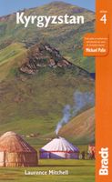
Voor vele landen net zo goed, zo niet beter dan de Planet. Beduidend soberder uitgevoerd, maar ook met veel informatie voor backpackers en met veel kaartmateriaal. Een aanrader! Following the break-up of the USSR, Kyrgyzstan soon earned a reputation as the most hospitable and least repressive of the newly emerged central Asian republics. Unlike some of its neighbours, it has actively encouraged foreign tourism and has pursued a policy of supporting community projects with an emphasis on adventure tourism. The Bradt guide details all the services and experiences the country offers including trekking, mountaineering, horseriding and wildlife-watching. Historical sites, cultural activities and background on the Kyrgystan people are all covered by this definitive guide. • Provides a invaluable resource for English-speaking expatriates. • Details the wide range of travel options within the country, including trekking and horseback tours, local buses, shared taxis and private taxi services.…
23,95

Klanten-reviews van Wegenkaart - landkaart Central Asia - Kazachstan, Uzbekistan, Kirgizië en Tajikistan | Gizi Map

Er zijn nog geen beoordelingen voor dit productBen jij de eerste die een review plaatst?

Meer over Wegenkaart - landkaart Central Asia - Kazachstan, Uzbekistan, Kirgizië en Tajikistan | Gizi Map

Productomschrijving

Goede overzichtskaart van Centraal Azië. Met Kazachstan, Uzbekistan, Kirgizië en Tajikistan.

Map for Businessmen & Tourists. Kazakhstan (South), Kyrgyzstan, Tajikistan, Turkmenistan (East), Uzbekistan. With Index. Shaded Relief Map

Productinformatie

    Verken gerelateerde categorieën

    Webshop.nl maakt gebruik van cookies. Ga je verder op onze website, ga dan akkoord met het plaatsen van cookies en de verwerking van deze data door ons en vermelde partners.