Wegenkaart - landkaart Caribbean, Central America, Virgin Islands, Bahamas | Kasprowski Maps

0
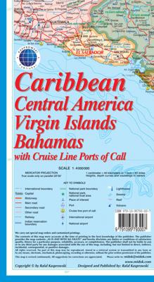
This map ( Scale 1 : 4 000 000 ) includes all of the Caribbean islands - both the Greater and Lesser Antilles, the Virgin Islands and the Bahamas. Central America is covered from the Yucatan and Guatemala through Panama. All of Florida is also depicted, as are the coastal regions of Colombia and Venezuela. The map is detailed as no other map of th...

Verkopers met dit product

Verkoper
Bezorging
Prijs
DeZwerver.nl logo
DeZwerver.nl
2,95
14,95

Anderen bekeken ook

Wegenkaart - landkaart Virgin Islands - Maagden eilanden | Borch
The soft-laminated map of the Virgin Islands includes: US Virgin Islands 1:80 000, St. Croix 1:80 000, Charlotte Amalie 1:15 000, Charlotte Amalie Historic District 1:7 500, Cruz Bay 1:15 000, Christiansted, Frederiksted 1:15 000, British Virgin Islands 1:80 000, Anegada 1:80 000, Road Town, The Valley (Spanish Town) 1:15 000, Lesser Antilles 1:7 000 000, Virgin Islands administrative / time zones; interesting statistics British / US Virgin Islands: conversion chart for temperatures, weights and measures; climate chart with temperatures, sunshine hours, precipitation and humidity; hotels, museums, markets and much more.   Virgin Islands is the name of two groups of small islands east of Puerto Rico which form the Virgin Islands archipelago. They lie between the Caribbean Sea and the Atlantic Ocean. One of the groups which consists of St. Croix, St. John and St. Thomas islands, together with many nearby islets, is called the U.S. Virgin Islands. The other group including Anegada, Jost …
11,50
Wegenkaart - landkaart Curacao | Kasprowski Maps
Bijzonder gedetailleerde kaart (1:55000) van alleen het eiland Curacao. Zowel de wegen als ook de wandelpaden staan er op vermeld. Stranden, interessante plekken en bovendien de meeste duikplakken staan met diepte helder weergegeven op de kaart. Met stadsplattegrond van Willemstad. The most up-to-date and only complete road map of Curaçao (Scale 1 : 55 000), as well as the entire Willemstad urban area on the reverse, spanning from the international airport to Spanse (Scale 1 : 18 500). Insets of the Willemstad center (Scale 1 : 8 000), Grote Berg (Scale 1 : 6 000), Tera Kora (Scale 1 : 6 000), Barber (Scale 1 : 6 000), and the island Klein Curaçao (Scale 1 : 55 000) are also included. All maps and insets come with thorough street indexes.   The map shows all the island's known roads and streets with their names, displays its many diving sites, and indicates an extensive set of biking routes and hiking trails..   The double-sided map is sold folded, measuring 4 7/8" x 8 7/8" ( 12.5 cm …
18,50
Wegenkaart - landkaart Bonaire | Kasprowski Maps
Bijzonder gedetailleerde kaart (1:40000) van alleen het eiland Bonaire. Zowel de wegen als ook de wandelpaden staan er op vermeld. Stranden, interessante plekken en bovendien de meeste duikplakken staan met diepte helder weergegeven op de kaart. Met stadsplattegrond van Kralendijk. The most up-to-date and only complete road map of Bonaire ( Scale 1 : 28 000 ), as well as the Kralendijk urban area, spanning from Santa Barbara Crowns, through the airport, to Punt Vierkant (Scale 1 : 15 000). An inset of Rincon (Scale 1 : 12 000) is also included. All maps and insets come with thorough street indexes.   All of the official diving sites around Bonaire and Klein Bonaire are displayed, most of them with their GPS locations, as recorded by STINAPA, the island's official conservation foundation.   The map shows all the island's known roads and streets with their names, as well as an extensive set of biking routes and kayaking trails.   The map is sold folded, measuring 5 1/4" x 9 5/8" ( 13.5 …
18,50
Wandelkaart - Wegenkaart - landkaart Sint Maarten - St. Martin | Kasprowski Maps
Bijzonder gedetailleerde kaart (1:15000 !) van alleen het eiland Sint Maarten - Saint Martin. Zowel de wegen als ook de wandelpaden staan er op vermeld. Stranden, interessante plekken en bovendien de meeste duikplakken staan met diepte helder weergegeven op de kaart. Met stadsplattegronden van Philipsburg en Marigot.   The most recent edition of the first and only complete road map of the French-Dutch island of Saint-Martin/Sint Maarten renders all known roads and streets with their names; indicates hiking trails, biking routes and diving sites; maps restaurants and hotels; features insets of the Marigot and Philipsburg capitals, as well as Tintamarre Island. Street, hotel, and restaurant indexes are printed on the reverse side of the map.   NEW FEATURES:   Street and road additions, incl. Simpson Bay Causeway; Over 200 restaurants and hotels mapped and indexed; Tintamarre island inset; Biking routes; Birding and turtle nesting sites, other natural attractions; Snorkeling si…
18,50
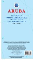
Wegenkaart - landkaart Aruba | Kasprowski Maps
Bijzonder gedetailleerde kaart (1:28000) van alleen het eiland Aruba. Zowel de wegen als ook de wandelpaden staan er op vermeld. Stranden, interessante plekken en bovendien de meeste duikplakken staan met diepte helder weergegeven op de kaart. Met stadsplattegrond van Oranjestad. The most up-to-date and only complete road map of Aruba with street-level detail of the entire island ( Scale 1 : 28 000 ).   The map shows all the island's known roads and streets with their names, displays its many diving sites and an extensive set of biking routes, and locates all the major hotels by name.   The map is sold folded, measuring 4 7/8" x 8 7/8" ( 12.5 cm x 22.5 cm ) and is designed for easy opening and refolding. Its full unfolded format is 26 3/8" x 38 1/2" ( 67 cm x 98 cm ). The map can be hung on a wall to show the entire island.   It contains the following features: Attractive full color layout with high-quality glossy finish; rich topographic detail; Symbol key and scale; Main and seconda…
18,50
Wegenkaart - landkaart Cayman Islands (Kaaiman Eilanden) & Jamaica | ITMB
Een degelijke kaart met aanduidingen van o.a. nationale parken, vliegveld, benzinepomp, dirt-roads en kleine plattegrond van verschillende steden. Als overzichtskaart goed te gebruiken. De kaart is aan twee zijden bedrukt, de ene zijde omvat de Cayman Islands (schaal 1:37.500 en 1:70.000). Op de andere zijde staat de kaart van Jamaica (schaal 1:250.000) en plattegronden van onder andere Kingston. We are pleased to announce the latest new Caribbean map to our growing series. The Caymans, for there are three major islands and numerous little shoals, remains a British colony, like the British Virgin Islands, the Turks and Caicos, and Bermuda. Tourism is the number one industry of the Cayman Islands, with dozens of hotels dotting the beachfronts, especially north of George Town. There are numerous dive sites for viewing tropical fish and we have shown about a hundred on the map, as well as every side street and gas station. One interesting place to visit is Hell, which is a frozen lava er…
13,95
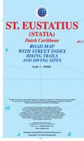
Wandelkaart - Wegenkaart - landkaart St. Eustatius | Kasprowski Maps
Bijzonder gedetailleerde kaart (1:10.000 !) van alleen het eiland St. Eustatius. Zowel de wegen als ook de wandelpaden staan er op vermeld. Stranden, interessante plekken en bovendien de meeste duikplakken staan met diepte helder weergegeven op de kaart. This first and only complete road and street map with a street index of the Dutch Caribbean island of Saint Eustatius (Statia), ( Scale 1 : 10 000 ) renders roads and streets with their names and locates hiking trails and diving sites.    The map is sold folded, measuring 4 7/8" x 8 7/8" ( 12.5 cm x 22.5 cm ), and is designed for easy opening and refolding. Its full unfolded format is 26 3/8" x 35"  ( 67 cm x 89 cm ).   Designed for travelers, this excellent map has unsurpassed coverage of the island, and its extensive information and depth of detail fit a broad range of interests. The map has hill shading, three levels of roads (footpaths, secondary roads, and main roads) and symbols representing a large number of physical features. …
18,50
Wegenkaart - landkaart South Pacific Cruising & Samoa | ITMB
Een overzichtskaart van de zuidelijke Stille Oceaan met de cruise routes tussen de verschillende eilanden aangegeven. Op de achterzijde een overzichtskaart van Samoa This is a new venture for ITMB. Cruising is a rapidly-growing segment of the travel industry, experiencing double-digit growth rates annually. Obviously, this is a thriving market. In conjunction with several cruise ship lines, we have prepared a map of the South Pacific Ocean, which extends southwards from Hawai'i to the southern tip of New Zealand and eastwards from central Australia/Papua New Guinea to the Pitcairn Islands. Thus, it does not include the popular South East Asia and China coast routes. We think this has to change at a time when 25,000,000 people are travelling by cruise ships. At the same time, we must keep coverage area relevant for those end users of the artwork. Even at 1:12M, most of the area covered is water, with island countries such as Fiji, Tonga, Kiribati, Tahiti, and the Cook Islands being vis…
13,95
Wegenkaart - landkaart US Virgin Islands & Puerto Rico | ITMB
Puerto Rico: schaal 1:190.000 US Virgin Islands: schaal 1:50.000   We are really pleased with this new edition of Puerto Rico. We spent part of August, 2020, touring the island and geo-referencing its many highways. The island is bigger and more densely road-networked than we thought, so we'll have to complete the job on our next visit, but the roads are now much more precisely shown accurately than was possible before satellite imagery. The map looks great on an Ipad screen as well. The map also shows updated inset maps of San Juan, Ponce, Mayaguez, Aguadilla, and Arecibo. Puerto Rico is part of the United States, so has all the benefits, but is internally self-governing. With this edition we are including a map of the other US colonial territory, the US Virgin Islands. The Danish West Indies was purchased from Denmark in 1917 and is an integral part of the USA, with all its benefits, but is, like Puerto Rico, neither fish nor fowl. It is internally self-governing and a great retirem…
13,95
Waterkaart Caribbean Cruising | ITMB
The Caribbean Sea is one of the most popular cruising destinations in the world. This colourful double-sided map starts just north of Orlando/Tampa in order to show the northernmost Bahamian islands and south as far as the Panama Canal at Colon and the coast of Venezuela. The map shows good detail for each island and the legal boundaries of each island nation. Side 1 concentrates on the western Caribbean, essentially the Bahamas, Cuba, Jamaica, and the Cayman Islands. Here’s a fun fact most of you won’t know: tiny Navassa Island between Haiti and Jamaica is claimed by both the USA and Haiti! Side 2 concentrates on the eastern islands of the Caribbean, such as Hispaniola (Haiti and the Dominican Republic), Puerto Rico and the US and British Virgin Islands, Turks & Caicos, and the Lesser Antilles chain of island countries, such as Antigua, Guadeloupe, Barbados, and Trinidad/Tobago, among others. Coverage then extends westward along the Venezuelan coastline to include the Dutch possessio…
14,95

Klanten-reviews van Wegenkaart - landkaart Caribbean, Central America, Virgin Islands, Bahamas | Kasprowski Maps

Er zijn nog geen beoordelingen voor dit productBen jij de eerste die een review plaatst?

Meer over Wegenkaart - landkaart Caribbean, Central America, Virgin Islands, Bahamas | Kasprowski Maps

Productomschrijving

This map ( Scale 1 : 4 000 000 ) includes all of the Caribbean islands - both the Greater and Lesser Antilles, the Virgin Islands and the Bahamas. Central America is covered from the Yucatan and Guatemala through Panama. All of Florida is also depicted, as are the coastal regions of Colombia and Venezuela. The map is detailed as no other map of this region on the market and features, among others, over 100 cruise line ports of call, as well as enlarged insets of the Panama Canal and 36 Caribbean islands.   The map is sold folded, measuring 4 7/8" x 8 7/8" (12.5 cm x 22.5 cm) and is designed for easy opening and refolding. Its full unfolded format is 26 3/8" x 38 1/2" ( 67 cm x 98 cm ).   It contains the following features
  • Attractive full color layout;
  • Rich topographic detail;
  • Symbol key and scale;
  • Major cities, main and secondary roads, national and international airports, lighthouses, reefs, national parks, ports, volcanoes, and other places of interest;
  • International boundaries, depth curves, soundings in meters, longitude and latitude lines and other identifiers.

Verken gerelateerde categorieën

Webshop.nl maakt gebruik van cookies. Ga je verder op onze website, ga dan akkoord met het plaatsen van cookies en de verwerking van deze data door ons en vermelde partners.