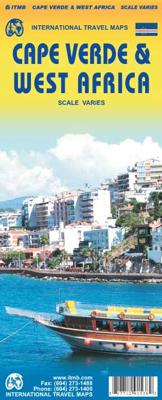
Wegenkaart - landkaart Cape Verde - Kaapverdische Eilanden en West Afrika | ITMB

0
Op de voorzijde een gedetailleerde kaart van de Kaapverdische eilanden, alle eilanden op een schaal van ongeveer 1: 200.000, deze varieert enigzins per eiland. De achterkant geeft een overzichtskaart van West Afrika op schaal 1:3.400.000 van Mauretanie in het westen tot en met Benin in het oosten. This map of Cape Verde features the usual care and...

Verkopers met dit product

Verkoper
Bezorging
Prijs
DeZwerver.nl logo
DeZwerver.nl
2,95
13,95

Anderen bekeken ook

Nieuw
Wegenkaart - landkaart Kaapverdische Eilanden - Cabo Verde | Freytag & Berndt
Uitstekende kaart van alle Kaapverdische eilanden met sommigen op een zodanige schaal dat er ook mee gewandeld kan worden. Cape Verde Islands on a large double-sided map from Freytag & Berndt, with the larger islands shown both individually and in groups with the surrounding islands, all presented at a convenient scales and with tourist information. Relief shading and spot heights indicate the topography, with roads clearly marked and icons highlighting main ports, ferries, archaeological sights and other places of interest. A general map of the whole Cape Verde archipelago shows frequency of ferry connections between various islands. Latitude and longitude lines are shown on all island maps. Multilingual map legend includes English. Larger islands at 1:80,000 Fogo; Santiago; Santo Antão; Sao Nicolau; São Vicente; Brava (at 1;30,000). Maps of groups at 1:150,000: Boavista and Sal; Santo Antão, Sao Vicente, Santa Luzia, Ilheu Braco, Ilheu Razo, and São Nicolau; Santiago and Maio; Fogo …
14,95
Reisgids Cape Verde Islands - Kaapverdische Eilanden | Bradt Travel Guides
Als er geen Lonely Planet is, is dit het alternatief ... En vaak nog beter ook. De beste gids over de Kaapverdische eilanden met alle mogelijke informatie, zowel praktisch (eten, slapen, reizen) als achtergronden over cultuur, landschap en bevolking. The new, thoroughly updated eighth edition of Bradt’s Cape Verde (Cabo Verde) remains the most detailed and extensive English-language guidebook available to this alluring Atlantic archipelago, described by some as ‘Africa light’. Stable and peaceful, quietly isolated by its mid-Atlantic location, malaria-free, and with year-round sun, Cabo Verde’s appeal to independent travellers is a natural one – with its unique island geography making it somewhat of an adventure to navigate beyond the more conventional single-island visit of the increasing numbers of package tourists.   The archipelago is diverse, particularly in terms of its tourist infrastructure. Sal and Boavista, the oldest of these volcanic islands, boast white-sand beaches that …
27,95
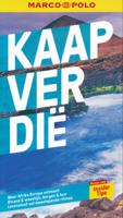
Reisgids Cape Verde - Kaapverdische Eilanden | Marco Polo
Handige en overzichtelijke, kleine reisgids voor een eerste kennismaking met de vakantiebestemming. Globale uitklapkaart achterin, makkelijk binnenzakformaat. Let Marco Polo Cape Verde guide you around this beautiful country. Explore Cape Verde with this handy, pocket-sized, authoritative guide, packed with Insider Tips. Discover boutique hotels, authentic restaurants, the islands' trendiest places, and get tips on shopping and what to do on a limited budget. There are plenty of ideas for travel with kids, and a summary of all the festivals and events that take place. Cape Verde is all about colour: the turquoise ocean, lush tropical valleys, beaches of black and white sand, the bright yellow of the bananas, the orange-coloured papayas, green heads of cabbage and red peppers. Colourful fishing boats lie on the white sandy beaches, the deep blue ocean glitters as far as the eye can see, a gentle breeze cools off the scorching sun. Let Marco Polo Cape Verde guide show you all this wond…
13,95
Nieuw
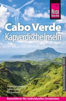
Reisgids Cabo Verde Kapverdische Inseln - Kaapverdische Eilanden | Reise Know-How Verlag
Uitstekende - meest uitgebreide - reisgids van de Kaapverdische Eilanden. Hoge kwaliteit, veel kaartjes en praktische informatie. Duits, 612 (!) bladzijden. Cabo Verde ist nicht nur reich an faszinierenden Landschaften, Bergen und Schluchten, Wüsten und grünen Tälern, weiten Stränden und kleinen Buchten, sondern besitzt auch einen großen kulturellen Reichtum. Ein Reichtum, der aus den Begegnungen rund um den Atlantischen Ozean entstanden ist und eine neue kreolische Kultur hervorgebracht hat: so stark wie das Meer und so vielfältig wie die Landschaften. Jede der kapverdischen Inseln für sich ist ein authentisches und unverwechselbares Reiseziel.   Das steckt in unserem Reiseführer Cabo Verde / Kapverdische Inseln:   - Übersichtsseiten mit Beschreibungen aller Inseln: Sal: Sonne, Sand und Salz, Boa Vista: Sahara im Atlantik, Maio: Einsamkeit und viel Ruhe, Santiago: Hauptinsel des Archipels, Fogo: die Vulkaninsel, Brava: die kleineste Insel, São Vicente: Insel der Kontraste, Santo…
28,95
Nieuw
Wegenkaart - landkaart - Fietskaart Vanouver Island south - Victoria | ITMB
ITMB wegenkaarten en wandelkaarten kenmerken zich door het kleurgebruik waarbij zo de nadruk wordt gelegd op de natuurkundige aspecten van het land of de streek. Het soort landschap en de hoogte worden hierdoor zeer duidelijk zichtbaar. Natuurlijk vind je ook de 'gewone' zaken als wegennet, spoorwegen, vliegvelden, ferrys, toeristische bezienswaardigheden en nationale parken er op terug.. Vaak - maar niet op alle kaarten - staat op de achterzijde een stadsplattegrond van hoofdstad of belangrijkste stad in de regio.  Voorzijde: Vancouver Island zuidelijk gedeelte met schaal 1:270.000 Achterzijde: stadsplattegrond Victoria met schaal 1:10.000 Victoria is a brand new title for ITMB. The city is the capital of British Columbia (each of Canada’s provinces and territories has its own capital, in addition to Ottawa for the entire country). Located at the southern tip of Vancouver Island, Victoria was established as the colonial capital after the Oregon Treaty of 1846 forced the British to ab…
13,95
Nieuw
Wegenkaart - landkaart Russia west & St. Petersburg | ITMB
Overzichtskaart van West Rusland tot aan de Oeral op schaal 1:3,2m - Moskou in het midden van de kaart met stadsplattegrond van Sint Petersburg, schaal 1:14.000, en een centrumskaartje van Moskou. Wegenkaart met veel plaatsen en wegen, spoorlijnen en rivieren, hoogten, lengte- en breedtegraden.   Russia West Travel Reference Map 1:3,200,000 - ITMB ITMB has prepared a map that is centred on Moscow and radiates outwards. Due to the projection necessary for a map close to the North Pole, St. Petersburg and Murmansk are at the top of the map, Rostov and the Black Sea are in the southwest corner, and the Ural Mountains bless the southeast portion of the map. The front side has an excellent inset of Moscow and the reverse a city centre map of St. Petersburg, along with the remaining portion of western Russia and the place names index.   Legend includes: Roads by classification, Boundaries, Highways, Major Roads, Secondary and other Roads,Volcanic Cultural Centres, Restaurants, Museums, Citi…
13,95
Wegenkaart - landkaart Cuba West | ITMB
Een degelijke wegenkaart met aanduidingen van o.a. nationale parken, vliegveld. Als overzichtskaart goed te gebruiken. his is a brand new title for ITMB and reflects the growing interest in travel to Cuba resulting from improved relations with the USA. Licenses to fly into the country from a dozen cities have already been approved; 60 more are awaiting approval. All are for flights into Havana and Varadero airports – in other words, the western half of the country. ITMB already has an exceptionally good map of the entire country. We also have a separate map of Havana. This map expands the scale and opens the information for the western half of the island nation as a double-sided map, with the portion west of Havana (La Habana) to Pinar del Rio province in the far west and south to the Isla de la Juventud (better known, but mis-named, as the Bay of Pigs Invasion Site). This side also has an excellent map of the Varadero beach resort area as an inset, and a map of greater Havana. The ot…
13,95
Wegenkaart - landkaart West Afrika - kustlanden | Reise Know-How Verlag
Senegal, Gambia, Guinee-Bissau, Guinee, Sierra Leone, Liberia, Ghana, Togo, Benin, Ivoorkust, Nigeria The map is double-sided to provide the best balance between a good scale and a convenient size sheet and covers countries from Senegal to Nigeria, Burkina Faso, plus southern Mali, with inset showing the Cape Verde Islands. Tweetalige kaart (Engels en Duits). Door ingetekende lengte- en breedtegraden is het gebruik van GPS mogelijk. Met hoogtelijnen en uitgebreid wegennetwerk: daarnaast worden ook de afstanden tussen belangrijke plaatsen duidelijk leesbaar weergegeven. Het kleurgebruik is zodanig dat je een goede indruk krijgt van hoogteverschillen en soorten landschap. Natuurlijk staan de toeristische bezienswaardigheden duidelijk vermeld.   Gedrukt op water- en scheurvast papier! Polyart is een synthetisch product vrij van giftige stoffen dus duurzaam. Het papier gaat echt lang mee.   Topography is indicated by altitude colouring with numerous spot heights and names of mountain rang…
11,50
Wegenkaart - landkaart South Pacific Cruising & Samoa | ITMB
Een overzichtskaart van de zuidelijke Stille Oceaan met de cruise routes tussen de verschillende eilanden aangegeven. Op de achterzijde een overzichtskaart van Samoa This is a new venture for ITMB. Cruising is a rapidly-growing segment of the travel industry, experiencing double-digit growth rates annually. Obviously, this is a thriving market. In conjunction with several cruise ship lines, we have prepared a map of the South Pacific Ocean, which extends southwards from Hawai'i to the southern tip of New Zealand and eastwards from central Australia/Papua New Guinea to the Pitcairn Islands. Thus, it does not include the popular South East Asia and China coast routes. We think this has to change at a time when 25,000,000 people are travelling by cruise ships. At the same time, we must keep coverage area relevant for those end users of the artwork. Even at 1:12M, most of the area covered is water, with island countries such as Fiji, Tonga, Kiribati, Tahiti, and the Cook Islands being vis…
13,95
Nieuw
Wegenkaart - landkaart Kaapverdische Eilanden - Cabo Verde | Reise Know-How Verlag
Tweetalige kaart (Engels en Duits). Door ingetekende lengte- en breedtegraden is het gebruik van GPS mogelijk. Met hoogtelijnen en uitgebreid wegennetwerk: daarnaast worden ook de afstanden tussen belangrijke plaatsen duidelijk leesbaar weergegeven. Het kleurgebruik is zodanig dat je een goede indruk krijgt van hoogteverschillen en soorten landschap. Natuurlijk staan de toeristische bezienswaardigheden duidelijk vermeld: 6 deelkaarten voor de verschillende eilanden, 1 overzichtskaart.   Gedrukt op water- en scheurvast papier! Polyart is een synthetisch product vrij van giftige stoffen dus duurzaam. Het papier gaat echt lang mee.   Topography is indicated by altitude colouring with numerous spot heights and names of mountain ranges and passes. Salt lakes, swamps, seasonal rivers and glacier are also shown. Detailed presentation of the road network includes minor roads and tracks and railways are also shown.   Internal administrative units are presented with their boundaries and names. …
15,50

Klanten-reviews van Wegenkaart - landkaart Cape Verde - Kaapverdische Eilanden en West Afrika | ITMB

Er zijn nog geen beoordelingen voor dit productBen jij de eerste die een review plaatst?

Meer over Wegenkaart - landkaart Cape Verde - Kaapverdische Eilanden en West Afrika | ITMB

Productomschrijving

Op de voorzijde een gedetailleerde kaart van de Kaapverdische eilanden, alle eilanden op een schaal van ongeveer 1: 200.000, deze varieert enigzins per eiland.

De achterkant geeft een overzichtskaart van West Afrika op schaal 1:3.400.000 van Mauretanie in het westen tot en met Benin in het oosten.

This map of Cape Verde features the usual care and attention to detail that ITMB put into all their maps. With over 300 maps of international travel destinations now available, ITMB are rightly recognized as one of the Worlds leading travel publishers.

Productinformatie

    Verken gerelateerde categorieën

    Webshop.nl maakt gebruik van cookies. Ga je verder op onze website, ga dan akkoord met het plaatsen van cookies en de verwerking van deze data door ons en vermelde partners.