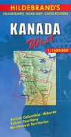
Wegenkaart - landkaart Canada west | Hildebrand's

0
Goede overzichtskaart van Westelijk Canada op redelijke schaal. Het is een tweezijdige kaart, waarbij het noordelijk deel op de ene kant en het zuidelijke - meest gebruikte - deel op de andere kant staat. Helder kleurgebruik met schaduwwerking waardoor de ligging van de bergruggen wat duidelijk wordt dan op andere kaarten.  Wegnummers worden verme...

Verkopers met dit product

Verkoper
Bezorging
Prijs
DeZwerver.nl logo
DeZwerver.nl
2,95
9,95

Anderen bekeken ook

Wegenkaart - landkaart Western Canada | ITMB
Een degelijke kaart met aanduidingen van o.a. nationale parken, vliegveld, benzinepomp, dirt-roads. Als overzichtskaart goed te gebruiken. This is actually our second attempt at mapping the western portion of Canada; the first covered everything from northwestern Ontario to the Pacific Ocean and, while it was an excellent map, the scale that such a huge area covered necessitated severe problems. In this version, all of British Columbia, Alberta, and the Yukon have been mapped from fresh digital data and presented at 1:1.4T scale. This would have been impossible when we prepared the first map. The Northwest Territories portion had to be compressed in two ways; first, the scale is 1:2M; second, only the portion with roads is shown. This is still an extremely large area. One has to consider the actual size of Canada when designing a map. Most countries in Europe would fit into this area, which only covers 20% of Canada. The Fort McMurray forest fire of a year ago covered an area larger t…
13,95
Wegenkaart - landkaart Canada Oost | Hildebrand's
Goede overzichtskaart van Oostelijk Canada op redelijke schaal. Het is een tweezijdige kaart, waarbij het noordelijk deel op de ene kant en het zuidelijke - meest gebruikte - deel op de andere kant staat. Helder kleurgebruik met schaduwwerking waardoor de ligging van de bergruggen wat duidelijk wordt dan op andere kaarten.    Wegnummers worden vermekd, alsmede de gradatie in de wegen, van gravelroads tot de highways. Met symbolen worden enkele bezienswaardigheden aangeduid en zijn de Nationale Parken terug te vinden op de kaart. Campings worden weergegeven met een wat moeilijk leesbaar symbool en het is maar de vraag of dit op deze schaal gedetailleerd genoeg is om volledig te zijn, daar kun je volgens ons niet echt op vertrouwen.  Met Ontario, Quebec, New Brunswick, Prince Edward Island, Nova Scotia & New Foundland.
10,95
Wegenkaart - landkaart Nunavut - Northwest Territories | ITMB
The far north of Canada, north of 60 degrees, consists of three territories; the Yukon, the Northwest Territories, and Nunavut. Until now, there has never been a proper map of the territory that was carved off from the NWT a quarter century ago. With only 30,000 people and a scattering of settlements, Nunavut is larger than western Europe in area. This map took us years to prepare, using 1:250,000 government topo maps as a base and tracing thousands of little lakes. The traditional passageway of the fabled Northwest Passage is also shown. The most northerly civilian community in the world is on the map – Grise Bay, as well as Alert, the most remote place on earth. Originally, the NWT covered all of northwestern North America west of the Louisiana Purchase and the Loyalist colonies, and north of the Spanish provinces (essentially north of current day Sactamento). Political changes have reduced its size over the past century and a half to the region of Canada north of the 60th parallel …
13,95
Reisgids Canada | Lonely Planet
De perfecte reisgids over Canada voor zowel de georganiseerde als de zelfstandige reiziger. Naast een algemene inleiding van het land / streek vol met praktische informatie over hoe je er het beste kunt reizen: slapen, eten, vervoer, excursies ... alles kun je er in vinden. Lonely Planet's local travel experts reveal all you need to know to plan the trip of a lifetime to Canada.   Discover popular and off the beaten track experiences from visiting Banff - the world's third-oldest national park - to making a poutine pilgrimage to Quebec City to try Canada's most famous dish, and spotting black bears and grizzlies in the Bella Coola Valley.   Build a trip to remember with Lonely Planet's Canada travel guide:   Our classic guidebook format provides you with the most comprehensive level of information for planning multi-week trips Updated with an all new structure and design so you can navigate Canada and connect experiences together with ease Create your perfect trip with exc…
27,95
Wegenkaart - landkaart Jasper National Park & Northern Alberta | ITMB
  Jasper National Park kaart, zeer gedetailleerd (schaal 1:250.000) plus op de anderekant van de kaart staat Noord Alberta, schaal 1:1.000.000. Natuurkundige overzichtskaart met veel plaatsen en wegen, spoorlijnen en rivieren, hoogten, lengte- en breedtegraden.   Two words immediately come to my mind if I were to describe Northern Alberta: Oil and Cold. Oil sands could be found relatively easily within the Northern Alberta region. This pushes the Canadian economy forward as gasoline and other petroleum products are becoming higher in demand. Northern Alberta is also about the subzero temperature. The region of Northern Alberta mostly contains very cold, long winters and warm, short summers. Fort McMurray, for example, one of the famous urban communities located in the Wood buffalo municipality, has only a yearly mean temperature of 0.7 degrees Celsius. Nonetheless, Northern Alberta is also a land of recreation activities and wild adventures. On the other side of the Northern Alberta …
13,95
Wegenkaart - landkaart New Caledonia & Oceania Cruising | ITMB
Aan de ene kant een degelijke kaart  van Nieuw Caledonië, schaal 1:530.000, met aanduidingen van o.a. nationale parken, vliegveld, benzinepomp, dirt-roads. As overzichtskaart goed te gebruiken. Aan de andere kant een overzicht van cruise routes in Oceanië, schaal 1:12.000.000 The South Pacific island complex known as New Caledonia, or Nouvelle Caledonie in French, consists of a main island and half a dozen smaller islands (collectively called the Loyalty Islands. It is an overseas possession of France and uses the Euro as its currency. It is located about halfway between Australia and Fiji and is south of Vanuatu. The main island is one of the larger land masses in the Pacific, with a reasonably well-developed road infrastructure linking the capital city of Naomea with other urban areas. There are resort hotels at various locations along the coastline, but this is a territory that one would have to regard as being adventuresome. Most of the attractions are concentrated in the vicinity…
13,95
Reisgids Best Road Trips Canada | Lonely Planet
Canada's Best Road Trips Lonely Planet is een Engelstalige praktische reisgids voor alle leeftijden, boordevol informatie over de route, accommodatie van budget tot luxe, en plaatsbeschrijvingen - kenmerk: kort en bondig. Let op: dit is een andere gids dan de 'gewone' Lonely Planet!   Discover the freedom of the open road with Lonely Planet's Canada's Best Road Trips. This trusted travel companion features 32 amazing drives, from 2-day escapes to 2-week adventures. Marvel at the Niagara Falls, spot whales in Newfoundland and sample wine on the Okanagan Valley Wine trail. Get to Canada, rent a car, and hit the road!         Inside Lonely Planet's Canada's Best Road Trips:   Itineraries for classic road trips plus other lesser-known drives with expert advice to pick the routes that suit your interests and needs Full-color route maps - easy-to-read, detailed directions Detours - delightful diversions to see the Canada's highlights along the way   Link Your Trip - cruise from …
24,95
Wegenkaart - landkaart Yukon - British Columbia North | ITMB
Overzichtskaart van Yukon, tweezijdig bedrukt. Starting with Yukon (NB: not “the” Yukon, please), this portion of NWT was carved out into its own territory a century ago, as a result of the gold rush to the Klondike. It is the same map we’ve done since 1989, updated whenever necessary and includes inset maps of Whitehorse (the capital), Dawson City, and Watson Lake. It is still a territory, not a full province, although essentially self-administering. The NWT side of the sheet shows the brand new all-season gravel road to Tuktoyaktuk on the Arctic Ocean, opening up this part of Canada for land travel for the first time. An inset map of Yellowknife (the capital) is included.  
14,95
Wegenkaart - landkaart New Brunswick (Canada) | ITMB
Een degelijke kaart met aanduidingen van o.a. nationale parken, vliegveld, benzinepomp, dirt-roads en kleine plattegrond van hoofdstad. Als overzichtskaart goed te gebruiken. The Canadian province of New Brunswick, called Acadia by its original French settlers, is perhaps best known for being the source of the famous epic poem Evangeline. It is also the home of the Cajun people. The British, unfairly regarding the Acadians (Cajuns), expelled thousands of them to French-controlled Louisiana in the mid-1750s. Some Acadians made the long trek back to the land they considered ‘home’, while many others re-built their lives in New Orleans. Today, the province is an industrious mix of French and English Canadians, sharing a land steeped in history. NB, for short, is the link between Central Canada and the Maritime Provinces. Historic Fredericton, Saint John, and St. Stephen retain many of the buildings built by loyalists fleeing the terror of the colonial revolution in what was to become the…
13,95
Wandelkaart - Wegenkaart - landkaart La Reunion | Freytag & Berndt
Bijzonder gedetailleerde kaart van het eiland Reunion. De schaal is uitstekend om deze kaart naast een gewone wegenkaart ook als wandelkaart te gebruiken. Alle doorgaande wandelroutes staan ingetekend en met symbolen staat alle noodzakelijke praktische informatie helder leesbaar vermeld. Ook topografische details als hoogtelijnen en bergruggen en vulkanen zijn uitstekend terug te vinden op deze kaart. Met kleine stadsplattegrond van St-Denis. Dubbelzijdig gedrukt, helaas nog wel op gewoon papier, daardoor wat minder scheur- en watervast.  Neben der übersichtlichen Gestaltung verfügt die “Straßenkarte Réunion 1:50.000” über zahlreiche Zusatzinformationen wie z.B. Straßenbeschaffenheit, Sehenswürdigkeiten und Campingplätze. Mit dem umfangreichen Ortsregister gelingt zudem eine rasche Orientierung. Der beigefügte Freizeitführer beschreibt besondere Ausflugsziele in Deutsch und Englisch.   Achtung! Besondere Ausflugsziele, Wanderwege, Cityplan Saint Denis, Ortsregister mit GPS, doppelseit…
14,95

Klanten-reviews van Wegenkaart - landkaart Canada west | Hildebrand's

Er zijn nog geen beoordelingen voor dit productBen jij de eerste die een review plaatst?

Meer over Wegenkaart - landkaart Canada west | Hildebrand's

Productomschrijving

Goede overzichtskaart van Westelijk Canada op redelijke schaal. Het is een tweezijdige kaart, waarbij het noordelijk deel op de ene kant en het zuidelijke - meest gebruikte - deel op de andere kant staat. Helder kleurgebruik met schaduwwerking waardoor de ligging van de bergruggen wat duidelijk wordt dan op andere kaarten. 

Wegnummers worden vermekd, alsmede de gradatie in de wegen, van gravelroads tot de highways. Met symbolen worden enkele bezienswaardigheden aangeduid en zijn de Nationale Parken terug te vinden op de kaart. Campings worden weergegeven met een wat moeilijk leesbaar symbool en het is maar de vraag of dit op deze schaal gedetailleerd genoeg is om volledig te zijn, daar kun je volgens ons niet echt op vertrouwen. 

Gebied: British Columbia / Alberta / Yukon Territory / Northwest Territories

Verken gerelateerde categorieën

Webshop.nl maakt gebruik van cookies. Ga je verder op onze website, ga dan akkoord met het plaatsen van cookies en de verwerking van deze data door ons en vermelde partners.