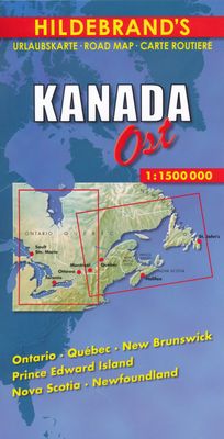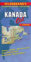
Wegenkaart - landkaart Canada Oost | Hildebrand's

0
Goede overzichtskaart van Oostelijk Canada op redelijke schaal. Het is een tweezijdige kaart, waarbij het noordelijk deel op de ene kant en het zuidelijke - meest gebruikte - deel op de andere kant staat. Helder kleurgebruik met schaduwwerking waardoor de ligging van de bergruggen wat duidelijk wordt dan op andere kaarten.    Wegnummers worden ver...

Verkopers met dit product

Verkoper
Bezorging
Prijs
DeZwerver.nl logo
DeZwerver.nl
2,95
10,95

Anderen bekeken ook

Wegenkaart - landkaart Canada west | Hildebrand's
Goede overzichtskaart van Westelijk Canada op redelijke schaal. Het is een tweezijdige kaart, waarbij het noordelijk deel op de ene kant en het zuidelijke - meest gebruikte - deel op de andere kant staat. Helder kleurgebruik met schaduwwerking waardoor de ligging van de bergruggen wat duidelijk wordt dan op andere kaarten.  Wegnummers worden vermekd, alsmede de gradatie in de wegen, van gravelroads tot de highways. Met symbolen worden enkele bezienswaardigheden aangeduid en zijn de Nationale Parken terug te vinden op de kaart. Campings worden weergegeven met een wat moeilijk leesbaar symbool en het is maar de vraag of dit op deze schaal gedetailleerd genoeg is om volledig te zijn, daar kun je volgens ons niet echt op vertrouwen.  Gebied: British Columbia / Alberta / Yukon Territory / Northwest Territories
9,95
Wegenkaart - landkaart Canada East Coast | ITMB
Canada is a vast country in area; inconceivably enormous in European terms. It is best mapped as a series of regional maps and this is the first of two maps that we hope will portray the Atlantic coastline of all of North America. Side 1 concentrates on Newfoundland and Labrador, with a tiny bit of Nunuvut at the top end of the Ungava Peninsula. An inset map of St. John’s, capital of Nfld/Lab is included, as is the French Overseas Territory of St. Pierre et Miquelon. The new paved highway across Labrador is the highlight of this side of the map! The second side of the map focusses on Nova Scotia/Cape Breton and parts of Prince Edward Island and New Brunswick, with a detailed inset of central Halifax. The former French fortress of Louisbourg is a must-see for anyone visiting Cape Breton, as are the many Loyalist towns created along the coast of Nova Scotia to house refugees fleeing turmoil in the American colonies during the Revolutionary War. A separate map concentrating on the Atlant…
13,95
Wegenkaart - landkaart Atlantic Canada | ITMB
The first edition was published in 2000 using artwork under licence. This edition uses original ITMB artwork. Side 1 covers Nova Scotia, New Brunswick, and Prince Edward Island as well as Quebec s Magdalen Islands at a scale of 1:800,000. This side also includes the Top 10 Attractions of the three provinces. The second side is devoted to the Canadian Province of Newfoundland and Labrador, with the much smaller island portion being a half-page inset at 1:150,000 scale and the larger mainland portion being at 1:1,700,000. The northernmost tip of Quebec/Labrador belongs to Nunavut. St. Pierre et Miquelon, a French overseas possession just south of Newfoundland Island, is also included, as well as the map s only urban inset, historic St. John s, one of North America s oldest cities. The map also includes a listing of 9 Top Attractions. ITMB also publishes maps of the individual provinces, but the advantage of this regional map is that it combines together four interesting parts of Canada …
13,95
Wegenkaart - landkaart New Orleans - Mississippi River Basin | ITMB
New Orleans stadsplattegrond met schaal 1:15.000, bijzonder uitgebreid. ITMB is pleased to continue its detailed coverage of the USA with its first-ever map of the historic City of New Orleans. The urban area was settled by the French, and was the capital of the vast Louisiana Territory for many years. Napoleon, needing money to fight his many wars, sold the colony to the USA, in 1803, doubling the size of the new American nation overnight. The French Quarter, with buildings dating back 300 years, is the heart of the city and home to dozens of jazz emporiums. The British expulsion of the Acadians from what is now the Canadian provinces of Nova Scotia and New Brunswick, added a vibrant component to the city, creating the concept of the Cajuns. The oldest cathedral in the USA, St Louis, has dominated the city's skyline since 1794, opened just as the French Revolution was at its height. The city offers much more than just music, however, The Louisiana State Museum is where the agreement …
13,95
Wegenkaart - landkaart 02 Schweiz Östlicher Teil - Zwitserland centraal en oost | Marco Polo
MARCO POLO Reisekaart – Zwitserland Oost (schaal 1:225.000) De MARCO POLO wegen- en reiskaart Zwitserland – Oostelijk deel is dé kaart voor vakantieplanners, roadtrippers en ontdekkers. Je vindt op de kaart de mooiste bezienswaardigheden, landschappen en routes overzichtelijk gemarkeerd. Dankzij het weerbestendige papier, het handige formaat en extra online Smart-Info is deze kaart een ideale reisgenoot in alle fasen van je reis: van planning tot onderweg oriënteren. 🏞️ Over de regio: Oost-Zwitserland De oostelijke regio van Zwitserland combineert spectaculaire Alpenpanorama’s met traditionele cultuur. Ontdek: St. Gallen – met zijn wereldberoemde barokke Stiftsbibliotheek Appenzellerland – heuvelachtig en authentiek Zwitsers Rheintal en de grensregio met Liechtenstein Walensee – dramatisch gelegen bergmeer met wandel- en zwemmogelijkheden Engadin – bergvallei met beroemde plaatsen als St. Moritz Nationaal Park Zwitserland – ongerepte natuur voor natuurliefhebbers ✅ …
14,95
Reisgids Best Road Trips Canada | Lonely Planet
Canada's Best Road Trips Lonely Planet is een Engelstalige praktische reisgids voor alle leeftijden, boordevol informatie over de route, accommodatie van budget tot luxe, en plaatsbeschrijvingen - kenmerk: kort en bondig. Let op: dit is een andere gids dan de 'gewone' Lonely Planet!   Discover the freedom of the open road with Lonely Planet's Canada's Best Road Trips. This trusted travel companion features 32 amazing drives, from 2-day escapes to 2-week adventures. Marvel at the Niagara Falls, spot whales in Newfoundland and sample wine on the Okanagan Valley Wine trail. Get to Canada, rent a car, and hit the road!         Inside Lonely Planet's Canada's Best Road Trips:   Itineraries for classic road trips plus other lesser-known drives with expert advice to pick the routes that suit your interests and needs Full-color route maps - easy-to-read, detailed directions Detours - delightful diversions to see the Canada's highlights along the way   Link Your Trip - cruise from …
24,95
Wegenkaart - landkaart 583 Northeastern USA, Eastern Canada | Michelin
Wegenkaart van het noordoostelijke gedeelte van de USA (Kansas City - Fargo - Boston - Washington DC) en zuidoost Canada (Québec - Montréal - Ottawa - Winnipeg - Regina). Zie uitsnede op de voorkant van de kaart. Primary & secondary road networks are clearly marked out with indications of the number of lanes, intermediate distances and various possible road obstacles or things you should know including steep hills, height limits, toll barriers, prohibited roads and roads subject to restrictions.   The map also includes small insets with street plans of the regions major towns, showing road names, one way streets and various places of interest (tourist sights, hospitals, parking, railway stations, etc.). Scenic routes on the map are marked out in green and an extensive index of place names is included.   The map also features:   Administrative boundaries Railways, Airports and Ferry Services Important sights such as castles, ruins, and churches Driving Times and Distance Cha…
12,95
Wegenkaart - landkaart Karjala - Karelië | Karttakeskus
De kaart beslaat de Russische regio Karelië en Moermansk en strekt zich uit van St. Petersburg tot aan de Noordelijke IJszee. In het oosten strekt de kaart zich uit tot de oostelijke kant van Ääninen en het oostelijke deel van het Kola-schiereiland. Op de kaart is ook het gebied nabij de grens aan de Finse kant te zien. De schaal is de bekende 1:800.000 van de wegenkaart van Autoilija (1 cm op de kaart = 8 km op het terrein).   De namen op de wegenkaart zijn geschreven in zowel Cyrillische als Latijnse letters, en de oude Finse namen staan er ook op. Naast de duidelijke weg zijn op de kaart bijvoorbeeld grensovergangen, brandstofverkooppunten, bezienswaardigheden en verblijfplaatsen gemarkeerd.   De wegenkaart voor automobilisten Karelië heeft ook negen gedetailleerde stadskaarten: St. Petersburg, Vyborg, Sortavala, Käkisalmi, Moermansk, Petroskoi, Pitkäranta, Lahdenpohja en Aunus/Olonets.
22,95
Wegenkaart - landkaart New Caledonia & Oceania Cruising | ITMB
Aan de ene kant een degelijke kaart  van Nieuw Caledonië, schaal 1:530.000, met aanduidingen van o.a. nationale parken, vliegveld, benzinepomp, dirt-roads. As overzichtskaart goed te gebruiken. Aan de andere kant een overzicht van cruise routes in Oceanië, schaal 1:12.000.000 The South Pacific island complex known as New Caledonia, or Nouvelle Caledonie in French, consists of a main island and half a dozen smaller islands (collectively called the Loyalty Islands. It is an overseas possession of France and uses the Euro as its currency. It is located about halfway between Australia and Fiji and is south of Vanuatu. The main island is one of the larger land masses in the Pacific, with a reasonably well-developed road infrastructure linking the capital city of Naomea with other urban areas. There are resort hotels at various locations along the coastline, but this is a territory that one would have to regard as being adventuresome. Most of the attractions are concentrated in the vicinity…
13,95

Klanten-reviews van Wegenkaart - landkaart Canada Oost | Hildebrand's

Er zijn nog geen beoordelingen voor dit productBen jij de eerste die een review plaatst?

Meer over Wegenkaart - landkaart Canada Oost | Hildebrand's

Productomschrijving

Goede overzichtskaart van Oostelijk Canada op redelijke schaal. Het is een tweezijdige kaart, waarbij het noordelijk deel op de ene kant en het zuidelijke - meest gebruikte - deel op de andere kant staat. Helder kleurgebruik met schaduwwerking waardoor de ligging van de bergruggen wat duidelijk wordt dan op andere kaarten.    Wegnummers worden vermekd, alsmede de gradatie in de wegen, van gravelroads tot de highways. Met symbolen worden enkele bezienswaardigheden aangeduid en zijn de Nationale Parken terug te vinden op de kaart. Campings worden weergegeven met een wat moeilijk leesbaar symbool en het is maar de vraag of dit op deze schaal gedetailleerd genoeg is om volledig te zijn, daar kun je volgens ons niet echt op vertrouwen. 

Met Ontario, Quebec, New Brunswick, Prince Edward Island, Nova Scotia & New Foundland.

Productinformatie

    Verken gerelateerde categorieën

    Webshop.nl maakt gebruik van cookies. Ga je verder op onze website, ga dan akkoord met het plaatsen van cookies en de verwerking van deze data door ons en vermelde partners.