webshop.nl
Categorieën
  Sluiten

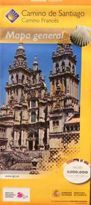
Wegenkaart - landkaart Camino de Santiago - Camino Frances | CNIG - Instituto Geográfico Nacional

Overzichtskaart van de Camino de Santiago, traject Saint-Jean-Pied-de-Port, Puerto de Somport naar Santiago de Compostela. Het traject staat ingetekend met Jacobsschelp pictogrammen. Prima kaart om je te orienteren in het groter geheel. Leuk voor de achterblijves om de route te volgen. ...
4,95

Webshops met dit product

Webshop
Bezorging
Prijs

Anderen bekeken ook

Pelgrimsroute (kaart) - Wandelkaart Camino de Santiago in Spanje | CNIG - Instituto Geográfico Nacional
Een duidelijke overzichtskaart van Spanje en Portugal waarop alle pelgrimsroutes naar Santiago de Compostela - de Camino"s - staan ingetekend. Ideaal voor het uitkiezen en plannen van een langere wandelroute. Het is door de schaal niet een kaart die te gebruiken is als wandelkaart. CAMINOS DE SANTIAGO Camino Francés ES01 Camino Francés Caminos del Este  ES08 Camino de Levante ES23 Camino de Santiago de Castellón-Bajo Aragon ES25 Camino de Sagunto   Caminos del Norte ES03 Camino del Norte  ES05 Camino Primitivo  ES37 Camino de la Lana Valencia-Requena ES11 Camino Olvidado Caminos del Sureste  ES20 Camino Vasco del Interior ES33 Camino de Baztán ES45 Camino Lebaniego   60S Caminos del Sureste  ES28 Camino de El Salvador ES13 Camino de la Lana  ES29 Ruta Vadiniense ES15 Ruta del Argar  ES30 Camino Calzada de los Blendios ES38 Camino del Alba  ES31 Camino del Valle de Mena Bilbao-Balmaseda-Burgos ES32 Camino Vía de Bayona ES39 Camino del Sureste Benidorm  ES42 Camino del Sureste Ramal Su…
8,95
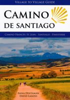
Wandelgids Camino de Santiago, Camino Frances | Village to Village Press
Now fully updated for 2023! This Village to Village Guide to the Camino de Santiago is a comprehensive guidebook to walking the Way of Saint James, from Saint-Jean-Pied-de- Port to Santiago de Compostela (the Camino Frances), and also the Camino Finisterre to Muxia and Finisterre. This Camino guidebook includes full-color detailed topographical stage maps of each day's walk with free GPS files online; 135 detailed stage, city and town maps (now easier to read); essential practical information on transport, accommodations and services. It includes detailed listings of pilgrim hostels (albergues) and private accommodations in each town, including prices, amenities, number of beds, contact information, open dates, and more.   There are regional introductions to the different areas along the Camino including information about traditional foods, flora and fauna, and local culture plus overviews of dozens of medieval pilgrim sites, with information about the historical context of the pilgrim…
30,95
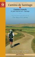
Wandelgids - Pelgrimsroute Camino de Santiago - Camino Francés | Camino Guides Brierley
Engelstalige wandelgids over het Spaanse traject, de El Camino Francés, van de pelgrimstocht naar Santiago de Compostella. In het gids wordt de wandelroute beschreven vanaf de Pyreneeen, Frankrijk Saint-Jean-Pied-de-Port, via Roncesvalles naar Santiago. Het wandelboek geeft duidelijke beschrijvingen van de dagetappes met routekaartjes, overnachtingsadressen in pelgrims hostels en andere accommodatie en verdere praktische informatie  2024 editionNow updated to include newer maps and photos, this comprehensive guidebook to the Camino de Santiago and its offshoots contains all the information needed by modern-day pilgrims wishing to walk the sacred Way of St. James. Overview route planners plus daily stage maps and detailed town plans help sojourners with all the advance preparation they need.   The maps feature contour guides to help distinguish the terrain that will be crossed each day, while full information on all pilgrim hostels, as well as details for alternative accommodation, …
27,95
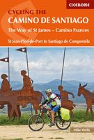
Fietsgids Cycling the Camino de Santiago | Cicerone
The Camino de Santiago de Compostela (Camino Francés or Way of St James) is among the world's most famous pilgrimages: Christian pilgrims have travelled to the shrine of St James in Santiago, northern Spain, since the ninth century. This guide provides all the information you need to successfully cycle the Camino. The Camino Francés is the most popular variant of the Camino, linking St Jean-Pied-de-Port on the French-Spanish border with Santiago via Pamplona, Burgos and León. The guide presents the journey in 18 stages. Two versions of the route are described, the first (770km) based closely on the walkers' route and suitable for hybrid or mountain bikes; the second (798km) a 'road route' for road and touring cycles. It can be cycled in around 10-14 days and is very well provisioned. Clear route description and mapping are accompanied by notes on local points of interest, as well as background information on Spanish history and the history of the Camino. The practicalities are also th…
18,95
Pelgrimsroute (kaart) - Wandelkaart Camino Frances, wandelen naar Santiago de Compostela | CNIG - Instituto Geográfico Nacional
Kaarten voor de Camino Frances: Set van 10 topografische kaarten en een overzichtskaart om te wandelen door Noord Spanje naar Santiago de Compostella, op de kaarten  toeristische informatie (zoals overnachten, restaurants, bussen, winkels, etc) met symbolen aangegeven. De kaarten zijn met UTM grid en geschikt voor gebruik met GPS. Op de kaarten zijn ook hoogteprofielen te vinden. De pelgrimsroute is in 38 etappes en loopt vanaf de grens, Pyreneeen naar Santiago.   The whole of Way of St James to Santiago de Compostela in a set of 11 maps: 10 double-sided topographic maps at 1:50,000 plus an overview map of northern Spain, published by the Spanish civilian survey organization. Descriptions in 6 languages; English, French, Spanish, German, Italian & Portuguese   Each 1:50,000 map is double-sided and has four 57 x 35cm panels with full topographic mapping of the area through which the route passes. Contours are at 50m intervals, with additional shading and colouring/graphics to show se…
14,95
Wandelgids - Pelgrimsroute Camino de Santiago - Camino Frances | Cicerone
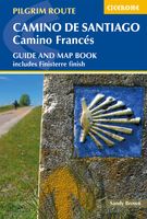
Voor diegenen die de klassieke Camino Frances gaan lopen (als één van de vele wegen dienaar Santiago de Compostela leiden) is dit één van de beste wandelgidsen die er zijn. Zowel de beschrijvingen van de routes en etappes, de kaarten in een losse set en de hoeveelheid praktische informatie is bijzonder goed te noemen.  This two-volume set of guidebook and map book makes an indispensable companion to planning and walking the 784km Camino Frances pilgrim route from St-Jean-Pied-de-Port across northern Spain to Santiago de Compostela. Divided into 6 sections, the guidebook includes an additional section from Santiago de Compostela to Finisterre and Muxia on the Galician coast. Each section is broken down into detailed stages with easily customisable start and finish points due to the amount of accommodation available en route. Over 500 of these pilgrim lodgings are listed within this guidebook, including all public and private albergues, with contact details and a description of facilitie…
24,95
Wandelkaart 1n-4n Camino Santiago de Compostella St-Jean - Puente Reina | CNIG - Instituto Geográfico Nacional
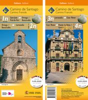
Deze kaart bevat etappe 1n Saint-Jean Pied-de-Port - Orreaga / Roncesvalles 24.7 km, 2n Orreaga / Roncesvalles - Larrasoaña 27 km, 3n Larrasoaña - Cizur Menor 19.7 km en 4n Cizur Menor - Puente de Reina / Gares 18.7 km   Het Instituto Geográfico Nacional heeft een verzameling cartografischewandelkaarten gepubliceerd van de Camino de Santiago en in het bijzonder van de populairste route, de Camino Francés. De kaarten zijn compatibel met het gebruik van GPS en bevatten nuttige informatie voor pelgrims.   Beschrijving: elk blad bevat 4 kaarten op 1:50 000 (1 cm = 500 m) met de route van de weg van St-Jacques en zijn varianten, indien aanwezig. Elke kaart correspondeert met een etappe, die een gemakkelijke en aangepaste lezing mogelijk maakt.   Een hoogteprofiel van elke etappe   Met afstanden tussen de verschillende serviceplaatsen (winkelen, vervoer, accommodatie, zorg, geldautomaten, fietsreparateurs, enz.)   De kaarten zijn GPS-compatibel (ETRS89-systeem )   140 X 47 cm   Legenda in he…
5,95
Wandelgids Camino de Santiago - Via Podiensis GR65 | Cicerone
Handzaam boekje met de routebeschrijving inclusief een heleboel praktische informatie. Uitstekende beschrijving en redelijke kaarten.   This guidebook describes in full the 735km Via Podiensis (GR65), a historic pilgrimage route through southern France from Le Puy-en-Velay to Saint-Jean-Pied-de-Port, where the trail meets the famous Camino Francés to Santiago de Compostela (Spain). Also detailed are 2 major variants: the Célé Valley (GR651) and Rocamadour (GR6 and GR46). Split into 28 stages, the full route takes 4 to 6 weeks to complete but can be divided into shorter sections - Figeac and Condom are well positioned to break the walk into three 2-week chunks. It can be adapted to suit all abilities, with regularly spaced accommodation and baggage transport available, and is best walked in spring and autumn, with May and September the most popular months. Abundant accommodation options offer a warm welcome to walkers and pilgrims and a chance to enjoy delicious home-cooked meals made …
24,95
Wandelgids Rother Wandefuhrer Spanje Camino de Santiago - Jakobsweg - Sint Jacobs route | Rother Bergverlag
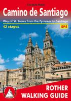
With over 1000 years of history, the Way of St. James is one of the classic long distance walks. This historical route along almost 1000 kilometres from the Pyrenees to Santiago de Compostela offers unique cultural, scenic and nature experiences. Since the Holy Year of 2010 the Way of St. James has gained even more in popularity and attracts more and more people from very different backgrounds, faiths and generations. It does not matter what the reason might be for setting out on the path to Santiago de Compostela - in the end you are confident that you have had a quite special experience. The Rother walking guide describes in a total of 42 stages the whole of the Camino francés from Saint-Jean-Pied-de-Port via Roncesvalles, as well as the Aragon route from the Somport pass via Jaca to Santiago de Compostela, including possible secondary routes and the extension to Finisterre or Muxía. Thus the Way of St. James leads through a wealth of diverse landscapes, continuously interrupted by c…
17,50
Wandelkaart 1a-4a Camino Santiago de Compostella Puerte Somport - Sangüesa | CNIG - Instituto Geográfico Nacional
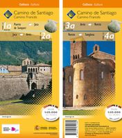
Deze kaart bevat etappe 1a die van Puerto de Somport naar Jaca van 29,6 km gaat, Etappe 2a die van Jaca naar Arrés van 24,8 km gaat, Etappe 3a die van Arrés naar Ruesta van 26,6 gaat. km. en etappe 4a die van Ruesta naar Sangüesa van 22,2 km gaat. Het Instituto Geográfico Nacional heeft een verzameling cartografische wandelkaarten gepubliceerd van de Camino de Santiago en in het bijzonder van de populairste route, de Camino Francés. De kaarten zijn compatibel met het gebruik van GPS en bevatten nuttige informatie voor pelgrims. Beschrijving: elk blad bevat 4 kaarten op 1:50 000 (1 cm = 500 m) met de route van de weg van St-Jacques en zijn varianten, indien aanwezig. Elke kaart correspondeert met een etappe, die een gemakkelijke en aangepaste lezing mogelijk maakt. Een hoogteprofiel van elke etappe Met afstanden tussen de verschillende serviceplaatsen (winkelen, vervoer, accommodatie, zorg, geldautomaten, fietsreparateurs, enz.) De kaarten zijn GPS-compatibel (ETRS89-systeem ) 140 X 47 …
5,95

Klanten-reviews van Wegenkaart - landkaart Camino de Santiago - Camino Frances | CNIG - Instituto Geográfico Nacional

Er zijn nog geen beoordelingen voor dit productBen jij de eerste die een review plaatst?

Meer over Wegenkaart - landkaart Camino de Santiago - Camino Frances | CNIG - Instituto Geográfico Nacional

Productomschrijving

Overzichtskaart van de Camino de Santiago, traject Saint-Jean-Pied-de-Port, Puerto de Somport naar Santiago de Compostela. Het traject staat ingetekend met Jacobsschelp pictogrammen. Prima kaart om je te orienteren in het groter geheel. Leuk voor de achterblijves om de route te volgen. 

Verken gerelateerde categorieën

Webshop.nl maakt gebruik van cookies. Ga je verder op onze website, ga dan akkoord met het plaatsen van cookies en de verwerking van deze data door ons en vermelde partners.