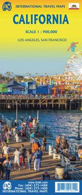
Wegenkaart - landkaart Californië - California | ITMB

0
  Waterproof wegenkaart van Californië op schaal 1:1m met inzetjes van Hollywood, LA, Santa Monica en San Francisco. Natuurkundige overzichtskaart met veel plaatsen en wegen, spoorlijnen en rivieren, hoogten, lengte- en breedtegraden   The map includes inset maps of Hollywood, Los Angeles, Santa Monica, and San Francisco.   Legend Includes: Roads ...

Verkopers met dit product

Verkoper
Bezorging
Prijs
DeZwerver.nl logo
DeZwerver.nl
2,95
13,95

Anderen bekeken ook

Wegenkaart - landkaart San Francisco - Northern California (Californië) | ITMB
San Francisco met schaal 1: 12.500   San Fran is one of my favourite cities; almost as nice as Vancouver. Names such as Chinatown, Nob Hill, the Tenderloin, and Cow Hollow evoke memories of a city that has long moved past its early reputation as a port feeding the goldfields around Sutter's Run, but it is still a clean and sophisticated city to visit. I personally like the old restored trolleys trundling down Market Street, and the restaurants in the Sunset district. This edition adds great value to our map in two ways: first, we have added an extremely detailed and attractive map of all of northern California to the reverse, to help visitors enjoy the Napa Valley, Sacramento, and the Redwood Sequoia trees, and secondly, the map has been printed on plastic paper for durability and attractiveness.   Legend Includes:   Roads by classification, Provincial Boundaries,State Highways, Main Roads, Secondary and other Roads, Capital, Cities, Nature sights, Airports, Point of Interests, Museum…
13,95
Wegenkaart - landkaart British Columbia | ITMB
Wegenkaart van alleen British Columbia. Calgary in het oosten staat er nog net op. Met campsites, register en nationale parken. This is our eight printing of our most popular provincial map for Canada. As with previous versions, we have updated road changes and new bridges. BC is not changing particularly quickly at the moment, due to the economic recession, but tens of thousands of people continue to migrate to the province each year, and its population is expected to double over the next twenty years. Thanks to its enormous size, huge tracts of land have been set aside for wilderness preservation, and yet the province boasts a road and rail network that would be the envy of smaller countries. The scenery tends to be described in superlative terms. Since I live her, I'll avoid the cliches, and content myself by saying that not only is this map superlative, we've reduced the retail price, so it is much more affordable both in America and overseas. Printed on paper, double-sided; inset…
13,95
Wegenkaart - landkaart - Fietskaart Vanouver Island south - Victoria | ITMB
ITMB wegenkaarten en wandelkaarten kenmerken zich door het kleurgebruik waarbij zo de nadruk wordt gelegd op de natuurkundige aspecten van het land of de streek. Het soort landschap en de hoogte worden hierdoor zeer duidelijk zichtbaar. Natuurlijk vind je ook de 'gewone' zaken als wegennet, spoorwegen, vliegvelden, ferrys, toeristische bezienswaardigheden en nationale parken er op terug.. Vaak - maar niet op alle kaarten - staat op de achterzijde een stadsplattegrond van hoofdstad of belangrijkste stad in de regio.  Voorzijde: Vancouver Island zuidelijk gedeelte met schaal 1:270.000 Achterzijde: stadsplattegrond Victoria met schaal 1:10.000 Victoria is a brand new title for ITMB. The city is the capital of British Columbia (each of Canada’s provinces and territories has its own capital, in addition to Ottawa for the entire country). Located at the southern tip of Vancouver Island, Victoria was established as the colonial capital after the Oregon Treaty of 1846 forced the British to ab…
13,95
Wegenkaart - landkaart Californië - California | Borch
Mooie geplasticieerde kaart van Californië. Deze kaart biedt een goed overzicht van dit deel van de Verenigde Staten met detailkaarten.   Our soft-laminated folded map of California shows: California North 1:1 200 000, California South 1:1 200 000, Yosemite National Park 1:675 000, USA administrative and time zones. Borch Maps are easy to fold, durable and water-repellent with a wipeable surface. Borch Maps show hotels, museums, monuments, markets, public transport, top sights and points of interest, useful statistics, conversion charts for temperatures, weights and measurements, climate charts showing temperatures, sunshine hours, precipitation and humidity, overview maps, time zones, and much more...   Mountains, ocean, forest, desert - California has everything to offer the visitor. And in Los Angeles, anything is possible: lying on Venice Beach in the morning, skiing in the nearby San Gabriel Mountains in the afternoon, a visit to Disneyland, an exciting tour through Universal Stu…
11,50
Wegenkaart - landkaart Alaska's Inside Passage | ITMB
Een degelijke kaart met aanduidingen van o.a. nationale parken, vliegveld, benzinepomp, dirt-roads en kleine plattegronden van Anchorage, Seattle, Vancouver en Victoria. Als overzichtskaart goed te gebruiken.    We recently released our USA Pacific Coast Map, covering the segment between San Diego and Vancouver. This map completes the mapping of the Pacific Ocean coastline by mapping the routes followed by cruise ships and Alaska Ferries heading north from Seattle and Vancouver to Alaska. This is a double-sided map, with Vancouver Island and the coastline as far north as Prince Rupert on one side (with inset maps of Seattle, Victoria, and Vancouver)on side 1, and the coastline north to Glacier Bay and an onward inset map to Anchorage (including an inset map of the city) on the second side. As the actual routes followed by the numerous cruise lines vary, we can't show their actual sailing routes, but they generally follow the coastline within viewing distance of either the mainland or …
13,95
Wegenkaart - landkaart 5 Californië, California - Nevada | Hallwag
Uitstekende wegenkaart waarbij de Europese kleurstelling de kaart zeer prettig leesbaar maken i.v.m. met Amerikaanse kaartenmakers. Deze kaart is eenzijdig bedrukt. Op de kaart is informatie te vinden waar allerlei voorzieningen te vinden zijn (d.m.v. symbolen), zoals campings, picknickplaatsen, informatiecentra, luchthavens enz. Bij de kaart zit een apart boekje met een aantal kleine stadsplattegronden, informatie over Nationale Parken en overige informatie voor toeristen.   Met Californie, Nevada, Far West USA.   These new, region by region "USA Road Guides", on a scale of 1 : 1 mio, provide up-to-date, detailed road maps with lots of tourist information. Transit and city maps, as well as detailed maps of national parks, are included in the map layout. The map package also includes a mileage chart with travelling times between major cities, and a brochure with an index of places, travel information from A to Z, top attractions and travel tips.   Plaatsen op de kaart: Los Angeles S…
14,50
Wegenkaart - landkaart Nevada & Northern California | ITMB
Een degelijke kaart met aanduidingen van o.a. nationale parken, vliegveld, benzinepompen.   The USA is one of the most challenging countries to map due to its strong identification with state boundaries. Last month, we introduced two new maps of Idaho and Montana; this month, we wish to introduce Nevada. As a state, Nevada is mostly desert-like and is lightly populated. Its two major urban areas, Las Vegas and Reno, are extremely popular travel destinations. In addition, Nevada offers the Hoover Dam, one of the seven wonders of the modern world, a national park with 5,000-year-old pine trees, America’s second deepest lake (Tahoe), the eighth highest mountain peak in the USA, and the biggest air force bombing range in the world (Nellis). The map is double-sided, and covers northern California on the other side. This includes such treasures as Death Valley, part of the Mojave Desert, Yosemite National Park, the beautiful sequoia trees in the far northeast corner, and man-made wonders s…
13,95
Wegenkaart - landkaart USA Southwest - zuidwest | ITMB
Een degelijke kaart met aanduidingen van o.a. nationale parken, vliegveld, benzinepomp, dirt-roads. Als overzichtskaart goed te gebruiken   We're introducing a map of the US Southwest States, notably most of California and Nevada, Arizona, most of Utah, and the western third of New Mexico and Colorado. Our regional series is at 1:1M scale. This results in instances where the name of the map may differ from the common perception. In US parlance, the 'Southwest' is often thought to be Arizona and New Mexico, whereas in reality it is southern California, Nevada, and Arizona. If one includes New Mexico, the square sheet of paper has to go so far north that one ends up including Denver. This is our compromise and we'll figure out how to deal with Texas, New Mexico, Louisiana, and Oklahoma a bit further down the line. This double-sided map covers from Reno and Sacramento in the north to Tijuana and Deming NM in the south, and from the Pacific coastline in the west to Gallop NM and Grand Jun…
13,95
Wegenkaart - landkaart Bahrain & Qatar | ITMB
Een degelijke kaart met aanduidingen van o.a. nationale parken, vliegveld, benzinepomp, dirt-roads en kleine plattegrond van hoofdstad. Als overzichtskaart goed te gebruiken.  Schaal: - Bahrein 1:115.000 - Qatar 1:300.000 The northern portion of the United Arab Emirates consists of a small peninsula (Qatar) and an island (Bahrain). Although these countries are not geographically significant in relation to their neighbours, they are enormously wealthy, thanks to oil, and have aspirations of grandeur. Qatar hosted the FIFA World Cup of soccer in November 2022. This is significant. Qatar, as a destination country, is now 'on the map'. Its capital, Doha, is quite well developed, with three Metro subway lines, motorways, and a sophisticated city centre dominated by superb high-rise architecture. Just to the west, the island of Bahrain is just as wealthy, and just as likely to have ornate architecture, luxurious shopping arcades, and an extravagant lifestyle. Its capital, Manama, is growing…
13,95
Fotoboek California | Amber Books
Presented in a handy, pocket-sized landscape format and with captions explaining the story behind each photo, California is a stunning collection of images that brings to life the vitality of this iconic west-coast American state. America's most populous state is often seen as a west-coast paradise by those who live there--and those who desire to live there. Anchored around the urban centers of Los Angeles in the south and San Francisco in the north, California is a place of idyllic beaches, cutting-edge architecture, spectacular national parks, and Hollywood dazzle. In the pages of California, find out about the Big Sur, the precipitous, beautiful windy drive along Route 1 in the central coast; Yosemite National Park, home to the imposing Half Dome and El Capitan mountains, and offering stunning views from Glacier Point; San José and Silicon Valley, center of the world's tech industry; Santa Monica State Beach, a mecca for sun seekers; Rodeo Drive, the home of luxury-goods stores in…
13,95

Klanten-reviews van Wegenkaart - landkaart Californië - California | ITMB

Er zijn nog geen beoordelingen voor dit productBen jij de eerste die een review plaatst?

Meer over Wegenkaart - landkaart Californië - California | ITMB

Productomschrijving


Waterproof wegenkaart van Californië op schaal 1:1m met inzetjes van Hollywood, LA, Santa Monica en San Francisco. Natuurkundige overzichtskaart met veel plaatsen en wegen, spoorlijnen en rivieren, hoogten, lengte- en breedtegraden   The map includes inset maps of Hollywood, Los Angeles, Santa Monica, and San Francisco.   Legend Includes: Roads by classification, Provincial Boundaries,State Highways, Main Roads, Secondary and other Roads, State Capital, Cities, Nature sights, Airports, Point of Interests, Museums, Hot Springs, Gas Stations, National Reserves, Hotels, Lodges,Golf courses and much more

Verken gerelateerde categorieën

Webshop.nl maakt gebruik van cookies. Ga je verder op onze website, ga dan akkoord met het plaatsen van cookies en de verwerking van deze data door ons en vermelde partners.