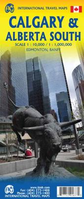
Wegenkaart - landkaart Calgary & Southern Alberta | ITMB

0
This is a brand new title for ITMB. Calgary is the focus of Canada’s oil industry, the largest city in Alberta, and a major travel hub for international flights. It is the destination of choice for Europeans planning to travel around Western Canada. The city was founded due to the rail line being pushed westward to meet the line being constructed ...

Verkopers met dit product

Verkoper
Bezorging
Prijs
DeZwerver.nl logo
DeZwerver.nl
2,95
13,95

Anderen bekeken ook

Wegenkaart - landkaart Southern Alberta & Southern British Columbia | ITMB
ITMB, being based in Vancouver, BC, understandably has a local/regional market for our map line. We have a map of Western Canada, as well as an atlas, a very nice map of BC itself, a map of the south half of BC, and a map of part of BC combined with Washington State. What we did not have, until now, was a map covering the most touristically-visited part of all of Canada – namely, the southern halves of both British Columbia and its neighbour, Alberta, with a small amount of Washington State, Idaho, and Montana (to assist those heading north and needing to know about border crossings). Therefore, ITMB is pleased to announce the release of Southern BC and Alberta. Side One covers BC from the US border (with a carry-on to Seattle) north to Prince George and east to the Alberta border, with a carry-on to Calgary. All of Vancouver Island, the Okanagan Valley, and the Rock Mountain National Parks of Banff and Jasper, are included. The map is rich with wilderness campsite (almost 1,000 are s…
13,95
Wegenkaart - landkaart Western Canada | ITMB
Een degelijke kaart met aanduidingen van o.a. nationale parken, vliegveld, benzinepomp, dirt-roads. Als overzichtskaart goed te gebruiken. This is actually our second attempt at mapping the western portion of Canada; the first covered everything from northwestern Ontario to the Pacific Ocean and, while it was an excellent map, the scale that such a huge area covered necessitated severe problems. In this version, all of British Columbia, Alberta, and the Yukon have been mapped from fresh digital data and presented at 1:1.4T scale. This would have been impossible when we prepared the first map. The Northwest Territories portion had to be compressed in two ways; first, the scale is 1:2M; second, only the portion with roads is shown. This is still an extremely large area. One has to consider the actual size of Canada when designing a map. Most countries in Europe would fit into this area, which only covers 20% of Canada. The Fort McMurray forest fire of a year ago covered an area larger t…
13,95
Wegenkaart - landkaart Alberta | ITMB
Een degelijke wegenkaart voor Alberta met aanduidingen van o.a. nationale parken, vliegveld, benzinepomp, dirt-roads. Als overzichtskaart goed te gebruiken. Wegenkaart Alberta   Alberta is many different things - a dynamic powerhouse of the Canadian economy, the source of oil in vast quantities, cow country, the Calgary Stampede, the Rockies. Alberta is a real gem in the crown of Canada, and is one of the most popular touristic destinations in North America. This double-sided map shows everything from Head-Smashed-In Buffalo Jump to the dinosaur pits of the badlands around Drumheller, to the foothills resorts close to the national parks of Banff and Jasper, and the gigantic parks themselves. The Province of Alberta is huge in area and exuberant as only a confident entity can be. This is Canada in its glory! A great place to visit, and a great map to explore it with. Printed on paper.   Legend Includes: Roads by classification, Airports, Points of Interest, Information Centres, Museums…
14,50
Wegenkaart - landkaart Banff - Jasper national parks | ITMB
Gedetailleerde wegenkaart van deze 2 bekende nationale parken in Canada. Naast toerischtische informatie zjn de belangrijkste wandelpaden schetsmatig ingetekend en worden de campings weergegeven, hogtelijnen geven een goed beeld van de hoogteverschillen en bergern in het gebied.. Jasper staat op de ene kant en Banff op de andere zijde.  Banff is the first national park declared anywhere in the world, done at a time when the idea of reserving huge tracts of land for the enjoyment of future generations was an admirable, though unheard of, concept. The park in the Rocky Mountains of western Alberta remains as lovely and as enjoyable as it must have seemed to the early CPR railway surveyors searching for a route through the mountains to join the then-colony of British Columbia to Canada. Nowadays, the park is laced with roads and hiking trails, and the town of Banff within the park is severely pressed to maintain a balance between serving the needs of the millions of visitors each year an…
13,95
Stadsplattegrond - Wegenkaart - landkaart Quebec City & Gaspe Peninsula | ITMB
Een degelijke kaart aan twee kanten bedrukt. Aan de ene zijde een plattegrond van Quebec stad, schaal 1:10.000. En aan de andere zijde een wegenkaart, schaal 1:750.000, van Gaspe schiereiland met aanduidingen van o.a. nationale parken, vliegveld, benzinepomp, dirt-roads. ITMB is pleased to be introducing yet another brand new title to our line. Quebec City is one of the oldest urban areas in North America, having been continuously occupied since 1608 (unfortunately, the first attempt at settlement, in 1606, failed through poor planning, and all the settlers perished). QC is also the only completely walled city in North America and the city streets within the walls have barely changed in 400 years. The city is also linguistically unique in being almost completely French Canadian in language (Montreal is much more Anglophiled). The city was the capital of French Canada until General Wolfe and the British army arrived in 1759. The British were able to climb the cliffs protecting the city…
13,95
Wegenkaart - landkaart Jasper National Park & Northern Alberta | ITMB
  Jasper National Park kaart, zeer gedetailleerd (schaal 1:250.000) plus op de anderekant van de kaart staat Noord Alberta, schaal 1:1.000.000. Natuurkundige overzichtskaart met veel plaatsen en wegen, spoorlijnen en rivieren, hoogten, lengte- en breedtegraden.   Two words immediately come to my mind if I were to describe Northern Alberta: Oil and Cold. Oil sands could be found relatively easily within the Northern Alberta region. This pushes the Canadian economy forward as gasoline and other petroleum products are becoming higher in demand. Northern Alberta is also about the subzero temperature. The region of Northern Alberta mostly contains very cold, long winters and warm, short summers. Fort McMurray, for example, one of the famous urban communities located in the Wood buffalo municipality, has only a yearly mean temperature of 0.7 degrees Celsius. Nonetheless, Northern Alberta is also a land of recreation activities and wild adventures. On the other side of the Northern Alberta …
13,95
Wegenkaart - landkaart - Stadsplattegrond Montreal & Southern Quebec | ITMB
Stadsplattegrond van Montreal met register. Op de achterzijde een kaart van het zuiden van Quebec. 1:12,500/1:850,000 on waterproof paper. In this third, updated, edition of Canada's third largest city, we have added a user-friendly bonus. As is common now to most of our city maps, we have included a regional map of the hinterland of the urban area, so buyers won't have to purchase a second map to explore the environs of the city being presented. In the case of Montreal, being in a huge geographic country, this means Southern Quebec which, because of its size, dictates a map of more than one to a million scale. In the European context this would be the equivalent of Paris and all of France as a 'regional' map of the surrounds of Paris - but that's France and this is Canada.   Montreal (or Mont Royale in its original) was a village called Hochelaga when the early French explorers arrived in the early 1600s. They established a trading fort and, generally speaking, maintained good relati…
13,95
Wegenkaart - landkaart South Pacific Cruising & Samoa | ITMB
Een overzichtskaart van de zuidelijke Stille Oceaan met de cruise routes tussen de verschillende eilanden aangegeven. Op de achterzijde een overzichtskaart van Samoa This is a new venture for ITMB. Cruising is a rapidly-growing segment of the travel industry, experiencing double-digit growth rates annually. Obviously, this is a thriving market. In conjunction with several cruise ship lines, we have prepared a map of the South Pacific Ocean, which extends southwards from Hawai'i to the southern tip of New Zealand and eastwards from central Australia/Papua New Guinea to the Pitcairn Islands. Thus, it does not include the popular South East Asia and China coast routes. We think this has to change at a time when 25,000,000 people are travelling by cruise ships. At the same time, we must keep coverage area relevant for those end users of the artwork. Even at 1:12M, most of the area covered is water, with island countries such as Fiji, Tonga, Kiribati, Tahiti, and the Cook Islands being vis…
13,95
Wegenkaart - landkaart Baja California - Mexico | ITMB
Een degelijke kaart met aanduidingen van o.a. nationale parken, vliegveld, benzinepomp, dirt-roads. Als overzichtskaart goed te gebruiken. The long peninsula on the north-western edge of Mexico (the ‘lost’ province of Alta California being the temporary possession of that country to the north) is a favourite travel destination for visitors from all over the world, whether they be day-trippers crossing into Tijuana, RVers headed for the Gulf, 4x4ers wanting to explore the dreaded Viscaino Desert, or intrepid explorers wanting to experience a part of Mexico that has always prided itself as being a little ‘different’. I remember the first time Kevin Healey and I visited the peninsula in 1988. He couldn’t handle the spicy food, and we had to beat a retreat to the north after three days, but he produced the definitive Baja map two months later. This digitized, double-sided map is based on his efforts, but has been updated several times since his death, and Lan and I love going to Baja to r…
13,95
Spoorwegenkaart England North and Central Rail and Road | ITMB
This is a new title for ITMB, and continues our expanded coverage of the United Kingdom. Many publishers carry a map of Great Britain (or of the UK), and a few might have one just for England and Wales. We travel extensively through Britain and usually find such maps too generalized for usability. All parts of the UK seem to be blessed with interesting places for a visitor to explore – parish churches, cathedrals, fortresses or castle ruins, market towns, lavish country estates, fabulous gardens, seaside resort towns – the list is endless. The only way to show tertiary-level roads leading to interesting tiny villages with fascinating names, and to portray the wealth of attractions available for the visitor is to divide the UK into logical units, which we did earlier with south East and South West England and now continue to the Scottish border with this map. Coverage is from Birmingham/Peterborough north to York on side one and from Lancaster north to the Scottish border at Berwick-up…
13,95

Klanten-reviews van Wegenkaart - landkaart Calgary & Southern Alberta | ITMB

Er zijn nog geen beoordelingen voor dit productBen jij de eerste die een review plaatst?

Meer over Wegenkaart - landkaart Calgary & Southern Alberta | ITMB

Productomschrijving

This is a brand new title for ITMB. Calgary is the focus of Canada’s oil industry, the largest city in Alberta, and a major travel hub for international flights. It is the destination of choice for Europeans planning to travel around Western Canada. The city was founded due to the rail line being pushed westward to meet the line being constructed from Vancouver eastward, creating North America’s only trans-continental rail line. The annual Stampede Rodeo held there each July is a highlight of the city’s busy program. The second side of the map covers the southern half of the Province of Alberta and a bit of BC, with an excellent inset map of the town of Banff, and another of the Province’s capital, Edmonton. This map would be perfect for the short-term visitor wishing to explore from the American border to the top of Jasper National Park, and from western Saskatchewan to British Columbia; excellent road coverage, and all attractions noted.   Legend Includes: Port of Entry, University, Gas Station, Airfield, Golf Course, Park with camping, Pass, First Nations, Military Use, Dam, Visitor Information Center, Point of Interest etc,.

Productinformatie

    Verken gerelateerde categorieën

    Webshop.nl maakt gebruik van cookies. Ga je verder op onze website, ga dan akkoord met het plaatsen van cookies en de verwerking van deze data door ons en vermelde partners.