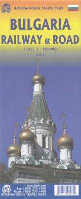
Wegenkaart - landkaart Bulgaria - Bulgarije | ITMB

0
Een degelijke kaart met aanduidingen van o.a. nationale parken, vliegveld, benzinepomp, dirt-roads en kleine plattegrond van hoofdstad. Als overzichtskaart goed te gebruiken.  Very detailed, double sided road and travel map, scale 1:390,000, includes inset map of Sofia and extensive place name index. Distinguishes roads ranging from motorways to l...

Verkopers met dit product

Verkoper
Bezorging
Prijs
DeZwerver.nl logo
DeZwerver.nl
2,95
13,95

Anderen bekeken ook

Wegenkaart - landkaart Belize & Guatemala East | ITMB
Een degelijke kaart met aanduidingen van o.a. nationale parken, vliegveld, benzinepomp, dirt-roads en kleine plattegrond van hoofdstad. Als overzichtskaart goed te gebruiken. Met oost Guatemala waaronder Tikal. A folded travel and road map in color showing elevations. Indexed with town, camps, and villages. Scale 1:250,000. Legend is in English and Spanish. The map distinguishes paved and unpaved roads, seasonal roads, and tracks. Icons locate international airport, domestic airports with scheduled service, airstrips/ landing ground, lakes, rivers, swamps, coral reefs, protected area, bird sanctuaries, diving, border crossings, bridges, ports, fishing, major and minor archaeological sites. Includes: location of the barrier reefs, marine reserves, forest reserves, and other sites of ecological interest
13,95
Wegenkaart - landkaart British Columbia South (Canada) | ITMB
Deze wegenkaart van British Columbia bestrijkt het gebied tussen Vancouver en Calgary, en is de perfecte toeristische kaart voor het verkennen van de regio Rocky Mountain. Alle wegen en spoorlijnen tussen de twee steden worden getoond, evenals campings en parken.   This map covers the area between Vancouver and Calgary, and is the perfect tourist map for exploring the Rocky Mountain region. All roads and rail lines between the two cities are shown, as well as camp grounds, parks. Legend Includes: Points of interests, airports, RV and camping sites, wilderness camps, picnic areas, waterfalls, tourist information, museums, golf courses, gas stations, outdoor activities and other information. Folded paper, road and travel map in color. Scale 1:900,000. Distinguishes roads ranging from divided highways to other roads-4WD/dry weather. Legend includes railways, trails, ferry routes, glaciers, points of interest, international airports, domestic airports, museums, mountain peaks, camping/rec…
13,95
Wegenkaart - landkaart Mali | ITMB
Een degelijke kaart met aanduidingen van o.a. nationale parken, vliegveld, benzinepomp, dirt-roads en kleine plattegrond van hoofdstad. Als overzichtskaart goed te gebruiken.   Folded road and travel map in color. Scale 1:2,400,000. Distinguishes roads ranging from primary paved roads to other roads or tracks. Legend includes international airport/national airports, air fields, gasoline/petrol stations, post office, hospital/medical facilities, hotels, motels/lodging, resthouse or hostel, campsites or huts, museums, border crossings, no border crossings, points of interest, crafts/pottery, archaelogical sites, historic ruins or sites, mines, bus station, forts, mosques, churches/missions, oasis, caves, fishing ports, beaches, hiking/trekking. Includes inset map of Bamako and Timbuktu, road distance chart and extensive index.
13,95
Wegenkaart - landkaart Ghana | ITMB
Een degelijke kaart met aanduidingen van o.a. nationale parken, vliegveld, benzinepomp, dirt-roads en kleine plattegrond van hoofdstad. Als overzichtskaart goed te gebruiken. Folded road and travel map in color. Scale 1:500,000. Distinguishes roads ranging from motorways to other roads. Legend includes tracks, railroads, ferry routes, international airports, national airports, aerodromes/small aircrafts, gasoline/petrol stations, bus stations, hospitals/medical facilities, castles/forts, points of interest, ruins or archaeological sites, campsites and huts, museums, lodges, churches, mosques. Includes inset map of Cape Coast, Accra and Kumasi. Extensive index.
13,95
Wegenkaart - landkaart Mexico Oaxaca & Chiapas & Guerrero | ITMB
Folded road and travel map, in color. Scale 1:700,000. Distinguishes roads ranging from expressways (free/toll) to rural roads. Legend includes tracks, trails, international airports, domestic airports, airfields, gas stations, points of interest, archaeological sites, caves, beaches, lighthouses, mines, national parks, swamps, mangroves. Includes inset map of Oaxaca City Downtown Legend Includes: Airports, roads by classifications, distances between points, gas station, point of interests, archaeological sites, beaches, lighthouses, hypsography and other information.
13,95
Wegenkaart - landkaart Baja California - Mexico | ITMB
Een degelijke kaart met aanduidingen van o.a. nationale parken, vliegveld, benzinepomp, dirt-roads. Als overzichtskaart goed te gebruiken. The long peninsula on the north-western edge of Mexico (the ‘lost’ province of Alta California being the temporary possession of that country to the north) is a favourite travel destination for visitors from all over the world, whether they be day-trippers crossing into Tijuana, RVers headed for the Gulf, 4x4ers wanting to explore the dreaded Viscaino Desert, or intrepid explorers wanting to experience a part of Mexico that has always prided itself as being a little ‘different’. I remember the first time Kevin Healey and I visited the peninsula in 1988. He couldn’t handle the spicy food, and we had to beat a retreat to the north after three days, but he produced the definitive Baja map two months later. This digitized, double-sided map is based on his efforts, but has been updated several times since his death, and Lan and I love going to Baja to r…
13,95
Wegenkaart - landkaart Kenia - Kenya | ITMB
Een degelijke kaart met aanduidingen van o.a. nationale parken, vliegveld, benzinepomp, dirt-roads . Als overzichtskaart prima te gebruiken. Gedrukt op waterproof papier! Folded paper (waterproof), road and travel map in color. Scale 1:920,000. Distinguishes roads ranging from freeways/expressways to other roads (unpaved). Legend includes tracks, railroads, ferry routes, waterfalls, wildlife reserves/game sanctuaries, sites of natural interest, parks or reserves, international airports, national airports, airfields, gas stations, hospitals/medical facilities, campsites/huts, rest houses, hotels, border crossings, UNESCO World Cultural Heritage Sites, UNESCO World Natural Heritage Sites, park gates, beaches, poits of interest, archaeological sites, museums, train/bus stations. Elevation in feet. About the Author
13,95
Wegenkaart - landkaart Mexico South | ITMB
Een degelijke wegenkaart met aanduidingen van o.a. nationale parken, vliegveld, benzinepomp, dirt-roads. Als overzichtskaart goed te gebruiken (De kaart beschrijft Mexico ten Zuiden van Tampico). Folded road and travel map in color. Scale 1:1,200,000. Distinguishes 5 types of roads, ranging from expressways to tracks. Legend shows international/provincial borders, international/domestic airports, airstrips, railways, trails, points of interest, archaeological sites, beaches, caves, gas stations, reefs, National Parks, swamps/mangroves. Map includes extensive index. Shown are also parts of Belize and Guatemala.  
13,95
Wegenkaart - landkaart Libya - Tunisia / Libië - Tunesië | ITMB
The recent 'jasmine revolution' brings real-life reality very close to our consciousness. It is fitting that a new map of Tunisia is coming out just at this momentous time of the country's long history, as the country has long been seen as a small but stable fortress in the sea of shifting sand known as North Africa. Having visited the country, the publishers wish its inhabitants well as they undertake the next leg of their political development, and hope that the 'revolution' won't be hijacked by extremist elements. This map benefits from the research the publishers were able to carry out during their recent visit to Tunisia. They were able to confirm a lot of road information, and improve the information on this map. The map also now includes several text blocks called capsule comments, describing in words certain brief facts about points of interest in the country.  The north coast of Africa is also the southern edge of Roman Africa, and the best-preserved ruins are in Libya, which…
13,95
Wegenkaart - landkaart - Stadsplattegrond Estonia, Estland en Tallinn | ITMB
Goede wegenkaart van Estland met bezienswaardigheden, kilometers etc. daarop aangegeven. The map displays Estonia on one side and Tallin on the other, each showing a separate index. Road networks distinguish motorways, major and minor roads with intermediate distances on connecting roads. Railways and ferry routes are also shown, while symbols clearly indicate parking and international and domestic airports.   Topography is represented by altitude colouring and graphics locate rivers, lakes, national parks and reserves, Unesco World Heritage sites, scenic spots, hotsprings etc. Symbols mark locations of various places of interest including hotels, campsites, historic ruins, castles, beaches, ports etc. International and administrative boundaries are marked. Latitude and longitude lines are drawn at intervals of 20’.   The street plan of Tallin is a clearly laid out and extends from the Gulf of Tallin to Tallin international airport and the intercity bus station in the south, the Centr…
13,95

Klanten-reviews van Wegenkaart - landkaart Bulgaria - Bulgarije | ITMB

Er zijn nog geen beoordelingen voor dit productBen jij de eerste die een review plaatst?

Meer over Wegenkaart - landkaart Bulgaria - Bulgarije | ITMB

Productomschrijving

Een degelijke kaart met aanduidingen van o.a. nationale parken, vliegveld, benzinepomp, dirt-roads en kleine plattegrond van hoofdstad. Als overzichtskaart goed te gebruiken. 

Very detailed, double sided road and travel map, scale 1:390,000, includes inset map of Sofia and extensive place name index. Distinguishes roads ranging from motorways to local roads. Legend includes tracks/paths, railways, border crossings, national parks, mountain huts, castles/fortresses, monasteries, churches, archaeological sites, other points of interest, camp sites, beaches, caves, international/domestic airports.

Verken gerelateerde categorieën

Webshop.nl maakt gebruik van cookies. Ga je verder op onze website, ga dan akkoord met het plaatsen van cookies en de verwerking van deze data door ons en vermelde partners.