webshop.nl
Categorieën
  Sluiten

Meer ITMB
Meer ITMB in Literatuur boeken

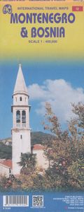
Wegenkaart - landkaart Bosnië en Montenegro | ITMB

0
For some reason, Bosnia Herzegovina has never attracted the attention of firms publishing maps. Understandably, since the breakup of Yugoslavia, the entire region has been somewhat unattractive for visitors. Also, Bosnia by itself is difficult to map, due to its shape. However, we have visited the country several times and find it to be interesting...

Webshops met dit product

Webshop
Bezorging
Prijs

Anderen bekeken ook

Wegenkaart - landkaart Bosnië en Montenegro | ITMB
For some reason, Bosnia Herzegovina has never attracted the attention of firms publishing maps. Understandably, since the breakup of Yugoslavia, the entire region has been somewhat unattractive for visitors. Also, Bosnia by itself is difficult to map, due to its shape. However, we have visited the country several times and find it to be interesting, friendly, and attractive. We were particularly impressed by Montenegro. Since it broke away from Serbia, this country has moved forward quickly. It uses the Euro as a currency, has lovely Mediterranean Sea resorts along its coast, and is a progressive country tying its future to the rest of Europe as a future EU member. The roads in both countries are good, and the damage done by civil in-fighting largely a thing of the past. Both countries are well-worth a visit. The map also includes Kosovo. Ethnically, it is probably more tied to Albania than to Bosnia, but geographically, Bosnia is closer and Kosovo is shown in good detail on this doubl…
13,95
Wegenkaart - landkaart Litouwen & Letland | ITMB
ITMB is very pleased to release its first-ever map of the Baltic country of Lithuania, which occupies Side 1 of this double-sided map. It is bordered by Latvia on its north, the Russian enclave of Kalingrad on its southeast, and Poland and Belarus on its south and east. It is now on the front lines of tension between Russia and its neighbours, as are all the Baltic states. It is also a valued member of both NATO and the EU, and as such is easy to access from either Poland or Latvia. Lithuania fronts on to the Baltic Sea with a major port at Klaipeda (formerly Memel), with its capital being Vilnius. Historically, the country has suffered German and Russian invasions during the 20th century, the last of which resulted in the country losing its independence completely by being absorbed into the Russian Empire in the latter stages of WW2. It regained its independence in 1991, with the collapse of the USSR and shortly thereafter applied to join both the European Union and NATO. Touristicall…
14,95
Wegenkaart - landkaart Afghanistan | ITMB
Een degelijke kaart met aanduidingen van o.a. nationale parken, vliegveld, benzinepomp, dirt-roads en kleine plattegrond van hoofdstad. Als overzichtskaart goed te gebruiken. Legend Includes: Roads by classification, silk road, airports, towns, villages, ruins, national parks, lakes, swamps, points of interest and other information It is a bit difficult to credit Afghanistan having touristic potential at the moment, but it is an extremely important country right now, and that justifies a very good map of the country. This is our third edition of this country and each one keeps getting better. We can’t justify sending a researcher into a combat zone to gather data, but we are thankful to those aid workers and soldiers who have added to our information base and helped make this map more useful. In this edition, we are showing some new roads, reflecting the reality that the country is succeeding in improving its infrastructure in spite of a very tense political situation. We have also pla…
13,95
Wegenkaart - landkaart USA Verenigde Staten | ITMB
Een degelijke kaart met aanduidingen van o.a. nationale parken, vliegveld, benzinepomp, dirt-roads en kleine plattegrond van hoofdstad. Als overzichtskaart goed te gebruiken. United States of America (USA) Travel Reference Map has been mapped before, but the USA is a huge country, extremely developed, and almost impossible to show on a map without over-simplification. Most commercial maps use small sheets of paper and print single-sided, making it impossible to show this vast country to advantage. Well, Lan’s been hard at work developing a ‘proper’ traveller’s aid to navigating around the USA, and here it is. We printed it on an exceptionally large sheet of paper, 39” tall by 54” wide (our normal printing size is 27”x39”). To do this, we merged our four existing databases into one, then split them so that the west side is on one side and the east side on the other. What results is a very large sheet, but a map at a VERY good scale. We were able to fit in 6,765 urban areas, all the Inte…
13,95
Wegenkaart - landkaart Botswana - Zimbabwe | ITMB
Een degelijke kaart met aanduidingen van o.a. nationale parken, vliegveld, benzinepomp, dirt-roads en kleine plattegrond van hoofdstad. Als overzichtskaart goed te gebruiken. 7th Edition 1:1,600,000/11:1,000,000 on waterproof stone paper Both Botswana and its neighbour, Zimbabwe, form a common entity and a British heritage in Central Southern Africa, but there the resemblance ends. The Bechuana formed an alliance of sorts with the Pritish to protect them from the Boers in the then-nearby Transvaal. Upon a peaceful transition to independence as Botswana, it has evolved into a democratic and peaceful country. Zimbabwe, formerly Rhodeisa, is a failed state, although potentially, Zimbabwe could dominate tourism if governmental affairs were orderly. This map focuses on Botswana simply because that country is a beacon of orderly pleasantness in the continent; well run, routistacally well developed, with good infrastructure, and close to the game preserves of both South Africa and Zimbabwe. T…
13,95
Wegenkaart - landkaart Oman & Yemen - Jemen | ITMB
Een degelijke kaart met aanduidingen van o.a. nationale parken, vliegveld, benzinepomp, dirt-roads en kleine plattegrond van hoofdstad. Als overzichtskaart goed te gebruiken.    We were in Oman a couple of weeks before year end and can certify that it is a safe and attractive country to visit; completely different from its neighbours. The main city is Muscat, which has an inset map on the country side of the sheet, as well as a map of Salalah, in the far west of the country. The road network of the country is well developed, with several crossings to the UAE. Unfortunately, none are available to Saudi Arabia, and the crossing to Yemen, while open, is not advised, due to on-going fighting. Oman also has two enclaves surrounded by UAE; a small one north of Fujairah, and another at the northern tip of the peninsula, separating the Gulf of Oman from the Persian (or Arabic) Gulf. Oman has a long history and an interesting culture, and is well worth a visit. The other side of the sheet cons…
13,95

Klanten-reviews van Wegenkaart - landkaart Bosnië en Montenegro | ITMB

Er zijn nog geen beoordelingen voor dit productBen jij de eerste die een review plaatst?

Meer over Wegenkaart - landkaart Bosnië en Montenegro | ITMB

Productomschrijving

For some reason, Bosnia Herzegovina has never attracted the attention of firms publishing maps. Understandably, since the breakup of Yugoslavia, the entire region has been somewhat unattractive for visitors. Also, Bosnia by itself is difficult to map, due to its shape. However, we have visited the country several times and find it to be interesting, friendly, and attractive. We were particularly impressed by Montenegro. Since it broke away from Serbia, this country has moved forward quickly. It uses the Euro as a currency, has lovely Mediterranean Sea resorts along its coast, and is a progressive country tying its future to the rest of Europe as a future EU member. The roads in both countries are good, and the damage done by civil in-fighting largely a thing of the past. Both countries are well-worth a visit. The map also includes Kosovo. Ethnically, it is probably more tied to Albania than to Bosnia, but geographically, Bosnia is closer and Kosovo is shown in good detail on this double-sided map. I see the political entity currently known as Bosnia separating into three distinct units in time, and one could speculate endlessly on the resulting combinations. For now, the entire region is at peace and rebuilding. It is extremely affordable, easy to get to now that Croatia is part of the EU, and a little-known part of Europe.   Legend Includes: Road by classification, Motorways, Main roads, Distances in kilometres, Natural features of interest, Churches, Archeological sites, Ski resorts, Beaches, and much more...

Productspecificaties

Artikelnummer(s)
Brand
ITMB

Verken gerelateerde categorieën

Webshop.nl maakt gebruik van cookies. Ga je verder op onze website, ga dan akkoord met het plaatsen van cookies en de verwerking van deze data door ons en vermelde partners.