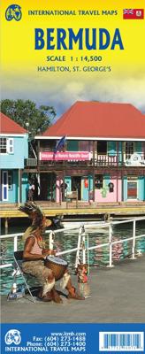
Wegenkaart - landkaart Bermuda | ITMB

0
Een degelijke kaart met aanduidingen van o.a. nationale parken, vliegveld, benzinepomp, dirt-roads. Als overzichtskaart goed te gebruiken. Bermuda is a lovely mid-Atlantic island far off the coast of South Carolina. It is full of colonial architecture and an ‘island’ way of life. Tourism is a key ingredient of the colony’s lifeblood and the island...

Verkopers met dit product

Verkoper
Bezorging
Prijs
DeZwerver.nl logo
DeZwerver.nl
2,95
13,95

Anderen bekeken ook

Wegenkaart - landkaart Tahiti - French Polynesia | ITMB
Anyone who has visited Tahiti retains fond memories of a wonderful Polynesian paradise. This map shows the major islands of French Polynesia as a series of large insets on Side 1. An overall inset map showing the many islands is also shown, but for showing detail, one must expand the individual islands. The largest one is the volcanic Tahiti Nui, with the capital city of Pape’ete (or Papeete in English), for which a detailed inset map is included. Most visitors stay in the vicinity of Papeete, along the coast. We show several popular resorts. There is a good circular road around the island’s shoreline, but no roads in the interior. The island is joined to another, called Tahiti Iti, or Little Tahiti, and roads extend partway around this less-developed part of the combined island. Most of the other islands are rarely visited, although they have resorts, beaches, and a lifestyle of their own. Names like Huahine, Riatea, Tahaa, and Maiao may not be as familiar as they should be, but all …
14,95
Nieuw
Wegenkaart - landkaart South Pacific Cruising & Samoa | ITMB
Een overzichtskaart van de zuidelijke Stille Oceaan met de cruise routes tussen de verschillende eilanden aangegeven. Op de achterzijde een overzichtskaart van Samoa This is a new venture for ITMB. Cruising is a rapidly-growing segment of the travel industry, experiencing double-digit growth rates annually. Obviously, this is a thriving market. In conjunction with several cruise ship lines, we have prepared a map of the South Pacific Ocean, which extends southwards from Hawai'i to the southern tip of New Zealand and eastwards from central Australia/Papua New Guinea to the Pitcairn Islands. Thus, it does not include the popular South East Asia and China coast routes. We think this has to change at a time when 25,000,000 people are travelling by cruise ships. At the same time, we must keep coverage area relevant for those end users of the artwork. Even at 1:12M, most of the area covered is water, with island countries such as Fiji, Tonga, Kiribati, Tahiti, and the Cook Islands being vis…
13,95
Nieuw
Wegenkaart - landkaart Alaska's Inside Passage | ITMB
Een degelijke kaart met aanduidingen van o.a. nationale parken, vliegveld, benzinepomp, dirt-roads en kleine plattegronden van Anchorage, Seattle, Vancouver en Victoria. Als overzichtskaart goed te gebruiken.    We recently released our USA Pacific Coast Map, covering the segment between San Diego and Vancouver. This map completes the mapping of the Pacific Ocean coastline by mapping the routes followed by cruise ships and Alaska Ferries heading north from Seattle and Vancouver to Alaska. This is a double-sided map, with Vancouver Island and the coastline as far north as Prince Rupert on one side (with inset maps of Seattle, Victoria, and Vancouver)on side 1, and the coastline north to Glacier Bay and an onward inset map to Anchorage (including an inset map of the city) on the second side. As the actual routes followed by the numerous cruise lines vary, we can't show their actual sailing routes, but they generally follow the coastline within viewing distance of either the mainland or …
13,95
Nieuw
Wegenkaart - landkaart US Virgin Islands & Puerto Rico | ITMB
Puerto Rico: schaal 1:190.000 US Virgin Islands: schaal 1:50.000   We are really pleased with this new edition of Puerto Rico. We spent part of August, 2020, touring the island and geo-referencing its many highways. The island is bigger and more densely road-networked than we thought, so we'll have to complete the job on our next visit, but the roads are now much more precisely shown accurately than was possible before satellite imagery. The map looks great on an Ipad screen as well. The map also shows updated inset maps of San Juan, Ponce, Mayaguez, Aguadilla, and Arecibo. Puerto Rico is part of the United States, so has all the benefits, but is internally self-governing. With this edition we are including a map of the other US colonial territory, the US Virgin Islands. The Danish West Indies was purchased from Denmark in 1917 and is an integral part of the USA, with all its benefits, but is, like Puerto Rico, neither fish nor fowl. It is internally self-governing and a great retirem…
13,95
Nieuw
Wegenkaart - landkaart Guam - West Pacific Cruising | ITMB
Een degelijke kaart met aanduidingen van o.a. nationale parken, vliegveld, benzinepomp, dirt-roads. Als overzichtskaart goed te gebruiken. Certainly, this is the only map of Guam by any major cartographic publishing house. Here are some details: Guam is a north-south island considerably north of New Guinea, and forms part of the American-held group of islands known as the Northern Marianas. Its capital is Hagatna, and the main town is called Tamuning. The island has a well-developed international airport in the middle portion of the island, with a large US military airbase in the northeast corner. The vast majority of the island is touristic, and well worth a visit. The island was "discovered" by Ferdinand Magellan in 1521, and Hagatna is the oldest "European" city in the Pacific, dating from 1686. The town of Inarajan retains a decidedly Spanish appearance to this day. Other attractions include Tumon Beach and its many resorts, the Piti Underwater Observatory, and the famous Cocos Is…
13,95
Wegenkaart - landkaart New Caledonia & Oceania Cruising | ITMB
Aan de ene kant een degelijke kaart  van Nieuw Caledonië, schaal 1:530.000, met aanduidingen van o.a. nationale parken, vliegveld, benzinepomp, dirt-roads. As overzichtskaart goed te gebruiken. Aan de andere kant een overzicht van cruise routes in Oceanië, schaal 1:12.000.000 The South Pacific island complex known as New Caledonia, or Nouvelle Caledonie in French, consists of a main island and half a dozen smaller islands (collectively called the Loyalty Islands. It is an overseas possession of France and uses the Euro as its currency. It is located about halfway between Australia and Fiji and is south of Vanuatu. The main island is one of the larger land masses in the Pacific, with a reasonably well-developed road infrastructure linking the capital city of Naomea with other urban areas. There are resort hotels at various locations along the coastline, but this is a territory that one would have to regard as being adventuresome. Most of the attractions are concentrated in the vicinity…
13,95
Wegenkaart - landkaart Honolulu and Oahu | ITMB
Een degelijke kaart met aanduidingen van o.a. nationale parken, vliegveld, benzinepomp, dirt-roads en kleine plattegrond van hoofdstad. As overzichtskaart goed te gebruiken. Schaal: - Oahu 1:80.000 - Honolulu 1:18.000 Honolulu/Waikiki is a brand new map for ITMB, and our first new title for a part of the USA this year. Almost everyone flying to Hawaii goes to Honolulu, and the vast majority stay in hotels located close to Waikiki Beach. This is quite a comprehensive city plan map for the Honolulu urban area, stretching from east of Diamond Head to the international airport. It also includes a large inset of the Pearl Harbour area, with its many memorials to the ships sunk during the surprise Japanese attack on December 6, 1941. Ford Island is still a major US military base. Our Top Attractions list shows the highlights of touristic interest. The second side is a newly-updated version of our map of the island of Oahu. Although the focus of this map is on Honolulu, most visitors include…
13,95
Nieuw
Wegenkaart - landkaart Sunshine Coast - British Columbia | ITMB
Mooi autokaart in overzichtelijke kleur van ITMB. Indexed. English text and legends. The coastline of Canada’s British Columbia is long and varied. The best-known portion is the part just north and west of Vancouver, known as the Sunshine Coast. The rugged Coast Mountain Range makes road-building impractical for much of the interior, so communities such as Gibsons, Sechelt, and Powell River are joined together by Highway 101 and by ferries. Many Fiords take kayakers deep into pristine wilderness areas, and former logging roads are now commonly used for wilderness hikes. The famous Strait of Georgia, used by cruise ships to Alaska, cuts through the middle of the map, with the largely unpopulated and wild Bute Inlet leading TO Waddington Glacier and the vast Homathko Icefield. Side 2 of the map covers southwestern BC, including all of Vancouver Island and the southern interior as far as Nelson and north to 100 Mile House. Insets of downtown Vancouver and Victoria are included.   Legend …
13,95
Nieuw
Stadsplattegrond - Wegenkaart - landkaart Dubrovnik & Croatian Coast Cruise | ITMB
Goede plattegrond van Dubrovnik, schaal 1:3.000. Met aan de achterzijde een wegenkaart, schaal 1:325.000, met als extra informatie routes van veerboten en cruiseschepen ingetekend.   The ancient port city of Dubrovnik, on the southern Croatian coastline, has evolved into a major tourist destination. The old walled city, normally entered through the famous Pile Gate, was so crowded with tourists when we arrived, that it took some time to get to the main street of Stradun. The city has completely recovered from the Montenegrin bombing during the breakup of Yugoslavia, with a few shellholes remaining just to show to tourists. The highlights of a visit are the Rector’s Palace, the Tvrdava fortress, and the cathedral. The map covers the urban area outside of the old town as well, as this is where most of the hotels and restaurants are located. The other side of the map shows the extensive coastline of Croatia in two parts – from the Italian border to Trogir, and from Split to the border wi…
13,95
Wegenkaart - landkaart St. Kitts - Nevis - Antigua | ITMB
Gedetailleerde kaart van de eilanden St. Kitts - Nevis - Antigua met ook Barbuda - English Harbour - St. John's. Naast de wegenkaart ligt er ook veel nadruk op de hoogteverschillen op de eilanden.  Our latest version of Antigua is also a new title for ITMB, in that we are combining the Caribbean island nation with nearby St. Kitts and Nevis, with a small inset map for the lovely island of Barbuda. Side 1 is a very expansive and detailed map of Antigua, with a good inset map of St. John’s, the capital. At the southern end of the island is Nelson’s Dockyard, a historical remnant that serviced British naval ships for centuries, and is well-worth a visit.   Map size: 27*39"   This map is also available in digital format and flat map. Please contact map@itmb.com if you would want to place an order or for more information. Legend Includes: Roads by classification, Rivers and Lakes, National Park, Airports, Points of Interests, Highways, Main Roads, Zoos, Fishing, and much more...
13,95

Klanten-reviews van Wegenkaart - landkaart Bermuda | ITMB

Er zijn nog geen beoordelingen voor dit productBen jij de eerste die een review plaatst?

Meer over Wegenkaart - landkaart Bermuda | ITMB

Productomschrijving

Een degelijke kaart met aanduidingen van o.a. nationale parken, vliegveld, benzinepomp, dirt-roads. Als overzichtskaart goed te gebruiken.

Bermuda is a lovely mid-Atlantic island far off the coast of South Carolina. It is full of colonial architecture and an ‘island’ way of life. Tourism is a key ingredient of the colony’s lifeblood and the island is very popular with cruise ships. There is ample accommodation for longer-term visitors, good roads, and much history. The airport was built by the US Navy during WW2 and is still a US Naval Air Station, but shares the runway with civil aviation. The map includes an excellent inset of St. George’s, which still has its stocks close to the town hall, and another of Hamilton, the capital. This is where most cruise ships dock. For those with the time, the map shows the Railway Trail along the former route of the island’s now-defunct rail line. Lots to see; lots to do!   Map size: 27*39"   Legend Includes: Roads by classification, Rivers and Lakes, National Park, Airports, Points of Interests, Highways, Main Roads, Zoos, Fishing, and much more...

Verken gerelateerde categorieën

Webshop.nl maakt gebruik van cookies. Ga je verder op onze website, ga dan akkoord met het plaatsen van cookies en de verwerking van deze data door ons en vermelde partners.