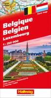
Wegenkaart - landkaart België, Luxemburg | Hallwag

0
Zeer goede, gedetailleerde en up-to-date autokaart van België en Luxemburg. Met afstandentabel en uitgebreide legenda en index. Hallwag road maps are renowned for their up-to-date information, clear layout and convenience. See for yourself the benefits of the Hallwag international map collection, with new ideas to make travel even easier. The map ...

Verkopers met dit product

Verkoper
Bezorging
Prijs
DeZwerver.nl logo
DeZwerver.nl
2,95
14,50

Anderen bekeken ook

Wegenkaart - landkaart België, Luxemburg | Hallwag
Zeer goede, gedetailleerde en up-to-date autokaart van België en Luxemburg. Met afstandentabel en uitgebreide legenda en index. Hallwag road maps are renowned for their up-to-date information, clear layout and convenience. See for yourself the benefits of the Hallwag international map collection, with new ideas to make travel even easier. The map also covers the north east of France. A range of symbols indicate information for tourists including: places of interests, viewpoints, natural curiosities, notable buildings and ruins, monuments, monasteries and churches, yearly and seasonal campsites, windmills, lighthouses and golf courses. The map includes extensive transportation detail, multiple language information (English, German, Italian, and French), and a complete multiple language index. There are also inset maps showing more detail of the major cities. Relief shading clearly shows the topography of the land. The map also includes Hallwag's Distoguide - the integrated mileage char…
14,50
Wegenkaart - landkaart 12 USA - Verenigde Staten | Hallwag
Goede duidelijke overzichtskaart van de USA, waarop de wegen met wegnummers eenvousig te volgen zijn. Nationale parken en National Reserves / Indianen-gebieden staan goed ingetekend. Daarnaast is een handige afstandentabel, waarbij duidelijk wordt hoe groot de USA wel niet is! Een ideale kaart voor iedereen die de USA gaat doorkruisen. Hallwag road maps are renowned for their up-to-date information, clear layout and convenience. See for yourself the benefits of the Hallwag international map collection, with new ideas to make travel even easier.    A range of symbols indicate information for tourists including: places of interests, viewpoints, natural curiosities, notable buildings and ruins, monuments, monasteries and churches, yearly and seasonal campsites, windmills, lighthouses and golf courses.    The map includes extensive transportation detail, multiple language information (English, German, Italian, and French), and a complete multiple language index. Relief shading clearly sho…
14,95
Wegenkaart - landkaart Spanje en Portugal - Spanien | Hallwag
Prima kaart van heel Spanje op 1 kant bedrukt met plaatsnamen index. Met distoguide: een afstanden tabel op schuifkaart die de afstanden geeft tussen de belangrijkste plaatsen. Hallwag road maps are renowned for their up-to-date information, clear layout and convenience. Full of new ideas to make travel even easier. Distoguide – the integrated mileage chart - on the outer map cover. Quick and easy to use. Extremely practical for planning and travel. Simply read off more than 2000 distances on the sliding mileage chart integreated in the map cover. Publisher: Hallwag Scale: 1:1.000 000 Strassenkarte Spanien, PortugalStrassenkarte mit Transitplänen, Ortsindex, touristische Informationen und Sehenswürdigkeiten.Aktuelle Information, übersichtliche Darstellung, einfache Handhabung: das Markenzeichen der Hallwag-Strassenkarten. Das internationale Programm mit neuen Ideen für besseres Reisen bietet Ihnen überzeugende Vorteile. Massstab: 1 : 1 000 000  
15,50
Wegenkaart - landkaart 716 België - Luxemburg 2025 | Michelin
Zoals je van Michelin mag verwachten is deze kaart zeer overzichtelijk en heeft een duidelijk helder kaartbeeld. Klassiek en beroemd zijn de groene lijnen langs de aantrekkelijke wegen: zo wordt in een oogopslag duidelijk waar de mooiste plekjes te vinden zijn. De kaart geeft uitgebreid toeristische informatie weer.  Met stadsplattegrond van de hoofdstad.   Belgium and Luxembourg at 1:350,000 from Michelin with information on driving regulations in each country, a distance and journey time table, plus enlargements showing in greater detail road access to Antwerp, Brussels, Liège and Luxembourg City which also has a small plan of its centre.   Roads network includes local roads and is graded according to the number of lanes. Junctions show full or partial interchanges. Steep gradients, level crossings and restricted entry sections are marked; scenic routes are highlighted. Railway lines and ferry routes are included.   Relief shading is used to indicate the topography, with colouring f…
11,95
Wegenkaart - landkaart 11 Florida | Hallwag
Uitstekende wegenkaart waarbij de Europese kleurstelling de kaart zeer prettig leesbaar maken i.v.m. met Amerikaanse kaartenmakers. Deze kaart is eenzijdig bedrukt. Op de kaart is informatie te vinden waar allerlei voorzieningen te vinden zijn (d.m.v. symbolen), zoals campings, picknickplaatsen, informatiecentra, luchthavens enz. Bij de kaart zit een apart boekje met een aantal kleine stadsplattegronden, informatie over Nationale Parken en overige informatie voor toeristen.   These new, region by region "USA Road Guides", on a scale of 1 : 1 mio, provide up-to-date, detailed road maps with lots of tourist information. Transit and city maps, as well as detailed maps of national parks, are included in the map layout. The map package also includes a mileage chart with travelling times between major cities, and a brochure with an index of places, travel information from A to Z, top attractions and travel tips.   Plaatsen op de kaart Meridian, Montgomery, Mobile, Tallahassee, Macon, Tifto…
14,50
Wegenkaart - landkaart Motomap Motorkaart Sardinië - Sardinie | Hallwag
Die schönsten Strecken mit Sehenswürdigkeiten und Herbergen. GPS-Daten: Gratis Download der Motorradtouren. Einzeln herausnehmbare Karten mit 16 Roadbooks Sardinia Motorbike Map Set from Hallwag with individual waterproof and tear-resistant maps for 16 day tours, plus an overview road map of the whole island. The tours are from 120 km to 260 km long, and each is prominently highlighted on a separate handy size, 24.5 x 23 cm map extract at 1:275,000, printed on waterproof and tear-resistant synthetic paper. Accompanying information indicates the degree of difficulty, distance and approximate timing, etc, and recommended accommodation. Also provided is a link to the website for downloading GPS coordinates. All the text is in German only.   The accompanying overview map shows all the tours together and covers not just Sardinia but also Corsica and mainland Italy from Turin and Piacenza in the north to Rome in the south, extending eastwards to Ravenna and Perugia. Road network is clearly …
19,50
Wegenkaart - landkaart 1 Pacific Northwest USA | Hallwag
Uitstekende wegenkaart waarbij de Europese kleurstelling de kaart zeer prettig leesbaar maken i.v.m. met Amerikaanse kaartenmakers. Deze kaart is eenzijdig bedrukt. Op de kaart is informatie te vinden waar allerlei voorzieningen te vinden zijn (d.m.v. symbolen), zoals campings, picknickplaatsen, informatiecentra, luchthavens enz. Bij de kaart zit een apart boekje met een aantal kleine stadsplattegronden, informatie over Nationale Parken en overige informatie voor toeristen. Met Washington, Oregon, Idaho and parts of Utah, Montana and California These new, region by region "USA Road Guides", on a scale of 1 : 1 mio, provide up-to-date, detailed road maps with lots of tourist information. Transit and city maps, as well as detailed maps of national parks, are included in the map layout. The map package also includes a mileage chart with travelling times between major cities, and a brochure with an index of places, travel information from A to Z, top attractions and travel tips. Plaatsen …
14,95
Wegenkaart - landkaart 2 North Central USA | Hallwag
North & South Dakota, Minnesota, Nebraska, Iowa, Montana, Colorado, Kansas en Missouri   Uitstekende wegenkaart waarbij de Europese kleurstelling de kaart zeer prettig leesbaar maken i.v.m. met Amerikaanse kaartenmakers. Deze kaart is eenzijdig bedrukt. Op de kaart is informatie te vinden waar allerlei voorzieningen te vinden zijn (d.m.v. symbolen), zoals campings, picknickplaatsen, informatiecentra, luchthavens enz. Bij de kaart zit een apart boekje met een aantal kleine stadsplattegronden, informatie over Nationale Parken en overige informatie voor toeristen.   These new, region by region "USA Road Guides", on a scale of 1 : 1 mio, provide up-to-date, detailed road maps with lots of tourist information. Transit and city maps, as well as detailed maps of national parks, are included in the map layout. The map package also includes a mileage chart with travelling times between major cities, and a brochure with an index of places, travel information from A to Z, top attractions and tra…
14,50
Wegenkaart - landkaart 8 Southeast USA zuidoost | Hallwag
Uitstekende wegenkaart waarbij de Europese kleurstelling de kaart zeer prettig leesbaar maken i.v.m. met Amerikaanse kaartenmakers. Deze kaart is eenzijdig bedrukt. Op de kaart is informatie te vinden waar allerlei voorzieningen te vinden zijn (d.m.v. symbolen), zoals campings, picknickplaatsen, informatiecentra, luchthavens enz. Bij de kaart zit een apart boekje met een aantal kleine stadsplattegronden, informatie over Nationale Parken en overige informatie voor toeristen. Middle Atlantic & Appalachen, Indiana, South Illinois,  Ohio, Pennsylvania, New Jersey, Virginia, North & South Carolina These new, region by region "USA Road Guides", on a scale of 1 : 1 mio, provide up-to-date, detailed road maps with lots of tourist information. Transit and city maps, as well as detailed maps of national parks, are included in the map layout. The map package also includes a mileage chart with travelling times between major cities, and a brochure with an index of places, travel information from A…
14,50
Wegenkaart - landkaart 3 Great Lakes USA | Hallwag
Uitstekende wegenkaart waarbij de Europese kleurstelling de kaart zeer prettig leesbaar maken i.v.m. met Amerikaanse kaartenmakers. Deze kaart is eenzijdig bedrukt. Op de kaart is informatie te vinden waar allerlei voorzieningen te vinden zijn (d.m.v. symbolen), zoals campings, picknickplaatsen, informatiecentra, luchthavens enz. Bij de kaart zit een apart boekje met een aantal kleine stadsplattegronden, informatie over Nationale Parken en overige informatie voor toeristen.   Grote Meren Gebied, Wisconsin en Michigan, North Illinois   These new, region by region "USA Road Guides", on a scale of 1 : 1 mio, provide up-to-date, detailed road maps with lots of tourist information. Transit and city maps, as well as detailed maps of national parks, are included in the map layout. The map package also includes a mileage chart with travelling times between major cities, and a brochure with an index of places, travel information from A to Z, top attractions and travel tips.   Plaatsen op de ka…
14,50

Klanten-reviews van Wegenkaart - landkaart België, Luxemburg | Hallwag

Er zijn nog geen beoordelingen voor dit productBen jij de eerste die een review plaatst?

Meer over Wegenkaart - landkaart België, Luxemburg | Hallwag

Productomschrijving

Zeer goede, gedetailleerde en up-to-date autokaart van België en Luxemburg. Met afstandentabel en uitgebreide legenda en index.

Hallwag road maps are renowned for their up-to-date information, clear layout and convenience. See for yourself the benefits of the Hallwag international map collection, with new ideas to make travel even easier.

The map also covers the north east of France. A range of symbols indicate information for tourists including: places of interests, viewpoints, natural curiosities, notable buildings and ruins, monuments, monasteries and churches, yearly and seasonal campsites, windmills, lighthouses and golf courses.

The map includes extensive transportation detail, multiple language information (English, German, Italian, and French), and a complete multiple language index. There are also inset maps showing more detail of the major cities. Relief shading clearly shows the topography of the land.

The map also includes Hallwag's Distoguide - the integrated mileage chart - on the outer map cover which is quick and easy to use and extremely practical for planning and travel. Simply read off more than 2000 distances on the sliding mileage chart integreated in the map cover.

Productinformatie

    Verken gerelateerde categorieën

    Webshop.nl maakt gebruik van cookies. Ga je verder op onze website, ga dan akkoord met het plaatsen van cookies en de verwerking van deze data door ons en vermelde partners.