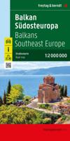
Wegenkaart - landkaart Balkan - Zuidoost Europa | Freytag & Berndt

0
A nicely detailed travelers map of Southeast Europe from Prague east to Odessa and south to Italy, Greece and western Turkey, including the Danube, Romania, Bulgaria and the Black Sea from Odessa to Istanbul. At a scale of 1:2,000,000.  Explore the Balkans and South-East Europe with this Freytag & Berndt road map - the best way to prepare your tri...

Verkopers met dit product

Verkoper
Bezorging
Prijs
DeZwerver.nl logo
DeZwerver.nl
2,95
14,95

Anderen bekeken ook

Wegenkaart - landkaart Balkan - Zuidoost Europa | Freytag & Berndt
A nicely detailed travelers map of Southeast Europe from Prague east to Odessa and south to Italy, Greece and western Turkey, including the Danube, Romania, Bulgaria and the Black Sea from Odessa to Istanbul. At a scale of 1:2,000,000.  Explore the Balkans and South-East Europe with this Freytag & Berndt road map - the best way to prepare your trip, to plan your itinerary, and to travel independently.    This map covers the following countries: Greece, Albania, FYROM, Bulgaria, Kosovo, Serbia, Montenegro, Bosnia Herzegocina, Croatia, Slovenia, Hungary, Romania, Moldova, the Czech & Slovak Republics, Western Turkey, Western Ukraine, Austria, and Southern Italy.   The map includes a localities index and more detailed city maps of Athens, Belgrade, Bratislava, Bucarest, Budapest, Chisinau, Istanbul, Kiev, Ljubljana, Podgorica, Prague, Pristina, Sarajevo, Skopje, Sofija, Tirana, Vienna, and Zagreb.
14,95
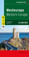
Wegenkaart - landkaart West Europa | Freytag & Berndt
Goede overzichtskaart van West Europa: ideaal om een reis te plannen. High quality road maps with place name index. In many countries these are simply the best maps available. Scales vary according to the size of the country. Index is in several languages. Western Europe at 1:2,000,000 from Freytag & Berndt, with coverage extending from the British Isles to Denmark, the western half of Germany, Switzerland and north-western Italy, with street plans of nine capitals in an index booklet.
14,95
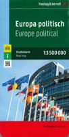
Wegenkaart - landkaart Europa politiek | Freytag & Berndt
Explore Europe with this Freytag & Berndt one-sided road map. The best way to plan your trip, prepare your itinerary, and to travel independently in the European continent. This is a political map, so each country has its own colour.   Main roads such as motorways, dual-carriageways and highways are shown, as are some minor roads. National boundaries are clearly marked, with railways, airports, ferry routes all clearly marked. Intermediate driving distances between locations are shown in kilometres alongside the road.   This map is ideal for route-planning, the legend is in several languages including English.
14,95
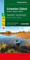
Wegenkaart - landkaart 3 Schweden Südost - Zweden zuidoost | Freytag & Berndt
Uitstekende autokaart van een deel van Zweden met veel informatie als campings, natuurgebieden, hoofd- en kleine wegen en veel bezienswaardigheden. De berijdbare wegen zijn goed weergeven, zowel de hoofdwegen als provinciale en lokale wegen; wegnummers worden vermeld. Afstanden tussen plaatsen zijn in kilometers op de kaart ingetekend, daarnaast worden ook op belangrijke plekken benzinepompen gemarkeerd.   In het kaartbeeld wordt door middel van schaduw het reliëf weergegeven en soms enkele punten in het landschap met de daadwerkelijke hoogte. Provinciegrenzen zijn goed terug te vinden, nationale parken en reservaten ook. Met allerhande symbolen worden toeristische bezienswaardigheden weergegeven als monumenten, historisch belangrijke plekken en uitzichtpunten. In bepaalde plaatsen zijn hotels en campings te vinden, luchthavens, treinverbindingen en havens vindt u er ook op!
14,95
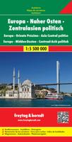
Wegenkaart - landkaart Europa Midden Oosten - Centraal Azië | Freytag & Berndt
Explore Europe, the Middle East and Central Asia with this Freytag & Berndt road map. The best way to plan your trip, prepare your itinerary, and to travel independently in this country.  One side is the detailed map of these areas, and the other side is a full index for this map.    Touristic information on the map include:    Places of interest Airports, castles & antique sites World Heritage sites   The legend is in English, Arabic, French, German, Italian, Spanish, Dutch, Hungarian, Slovak, and Czech.  
14,95
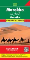
Wegenkaart - landkaart Marokko | Freytag & Berndt
Gedetailleerde, tweezijdige landkaart van Marokko, prima geschikt voor planning en rondtrekken over alle eilanden. De berijdbare wegen zijn goed weergeven, zowel de hoofdwegen als provinciale en lokale wegen; wegnummers worden vermeld. Afstanden tussen plaatsen zijn in kilometers op de kaart ingetekend, daarnaast worden ook op belangrijke plekken benzinepompen gemarkeerd. Morocco at 1:800,000 with the Western Sahara at 1:2,000,000 on a large map from Freytag and Berndt with an index booklet attached to the cover providing street plans of central Casablanca, Fès, Marrakesh, Rabat/Salé and Tangier. Relief shading with spot heights, graphics for sandy or rocky deserts, swamps, seasonal streams, etc. show the topography. Road network includes desert tracks and indicates distances on main routes. Railway lines are included and local airports are marked. Places of interest including the country’s UNESCO World Heritage sites are highlighted.
14,95
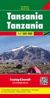
Wegenkaart - landkaart Tanzania | Freytag & Berndt
Prima wegenkaart - landkaart van Tanzania, nu met een nieuwe schaal van 1:1.300.000. Met uitgebreide legenda zodat campings, tankstations, bezienswaardigheden en dergelijke staan aangegeven. Explore Tanzania with this Freytag & Berndt road map. The best way to plan your trip, prepare your itinerary, and to travel independently in this country.   This map includes an index on the back, and touristic information on this map includes accommdation, international airports, museums, places of particular interest, antique sites and river/canal systems.
14,95
Wegenkaart - landkaart Rusland - Russia | Freytag & Berndt
Uitstekende landkaart van Rusland. Met index, toeristische informatie en afstanden in kilometers. Het westen op een schaal van 1 op 2 miljoen en na de Oeral wordt het een grove schaal van 1 op 8 miljoen. Toch een van de betere kaarten van Rusland! Explore Russia and the other members of the Commonwealth of Independent States (C.I.S) with this Freytag & Berndt double-sided road map. The best way to plan your trip, prepare your itinerary, and to travel independently on this region. As with all Freytag & Berndt maps, the cartography is clear and detailed with the topography shown with relief shading with plenty of spot heights.   One side of the map features a 1: 200 000 scale map of Eastern Europe, while the other side features a large scale 1: 8 000 000 map showing the members of the C.I.S. Names of townships in former Soviet countries are listed in both English and the Cyrillic script.   A icon system is used to show tourist information. Icons are displayed for:   Railways and canal s…
14,95
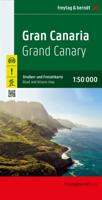
Wegenkaart - landkaart Gran Canaria | Freytag & Berndt
Duidelijke autokaart van Gran Canaria met veel detail. Met hoogtelijnen, een aantal wandelpaden, bezienswaardigheden, berghutten en campings. Overigens vinden wij dat de Freytag & Berndt kaarten van de Spaanse en Portugese eilanden iets meer gericht zjin op algemeen toerisme en iets minder op wandelen; voor wandelen raden we toch de Kompass - kaarten serie aan die van de meest eilanden ook voor handen is. Gran Canaria at 1:50,000 from Freytag & Berndt on a road map clearly presenting its network of main roads and various places of interest or tourist facilities, whilst also including topographic information and selected hiking routes.   The map has contours with relief shading and spot heights to show the island’s topography. Road network includes selected local roads and cart tracks, with road junctions on the motorway linking the airport with Las Palmas and the popular resorts in the south clearly marked.   Overprint highlights hiking routes and icons mark places of interest, includ…
14,95
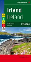
Wegenkaart - landkaart Ierland | Freytag & Berndt
Goede tweezijdige wegenkaart van het hele land. Met register en enkele stadsplattegronden.   De berijdbare wegen zijn goed weergeven, zowel de hoofdwegen als provinciale en lokale wegen; wegnummers worden vermeld. Afstanden tussen plaatsen zijn in kilometers op de kaart ingetekend, daarnaast worden ook op belangrijke plekken benzinepompen gemarkeerd.   In het kaartbeeld wordt door middel van schaduw het reliëf weergegeven en soms enkele punten in het landschap met de daadwerkelijke hoogte. Provinciegrenzen zijn goed terug te vinden, nationale parken en reservaten ook. Met allerhande symbolen worden toeristische bezienswaardigheden weergegeven als monumenten, historisch belangrijke plekken en uitzichtpunten. In bepaalde plaatsen zijn hotels en campings te vinden, luchthavens, treinverbindingen en havens vindt u er ook op!Explore Ireland with this Freytag & Berndt double-sided road map. The best way to plan your trip, prepare your itinerary, and to travel independently in this country. …
14,95

Klanten-reviews van Wegenkaart - landkaart Balkan - Zuidoost Europa | Freytag & Berndt

Er zijn nog geen beoordelingen voor dit productBen jij de eerste die een review plaatst?

Meer over Wegenkaart - landkaart Balkan - Zuidoost Europa | Freytag & Berndt

Productomschrijving

A nicely detailed travelers map of Southeast Europe from Prague east to Odessa and south to Italy, Greece and western Turkey, including the Danube, Romania, Bulgaria and the Black Sea from Odessa to Istanbul. At a scale of 1:2,000,000. 

Explore the Balkans and South-East Europe with this Freytag & Berndt road map - the best way to prepare your trip, to plan your itinerary, and to travel independently.    This map covers the following countries: Greece, Albania, FYROM, Bulgaria, Kosovo, Serbia, Montenegro, Bosnia Herzegocina, Croatia, Slovenia, Hungary, Romania, Moldova, the Czech & Slovak Republics, Western Turkey, Western Ukraine, Austria, and Southern Italy.   The map includes a localities index and more detailed city maps of Athens, Belgrade, Bratislava, Bucarest, Budapest, Chisinau, Istanbul, Kiev, Ljubljana, Podgorica, Prague, Pristina, Sarajevo, Skopje, Sofija, Tirana, Vienna, and Zagreb.

Productinformatie

    Verken gerelateerde categorieën

    Webshop.nl maakt gebruik van cookies. Ga je verder op onze website, ga dan akkoord met het plaatsen van cookies en de verwerking van deze data door ons en vermelde partners.