Wegenkaart - landkaart Bali & Lombok | ITMB

0
Goede kaart met op de ene zijde Bali, schaal 1:145.000 en op de andere kant Lombok, schaal 1:130.000 Lombok may not be as well-known as Bali, but both Indonesian islands are prime tourist destinations. This edition includes new inset maps of Denpasar, the main city in Bali, as well as maps of the Kuta-Legan and Sanur beach resort areas, and of the...

Verkopers met dit product

Verkoper
Bezorging
Prijs
DeZwerver.nl logo
DeZwerver.nl
2,95
13,95

Anderen bekeken ook

Wegenkaart - landkaart Bali & Lombok | ITMB
Goede kaart met op de ene zijde Bali, schaal 1:145.000 en op de andere kant Lombok, schaal 1:130.000 Lombok may not be as well-known as Bali, but both Indonesian islands are prime tourist destinations. This edition includes new inset maps of Denpasar, the main city in Bali, as well as maps of the Kuta-Legan and Sanur beach resort areas, and of the northern city of Singaraja. The Lombok map on the reverse side includes a map of Mataram, the principal city and a special inset showing the three Gili Islands off the west coast, with their dozens of resort hotels. Legend Includes: Roads by classification, Airports, Turtle Reserve Area, Bird Sanctuary, Hospitals, Hotels, Park Headquarters, World Heritage, Volcano, Habour, Police Stations, Viewpoints, Beaches, Gas Stations, Mines and much more.  
13,95
Wegenkaart - landkaart Bali & Lombok | Nelles Verlag
Goede wegenkaart van Bali & Lombok. Aan beide kanten bedrukt. Met veel toeristische aanduidingen als nationale parken en culturele bezienswaardigheden. Prima leesbare kaart. One of six maps in a series covering Indonesia, this is a folded road and tourist map of the two Indonesian islands of Bali and Lombok at 1:180 000 scale. Parks, beaches, and places of interest are all highlighted and shaded-relief coloyring clearly depicts the topography.    The map includes insets showing Ubud and it's surroundings at 1:33 000, Denpasar at 1:20 000, Kuta at 1:20 000, Lovina Beach at 1:30 000, Sanur at 1:35 000, Nusa Dua at 1:50 000, the Gili Islands at 1:55 000, Mataram at 1:50 000 and an overview locator map. The legend is in English, French and German.   For over 20 years Nelles maps have been renowned throughout the world for their quality, faithfulness to detail and up-to-dateness.    So that streets, ferry links, railway lines, etc are always up to date, Nelles are continuously upgrading th…
10,95
Wegenkaart - landkaart 190 Bali - Lombok | Michelin
Zoals gewend van Michelin een zeer leesbare kaart met alle gewenste details. Alle berijdbare wegen staan duidelijk ingetekend, groene lijnen geven de mooiste stukken aan. Inclusief plattegronden van het centrum van Denpasar, Kuta en Mataram The Michelin Bali-Lombok Road and Tourist ZOOM Map 190 includes an index of place names, tourist sites from the Michelin travel guides and city map insets of Denpasar, Kuta, and Mataram. The scale is 1:180,000 (1 cm = 1.8 km, ) Bali, Indonésie, Lombok
10,95
Wegenkaart - landkaart 3005 Adventure Map Bali - Lombok - Komodo | National Geographic
Wegenkaart van Bali, Lombok en Komodo met vermelding van veel bezienswaardigheden, nationale parken en attrakties. Watervast en scheurvast. Juist door deze vermeldingen onderscheidt de kaart zich van andere wegenkaarten. National Geographic's Bali, Lombok, and Komodo Adventure Map is designed to meet the unique needs of adventure travelers to these Indonesian islands with its durability and accurate information. Each folded map provides global travelers with the perfect combination of detail and perspective, highlighting the area’s terrain and best locations for adventure activities like snorkeling, surfing, fishing, and more. Adventure Maps include hundreds of points of interest that highlight diverse and unique destinations within the country.   The map includes the locations of thousands of cities and towns with a user-friendly index, plus a clearly marked road network complete with distances and designations for major highways, main roads, and tracks and trails for those seeking t…
17,50
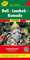
Wegenkaart - landkaart Bali - Lombok - Komodo | Freytag & Berndt
Goede duidelijke wegenkaart aan twee kanten bedrukt. Alle details staan er op! Met toeristische informatie, Nationale Parken en een index. Detailed, double-sided road map of Bali, Lombok and Komodo islands. Clearly shows the national road network and selected provincial and local roads, with each class of road clearly indicated and road numbers shown. Intermediate driving distances between locations are shown in kilometres alongside the road, motorway filling stations are shown and motorway junctions are indicated. Topography is shown with relief shading and some spot heights, and colour shading is used to indicate land types such as forests or marshland. International and provincial boundaries are clearly marked, as are National Parks, nature reserves and restricted military areas. Symbols indicate various sights & locations of tourist interest, such as churches, leisure & sports destinations, panoramas & viewing points, monuments and historic sites. Some hotels and campsites are mar…
14,95
Wegenkaart - landkaart Indonesië - Indonesia | ITMB
Een degelijke landkaart van Indonesië met aanduidingen van o.a. nationale parken, vliegvelden en grote wegen. Als overzichtskaart goed te gebruiken. De nadruk ligt echter vooral op de natuurkundige aspecten. Scheur- en watervast! Met een kleine kaart van Jakarta. The hundreds of islands making up the island nation of Indonesia make a double-sided map inevitable in order to show any significant amount of detail. Side 1 shows the western half, starting with Sumatra in the upper left and including Java and most of the island of Borneo (Kalimantan Province to the Indonesians). This side also includes a large inset map of central Jakarta (for better detail see our separate map of the city); ditto for Sumatra, Java, and Borneo. Bali, Lombok, and Sumbawa islands are in the lower right portion of the map, and most of Malaysia and all of Singapore are included, simply because they are there. The infamous volcanic island of Krakatoa is located just to the west of Java. The other side of the map…
13,95
Wegenkaart - landkaart Maui, Kauai, & Molokai | ITMB
At long last, we have finally found time to complete our detailed mapping of the American state of Hawaii. The island of Maui may not be at well-known as Oahu, which is extremely popular with Japanese honeymooners, but it is as attractive touristically. Our coverage covers most of Side 1 and includes a detailed inset map of Wailuku, the principal urban area, as well as insets of Lahaina on the west coast and Wailea resort area. This side also includes a map of the island of Lanai, with its main urban area of Lanai City as an inset. Side 2 concentrates on the islands of Molokai, Kauai, and the lightly populated island of Ni’ihau, and includes detailed inset maps of Lihue, Kaunakakai, and Po’ipu, all of which are major resort destinations. The islands are loaded with beaches and places to stay, but also with attractions, which are shown on the map. This is a beautiful map, one of the best we have ever produced, and is a fitting companion to our maps of Big Island, and Oahu/Honolulu, as …
13,95
Reisgids Bali - Lombok | Rough Guides
Zeer goede reisgids over Bali & Lombok voor zowel de georganiseerde maar vooral voor de zelfstandige reiziger. Boordevol informatie over reizen, slapen, eten, maar ook musea en cultuur. Voor veel landen meestal completer en beter dan de Lonely Planet ! Ideal for independent travellers, this guidebook to Bali and Lombok, written by destination experts, combines must-see sights with hidden gems and offers essential tips for both planning and on-the-ground adventures. It's sustainably printed to ensure environmental responsibility.   Inside this Bali and Lombok travel book, you'll find:   Regional deep dive – coverage of key regions, offering a rich selection of places and experiences, and honest reviews of each one Itinerary samples – designed for various durations and interests Practical information – tips on how to get there and get around, use public transport, beat the crowds, save time and money, travel responsibly and more Expert recommendations – insider advice on where t…
23,95
Wegenkaart - landkaart 5 Bali - Lombok, Komodo | Reise Know-How Verlag
Tweetalige kaart (Engels en Duits). Door ingetekende lengte- en breedtegraden is het gebruik van GPS mogelijk. Met hoogtelijnen en uitgebreid wegennetwerk: daarnaast worden ook de afstanden tussen belangrijke plaatsen duidelijk leesbaar weergegeven. Het kleurgebruik is zodanig dat je een goede indruk krijgt van hoogteverschillen en soorten landschap. Natuurlijk staan de toeristische bezienswaardigheden duidelijk vermeld. Gedrukt op water- en scheurvast papier! Polyart is een synthetisch product vrij van giftige stoffen dus duurzaam. Het papier gaat echt lang mee. Topography is indicated by altitude colouring with numerous spot heights and names of mountain ranges and passes. Salt lakes, swamps, seasonal rivers and glacier are also shown. Detailed presentation of the road network includes minor roads and tracks and railways are also shown.   Internal administrative units are presented with their boundaries and names. National parks and other protected areas are highlighted. A wide rang…
11,50
Wegenkaart - landkaart Madagascar | ITMB
Een degelijke kaart met aanduidingen van o.a. nationale parken, vliegveld, benzinepomp, dirt-roads en kleine plattegrond van hoofdstad. Als overzichtskaart goed te gebruiken. Tweezijdig! IThe large island off the east coast of Africa is Madagascar. The actual name of the country is the Malagasy Republic, but the public is much more likely to know the country by its island name, so we call our map by the island’s name, rather than using the country name. Makes sense to us! Regardless, this is a major touristic destination. The double-sided map covers the island in great detail, with an inset map of the capital city, Antananarivo. As with other ITMB maps, this one includes a listing of ‘must see’ attractions, such as Tsingy National Park and the famous Lemur’s Park. The island also has a regular surface route to the Comoro Islands, which are also included on this map. Legend Includes: Railroads, Forest, Mational Park, International Airport, Domestic Airport, Fort, holtel, Cave, Museum, …
13,95

Klanten-reviews van Wegenkaart - landkaart Bali & Lombok | ITMB

Er zijn nog geen beoordelingen voor dit productBen jij de eerste die een review plaatst?

Meer over Wegenkaart - landkaart Bali & Lombok | ITMB

Productomschrijving

Goede kaart met op de ene zijde Bali, schaal 1:145.000 en op de andere kant Lombok, schaal 1:130.000

Lombok may not be as well-known as Bali, but both Indonesian islands are prime tourist destinations. This edition includes new inset maps of Denpasar, the main city in Bali, as well as maps of the Kuta-Legan and Sanur beach resort areas, and of the northern city of Singaraja. The Lombok map on the reverse side includes a map of Mataram, the principal city and a special inset showing the three Gili Islands off the west coast, with their dozens of resort hotels.

Legend Includes:
Roads by classification, Airports, Turtle Reserve Area, Bird Sanctuary, Hospitals, Hotels, Park Headquarters, World Heritage, Volcano, Habour, Police Stations, Viewpoints, Beaches, Gas Stations, Mines and much more.


Productinformatie

    Verken gerelateerde categorieën

    Webshop.nl maakt gebruik van cookies. Ga je verder op onze website, ga dan akkoord met het plaatsen van cookies en de verwerking van deze data door ons en vermelde partners.