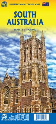
Wegenkaart - landkaart Australia South & Northern Territory | ITMB

0
Australia was one of the first countries ITMB published, back in the 1980s, albeit a licensed version. Our own original artwork was completed in the mid-1990s, but until recently, we have not focused on sectional maps of the country based on individual states. In 2019, we published Brisbane and Queensland, and Sydney and New South Wales. Now, we a...

Verkopers met dit product

Verkoper
Bezorging
Prijs
DeZwerver.nl logo
DeZwerver.nl
2,95
13,95

Anderen bekeken ook

Wegenkaart - landkaart Australia South & Northern Territory | ITMB
Australia was one of the first countries ITMB published, back in the 1980s, albeit a licensed version. Our own original artwork was completed in the mid-1990s, but until recently, we have not focused on sectional maps of the country based on individual states. In 2019, we published Brisbane and Queensland, and Sydney and New South Wales. Now, we are issuing the ‘middle’ states of South Australia and Northern Territory to provide better coverage of these important parts of Australia at a better scale than a country map could provide. South Australia can be thought of as having two parts; the fertile farming economy surrounding Adelaide in the south and the much more arid northern portion. The road network in the south tends to be well developed, with paved roads going more or less east-west to NSW and WA. Northerly roads tend to be gravel or dirt, such as the Birdville Track, and the north-westerly roads tend to pass through land ceded to aboriginals and require permits. Northern Terri…
13,95
Reisgids South Australia & Northern Territory | Lonely Planet
De reisgids voor centraal Australië, wat u gewend bent van de Lonely Planet.. Dat houdt in geschiedenis, traditionele culturen en de natuurlijke omgeving van de Outback. Maar ook een schat aan praktische informatie, accomodatie, eten & drinken, activiteiten, vermaak en transport van alle soorten en maten. Lonely Planet’s South Australia & Northern Territory is your passport to the most relevant, up-to-date advice on what to see and skip, and what hidden discoveries await you. Gaze at Uluru, explore the outback, and spot wildlife on Kangaroo Island; all with your trusted travel companion. Get to the heart of SA & NT and begin your journey now!   Inside Lonely Planet’s South Australia & Northern Territory Travel Guide:   Up-to-date information - all businesses were rechecked before publication to ensure they are still open after 2020’s COVID-19 outbreak   NEW top experiences feature - a visually inspiring collection of South Australia & Northern Territory ’s best experiences and …
22,50
Wegenkaart - landkaart Planning Map Northern Territory | Lonely Planet
From Lonely Planet: The world's number one travel guide publisher* Durable and waterproof, with a handy slipcase and an easy-fold format, Lonely Planet's Northern Territory Planning Map helps you explore with ease. Get more from your map and your trip with images and information about top attractions, itinerary suggestions, a transport guide, planning information, themed lists and practical travel tips. With this easy-to-use, full-colour map in your back pocket, you can truly get to the heart of the Northern Territory - so begin your journey now! Durable and waterproof Easy-fold format and convenient size Handy slipcase Full colour and easy to use Before-you-go infoBeautiful imageryTailored itinerariesCan't-miss regional highlightsDetailed town indexTransport plannerThemed lists Covers: Northern Territory Looking for more extensive coverage? Check out Lonely Planet's South Australia & Northern Territory, our most comprehensive guidebook to these regions, covering their top sights and …
10,95
Wegenkaart - landkaart Northern Territory handy map - tweezijdig | Hema Maps
Duidelijke, handzame kaart van de Northern Territory. A map of the Northern Territory that has camping and rest areas, 24hour fuel and points of interest marked on the mapping. On the reverse are CBD maps of Darwin and Alice Springs, a map of the greater Darwin region and maps of Yulara, Uluru and Kata Tjuta with walking tracks, points of interest and accommodation included. For trip planning there is a national park matrix and contact details for information centres.   PRODUCT FEATURES: GPS surveyed roads and tracks Fuel stops 4WD tracks Camping areas Historic sites Detailed inset maps
14,50
Wegenkaart - landkaart Western Australia | ITMB
The State of Western Australia occupies the western third of the continental country of Australia. The main city is Perth, in the southwest portion, and this is the part of the State with the best land and the most people. Much of the interior is arid desert-like grassland with shallow lakes that often dry out. The road network in the south is generally paved highways and secondary roads, with one road and one rail line heading east to SZ and the rest of the country. Roads in the north tend to be dirt, with the exception of the highway going towards Darwin in NT. There are no roads through the Great Sandy Desert, but the Canning Stock Route crosses the eastern fringe, going north-south. One needs an expensive permit to drive this hazardous track. Most of the attractions of the State are to be found fairly close to the coastline. Most of the larger urban areas tend to have been named after British places, such as Albany, Exmouth, and Port Hedland, but many names have been adopted from …
13,95
Wegenkaart - landkaart Northern Territory state map | Hema Maps
Goede, overzichtelijke, leesbare kaart van de hele provincie. Nationale Parken zijn er goed op te vinden en de afstanden worden weergegeven. Op praktische informatie - accommodatie, tankstations e.d. ingerichte legenda en kaart. Op de achterkant nog deelkaartjes van enkele steden en NP s. Great for use in the car, Hema's State Maps clearly show highways, minor and secondary roads, national and state routes and fully-indexed cities, towns and localities. Detailed road distances are also shown.They are all also available with a deluxe cover (celloglazed cardboard).
17,50
Wegenkaart - landkaart Nevada & Northern California | ITMB
Een degelijke kaart met aanduidingen van o.a. nationale parken, vliegveld, benzinepompen.   The USA is one of the most challenging countries to map due to its strong identification with state boundaries. Last month, we introduced two new maps of Idaho and Montana; this month, we wish to introduce Nevada. As a state, Nevada is mostly desert-like and is lightly populated. Its two major urban areas, Las Vegas and Reno, are extremely popular travel destinations. In addition, Nevada offers the Hoover Dam, one of the seven wonders of the modern world, a national park with 5,000-year-old pine trees, America’s second deepest lake (Tahoe), the eighth highest mountain peak in the USA, and the biggest air force bombing range in the world (Nellis). The map is double-sided, and covers northern California on the other side. This includes such treasures as Death Valley, part of the Mojave Desert, Yosemite National Park, the beautiful sequoia trees in the far northeast corner, and man-made wonders s…
13,95
Wegenkaart - landkaart Jasper National Park & Northern Alberta | ITMB
  Jasper National Park kaart, zeer gedetailleerd (schaal 1:250.000) plus op de anderekant van de kaart staat Noord Alberta, schaal 1:1.000.000. Natuurkundige overzichtskaart met veel plaatsen en wegen, spoorlijnen en rivieren, hoogten, lengte- en breedtegraden.   Two words immediately come to my mind if I were to describe Northern Alberta: Oil and Cold. Oil sands could be found relatively easily within the Northern Alberta region. This pushes the Canadian economy forward as gasoline and other petroleum products are becoming higher in demand. Northern Alberta is also about the subzero temperature. The region of Northern Alberta mostly contains very cold, long winters and warm, short summers. Fort McMurray, for example, one of the famous urban communities located in the Wood buffalo municipality, has only a yearly mean temperature of 0.7 degrees Celsius. Nonetheless, Northern Alberta is also a land of recreation activities and wild adventures. On the other side of the Northern Alberta …
13,95
Wegenkaart - landkaart Northern British Columbia | ITMB
British Columbia is big! Gargantuan huge, in fact, although it is lightly populated. ITMB published a map of the more densely populated southern half of the province a number of years ago, and we have been asked to give the same emphasis to the northern half ever since. Here it is! Side 1 is of the western portion, including the Alaskan Panhandle, with the route followed by cruise ships heading north and clearly delineates the border between Canada and the USA that nearly erupted into warfare (54 40 or fight). It also shows the Stewart Highway heading north towards the Yukon, with its branch leading to Hyder, Alaska, the only place in the USA that uses Canadian money and does all its banking in Canada. The second side covers the eastern half of BC’s north, with the Alaska Highway starting in Dawson Creek and extending north to Fort Nelson before veering west into the eastern edge of the Rocky Mountains to the Yukon border. This is true wilderness country. It is virtually unpopulated o…
14,95
Wegenkaart - landkaart San Francisco - Northern California (Californië) | ITMB
San Francisco met schaal 1: 12.500   San Fran is one of my favourite cities; almost as nice as Vancouver. Names such as Chinatown, Nob Hill, the Tenderloin, and Cow Hollow evoke memories of a city that has long moved past its early reputation as a port feeding the goldfields around Sutter's Run, but it is still a clean and sophisticated city to visit. I personally like the old restored trolleys trundling down Market Street, and the restaurants in the Sunset district. This edition adds great value to our map in two ways: first, we have added an extremely detailed and attractive map of all of northern California to the reverse, to help visitors enjoy the Napa Valley, Sacramento, and the Redwood Sequoia trees, and secondly, the map has been printed on plastic paper for durability and attractiveness.   Legend Includes:   Roads by classification, Provincial Boundaries,State Highways, Main Roads, Secondary and other Roads, Capital, Cities, Nature sights, Airports, Point of Interests, Museum…
13,95

Klanten-reviews van Wegenkaart - landkaart Australia South & Northern Territory | ITMB

Er zijn nog geen beoordelingen voor dit productBen jij de eerste die een review plaatst?

Meer over Wegenkaart - landkaart Australia South & Northern Territory | ITMB

Productomschrijving

Australia was one of the first countries ITMB published, back in the 1980s, albeit a licensed version. Our own original artwork was completed in the mid-1990s, but until recently, we have not focused on sectional maps of the country based on individual states. In 2019, we published Brisbane and Queensland, and Sydney and New South Wales. Now, we are issuing the ‘middle’ states of South Australia and Northern Territory to provide better coverage of these important parts of Australia at a better scale than a country map could provide. South Australia can be thought of as having two parts; the fertile farming economy surrounding Adelaide in the south and the much more arid northern portion. The road network in the south tends to be well developed, with paved roads going more or less east-west to NSW and WA. Northerly roads tend to be gravel or dirt, such as the Birdville Track, and the north-westerly roads tend to pass through land ceded to aboriginals and require permits. Northern Territory occupies the second side. It is state-like, if not legally a state, and occupies a huge area. The north-south highway from Darwin through Alice Springs to SA is the main transportation route of the territory, with one highway going to NSW and a partly-paved one to QLD. ITMB can supply maps of Adelaide and Darwin by other publishers.   Legend Includes: Roads by classification, Rivers and Lakes, National Park, Airports, Points of Interests, Mining, Highways, Main Roads, Zoos, Fishing, , and much more...

Productinformatie

    Verken gerelateerde categorieën

    Webshop.nl maakt gebruik van cookies. Ga je verder op onze website, ga dan akkoord met het plaatsen van cookies en de verwerking van deze data door ons en vermelde partners.