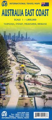
Wegenkaart - landkaart Australia East Coast - Oost Australie | ITMB

0
Wegenkaart van de oostelijke kuststreek van Australië met uitvergrotingen van Brisbane, Sydney en Melbourne en een inzet van Tasmanië.   This double-sided map begins at Australia’s northernmost point of Cape York and proceeds southward through Queensland, New South Wales, and Victoria; in essence covering the portion of the country dominated by Br...

Verkopers met dit product

Verkoper
Bezorging
Prijs
DeZwerver.nl logo
DeZwerver.nl
2,95
13,95

Anderen bekeken ook

Wegenkaart - landkaart Australia East Coast - Oost Australie | ITMB
Wegenkaart van de oostelijke kuststreek van Australië met uitvergrotingen van Brisbane, Sydney en Melbourne en een inzet van Tasmanië.   This double-sided map begins at Australia’s northernmost point of Cape York and proceeds southward through Queensland, New South Wales, and Victoria; in essence covering the portion of the country dominated by Brisbane, Sydney, and Melbourne, all of which are included as largish inset maps. As a bonus, Tasmania is included as a large inset. The scale is generous, making the map easy to read, and while this map will not meet some expectations, 90% of all visitors to Australia concentrate all their travel within the limits of this map. 
13,95
Wegenkaart - landkaart Australia South & Northern Territory | ITMB
Australia was one of the first countries ITMB published, back in the 1980s, albeit a licensed version. Our own original artwork was completed in the mid-1990s, but until recently, we have not focused on sectional maps of the country based on individual states. In 2019, we published Brisbane and Queensland, and Sydney and New South Wales. Now, we are issuing the ‘middle’ states of South Australia and Northern Territory to provide better coverage of these important parts of Australia at a better scale than a country map could provide. South Australia can be thought of as having two parts; the fertile farming economy surrounding Adelaide in the south and the much more arid northern portion. The road network in the south tends to be well developed, with paved roads going more or less east-west to NSW and WA. Northerly roads tend to be gravel or dirt, such as the Birdville Track, and the north-westerly roads tend to pass through land ceded to aboriginals and require permits. Northern Terri…
13,95
Wegenkaart - landkaart 3502 Adventure Map Australia East - Australië Oost | National Geographic
Wegenkaart van Australië Oost met vermelding van veel bezienswaardigheden, nationale parken en attrakties. Watervast en scheurvast. Juist door deze vermeldingen onderscheidt de kaart zich van andere wegenkaarten. National Geographic's Australia East AdventureMapis designed to meet the unique needs of adventure travelers with its durability and detailed, accurate information. The map includes the locations of thousands of cities and towns with a user-friendly index, plus a clearly marked road network complete with distances and designations for major highways, main roads, plus tracks and trails for those seeking to explore more remote regions.    The Australia East AdventureMap differs from a traditional road map because it includes hundreds of points of interest that highlight diverse and unique destinations within the country. National parks, World Heritage sites, caves, archeological sites, aboriginal settlements and protected lands are included, making it an invaluable resource to …
17,50
Wegenkaart - landkaart Australia - Australië | Hema Maps
Mooie, grote, duidelijke kaart van Australië met veel informatie. Oa bezinestations (ook in de outback) en een goed overzicht van de doorgaande (grote) wegen waardoor de kaart erg handig is van het plannen van uw route. Ook staan er afstanden op vermeld.   Verder staan er stadkaartjes op van het (centrum) van de belangrijkste Australische steden:   Adelaide, Brisbane, Canberra, Darwin, Hobart, Melbourne, Perth en Sydney   Hema’s iconic large map of Australia is ideal as a trip planning tool and travel companion. Marked on the map are localities, the major road network, distances and major national parks. The map also shows localities, the major road network, distances and major national parks. The visual appeal makes it perfect as a decorative map or an educational tool. On the reverse side is an overview of Australia's iconic touring regions featuring history, geology and landforms, nature, bucket-list attractions and iconic 4WD tracks.   Key Features Hema's iconic map of Austra…
17,50
Wegenkaart - landkaart Sydney & Australia Southeast | ITMB
Plattegrond van Sydney, schaal 1:7.500, met aan de andere zijde een overzichtskaart van zuidoost Australië, schaal 1:2.000.000   Sydney is probably the best-known city in Australia and this map benefits from trips we have taken to ground-truth the information. It is attractive, pertinent, and easy to use as a map. As with many of our international city maps, we have re-worked this title into a double-sided map with the souteastern half of Australia on the reverse side. As with many of ITMB's map this edition is freshly printed on waterproof paper, more for its durability in the case of Australia than humidity.   Legend Includes: Roads by classification, International Airports, Airports, Ferry lines, Boat-Ferry docks, Railways, Railway stations, Bus terminals, Bicycle Trails, Foreshore trail systems, Pedestrian streets, Staircases, Small Nature reservesm Zoos, Fishing, Caves, Camps sites, Accomodation, Tourism information centers, Museums, Live Theatres, Cinemas, Post offices, Police S…
13,95
Wegenkaart - landkaart Australië - Australia | Nelles Verlag
Goede wegenkaart van Australië. Aan beide kanten bedrukt. Met veel toeristische aanduidingen als nationale parken en culturele bezienswaardigheden. Prima leesbare kaart. The main map is surrounded by street plans of city centres, plus enlargements of their environs and other most visited areas: central and greater Sydney, Melbourne and Perth, central Adelaide and Brisbane, the Gold and Sunshine Coast region of Queensland, Alice Springs and environs, plus Mt. Olga - Uluru (Ayers Rock) area. Alice Springs Environs 1 : 1.500.000 Greater Melbourne 1 : 1.000.000 Greater Perth 1 : 300.000 Greater Sydney 1 : 600.000 Mt. Olga / Ayers Rock 1 : 300.000 Sunshine Coast / Gold Coast 1 : 1.000.000 Brisbane City 1 : 30.000 Canberra 1 : 50.000 Central Adelaide 1 : 20.000 Central Melbourne 1 : 30.000 Central Perth 1 : 20.000 Central Sydney 1 : 25.000
11,95
Wegenkaart - landkaart 785 Australië - Australia | Michelin
Zoals je van Michelin mag verwachten is deze kaart zeer overzichtelijk en heeft een duidelijk helder kaartbeeld. De kaart geeft uitgebreid toeristische informatie weer. Met register, afstanden en reistijden. Wegen worden naar verschillende klasse ingedeeld en - mooi van Michelin - de interessante mooie routes worden gemarkeerd met een groene streep.    Hindernissen voor automobilisten met caravans zijn gemarkeerd: steile hellingen, bergpassen of een anderzins moeilijke route. Bezienswaardigheden als een kasteel, religieus gebouw, ruine of grot is door een symbool goed te vinden.   Australia Michelin Map is perfect for route planning as well as navigating overland once you're there, they have excellent road detail and classification and clearly show the regions topography.   Roads are well classified, distinguishing between major and minor roads as well as by road surface (e.g. earth roads). Difficult and prohibited roads; and roads that are impassable at certain times of year are a…
12,95
Wegenkaart - landkaart Western Australia | ITMB
The State of Western Australia occupies the western third of the continental country of Australia. The main city is Perth, in the southwest portion, and this is the part of the State with the best land and the most people. Much of the interior is arid desert-like grassland with shallow lakes that often dry out. The road network in the south is generally paved highways and secondary roads, with one road and one rail line heading east to SZ and the rest of the country. Roads in the north tend to be dirt, with the exception of the highway going towards Darwin in NT. There are no roads through the Great Sandy Desert, but the Canning Stock Route crosses the eastern fringe, going north-south. One needs an expensive permit to drive this hazardous track. Most of the attractions of the State are to be found fairly close to the coastline. Most of the larger urban areas tend to have been named after British places, such as Albany, Exmouth, and Port Hedland, but many names have been adopted from …
13,95
Wegenkaart - landkaart Planning Map Australia - Australië | Lonely Planet
Durable and waterproof, with a handy slipcase and an easy-fold format, Lonely Planet Australia Planning Map is your conveniently-sized passport to traveling with ease. Get more from your map and your trip with images and information about top country attractions, itinerary suggestions, a transport guide, planning information, themed lists and practical travel tips. With this easy-to-use, full colour navigation tool in your back pocket, you can truly get to the heart of Australia, so begin your journey now! Durable and waterproof Easy-fold format and convenient size Handy slipcase Full colour and easy-to-use Before-you-go info Beautiful imagery Tailored itineraries Can't-miss regional highlights Detailed town index Transport planner Themed lists Covers Sydney, Byron Bay, Blue Mountains, Canberra, Melbourne, Goldfields, Great Ocean Road, Murray River, Brisbane, Great Barrier Reef, Whitsundays, The Daintree, Darwin, Kakadu National Park, Uluru-Kata Tjuta National Park, Hob…
10,95
Reisgids Experience East Coast Australia | Lonely Planet
De nieuwste reisgidsen-serie van Lonely Planet: een luxe uitgave met als titel 'Experience... ' waarin aandacht voor de belangrijkste niet te missen hoogtepunten van het land. Ook hier wordt het kort en bondig geschreven met veel praktische informatie erbj als eten-drinken en vervoer. De lijst met accommodaties - zoals bij de gewone Planets - hebben ze weggelaten. Wel weer met veel plattegronden en kaartjes, rijkelijk geillustreerd met mooie foto's. Unique experiences to string together an unforgettable trip   Inspiring full-colour travel photography and maps throughout   Highlights and trip builders to help tailor a trip to your personal needs and interests   Fresh perspectives to surprise you with things you hadn't thought of, as well as fresh takes on the well-known sights   Insider tips help you discover hidden gems and get around like a local    Expert insights take you to the heart of the place - Indigenous culture, coral reefs, beaches, new Australian cuisine, Melbourne's art s…
23,95

Klanten-reviews van Wegenkaart - landkaart Australia East Coast - Oost Australie | ITMB

Er zijn nog geen beoordelingen voor dit productBen jij de eerste die een review plaatst?

Meer over Wegenkaart - landkaart Australia East Coast - Oost Australie | ITMB

Productomschrijving

Wegenkaart van de oostelijke kuststreek van Australië met uitvergrotingen van Brisbane, Sydney en Melbourne en een inzet van Tasmanië.   This double-sided map begins at Australia’s northernmost point of Cape York and proceeds southward through Queensland, New South Wales, and Victoria; in essence covering the portion of the country dominated by Brisbane, Sydney, and Melbourne, all of which are included as largish inset maps. As a bonus, Tasmania is included as a large inset. The scale is generous, making the map easy to read, and while this map will not meet some expectations, 90% of all visitors to Australia concentrate all their travel within the limits of this map. 

Productinformatie

    Verken gerelateerde categorieën

    Webshop.nl maakt gebruik van cookies. Ga je verder op onze website, ga dan akkoord met het plaatsen van cookies en de verwerking van deze data door ons en vermelde partners.