webshop.nl
Categorieën
  Sluiten

Meer ITMB

Wegenkaart - landkaart Australia - Australie | ITMB

0
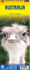
Een degelijke kaart - geplastificeerd en 2-zijdig bedrukt - met aanduidingen van o.a. nationale parken, vliegveld, Aboriginal-gebieden, gebieden waar koraal te vinden is, dirt-roads en een kleine plattegrond van Sydney. Als overzichtskaart goed te gebruiken. Australia Travel Reference Map 6th Ed. 2010 1:3,500,000 on waterproof ITM paper. This was a...

Webshops met dit product

Webshop
Bezorging
Prijs

Anderen bekeken ook

Wegenkaart - landkaart Australia - Australie | ITMB
Een degelijke kaart - geplastificeerd en 2-zijdig bedrukt - met aanduidingen van o.a. nationale parken, vliegveld, Aboriginal-gebieden, gebieden waar koraal te vinden is, dirt-roads en een kleine plattegrond van Sydney. Als overzichtskaart goed te gebruiken. Australia Travel Reference Map 6th Ed. 2010 1:3,500,000 on waterproof ITM paper. This was a minor update to Australia, and we’ve kept the same cover picture. The changes may be less important than the price, which has been decreased for this edition only for the North American market to stimulate demand. As a result, the ISBN has changed. At $10.95, this map is a bargain – updated, double-sided, and printed waterproof paper for durability. The map also contains excellent inset maps of Brisbane, Melbourne, and Sydney. It never ceases to amaze me how many editions some of our maps have gone through. At the start of this new edition, we have sold 25,000 copies of this title and are on our way to 30,000. Legend Includes: Roads by class…
13,95
Wegenkaart - landkaart Sydney & Australia Southeast | ITMB
Plattegrond van Sydney, schaal 1:7.500, met aan de andere zijde een overzichtskaart van zuidoost Australië, schaal 1:2.000.000   Sydney is probably the best-known city in Australia and this map benefits from trips we have taken to ground-truth the information. It is attractive, pertinent, and easy to use as a map. As with many of our international city maps, we have re-worked this title into a double-sided map with the souteastern half of Australia on the reverse side. As with many of ITMB's map this edition is freshly printed on waterproof paper, more for its durability in the case of Australia than humidity.   Legend Includes: Roads by classification, International Airports, Airports, Ferry lines, Boat-Ferry docks, Railways, Railway stations, Bus terminals, Bicycle Trails, Foreshore trail systems, Pedestrian streets, Staircases, Small Nature reservesm Zoos, Fishing, Caves, Camps sites, Accomodation, Tourism information centers, Museums, Live Theatres, Cinemas, Post offices, Police St…
13,95
Wegenkaart - landkaart 3502 Adventure Map Australia East - Australië O
Wegenkaart van Australië Oost met vermelding van veel bezienswaardigheden, nationale parken en attrakties. Watervast en scheurvast. Juist door deze vermeldingen onderscheidt de kaart zich van andere wegenkaarten. National Geographic's Australia East AdventureMapis designed to meet the unique needs of adventure travelers with its durability and detailed, accurate information. The map includes the locations of thousands of cities and towns with a user-friendly index, plus a clearly marked road network complete with distances and designations for major highways, main roads, plus tracks and trails for those seeking to explore more remote regions.    The Australia East AdventureMap differs from a traditional road map because it includes hundreds of points of interest that highlight diverse and unique destinations within the country. National parks, World Heritage sites, caves, archeological sites, aboriginal settlements and protected lands are included, making it an invaluable resource to t…
17,50
Wegenkaart - landkaart Western Australia | ITMB
The State of Western Australia occupies the western third of the continental country of Australia. The main city is Perth, in the southwest portion, and this is the part of the State with the best land and the most people. Much of the interior is arid desert-like grassland with shallow lakes that often dry out. The road network in the south is generally paved highways and secondary roads, with one road and one rail line heading east to SZ and the rest of the country. Roads in the north tend to be dirt, with the exception of the highway going towards Darwin in NT. There are no roads through the Great Sandy Desert, but the Canning Stock Route crosses the eastern fringe, going north-south. One needs an expensive permit to drive this hazardous track. Most of the attractions of the State are to be found fairly close to the coastline. Most of the larger urban areas tend to have been named after British places, such as Albany, Exmouth, and Port Hedland, but many names have been adopted from a…
13,95
Wegenkaart - landkaart Brisbane & Queensland | ITMB
Australia is a very large country. It is also very unevenly populated, with most of the people living close to the eastern coast. Brisbane is the second-largest city in Australia, and the preferred landing spot for most international flights. This makes Brisbane an attractive point of entry to Australia for visitors. The city has several attractions, which are noted on the map, several transit lines, also noted, and an interesting ferry boat system along the Brisbane River. The city is also the capital of Queensland, which occupies the north-east quarter of the continent and fills the second side of the map. Our map of the state stretches from the northern tip of Cape York to beyond the southern boundary of the state to just south of Sydney, in New South Wales. An inset map of central Sydney is included, but the strength of the map is the fact that Queensland is covered in excellent detail. ITMB also has a separate map of Sydney.   Legend Includes: Roads by classification, Rivers and L…
13,95
Wegenkaart - landkaart Botswana - Zimbabwe | ITMB
Een degelijke kaart met aanduidingen van o.a. nationale parken, vliegveld, benzinepomp, dirt-roads en kleine plattegrond van hoofdstad. Als overzichtskaart goed te gebruiken. 7th Edition 1:1,600,000/11:1,000,000 on waterproof stone paper Both Botswana and its neighbour, Zimbabwe, form a common entity and a British heritage in Central Southern Africa, but there the resemblance ends. The Bechuana formed an alliance of sorts with the Pritish to protect them from the Boers in the then-nearby Transvaal. Upon a peaceful transition to independence as Botswana, it has evolved into a democratic and peaceful country. Zimbabwe, formerly Rhodeisa, is a failed state, although potentially, Zimbabwe could dominate tourism if governmental affairs were orderly. This map focuses on Botswana simply because that country is a beacon of orderly pleasantness in the continent; well run, routistacally well developed, with good infrastructure, and close to the game preserves of both South Africa and Zimbabwe. T…
13,95

Klanten-reviews van Wegenkaart - landkaart Australia - Australie | ITMB

Er zijn nog geen beoordelingen voor dit productBen jij de eerste die een review plaatst?

Meer over Wegenkaart - landkaart Australia - Australie | ITMB

Productomschrijving

Een degelijke kaart - geplastificeerd en 2-zijdig bedrukt - met aanduidingen van o.a. nationale parken, vliegveld, Aboriginal-gebieden, gebieden waar koraal te vinden is, dirt-roads en een kleine plattegrond van Sydney. Als overzichtskaart goed te gebruiken. Australia Travel Reference Map 6th Ed. 2010 1:3,500,000 on waterproof ITM paper. This was a minor update to Australia, and we’ve kept the same cover picture. The changes may be less important than the price, which has been decreased for this edition only for the North American market to stimulate demand. As a result, the ISBN has changed. At $10.95, this map is a bargain – updated, double-sided, and printed waterproof paper for durability. The map also contains excellent inset maps of Brisbane, Melbourne, and Sydney. It never ceases to amaze me how many editions some of our maps have gone through. At the start of this new edition, we have sold 25,000 copies of this title and are on our way to 30,000. Legend Includes: Roads by classification, Small Nature Reserves, Zoos, Caves, Beaches, Point of Interests, Ruins, Aboriginal Settlements, Lighthouses, Castles, Palaces, Airports, Airstrips, Mines, Oils, Gas Wells and more.

Productspecificaties

Artikelnummer(s)
Brand
ITMB
Webshop.nl maakt gebruik van cookies. Ga je verder op onze website, ga dan akkoord met het plaatsen van cookies en de verwerking van deze data door ons en vermelde partners.