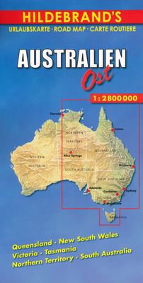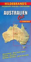
Wegenkaart - landkaart Australië Oost | Hildebrand's

0
Goede landkaart van het Oostelijk deel van Australië. Dus met Queensland, New South Wales, Victoria, Tasmania, Nothern Territory en South Australia. Tweezijdig bedrukt.  ...

Verkopers met dit product

Verkoper
Bezorging
Prijs
DeZwerver.nl logo
DeZwerver.nl
2,95
10,95

Anderen bekeken ook

Wegenkaart - landkaart 3501 Adventure Map Australia - Australië | National Geographic
Wegenkaart van Australië met vermelding van veel bezienswaardigheden, nationale parken en attrakties. Watervast en scheurvast. Juist door deze vermeldingen onderscheidt de kaart zich van andere wegenkaarten. National Geographic's Australia Adventure Map is designed to meet the unique needs of adventure travelers with its durability and detailed, accurate information. The map includes the locations of thousands of cities and towns with a user-friendly index, plus a clearly marked road network complete with distances and designations for major highways, main roads, and tracks and trails for those seeking to explore more remote regions.   The Australia Adventure Map differs from a traditional road map because it includes hundreds of points of interest that highlight diverse and unique destinations within the country. National parks, World Heritage sites, caves, archeological sites, aboriginal settlements, and protected lands are included, making it an invaluable resource to travelers …
17,50
Wegenkaart - landkaart 3502 Adventure Map Australia East - Australië Oost | National Geographic
Wegenkaart van Australië Oost met vermelding van veel bezienswaardigheden, nationale parken en attrakties. Watervast en scheurvast. Juist door deze vermeldingen onderscheidt de kaart zich van andere wegenkaarten. National Geographic's Australia East AdventureMapis designed to meet the unique needs of adventure travelers with its durability and detailed, accurate information. The map includes the locations of thousands of cities and towns with a user-friendly index, plus a clearly marked road network complete with distances and designations for major highways, main roads, plus tracks and trails for those seeking to explore more remote regions.    The Australia East AdventureMap differs from a traditional road map because it includes hundreds of points of interest that highlight diverse and unique destinations within the country. National parks, World Heritage sites, caves, archeological sites, aboriginal settlements and protected lands are included, making it an invaluable resource to …
17,50
Wegenkaart - landkaart Australia East Coast - Oost Australie | ITMB
Wegenkaart van de oostelijke kuststreek van Australië met uitvergrotingen van Brisbane, Sydney en Melbourne en een inzet van Tasmanië.   This double-sided map begins at Australia’s northernmost point of Cape York and proceeds southward through Queensland, New South Wales, and Victoria; in essence covering the portion of the country dominated by Brisbane, Sydney, and Melbourne, all of which are included as largish inset maps. As a bonus, Tasmania is included as a large inset. The scale is generous, making the map easy to read, and while this map will not meet some expectations, 90% of all visitors to Australia concentrate all their travel within the limits of this map. 
13,95
Reisgids Australia - Australië | Lonely Planet
De perfecte reisgids voor zowel de georganiseerde als de zelfstandige reiziger. Naast een algemene inleiding van het land / streek vol met praktische informatie over hoe je er het beste kunt reizen: slapen, eten, vervoer, excursies ... alles kun je er in vinden. Engelstalig. Lonely Planet. Discover popular and off the beaten track experiences from surfing the waves on Byron Bay's iconic beaches to watching little penguins waddle ashore at the famous Penguin Parade, and touring the famous rock art sites of Kakadu National Park with an Aboriginal guide.   Build a trip to remember with Lonely Planet's Australia travel guide:   Our classic guidebook format provides you with the most comprehensive level of information for planning multi-week trips Updated with an all new structure and design so you can navigate Australia and connect experiences together with ease Create your perfect trip with exciting itineraries for extended journeys combined with suggested day trips, walking tou…
28,95
Wegenkaart - landkaart Australië - Australia | Nelles Verlag
Goede wegenkaart van Australië. Aan beide kanten bedrukt. Met veel toeristische aanduidingen als nationale parken en culturele bezienswaardigheden. Prima leesbare kaart. The main map is surrounded by street plans of city centres, plus enlargements of their environs and other most visited areas: central and greater Sydney, Melbourne and Perth, central Adelaide and Brisbane, the Gold and Sunshine Coast region of Queensland, Alice Springs and environs, plus Mt. Olga - Uluru (Ayers Rock) area. Alice Springs Environs 1 : 1.500.000 Greater Melbourne 1 : 1.000.000 Greater Perth 1 : 300.000 Greater Sydney 1 : 600.000 Mt. Olga / Ayers Rock 1 : 300.000 Sunshine Coast / Gold Coast 1 : 1.000.000 Brisbane City 1 : 30.000 Canberra 1 : 50.000 Central Adelaide 1 : 20.000 Central Melbourne 1 : 30.000 Central Perth 1 : 20.000 Central Sydney 1 : 25.000
11,95
Wegenkaart - landkaart Canada Oost | Hildebrand's
Goede overzichtskaart van Oostelijk Canada op redelijke schaal. Het is een tweezijdige kaart, waarbij het noordelijk deel op de ene kant en het zuidelijke - meest gebruikte - deel op de andere kant staat. Helder kleurgebruik met schaduwwerking waardoor de ligging van de bergruggen wat duidelijk wordt dan op andere kaarten.    Wegnummers worden vermekd, alsmede de gradatie in de wegen, van gravelroads tot de highways. Met symbolen worden enkele bezienswaardigheden aangeduid en zijn de Nationale Parken terug te vinden op de kaart. Campings worden weergegeven met een wat moeilijk leesbaar symbool en het is maar de vraag of dit op deze schaal gedetailleerd genoeg is om volledig te zijn, daar kun je volgens ons niet echt op vertrouwen.  Met Ontario, Quebec, New Brunswick, Prince Edward Island, Nova Scotia & New Foundland.
10,95
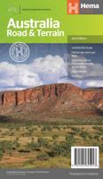
Wegenkaart - landkaart Australië - natuurkundig -Australia Road & Terrain | Hema Maps
Landkaart van heel Australië met nadruk op de natuurkundige aspecten, toch zijn ook de wegen goed zichtbaar. Hema’s iconic large map of Australia is coloured to reflect the country's climate zones. Marked on the map are localities, the major road network, distances and major national parks. The visual appeal makes it perfect as a decorative map or an educational tool. On the reverse side is an overview of Australia's iconic touring regions featuring history, geology and landforms, nature, bucket-list attractions and iconic 4WD tracks.   Key Features Full road and terrain hillshade map Major road networks & distances Overview of Australia's iconic touring regions Climate zones National parks Aboriginal Land Distance grid Locality Index
17,50
Wegenkaart - landkaart Australia South & Northern Territory | ITMB
Australia was one of the first countries ITMB published, back in the 1980s, albeit a licensed version. Our own original artwork was completed in the mid-1990s, but until recently, we have not focused on sectional maps of the country based on individual states. In 2019, we published Brisbane and Queensland, and Sydney and New South Wales. Now, we are issuing the ‘middle’ states of South Australia and Northern Territory to provide better coverage of these important parts of Australia at a better scale than a country map could provide. South Australia can be thought of as having two parts; the fertile farming economy surrounding Adelaide in the south and the much more arid northern portion. The road network in the south tends to be well developed, with paved roads going more or less east-west to NSW and WA. Northerly roads tend to be gravel or dirt, such as the Birdville Track, and the north-westerly roads tend to pass through land ceded to aboriginals and require permits. Northern Terri…
13,95
Wegenkaart - landkaart Australia - Australië | Freytag & Berndt
Gedetailleerde landkaart van Australië, prima geschikt voor planning en rondtrekken. De berijdbare wegen zijn goed weergeven, zowel de hoofdwegen als provinciale en lokale wegen; wegnummers worden vermeld. Afstanden tussen plaatsen zijn in kilometers op de kaart ingetekend, daarnaast worden ook op belangrijke plekken benzinepompen gemarkeerd. In het kaartbeeld wordt door middel van schaduw het reliëf weergegeven en soms enkele punten in het landschap met de daadwerkelijke hoogte. Provinciegrenzen zijn goed terug te vinden, nationale parken en reservaten ook. Met allerhande symbolen worden toeristische bezienswaardigheden weergegeven als monumenten, historisch belangrijke plekken en uitzichtpunten. In bepaalde plaatsen zijn hotels en campings te vinden, luchthavens, treinverbindingen en havens vindt u er ook op!   Explore the Commonwealth nation of Australia with this Freytag & Berndt road map. It will allow you to plan your itinerary, and travel independently. The topography is clear …
14,95

Klanten-reviews van Wegenkaart - landkaart Australië Oost | Hildebrand's

Er zijn nog geen beoordelingen voor dit productBen jij de eerste die een review plaatst?

Meer over Wegenkaart - landkaart Australië Oost | Hildebrand's

Productomschrijving

Goede landkaart van het Oostelijk deel van Australië. Dus met Queensland, New South Wales, Victoria, Tasmania, Nothern Territory en South Australia. Tweezijdig bedrukt.


Productinformatie

    Verken gerelateerde categorieën

    Webshop.nl maakt gebruik van cookies. Ga je verder op onze website, ga dan akkoord met het plaatsen van cookies en de verwerking van deze data door ons en vermelde partners.