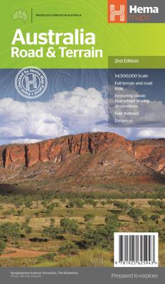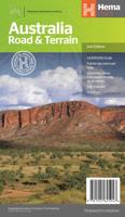
Wegenkaart - landkaart Australië - natuurkundig -Australia Road & Terrain | Hema Maps

0
Landkaart van heel Australië met nadruk op de natuurkundige aspecten, toch zijn ook de wegen goed zichtbaar. Hema’s iconic large map of Australia is coloured to reflect the country's climate zones. Marked on the map are localities, the major road network, distances and major national parks. The visual appeal makes it perfect as a decorative map or...

Verkopers met dit product

Verkoper
Bezorging
Prijs
DeZwerver.nl logo
DeZwerver.nl
2,95
17,50

Anderen bekeken ook

Wegenkaart - landkaart Australië - natuurkundig -Australia Road & Terrain | Hema Maps
Landkaart van heel Australië met nadruk op de natuurkundige aspecten, toch zijn ook de wegen goed zichtbaar. Hema’s iconic large map of Australia is coloured to reflect the country's climate zones. Marked on the map are localities, the major road network, distances and major national parks. The visual appeal makes it perfect as a decorative map or an educational tool. On the reverse side is an overview of Australia's iconic touring regions featuring history, geology and landforms, nature, bucket-list attractions and iconic 4WD tracks.   Key Features Full road and terrain hillshade map Major road networks & distances Overview of Australia's iconic touring regions Climate zones National parks Aboriginal Land Distance grid Locality Index
17,50
Wegenkaart - landkaart Australia - Australië | Hema Maps
Mooie, grote, duidelijke kaart van Australië met veel informatie. Oa bezinestations (ook in de outback) en een goed overzicht van de doorgaande (grote) wegen waardoor de kaart erg handig is van het plannen van uw route. Ook staan er afstanden op vermeld.   Verder staan er stadkaartjes op van het (centrum) van de belangrijkste Australische steden:   Adelaide, Brisbane, Canberra, Darwin, Hobart, Melbourne, Perth en Sydney   Hema’s iconic large map of Australia is ideal as a trip planning tool and travel companion. Marked on the map are localities, the major road network, distances and major national parks. The map also shows localities, the major road network, distances and major national parks. The visual appeal makes it perfect as a decorative map or an educational tool. On the reverse side is an overview of Australia's iconic touring regions featuring history, geology and landforms, nature, bucket-list attractions and iconic 4WD tracks.   Key Features Hema's iconic map of Austra…
17,50
Wegenkaart - landkaart Iconic Map Central Australia - Centraal Australië | Hema Maps
Detailkaart van een deel van Australië. Zeer goed leesbaar, met naast de topografische details veel symbolen waarmee allerhande toeristische zaken worden aangeduid als campsites, nationale parken, attracties, wandelmogelijkheden etc. This waterproof map of the Central Australia region is ideal for discovering some of Australia's most iconic landscapes. The main map covers the area around Alice Springs, including Uluru, Kata Tjuta, West MacDonnell Range, as well as the Simpson Desert and popular tracks such as the Canning Stock Route.   It also features additional information relating to permits, useful contacts and historical context surrounding some of the area's most popular tourist destinations.    PRODUCT FEATURES   GPS surveyed roads and tracks Fuel stops 4WD tracks Camping areas Historic sites Detailed inset maps
17,50
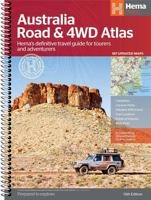
Wegenatlas Australië - Australia Road and 4WD Atlas - | Hema Maps
Deze wegenatlas (met ringband) is als volgt ingedeeld: in de omslag vindt u de legenda. Daarna volgt per staat een overzicht van de Nationale Parken en de voorzieningen. Aansluitend vindt u de wegenkaarten en stadsplattegronden per staat. Achterin de atlas een aparte sectie met kaarten voor de 4WD liefhebbers. Tot slot een afstandentabel.   Op de kaarten staan d.m.v. symbolen voorzieningen aangegeven zoals campings, 'lookouts', benzinestations, visitor information centers, picnic area enz.   Featuring trusted Hema mapping for all of Australia, the Hema Road & 4WD Atlas is the definitive travel guide for tourers and adventurers. Hema atlases feature more information useful to travellers, including 4WD tracks, campsites, caravan parks, rest areas, 24-hour fuel and points of interest.   This edition contains more mapping than ever before, which is enhanced by a striking new cartographic style that's incredibly easy to read. Included in this is up-to-date mapping for Australia's bigges…
40,95
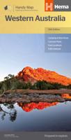
Wegenkaart - landkaart Western Australia - West Australië state handy map | Hema Maps
Duidelijke, handzame kaart van Western Australia. Zeer goed leesbaar, met naast de topografische details veel symbolen waarmee allerhande toeristische zaken worden aangeduid als campsites, nationale parken, attracties, wandelmogelijkheden etc. Great for using in the car, Hema's Western Australia Handy Map clearly shows highways, minor and secondary roads, national and state routes and fully-indexed cities, towns and localities. Detailed road distances are also shown.    The map splits the state in two, with half on one side of the map and half on the other. This results in a much smaller piece of paper which is far easier to manage in your car.   The map features:   Camping Areas Rest Areas 24 Hour Fuel Outback Fuel Caravan Parks National Parks Fully Indexed Points of Interest Distance Grid   All of the state handy maps are double-sided and come in an easy-to-fold format.
14,50
Wegenkaart - landkaart 3501 Adventure Map Australia - Australië | National Geographic
Wegenkaart van Australië met vermelding van veel bezienswaardigheden, nationale parken en attrakties. Watervast en scheurvast. Juist door deze vermeldingen onderscheidt de kaart zich van andere wegenkaarten. National Geographic's Australia Adventure Map is designed to meet the unique needs of adventure travelers with its durability and detailed, accurate information. The map includes the locations of thousands of cities and towns with a user-friendly index, plus a clearly marked road network complete with distances and designations for major highways, main roads, and tracks and trails for those seeking to explore more remote regions.   The Australia Adventure Map differs from a traditional road map because it includes hundreds of points of interest that highlight diverse and unique destinations within the country. National parks, World Heritage sites, caves, archeological sites, aboriginal settlements, and protected lands are included, making it an invaluable resource to travelers …
17,50
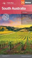
Wegenkaart - landkaart South Australia state map | Hema Maps
Mooie, duidelijke en uitgebreide kaart van South Australia. Great for travel planning, Hema's South Australia state map clearly shows highways, minor and secondary roads, national and state routes and fully-indexed cities, towns and localities. Detailed road distances are also shown.   The flipside of the map features loads of insets covering various bits and pieces throughout South Australia including an Adelaide CBD and throughroads map, an Adelaide region map, a map of the Barossa Valley and the Flinders Ranges National Park. There's also a list of information centres giving their address, phone number and website.   The map features:   Camping areas Rest areas 24 hour fuel locations Outback fuel stops Caravan parks National parks A full index Points of interest A distance grid
17,50
Wegenkaart - landkaart 3502 Adventure Map Australia East - Australië Oost | National Geographic
Wegenkaart van Australië Oost met vermelding van veel bezienswaardigheden, nationale parken en attrakties. Watervast en scheurvast. Juist door deze vermeldingen onderscheidt de kaart zich van andere wegenkaarten. National Geographic's Australia East AdventureMapis designed to meet the unique needs of adventure travelers with its durability and detailed, accurate information. The map includes the locations of thousands of cities and towns with a user-friendly index, plus a clearly marked road network complete with distances and designations for major highways, main roads, plus tracks and trails for those seeking to explore more remote regions.    The Australia East AdventureMap differs from a traditional road map because it includes hundreds of points of interest that highlight diverse and unique destinations within the country. National parks, World Heritage sites, caves, archeological sites, aboriginal settlements and protected lands are included, making it an invaluable resource to …
17,50
Wegenkaart - landkaart 785 Australië - Australia | Michelin
Zoals je van Michelin mag verwachten is deze kaart zeer overzichtelijk en heeft een duidelijk helder kaartbeeld. De kaart geeft uitgebreid toeristische informatie weer. Met register, afstanden en reistijden. Wegen worden naar verschillende klasse ingedeeld en - mooi van Michelin - de interessante mooie routes worden gemarkeerd met een groene streep.    Hindernissen voor automobilisten met caravans zijn gemarkeerd: steile hellingen, bergpassen of een anderzins moeilijke route. Bezienswaardigheden als een kasteel, religieus gebouw, ruine of grot is door een symbool goed te vinden.   Australia Michelin Map is perfect for route planning as well as navigating overland once you're there, they have excellent road detail and classification and clearly show the regions topography.   Roads are well classified, distinguishing between major and minor roads as well as by road surface (e.g. earth roads). Difficult and prohibited roads; and roads that are impassable at certain times of year are a…
12,95

Klanten-reviews van Wegenkaart - landkaart Australië - natuurkundig -Australia Road & Terrain | Hema Maps

Er zijn nog geen beoordelingen voor dit productBen jij de eerste die een review plaatst?

Meer over Wegenkaart - landkaart Australië - natuurkundig -Australia Road & Terrain | Hema Maps

Productomschrijving

Landkaart van heel Australië met nadruk op de natuurkundige aspecten, toch zijn ook de wegen goed zichtbaar.

Hema’s iconic large map of Australia is coloured to reflect the country's climate zones. Marked on the map are localities, the major road network, distances and major national parks. The visual appeal makes it perfect as a decorative map or an educational tool. On the reverse side is an overview of Australia's iconic touring regions featuring history, geology and landforms, nature, bucket-list attractions and iconic 4WD tracks.   Key Features
  • Full road and terrain hillshade map
  • Major road networks & distances
  • Overview of Australia's iconic touring regions
  • Climate zones
  • National parks
  • Aboriginal Land
  • Distance grid
  • Locality Index

Productinformatie

    Verken gerelateerde categorieën

    Webshop.nl maakt gebruik van cookies. Ga je verder op onze website, ga dan akkoord met het plaatsen van cookies en de verwerking van deze data door ons en vermelde partners.