webshop.nl
Categorieën
  Sluiten

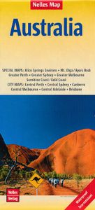
Wegenkaart - landkaart Australië - Australia | Nelles Verlag

Goede wegenkaart van Australië. Aan beide kanten bedrukt. Met veel toeristische aanduidingen als nationale parken en culturele bezienswaardigheden. Prima leesbare kaart. The main map is surrounded by street plans of city centres, plus enlargements of their environs and other most visited areas: central and greater Sydney, Melbourne and Perth, centr...
11,95

Webshops met dit product

Webshop
Bezorging
Prijs

Anderen bekeken ook

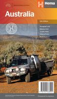
Wegenkaart - landkaart Australia - Australië | Hema Maps
Mooie, grote, duidelijke kaart van Australië met veel informatie. Oa bezinestations (ook in de outback) en een goed overzicht van de doorgaande (grote) wegen waardoor de kaart erg handig is van het plannen van uw route. Ook staan er afstanden op vermeld.   Verder staan er stadkaartjes op van het (centrum) van de belangrijkste Australische steden:   Adelaide, Brisbane, Canberra, Darwin, Hobart, Melbourne, Perth en Sydney   Hema’s iconic large map of Australia is ideal as a trip planning tool and travel companion. Marked on the map are localities, the major road network, distances and major national parks. The map also shows localities, the major road network, distances and major national parks. The visual appeal makes it perfect as a decorative map or an educational tool. On the reverse side is an overview of Australia's iconic touring regions featuring history, geology and landforms, nature, bucket-list attractions and iconic 4WD tracks.   Key Features Hema's iconic map of Austral…
15,95
Wegenkaart - landkaart 785 Australië - Australia | Michelin
Zoals je van Michelin mag verwachten is deze kaart zeer overzichtelijk en heeft een duidelijk helder kaartbeeld. De kaart geeft uitgebreid toeristische informatie weer. Met register, afstanden en reistijden. Wegen worden naar verschillende klasse ingedeeld en - mooi van Michelin - de interessante mooie routes worden gemarkeerd met een groene streep.    Hindernissen voor automobilisten met caravans zijn gemarkeerd: steile hellingen, bergpassen of een anderzins moeilijke route. Bezienswaardigheden als een kasteel, religieus gebouw, ruine of grot is door een symbool goed te vinden.   Australia Michelin Map is perfect for route planning as well as navigating overland once you're there, they have excellent road detail and classification and clearly show the regions topography.   Roads are well classified, distinguishing between major and minor roads as well as by road surface (e.g. earth roads). Difficult and prohibited roads; and roads that are impassable at certain times of year are al…
12,95
Wegenkaart - landkaart Japan | Nelles Verlag
Goede wegenkaart van Japan. Aan beide kanten bedrukt. Met veel toeristische aanduidingen als nationale parken en culturele bezienswaardigheden. Prima leesbare kaart. The map divides the country north/south with Tokyo shown on both sides. On one side is southern part of Honshu and Kyushu Island, plus the smaller groups of islands including Okinawa and the Sakishima Archipelago shown on separate panels. Insets show the environs of Osaka and Nagoya in greater detail. On the reverse is the northern part of Honshu and Hokkaido, plus an enlargement for the environs of Tokyo.  Nagoya Environs 1 : 400.000 Osaka Environs 1 : 400.000 Tokyo Environs 1 : 555.000
11,95
Wegenkaart - landkaart Tasmania & Victoria | ITMB
Een degelijke wegenkaart van Tasmanie & Victoria, schaal 1:1.800.000, en Tasmanië, schaal 1:800.000 met aanduidingen van o.a. nationale parken, vliegveld, benzinepomp, dirt-roads. Als overzichtskaart goed te gebruiken. The island of Tasmania is Australia’s smallest state, but is packed with touristic delights. Hobart is the capital and a charming Victorian city in the south of the island. Much of the west coast is a large nature preserve with limited access and most development is close to the northern shore, centred on Devonport and its ferry connections with Melbourne, in Victoria State. Tasmania also administers several offshore islands, such as King, Flinders, and Bruny. We have included a Top Attractions listing for the reader to enjoy. The other side of the sheet is the Australian mainland state of Victoria, best known as the home of Melbourne and the beautiful coastal highway to Adelaide. A basic inset map of Melbourne is included, but the focus of the map is on the recreational…
13,95
Wegenkaart - landkaart India | Nelles Verlag
Goede overzichtskaart van India - Nepal en Sri Lanka. Aan beide kanten bedrukt. Met veel toeristische aanduidingen als culturele bezienswaardigheden en nationale parken. Prima leesbare kaart. Included in this Nelles Verlag map are detailed, relief shading clearly shows spot heights and mountain ranges giving a real sense of the terrain with distances provided for major routes.   This map also shows inset maps of Greater Kathmandu, Kolkata (Calcutta), Mumbia (Bombay) as well as street plans of Delhi and Colombo, with numerous points of interest highlighted. Greater Kathmandu 1 : 100.000 Kolkata (Calcutta) 1 : 300.000 Mumbai (Bombay) 1 : 300.000 Colombo 1 : 12.500 Delhi 1 : 50.000  
11,95
Reisgids Australia - Australië | Lonely Planet
De perfecte reisgids voor zowel de georganiseerde als de zelfstandige reiziger. Naast een algemene inleiding van het land / streek vol met praktische informatie over hoe je er het beste kunt reizen: slapen, eten, vervoer, excursies ... alles kun je er in vinden. Engelstalig. Lonely Planet. Lonely Planet’s Australia is your passport to the most relevant, up-to-date advice on what to see and skip, and what hidden discoveries await you. Dive in the Great Barrier Reef, marvel at the unique wildlife, and hit the beach at Byron Bay; all with your trusted travel companion. Get to the heart of Australia and begin your journey now!   Inside Lonely Planet’s Australia Travel Guide:   Up-to-date information - all businesses were rechecked before publication to ensure they are still open after 2020’s COVID-19 outbreak   NEW top experiences feature - a visually inspiring collection of Australia’s best experiences and where to have them   What's NEW feature taps into cultural trends and hel…
27,95
Wegenkaart - landkaart Brisbane to Cairns | Hema Maps
Detailkaart van een deel van Australië. Zeer goed leesbaar, met naast de topografische details veel symbolen waarmee allerhande toeristische zaken worden aangeduid als campsites, nationale parken, attracties, wandelmogelijkheden etc. An easy-to-follow map that shows both the coastal and inland routes from Brisbane to Cairns. Roadside rest areas, intermediate distances, and a quick-find distance chart are also shown. The map shows all the popular tourist destinations along the Queensland coast. Routes between Brisbane with Cairns in a series of touring maps connecting Australia’s main centres of population along some of the most spectacular routes such as the Great Ocean Road or the Savannah Way. The maps highlight 24-hour fuel supplies, roadside rest areas, camping facilities, places of interest, etc., and include distance charts and, in some titles, city maps. Road network indicates unsurfaced roads and tracks. The maps also show railway lines. There is no topographical information be…
13,95
Reisgids East Coast Australia | Lonely Planet
De perfecte reisgids voor zowel de georganiseerde als de zelfstandige reiziger. Naast een algemene inleiding van het land / streek vol met praktische informatie over hoe je er het beste kunt reizen: slapen, eten, vervoer, excursies ... alles kun je er in vinden. Lonely Planet East Coast Australia is your passport to the most relevant, up-to-date advice on what to see and skip, and what hidden discoveries await you. Dive the Great Barrier Reef, cruise Sydney Harbour and explore Melbourne's laneways; all with your trusted travel companion. Get to the heart of Australia's East Coast and begin your journey now!   Inside Lonely Planet East Coast Australia:   Colour maps and images throughout Highlights and itineraries help you tailor your trip to your personal needs and interests Insider tips to save time and money and get around like a local, avoiding crowds and trouble spots Essential info at your fingertips - hours of operation, phone numbers, websites, transit tips, prices Honest review…
22,50
Wegenkaart - landkaart Argentinië - Noord en Uruguay | Nelles Verlag
Goede kaart van het noorden van Argentinie met Uruguay. Aan beide kanten bedrukt. Met veel toeristische aanduidingen als nationale parken en culturele bezienswaardigheden. Prima leesbare kaart. Folded road and tourist map of Northern Argentina and Uruguay at 1:2 500 000 scale. All of Uruguay is covered and Argentina is covered from the northern border south past Bahia Blanca on the eastern coast. Places of interest and national parks are highlighted and shaded-relief colouring clearly depicts topography.    The map includes insets showing central Montevideo at 1:12 500, Tucuman at 1:30 000, Cordoba at 1:16 000, Iguacu at 1:450 000, central Buenos Aires at 1:20 000, greater Buenos Aires at 1:750 000 and a locator map. The legend is in English, German, Spanish and French.   For over 20 years Nelles maps have been renowned throughout the world for their quality, faithfulness to detail and up-to-dateness.    So that streets, ferry links, railway lines, etc are always up to date, Nelles are…
11,95
Wegenkaart - landkaart Planning Map Australia - Australië | Lonely Planet
Durable and waterproof, with a handy slipcase and an easy-fold format, Lonely Planet Australia Planning Map is your conveniently-sized passport to traveling with ease. Get more from your map and your trip with images and information about top country attractions, itinerary suggestions, a transport guide, planning information, themed lists and practical travel tips. With this easy-to-use, full colour navigation tool in your back pocket, you can truly get to the heart of Australia, so begin your journey now! Durable and waterproof Easy-fold format and convenient size Handy slipcase Full colour and easy-to-use Before-you-go info Beautiful imagery Tailored itineraries Can't-miss regional highlights Detailed town index Transport planner Themed lists Covers Sydney, Byron Bay, Blue Mountains, Canberra, Melbourne, Goldfields, Great Ocean Road, Murray River, Brisbane, Great Barrier Reef, Whitsundays, The Daintree, Darwin, Kakadu National Park, Uluru-Kata Tjuta National Park, Hoba…
10,95

Klanten-reviews van Wegenkaart - landkaart Australië - Australia | Nelles Verlag

Er zijn nog geen beoordelingen voor dit productBen jij de eerste die een review plaatst?

Meer over Wegenkaart - landkaart Australië - Australia | Nelles Verlag

Productomschrijving

Goede wegenkaart van Australië. Aan beide kanten bedrukt. Met veel toeristische aanduidingen als nationale parken en culturele bezienswaardigheden. Prima leesbare kaart. The main map is surrounded by street plans of city centres, plus enlargements of their environs and other most visited areas: central and greater Sydney, Melbourne and Perth, central Adelaide and Brisbane, the Gold and Sunshine Coast region of Queensland, Alice Springs and environs, plus Mt. Olga - Uluru (Ayers Rock) area. Alice Springs Environs 1 : 1.500.000 Greater Melbourne 1 : 1.000.000 Greater Perth 1 : 300.000 Greater Sydney 1 : 600.000 Mt. Olga / Ayers Rock 1 : 300.000 Sunshine Coast / Gold Coast 1 : 1.000.000 Brisbane City 1 : 30.000 Canberra 1 : 50.000 Central Adelaide 1 : 20.000 Central Melbourne 1 : 30.000 Central Perth 1 : 20.000 Central Sydney 1 : 25.000

Verken gerelateerde categorieën

Webshop.nl maakt gebruik van cookies. Ga je verder op onze website, ga dan akkoord met het plaatsen van cookies en de verwerking van deze data door ons en vermelde partners.