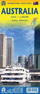
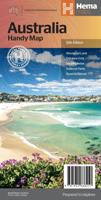
Wegenkaart - landkaart Australië Australia | ITMB

0

Verkopers met dit product

Verkoper
Bezorging
Prijs
DeZwerver.nl logo
DeZwerver.nl
2,95
14,95

Anderen bekeken ook

Wegenkaart - landkaart Australië - Australia | Nelles Verlag
Goede wegenkaart van Australië. Aan beide kanten bedrukt. Met veel toeristische aanduidingen als nationale parken en culturele bezienswaardigheden. Prima leesbare kaart. The main map is surrounded by street plans of city centres, plus enlargements of their environs and other most visited areas: central and greater Sydney, Melbourne and Perth, central Adelaide and Brisbane, the Gold and Sunshine Coast region of Queensland, Alice Springs and environs, plus Mt. Olga - Uluru (Ayers Rock) area. Alice Springs Environs 1 : 1.500.000 Greater Melbourne 1 : 1.000.000 Greater Perth 1 : 300.000 Greater Sydney 1 : 600.000 Mt. Olga / Ayers Rock 1 : 300.000 Sunshine Coast / Gold Coast 1 : 1.000.000 Brisbane City 1 : 30.000 Canberra 1 : 50.000 Central Adelaide 1 : 20.000 Central Melbourne 1 : 30.000 Central Perth 1 : 20.000 Central Sydney 1 : 25.000
11,95
Wegenkaart - landkaart Western Australia | ITMB
The State of Western Australia occupies the western third of the continental country of Australia. The main city is Perth, in the southwest portion, and this is the part of the State with the best land and the most people. Much of the interior is arid desert-like grassland with shallow lakes that often dry out. The road network in the south is generally paved highways and secondary roads, with one road and one rail line heading east to SZ and the rest of the country. Roads in the north tend to be dirt, with the exception of the highway going towards Darwin in NT. There are no roads through the Great Sandy Desert, but the Canning Stock Route crosses the eastern fringe, going north-south. One needs an expensive permit to drive this hazardous track. Most of the attractions of the State are to be found fairly close to the coastline. Most of the larger urban areas tend to have been named after British places, such as Albany, Exmouth, and Port Hedland, but many names have been adopted from …
13,95
Wegenkaart - landkaart Australia East Coast - Oost Australie | ITMB
Wegenkaart van de oostelijke kuststreek van Australië met uitvergrotingen van Brisbane, Sydney en Melbourne en een inzet van Tasmanië.   This double-sided map begins at Australia’s northernmost point of Cape York and proceeds southward through Queensland, New South Wales, and Victoria; in essence covering the portion of the country dominated by Brisbane, Sydney, and Melbourne, all of which are included as largish inset maps. As a bonus, Tasmania is included as a large inset. The scale is generous, making the map easy to read, and while this map will not meet some expectations, 90% of all visitors to Australia concentrate all their travel within the limits of this map. 
13,95
Wegenkaart - landkaart 785 Australië - Australia | Michelin
Zoals je van Michelin mag verwachten is deze kaart zeer overzichtelijk en heeft een duidelijk helder kaartbeeld. De kaart geeft uitgebreid toeristische informatie weer. Met register, afstanden en reistijden. Wegen worden naar verschillende klasse ingedeeld en - mooi van Michelin - de interessante mooie routes worden gemarkeerd met een groene streep.    Hindernissen voor automobilisten met caravans zijn gemarkeerd: steile hellingen, bergpassen of een anderzins moeilijke route. Bezienswaardigheden als een kasteel, religieus gebouw, ruine of grot is door een symbool goed te vinden.   Australia Michelin Map is perfect for route planning as well as navigating overland once you're there, they have excellent road detail and classification and clearly show the regions topography.   Roads are well classified, distinguishing between major and minor roads as well as by road surface (e.g. earth roads). Difficult and prohibited roads; and roads that are impassable at certain times of year are a…
12,95
Wegenkaart - landkaart Australia - Australië | Marco Polo
Duidelijke wegenkaart van Marco Polo: alle wegen, zowel de verharde als belangrijke onverharde wegen zijn weergegeven.  Mooie toeristisch interessante wegen die de moeite waard zijn, zijn groen gearceerd. Veel toeristische informatie is toegevoegd zoals de nationale parken, campings, kastelen en vliegvelden. Afstanden tussen belangrijke steden en benzinestations staan ook op de kaart. Een plaatsnamenregister ontbreekt niet.   Entdecken Sie mit dieser MARCO POLO Karte das Land der Gegensätze . . . Die Karten bestechen durch eine leicht lesbare, neue Kartografie, in der durchgängig landschaftlich schöne Strecken und Orte markiert sind. Schon in der im Kartendeckel befindlichen, ausklappbaren Übersichtskarte sind die schönsten Orte mit Highlightsternen gekennzeichnet und gelben oder grünen Markierungen unterlegt, um unterwegs auch wirklich nichts zu verpassen. Wo alle Orte auf der Karte zu finden sind, ist im Registerheft nachzuschlagen.      
14,95
Wegenkaart - landkaart Australia - Australië | Hema Maps
Mooie, grote, duidelijke kaart van Australië met veel informatie. Oa bezinestations (ook in de outback) en een goed overzicht van de doorgaande (grote) wegen waardoor de kaart erg handig is van het plannen van uw route. Ook staan er afstanden op vermeld.   Verder staan er stadkaartjes op van het (centrum) van de belangrijkste Australische steden:   Adelaide, Brisbane, Canberra, Darwin, Hobart, Melbourne, Perth en Sydney   Hema’s iconic large map of Australia is ideal as a trip planning tool and travel companion. Marked on the map are localities, the major road network, distances and major national parks. The map also shows localities, the major road network, distances and major national parks. The visual appeal makes it perfect as a decorative map or an educational tool. On the reverse side is an overview of Australia's iconic touring regions featuring history, geology and landforms, nature, bucket-list attractions and iconic 4WD tracks.   Key Features Hema's iconic map of Austra…
17,50
Wegenkaart - landkaart Australia - Australië | Freytag & Berndt
Gedetailleerde landkaart van Australië, prima geschikt voor planning en rondtrekken. De berijdbare wegen zijn goed weergeven, zowel de hoofdwegen als provinciale en lokale wegen; wegnummers worden vermeld. Afstanden tussen plaatsen zijn in kilometers op de kaart ingetekend, daarnaast worden ook op belangrijke plekken benzinepompen gemarkeerd. In het kaartbeeld wordt door middel van schaduw het reliëf weergegeven en soms enkele punten in het landschap met de daadwerkelijke hoogte. Provinciegrenzen zijn goed terug te vinden, nationale parken en reservaten ook. Met allerhande symbolen worden toeristische bezienswaardigheden weergegeven als monumenten, historisch belangrijke plekken en uitzichtpunten. In bepaalde plaatsen zijn hotels en campings te vinden, luchthavens, treinverbindingen en havens vindt u er ook op!   Explore the Commonwealth nation of Australia with this Freytag & Berndt road map. It will allow you to plan your itinerary, and travel independently. The topography is clear …
14,95
Wegenkaart - landkaart Australië - natuurkundig -Australia Road & Terrain | Hema Maps
Landkaart van heel Australië met nadruk op de natuurkundige aspecten, toch zijn ook de wegen goed zichtbaar. Hema’s iconic large map of Australia is coloured to reflect the country's climate zones. Marked on the map are localities, the major road network, distances and major national parks. The visual appeal makes it perfect as a decorative map or an educational tool. On the reverse side is an overview of Australia's iconic touring regions featuring history, geology and landforms, nature, bucket-list attractions and iconic 4WD tracks.   Key Features Full road and terrain hillshade map Major road networks & distances Overview of Australia's iconic touring regions Climate zones National parks Aboriginal Land Distance grid Locality Index
17,50

Klanten-reviews van Wegenkaart - landkaart Australië Australia | ITMB

Er zijn nog geen beoordelingen voor dit productBen jij de eerste die een review plaatst?

Meer over Wegenkaart - landkaart Australië Australia | ITMB

Productinformatie

    Verken gerelateerde categorieën

    Webshop.nl maakt gebruik van cookies. Ga je verder op onze website, ga dan akkoord met het plaatsen van cookies en de verwerking van deze data door ons en vermelde partners.