webshop.nl
Categorieën
  Sluiten

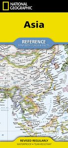
Wegenkaart - landkaart Asia - Azië | National Geographic

• Waterproof • Tear-Resistant • Reference Map   Expertly researched and designed, National Geographic's Asia Flags & Facts Map is the authoritative map of Asia by which other reference maps are measured. The map side includeds a political map showing countries, cities and other landmarks and a physical map shows the landforms such as mountain range...
17,50

Webshops met dit product

Webshop
Bezorging
Prijs

Anderen bekeken ook

Wegenkaart - landkaart Australia and Oceania | National Geographic
• Waterproof • Tear-Resistant • Reference Map   Expertly researched and designed, National Geographic's Australia and Oceania Flags & Facts Map is the authoritative map of Australia by which other reference maps are measured. The map side includeds a political map showing countries, cities and other landmarks and a physical map shows the landforms such as mountain ranges and rivers. The Flags & Facts side includes an overview map of Oceania, the section of the Pacific Ocean stretching from New Zealand to the Galapagos Islands.   Clearly defined boundaries, major cities, and physical features Hundreds of place names carefully placed to maintain legibility in heavily populated areas Includes Australia and Oceania and adjacent regions of Asia Detailed physical map of Australia with mountain ranges, plains, lakes, and rivers Flags and facts with detailed information about cultural and physcial attributes Printed in the U.S.A. on extremely durable, waterproof, and tear-resistant material Th…
17,50
Wegenkaart - landkaart Africa - Afrika | National Geographic
  • Waterproof • Tear-Resistant • Reference Map   Expertly researched and designed, National Geographic's Africa Flags & Facts Map is the authoritative map of Africa by which other reference maps are measured. The map side includeds a political map showing countries, cities and other landmarks and a physical map shows the landforms such as mountain ranges and rivers.   Clearly defined boundaries, major cities, and physical features Hundreds of place names carefully placed to maintain legibility in heavily populated areas Includes Africa and adjacent regions within Europe and Asia Detailed physical map of Africa with mountain ranges, plains, lakes, and rivers Flags and facts with detailed information about cultural and physcial attributes Printed in the U.S.A. on extremely durable, waterproof, and tear-resistant material This Reference Map is printed on durable synthetic paper, making it waterproof, tear-resistant and tough — capable of withstanding the rigors of any kind of use in the …
17,50
Wegenkaart - landkaart Europe - Europa | National Geographic
• Waterproof • Tear-Resistant • Reference Map   Expertly researched and designed, National Geographic's Europe Flags & Facts Map is the authoritative map of Europe by which other reference maps are measured. The map side includeds a political map showing countries, cities and other landmarks and a physical map shows the landforms such as mountain ranges and rivers.   Clearly defined boundaries, major cities, and physical features Hundreds of place names carefully placed to maintain legibility in heavily populated areas Includes Europe including Russia and adjacent regions within Asia and Africa Detailed physical map of Europe with mountain ranges, plains, lakes, and rivers Flags and facts with detailed information about cultural and physcial attributes Printed in the U.S.A. on extremely durable, waterproof, and tear-resistant material This Reference Map is printed on durable synthetic paper, making it waterproof, tear-resistant and tough — capable of withstanding the rigors of any kind…
17,50
Wegenkaart - landkaart North America - Noord Amerika | National Geographic
• Waterproof • Tear-Resistant • Reference Map   Expertly researched and designed, National Geographic's North America Flags & Facts Map is the authoritative map of North America by which other reference maps are measured. The map side includeds a political map showing countries, cities and other landmarks and a physical map shows the landforms such as mountain ranges and rivers.   Clearly defined boundaries, major cities, and physical features Hundreds of place names carefully placed to maintain legibility in heavily populated areas Includes North America and adjacent regions within Asia and South America Detailed physical map of North America with mountain ranges, plains, lakes, and rivers Flags and facts with detailed information about cultural and physcial attributes Printed in the U.S.A. on extremely durable, waterproof, and tear-resistant material This Reference Map is printed on durable synthetic paper, making it waterproof, tear-resistant and tough — capable of withstanding the …
17,50
Wegenkaart - landkaart South America and Antarctica | National Geographic
• Waterproof • Tear-Resistant • Reference Map   Expertly researched and designed, National Geographic's South America and Antarctica Flags & Facts Map is the authoritative map of South America by which other reference maps are measured. The map side includeds a political map showing countries, cities and other landmarks and a physical map shows the landforms such as mountain ranges and rivers. The Flags & Facts side includes a combined political and physical map of Antarctica.   Clearly defined boundaries, major cities, and physical features Hundreds of place names carefully placed to maintain legibility in heavily populated areas Includes South America and Antarctica and adjacent regions within North America Detailed physical map of South America with mountain ranges, plains, lakes, and rivers Flags and facts with detailed information about cultural and physcial attributes Printed in the U.S.A. on extremely durable, waterproof, and tear-resistant material This Reference Map is printed…
17,50
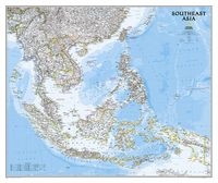
Wandkaart Zuidoost Azië, politiek, 96 x 81 cm | National Geographic
The Southeast Asia Political Map is a detailed reference map containing National Geographic’s clear visual presentation in a bright and appealing color palette. The map contains thousand of place names, accurate political boundaries, and infrastructure, making it the perfect reference for student, home, or business.   This detailed wall map of Southeast Asia by National Geographic includes Indonesia, New Guinea, the Phillipines, Malaysia, Thailand, Myanmar, Cambodia and Vietnam. Coverage includes the whole of Indonesia and the Philippines, and extends north to cover China as far as Hangzhou and, in the north-western corner, Bhutan.   Details featured on this Southeast Asia Wall Map include:   • Political Boundaries • Major Cities and Capitals • Physical Terrain Shading • Mountain Ranges, Highest Point • Lakes, Rivers and Waterways • Latitude and Longitude Lines • Basic Bathymetry (Ocean Depths) • Major Airports • National Parks
34,95
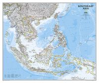
Wandkaart Zuidoost Azië, politiek, 96 x 81 cm | National Geographic
The Southeast Asia Political Map is a detailed reference map containing National Geographic’s clear visual presentation in a bright and appealing color palette. The map contains thousand of place names, accurate political boundaries, and infrastructure, making it the perfect reference for student, home, or business. This detailed wall map of Southeast Asia by National Geographic includes Indonesia, New Guinea, the Phillipines, Malaysia, Thailand, Myanmar, Cambodia and Vietnam. Coverage includes the whole of Indonesia and the Philippines, and extends north to cover China as far as Hangzhou and, in the north-western corner, Bhutan. Details featured on this Southeast Asia Wall Map include:   • Political Boundaries • Major Cities and Capitals • Physical Terrain Shading • Mountain Ranges, Highest Point • Lakes, Rivers and Waterways • Latitude and Longitude Lines • Basic Bathymetry (Ocean Depths) • Major Airports • National Parks
26,95
Wegenkaart - landkaart Sierra Nevada | National Geographic
&; Waterproof &; Tear-Resistant &; Travel Map   National Geographic's Sierra Nevada Destination Map strikes the perfect balance between map and guidebook and is an ideal resource for touring the rugged landscape of this culturally and geographically unique region of California and Nevada.   The front side of the print map reveals a detailed map of the region stretching from the Oregon border to California's Eldorado National Forest, bordered by the Sacramento Valley to the west and Nevada's Great Basin to the east. Modoc, Shasta-Trinity, Lassen, Plumas, and Humbolt-Toiyabe National Forests are also included on the map. The map features a comprehensive road network including scenic byways as well as areas of interest such as Indian Reservations, National Parks and Monuments, and Recreation Areas. Trails, historic sites, museums, cultural centers, scenic areas, state parks and other points of interest are also included. In addition, the map features beautiful photographs and informat…
17,50
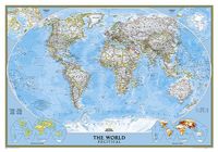
Wereldkaart 85 Politiek, 278 x 194 cm | National Geographic
Een bijzonder grote wereldkaart van National Geographic. Deze kaart is politiek van opbouw: alle landen worden met duidelijke grenzen heel goed zichtbaar. Daarnaast staan er veel plaatsen op en worden ook de dieptes van de verschillende oceanen, golfstromen en heersende windrichtingen weergegeven.   Een prachtige kaart aan de muur, aan de zijkanten afgewerkten met een mooie rand en een heldere maar tegelijk ook vrij zachte, niet overheersende kleurstelling. Deze kaart wordt gemaakt in drie delen - te groot om in 1 keer te fabriceren met kans op beschadigingen - die vervolgens zeer nauwkeurig aan elkaar worden geplakt.    De kaart wordt verzonden in een grote stevige kartonnen koker. Bedenk wel dat DHL deze kaart afleverd en dat u zelf moet zorgen dat er op dat adres iemand aanwezig is op moment van levering. Kijk ook de kaart na op eventuele gebreken.   Bedenk dat ophangen van zo'n formaat kaart niet eenvoudig is. Voor het beste resulataat moet de kaart worden verlijmd op een vlakke on…
126,95
Wandelkaart - Wegenkaart - landkaart 902 Jasper South National Park | National Geographic
Goede kaart van een deel van Jasper National Park. Geschikt voor overzicht maar ook voor de langere trails: campsites, rivieren, paden, alles kun je er op terug vinden.   National Geographic's Trails Illustrated map of Jasper South is a two-sided, waterproof map designed to meet the needs of outdoor enthusiasts with unmatched durability and detail. This map was created in conjunction with local land management agencies and is loaded with valuable recreation information.   The front side of the Jasper South map details the east side of the national park, from Whitehorse Wildland Provincial Park to the north, to White Goat Wilderness Area to the south. The reverse side of the map details the west side of the park, extending from Cummins Lakes Provincial Park to the south, to Victoria Cross Ranges to the North. Insets show survival tips, safe travel in Bear Country, and all the recreation the park has to offer with backpacking, camping, biking, hiking and horseback riding.   Trails I…
17,50

Klanten-reviews van Wegenkaart - landkaart Asia - Azië | National Geographic

Er zijn nog geen beoordelingen voor dit productBen jij de eerste die een review plaatst?

Meer over Wegenkaart - landkaart Asia - Azië | National Geographic

Productomschrijving

• Waterproof • Tear-Resistant • Reference Map   Expertly researched and designed, National Geographic's Asia Flags & Facts Map is the authoritative map of Asia by which other reference maps are measured. The map side includeds a political map showing countries, cities and other landmarks and a physical map shows the landforms such as mountain ranges and rivers.   Clearly defined boundaries, major cities, and physical features Hundreds of place names carefully placed to maintain legibility in heavily populated areas Includes Asia including Russia and adjacent regions within Europe and Africa Detailed physical map of Asia with mountain ranges, plains, lakes, and rivers Flags and facts with detailed information about cultural and physcial attributes Printed in the U.S.A. on extremely durable, waterproof, and tear-resistant material This Reference Map is printed on durable synthetic paper, making it waterproof, tear-resistant and tough — capable of withstanding the rigors of any kind of use in the home or classroom.
Webshop.nl maakt gebruik van cookies. Ga je verder op onze website, ga dan akkoord met het plaatsen van cookies en de verwerking van deze data door ons en vermelde partners.