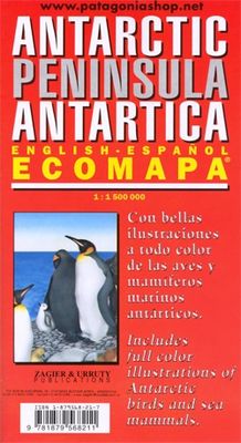
Wegenkaart - landkaart Antarctic Peninsula - Antarctica | Zagier & Urruty

0
Kaart van het Antarctisch Schiereiland met tekeningen van de voorkomende Fauna. Dit is het stuk van Antarctica waar vrijwel alle toeristen rondvaren op de cruiseschepen of zeilboten. The North of the Peninsula is the most visited part of Antarctica every summer. Glaciers, inlets and sailing ports, scientific stations, etc. On the back side large m...

Verkopers met dit product

Verkoper
Bezorging
Prijs
DeZwerver.nl logo
DeZwerver.nl
2,95
17,95

Anderen bekeken ook

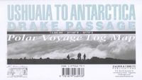
Wegenkaart - landkaart Ushuaia to Antarctica - Drake Passage | Zagier & Urruty
Deze kaart is geschikt voor bootreizen van Ushuaia naar Antarctica. De kaart bevat behalve dieptemeters en stromingen ook de plaatsen van scheepswrakken en andere interessante plekken. The ship voyage from South America to the Antarctic Peninsula is a travel of a lifetime. After two days navigating on a sea of miles deep with the strongest and wildest currents and winds, the traveler arrives to a paradise for people looking for nature, history and adventure. This map is based in the Argentine Hydrographic Survey and the Ushuaia Maritime Museum charts and includes historic sites in the area as well as place for stamps and signatures from the ship and stations crew. A certificate for having crossed the Drake Passage is printed, too. afmeting 65 x 95 cm
17,95
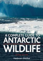
Natuurgids A Complete Guide to Antarctic Wildlife | Bloomsbury
Prachtig naslagwerk over alle aspecten van de wildlife op de Zuidpool en Antarctica. Zeer gedegen vakwerk met prachtige soortbeschrijvingen en verspreidingskaarten. Harde kaft. This spectacularly illustrated book is the only complete guide to the wildlife and natural history of the vast and beautiful Antarctic region. Covering the Antarctic continent, the southern ocean, and the subantarctic islands, this guide illustrates all of the region's breeding birds and marine mammals with stunning colour photographs. In addition to the colour plates, it features distribution maps and up-to-date species accounts expertly detailing abundance, seasonal status, and conservation prospects. The volume also covers numerous nonbreeding species, migrants, and vagrants. Regional chapters describe all of the subantarctic islands, in addition to most regularly visited sites in Antarctica, and are accompanied by maps of each area and photographs of each locale. These chapters present detailed information …
61,95
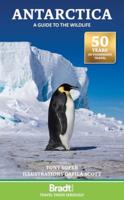
Natuurgids Antarctica: A Guide to the Wildlife | Bradt Travel Guides
Uitgever Bradt richt zich steeds meer op de ware natuurliefhebber: hoe, wat en waar te zien is een belangrijk motto in deze speciale reisgidsen. Wat ons betreft had het allemaal nog wel wat uitgebreider gemogen, maar met deze gids mogen we echter niet mopperen! Een waar genoegen ..... A superbly illustrated and attractive new edition of this traveller’s companion to the wildlife of the Antarctic wilderness. Dafila Scott’s illustrations provide the perfect accompaniment to naturalist Tony Soper’s immaculate text. This guide provides full coverage of plumage and identification, breeding and nesting, feeding and the best locations to observe the varied species to be found in Antarctica. • Illustrated in full colour throughout with specially commissioned watercolour paintings • Authoritative writing by TV naturalist Tony Soper • Species identification, behaviour and habitats and conservation guidelines for visitors • History of discovery and exploration Updated throughout, the 7th edition…
26,50
Wegenkaart - landkaart Parque Nacional los Glaciares | Zagier & Urruty
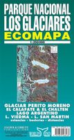
LOS GLACIARES NATIONAL PARK ECOMAP The most incredible Park of Patagonia, including Perito Moreno Glacier and Mount Fitz Roy. Satellite relief, roads, navigation, camping, inns and estancias, etc. El Parque mas espectacular de la Patagonia, donde sobresalen el Glaciar Perito Moreno y el Monte Fitz Roy. Rutas, navegaciones, estancias turisticas, paradores, camping, etc. Spanish / English edition. Southern Patagonia’s main National Park, Los Glaciares, with the world's only advancing glacier. The map uses satellite imagery, enhanced with colours and hill-shading to give a vivid representation of the relief. Many local peaks, glaciers and other geographical features are marked and named. Road network includes unpaved roads and dirt tracks, with locations of petrol stations and intermediate driving distances. Ferry connections on the region’s numerous lakes are also indicated. Symbols highlight accommodation and restaurant facilites. Latitude and longitude lines are drawn at 15' intervals…
17,95
Wegenkaart - landkaart Antarctica & Tierra del Fuego | ITMB
Goede overzichtskaart van Antarctica, schaal 1:7.000.000 met toeristische informatie en informatie over het klimaat en de natuur. Aan de andere zijde een kaart van Tierra del Fuego, schaal 1:750.000, de Falklandeilanden, schaal 1:1.100.000 en een plattegrond van Ushaia, schaal 1:10.00 This is actually brand new artwork, replacing the partly-digital version with new digitized line work. It looks similar to our earlier editions; its real value will be in tracking changes to the continent as the ice cover gradually melts.  Folded color map of Antarctica. Scale: 1:7,000,000. Map of the continent shows glaciers, islands, mountains, ice rises, other natural features and stations/settlements. Information about climate and natural features, flora and fauna of the land and surrounding seas and history. I
14,50
Vogelgids - Natuurgids Antarctic Wildlife | Waterford Press
Een bijzonder handige uitklapkaart met alle veelvoorkomende dieren van Antarctica. Duidelijke illustraties, goede korte omschrijving van soort en leefgebied, geplastificeerd. Familiar species, common plants, and natural phenomena are introduced in these beautifully illustrated guides to nature and the outdoors. Printed on laminated, water-resistant paper in a folded format, Pocket Naturalist® Guides are highly durable for use in the field as each title provides a portable reference to a variety of mammals, birds, reptiles, amphibians, fishes, butterflies, and insects. Nature enthusiasts, from the beginner to the seasoned explorer, will relish the abundance of detailed information packed within these handheld guides. The perfect pocket-sized reference for the eco-tourist visiting Antarctica, this beautifully colored and illustrated guide highlights more than 120 of the most common species of marine life, whales, seals, and invertebrates.
10,95
Reisgids Antarctica: Guide to your adventure Paperback | Rucksack Readers
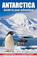
To people who haven’t been there, Antarctica seems remote, extreme and perhaps even forbidding. Yet everybody who has visited comes back full of enthusiasm, with amazing memories and stunning photos. The author inspires interest in this amazing place while encouraging responsible, informed and sustainable tourism. She helps you to decide where and when to go, whether to include South Georgia and/or the Falklands, how to read between the lines of an itinerary, which operator to book with and what size of ship will suit you best. She provides practical information about weather, clothing and photography, and gives links to useful websites and further reading. She covers various specialist options from sea kayaking to camping on the ice. The wildlife section is lavishly illustrated with photos of creatures ranging from tiny krill through seabirds and penguins to seals, dolphins and whales with their amazing adaptations. Understanding their breeding cycles helps you to anticipate what you…
22,50
Wegenkaart - landkaart Baja California - Mexico | ITMB
Een degelijke kaart met aanduidingen van o.a. nationale parken, vliegveld, benzinepomp, dirt-roads. Als overzichtskaart goed te gebruiken. The long peninsula on the north-western edge of Mexico (the ‘lost’ province of Alta California being the temporary possession of that country to the north) is a favourite travel destination for visitors from all over the world, whether they be day-trippers crossing into Tijuana, RVers headed for the Gulf, 4x4ers wanting to explore the dreaded Viscaino Desert, or intrepid explorers wanting to experience a part of Mexico that has always prided itself as being a little ‘different’. I remember the first time Kevin Healey and I visited the peninsula in 1988. He couldn’t handle the spicy food, and we had to beat a retreat to the north after three days, but he produced the definitive Baja map two months later. This digitized, double-sided map is based on his efforts, but has been updated several times since his death, and Lan and I love going to Baja to r…
13,95
Wegenkaart - landkaart South America and Antarctica | National Geographic
• Waterproof • Tear-Resistant • Reference Map   Expertly researched and designed, National Geographic's South America and Antarctica Flags & Facts Map is the authoritative map of South America by which other reference maps are measured. The map side includeds a political map showing countries, cities and other landmarks and a physical map shows the landforms such as mountain ranges and rivers. The Flags & Facts side includes a combined political and physical map of Antarctica.   Clearly defined boundaries, major cities, and physical features Hundreds of place names carefully placed to maintain legibility in heavily populated areas Includes South America and Antarctica and adjacent regions within North America Detailed physical map of South America with mountain ranges, plains, lakes, and rivers Flags and facts with detailed information about cultural and physcial attributes Printed in the U.S.A. on extremely durable, waterproof, and tear-resistant material This Reference Map is printe…
17,50

Klanten-reviews van Wegenkaart - landkaart Antarctic Peninsula - Antarctica | Zagier & Urruty

Er zijn nog geen beoordelingen voor dit productBen jij de eerste die een review plaatst?

Meer over Wegenkaart - landkaart Antarctic Peninsula - Antarctica | Zagier & Urruty

Productomschrijving

Kaart van het Antarctisch Schiereiland met tekeningen van de voorkomende Fauna. Dit is het stuk van Antarctica waar vrijwel alle toeristen rondvaren op de cruiseschepen of zeilboten.

The North of the Peninsula is the most visited part of Antarctica every summer. Glaciers, inlets and sailing ports, scientific stations, etc. On the back side large maps of the main visited islands and ports. Artistic drawings of birds and mammals.

Verken gerelateerde categorieën

Webshop.nl maakt gebruik van cookies. Ga je verder op onze website, ga dan akkoord met het plaatsen van cookies en de verwerking van deze data door ons en vermelde partners.