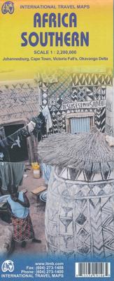
Wegenkaart - landkaart Africa Southern - zuidelijk Afrika | ITMB

0
met extra kaarten van Johannesburg - Kapstad - Victoria Falls - Okavango Delta   This map is the updated version of our previous map, which was called Southern Africa, covering the southernmost portion of Africa. It is also the most developed part of the continent, with the densest road network and number of urban areas on the continent. This edit...

Verkopers met dit product

Verkoper
Bezorging
Prijs
DeZwerver.nl logo
DeZwerver.nl
2,95
13,95

Anderen bekeken ook

Wegenkaart - landkaart Africa Equatorial - Afrika midden | ITMB
This is the third of our regional maps covering the African continent and covers the portion just south of Nigeria/Cameroun that, essentially, straddles the equator. The jungle-like western half has always been referred to as Equatorial Africa, which is a bit of a mis-nomer because Uganda and Kenya also straddle the equator. The area of coverage of this map is two-fold: to bring the western portion into our growing digital data base and to provide our first-ever ITM map of beautiful East Africa (the KUT countries, Rwanda, and Burundi). Unlike Michelin, that places what it calls Central and Southern Africa on to one large single-sided sheet, we have decided to divide the southern half of the African continent into three double-sided sheets at a better scale. This is the first one, covering Africa as far south as Zambia, with a bit of Zimbabwe. As with all of our regional African maps, this one focuses on road conditions, distances, urban areas, facilities, parks, and attractions.  Lege…
13,95
Wegenkaart - landkaart Afrika Africa | ITMB
Een degelijke kaart met aanduidingen van o.a. nationale parken, vliegveld, benzinepomp, dirt-roads en kleine plattegrond van hoofdstad. Als overzichtskaart goed te gebruiken. Finally! This is the most innovative map we've published in years! This is the first proper digital data base map of Africa ever published that covers the entire continent from top to bottom and east to west.   The continent of Africa is fascinating. Whether on wishes to visit the continent or just learn more about it, a detailed map is vital, and a good map is hard to find! The first edition of our ITM Africa map sold out in less than two years. We have added a considerable amount of data to this edition of the map, particularly in the northwest portion. One has to be careful not to overload a continental map with too much information, or to show roads so prominently as to obscure too much the map, but one also has to have enough information to make the map useful, readable and attractive. We feel that this edit…
13,95
Wegenkaart - landkaart Africa central and south - Afrika zuid en centraal | ITMB
This title is in our series of regional titles for Africa at 1:3,400,000 scale. All of Africa is available as a continental sheet at 1:5M scale and as regional titles at 1:3.8M and 1:3.4M, based on GIS data. This is a milestone for ITMB and the realization of a dream that began in 1993. However, the work is still only in its early stages. This map covers that portion of the continent that old Africa hands always referred to as 'central', meaning the Rhodesias and Nyasaland � now known as Zambia, Malawi, and Zimbabwe.   By its shape, generous portions of the southern portions of DEM Congo, the eastern third of Angola, the northern half of Mozambique, and Botswana's Okavunga Delta are included on the one side. The second side covers South Africa, Lesotho, Swaziland, the rest of Botswana, and southern Namibia in great detail. This is an excellent map for anyone visiting the larger region of the southern third of Africa. As with our other regional titles, this is a work in progress. The n…
13,95
Wegenkaart - landkaart Western Africa - Afrika westen | ITMB
Een degelijke kaart met aanduidingen van o.a. nationale parken, vliegveld, benzinepomp, dirt-roads en kleine plattegrond van hoofdstad. Als overzichtskaart goed te gebruiken.   This map, at 1:3,400,000 scale is ideal for travellers crossing Africa from Europe to central and southern parts of Africa by land. It covers from the southern tip of Spain through Morocco and western Algeria on one side to Mauritania and the Bight of Benin states of West Africa, as far east as western Nigeria. As a regional map, the detail provided is unsurpassed by any other map of this part of the world. It is the most detailed map to date of the West African states of Guinea, Guinea-Bissau, Liberia, and Sierra Leone. As is always the case with Africa, road information is presented in practical terms of road quality, not road designation. This is a practical map for travellers, so information has been provided with the greatest degree of accuracy possible, given that reliable information can be extremely dif…
13,95
Wegenatlas Traveller's Atlas Southern Africa - Zuidelijk Afrika | A3-Formaat | Ringband | Tracks4Africa
Deze atlas omvat tien landen in zuidelijk Afrika en is speciaal gericht op reizigers die zelf rijden. De betrokken landen zijn: Angola, Botswana, Lesotho, Malawi, Mozambique, Namibië, Zuid-Afrika, Swaziland, Zambia en Zimbabwe.   De Atlas bevat 223 kaartpagina's met hetzelfde vertrouwde kaartdetail waarvoor Tracks4Africa bekend is.   De wegenatlas is afgedrukt in A3 formaat, weegt 2750g, heeft een stevige omslag, spiraal gebonden en de pagina's zijn afgedrukt op dik papier.   Bigger coverage than ever before: 1:4m maps for Southern and Eastern Africa – ideal for macro planning. 1:1m maps for Southern Africa, covering the following countries: Angola, Botswana, eSwatini, Lesotho, Malawi, Mozambique, Namibia, South Africa, Zambia and Zimbabwe. 1:500k maps for South Africa, Malawi, most part of Zambia and the area around Moremi/Chobe in Botswana. Road coverage: This Atlas is designed for overland travel and compiled from the same data used on our famous GPS maps. Use it for trip p…
79,95
Wegenkaart - landkaart Afrika noordwest - Africa northwest | ITMB
Een degelijke kaart met aanduidingen van o.a. nationale parken, vliegveld, benzinepomp, dirt-roads en kleine plattegrond van hoofdstad. Als overzichtskaart goed te gebruiken. This is the detailed map of Africa emanating from our continental data base and, at an scale better than Michelin's famous regional map, we feel that this version is a winner. First, it is printed double-sided with the western coastal segment on one side and the eastern half on the other. Second, we have been able to improve the accuracy of the road information enormously at the better scale, and third we are making progress in developing a new series of travel maps for Africa by publishing the first of what we hope will become a new regional map covering Africa from top to bottom, or from Cape to Cairo, as Uncle Cecil used to say. The coverage of this map is from Morocco in the west to the Libyan/Egyptian border and from Senegal and Liberia in the southwest to the Chad/Sudan border in the southeast. This is also…
13,95
Wegenkaart - landkaart Africa north east - noord oost Afrika | ITMB
This is the third ITMB title on Africa to be released using our digital data base material. As with Africa as a continental map and Africa North West, this map covers a large area and tries to do so fairly and in detail. The essential areas of coverage are Libya and Egypt in the north, with Sudan/South Sudan, Ethiopia/Eritrea in the middle, and Kenya/Uganda in the south, with a fair portion of Tanzania and Congo thrown in simply because it fits. Being a regional map, it is useful for the 'big' picture. It is quite detailed, showing roads, towns, and major touristic sites. It is more detailed and at a better scale than the Michelin map of the same name   Legend Includes: Road by classification, Main Road, National Park, Lake, Capital, International Airport, Oasis, Ruins, Hotels and much more...
13,95
Wegenkaart - landkaart Wales & south of England - Zuid Engeland | ITMB
Een degelijke kaart met aanduidingen van o.a. nationale parken, vliegveld, benzinepompen. We are gradually increasing the scales for our data of Great Britain and this is our latest effort. Most visitors to the UK fly into one of London's four airports and combine a visit to the city with an opportunity to travel to various destinations within striking distance of London. England is so incredibly rich in heritage and scenic attractions that it is extremely difficult to portray the country as a map of the entire entity. As a result, England lends itself nicely to be divided into a central/northern portion and a southern portion. To fit areas as diverse as Cornwall and Norwich on one sheet, one needs to have a vertical frame, with Devon/Cornwall up to the top of Wales on one side and Wiltshire to Kent up to York (admittedly, not normally considered to be part of 'southern', but vertically, that's what happens. At this scale, all of southern England and all of Wales can be shown in good …
13,95
Wegenkaart - landkaart SC5-SC6 George to Kareedouw | Tracks4Africa
The Cape to Addo map series covers the southern parts of the Western Cape of South Africa in a series of eight highly detailed maps, printed on four sheets of A1 durable paper.   We start in Cape Town in the west and move along the southern coast through the Overberg, Winelands, Garden Route, Klein Karoo R62, Baviaanskloof to eventually arrive in the Addo National Park up to Gqeberha (Port Elizabeth) in the east.   The maps are highly detailed and well researched. Our map scale is 1:200 000 which allows us to show a lot of detail including minor gravel roads, hiking trails, farm boundaries and points of interest which are relevant to self-drive tourists.   The size of the paper is kept small enough to allow this to be the perfect road tripping map. We use Duraflex paper and print two maps per sheet of A1 paper, making this a four-sheet series. Each map sheet is individually packed in a plastic protective sleeve.   The maps are perfect for day drives, overlanding or just doing road tri…
29,95
Wegenkaart - landkaart Scotland - Schotland | ITMB
Anyone who has been in this business for a few years remembers Ordnance Survey and their brilliantly detailed artwork. They should also remember that OS guarded this artwork religiously. That all changed when the then head of government in the UK, one soon-forgotten Gordon Brown, decreed that commercial OS artwork had to be discontinued and artwork had to be made more freely available to users. I expected an outpouring of new artwork by private UK firms. It did not happen; in fact, the range of travel maps decreased dramatically. However, OS artwork is still an excellent source of mapping artwork. This is a wonderful double-sided, detailed map of Scotland. It is both extremely detailed and accurate. We have added symbols for parks, historic sites, battlefields, country hotels, and anything else that we think would interest visitors. In order to portray Scotland to best scale advantage, the only inset included with this map are those of outlying islands, such as the Shetlands. ITMB als…
13,95

Klanten-reviews van Wegenkaart - landkaart Africa Southern - zuidelijk Afrika | ITMB

Er zijn nog geen beoordelingen voor dit productBen jij de eerste die een review plaatst?

Meer over Wegenkaart - landkaart Africa Southern - zuidelijk Afrika | ITMB

Productomschrijving

met extra kaarten van Johannesburg - Kapstad - Victoria Falls - Okavango Delta   This map is the updated version of our previous map, which was called Southern Africa, covering the southernmost portion of Africa. It is also the most developed part of the continent, with the densest road network and number of urban areas on the continent. This edition was started a year ago and incorporates an innovative approach to data portrayal by essentially over-lapping our very detailed South Africa artwork over top of the southern Africa artwork. The result is a much more detailed regional map than was possible previously.   Legend Includes: Road by classification, Major Road, Highway, Railway, Ferry, Lake, River, National Park, Beach, Diving, World Heritage, Waterfall, Cave, Monument, Camping Site and much more...

Productinformatie

    Verken gerelateerde categorieën

    Webshop.nl maakt gebruik van cookies. Ga je verder op onze website, ga dan akkoord met het plaatsen van cookies en de verwerking van deze data door ons en vermelde partners.