webshop.nl
Categorieën
  Sluiten

Meer ITMB
Meer ITMB in Geschiedenis & politiek boeken

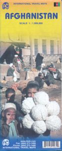
Wegenkaart - landkaart Afghanistan | ITMB

Een degelijke kaart met aanduidingen van o.a. nationale parken, vliegveld, benzinepomp, dirt-roads en kleine plattegrond van hoofdstad. Als overzichtskaart goed te gebruiken. Legend Includes: Roads by classification, silk road, airports, towns, villages, ruins, national parks, lakes, swamps, points of interest and other information It is a bit diff...
13,95

Webshops met dit product

Webshop
Bezorging
Prijs

Anderen bekeken ook

Wegenkaart - landkaart Afghanistan | ITMB
Een degelijke kaart met aanduidingen van o.a. nationale parken, vliegveld, benzinepomp, dirt-roads en kleine plattegrond van hoofdstad. Als overzichtskaart goed te gebruiken. Legend Includes: Roads by classification, silk road, airports, towns, villages, ruins, national parks, lakes, swamps, points of interest and other information It is a bit difficult to credit Afghanistan having touristic potential at the moment, but it is an extremely important country right now, and that justifies a very good map of the country. This is our third edition of this country and each one keeps getting better. We can’t justify sending a researcher into a combat zone to gather data, but we are thankful to those aid workers and soldiers who have added to our information base and helped make this map more useful. In this edition, we are showing some new roads, reflecting the reality that the country is succeeding in improving its infrastructure in spite of a very tense political situation. We have also pla…
13,95
Wegenkaart - landkaart Western Canada | ITMB
Een degelijke kaart met aanduidingen van o.a. nationale parken, vliegveld, benzinepomp, dirt-roads. Als overzichtskaart goed te gebruiken. This is actually our second attempt at mapping the western portion of Canada; the first covered everything from northwestern Ontario to the Pacific Ocean and, while it was an excellent map, the scale that such a huge area covered necessitated severe problems. In this version, all of British Columbia, Alberta, and the Yukon have been mapped from fresh digital data and presented at 1:1.4T scale. This would have been impossible when we prepared the first map. The Northwest Territories portion had to be compressed in two ways; first, the scale is 1:2M; second, only the portion with roads is shown. This is still an extremely large area. One has to consider the actual size of Canada when designing a map. Most countries in Europe would fit into this area, which only covers 20% of Canada. The Fort McMurray forest fire of a year ago covered an area larger th…
13,95
Wegenkaart - landkaart USA Verenigde Staten | ITMB
Een degelijke kaart met aanduidingen van o.a. nationale parken, vliegveld, benzinepomp, dirt-roads en kleine plattegrond van hoofdstad. Als overzichtskaart goed te gebruiken. United States of America (USA) Travel Reference Map has been mapped before, but the USA is a huge country, extremely developed, and almost impossible to show on a map without over-simplification. Most commercial maps use small sheets of paper and print single-sided, making it impossible to show this vast country to advantage. Well, Lan’s been hard at work developing a ‘proper’ traveller’s aid to navigating around the USA, and here it is. We printed it on an exceptionally large sheet of paper, 39” tall by 54” wide (our normal printing size is 27”x39”). To do this, we merged our four existing databases into one, then split them so that the west side is on one side and the east side on the other. What results is a very large sheet, but a map at a VERY good scale. We were able to fit in 6,765 urban areas, all the Inte…
13,95
Wegenkaart - landkaart Wales & south of England - Zuid Engeland | ITMB
Een degelijke kaart met aanduidingen van o.a. nationale parken, vliegveld, benzinepompen. We are gradually increasing the scales for our data of Great Britain and this is our latest effort. Most visitors to the UK fly into one of London's four airports and combine a visit to the city with an opportunity to travel to various destinations within striking distance of London. England is so incredibly rich in heritage and scenic attractions that it is extremely difficult to portray the country as a map of the entire entity. As a result, England lends itself nicely to be divided into a central/northern portion and a southern portion. To fit areas as diverse as Cornwall and Norwich on one sheet, one needs to have a vertical frame, with Devon/Cornwall up to the top of Wales on one side and Wiltshire to Kent up to York (admittedly, not normally considered to be part of 'southern', but vertically, that's what happens. At this scale, all of southern England and all of Wales can be shown in good d…
13,95
Wegenkaart - landkaart Canada | ITMB
Een degelijke kaart met aanduidingen van o.a. nationale parken, vliegveld, benzinepomp, dirt-roads en kleine plattegrond van hoofdstad. Well, it’s about time, eh?!? ITMB, after only thirty years on the go, finally gets around to publishing a map of Canada. When we first started mapping, there was a pressing need for good maps of Central and South America, then of Africa, then etc etc and we never found time to concentrate on our own country until fairly recently. This map was prepared by Natural Resources Canada and is, as a result, as accurate a map as one could hope to have. We are very proud of it, and very pleased to be able to use such top-rate cartography. The map covers all of the land mass of Canada, from its southernmost point to the top of Ellesmere Island and from the Atlantic coast to the Pacific. It’s an excellent map, but I’m going to give one proviso. Canada is the second-largest country on the face of the planet and there is no way that a single-sided sheet can portray …
13,95
Wegenkaart - landkaart Scotland - Schotland | ITMB
Anyone who has been in this business for a few years remembers Ordnance Survey and their brilliantly detailed artwork. They should also remember that OS guarded this artwork religiously. That all changed when the then head of government in the UK, one soon-forgotten Gordon Brown, decreed that commercial OS artwork had to be discontinued and artwork had to be made more freely available to users. I expected an outpouring of new artwork by private UK firms. It did not happen; in fact, the range of travel maps decreased dramatically. However, OS artwork is still an excellent source of mapping artwork. This is a wonderful double-sided, detailed map of Scotland. It is both extremely detailed and accurate. We have added symbols for parks, historic sites, battlefields, country hotels, and anything else that we think would interest visitors. In order to portray Scotland to best scale advantage, the only inset included with this map are those of outlying islands, such as the Shetlands. ITMB also…
13,95
Wegenkaart - landkaart Montana & Idaho | ITMB
Een degelijke kaart met aanduidingen van o.a. nationale parken, vliegveld, benzinepompen. ITMB is pleased to release two more state maps, this time of Montana on one side, and adjacent Idaho on the other side. Montana prides itself on being the ‘blue sky’ state. Due to its high elevation, the sky does appear to be a darker shade of blue than is common in areas closer to the ocean. The state is lightly populated, so much of its attractiveness rests with natural features, such as Glacier National Park on the Canadian border, and Yellowstone National Park on the Wyoming border. The state is also perfect camping country, and our map includes dozens of authorized campsites. It also includes the national heritage site of Little Big Horn, where Lt. Colonel Custer and the US 7th Cavalry were massacred after foolishly attacking a vastly larger encampment of Sioux and Cheyenne first nations people under the leadership of Sitting Bull. The second side of the map portrays the State of Idaho, an eq…
13,95

Klanten-reviews van Wegenkaart - landkaart Afghanistan | ITMB

Er zijn nog geen beoordelingen voor dit productBen jij de eerste die een review plaatst?

Meer over Wegenkaart - landkaart Afghanistan | ITMB

Productomschrijving

Een degelijke kaart met aanduidingen van o.a. nationale parken, vliegveld, benzinepomp, dirt-roads en kleine plattegrond van hoofdstad. Als overzichtskaart goed te gebruiken. Legend Includes: Roads by classification, silk road, airports, towns, villages, ruins, national parks, lakes, swamps, points of interest and other information It is a bit difficult to credit Afghanistan having touristic potential at the moment, but it is an extremely important country right now, and that justifies a very good map of the country. This is our third edition of this country and each one keeps getting better. We can’t justify sending a researcher into a combat zone to gather data, but we are thankful to those aid workers and soldiers who have added to our information base and helped make this map more useful. In this edition, we are showing some new roads, reflecting the reality that the country is succeeding in improving its infrastructure in spite of a very tense political situation. We have also placed more focus on the borderlands with Pakistan as that country has been immersed in the Afghan conflict. This edition is dedicated to the Canadian forces, both military, police, and civilian, who are trying so hard to bring peace and stability to southern Afghanistan and who have suffered more than 100 casualties to date. This is not to minimize the enormous contributions being made by many tens of thousands of men and women of other nations, or their equally heavy losses, but as a Canadian, I feel closer to our own. The map also shows a good inset map of Kabul and a recent cover picture taken by one of our helpers

Productspecificaties

Artikelnummer(s)
Brand
ITMB

Verken gerelateerde categorieën

Webshop.nl maakt gebruik van cookies. Ga je verder op onze website, ga dan akkoord met het plaatsen van cookies en de verwerking van deze data door ons en vermelde partners.