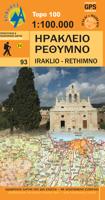
Wegenkaart - landkaart 93 Kreta centraal - midden Heraklion en Rethimnon | Anavasi

0
Gebaseerd op topografische kaarten, GPS compatible, gedrukt op watervast en scheurvast papier. Hoogtelijnen met 100 m interval, schaduwkleuren en punten met hoogte geven de topografie van het landschap aan. De kaart kent een UTM grid. Het wegennet wordt aangeduid met verschillende gradaties: grote en kleine wegen, verhard en onverhard. Toeristisch...

Verkopers met dit product

Verkoper
Bezorging
Prijs
DeZwerver.nl logo
DeZwerver.nl
2,95
11,95

Anderen bekeken ook

Wegenkaart - landkaart 92 Kreta oost - Lasithi | Anavasi
Gebaseerd op topografische kaarten, GPS compatible, gedrukt op watervast en scheurvast papier. Hoogtelijnen met 100 m interval, schaduwkleuren en punten met hoogte geven de topografie van het landschap aan. De kaart kent een UTM grid. Het wegennet wordt aangeduid met verschillende gradaties: grote en kleine wegen, verhard en onverhard. Toeristische bezienswaardigheden staan als zodanig aangeduid zoals thermen, kloosters, berghutten, grotten etc. Namen van steden zowel in het normale schrift als in het Grieks, met een legenda die ook in het Engels is. Van de uitgever This map includes all the information a traveler needs to discover Eastern Crete. It includes the entire road network from the biggest arteries to the smallest dirt roads, paths and trails, all the towns and villages, beaches and toponyms. In addition to the above, you will find the E4 route from Dikti to Zakros that crosses the entire inland of Eastern Crete. On the reverse side you will find sections of the E4 route with…
11,95
Wegenkaart - landkaart Tel Aviv - Jaffa en Centraal Israel | ITMB
Een kaart die naast het wegennet en plaatsen ook de nadruk legt op de natuurkundige aspecten van het land of gebied. Met kleur worden de verschillende hoogtelagen weergegeven, waardoor je een mooi beeld krijgt van het land. Met symbolen worden bijvoorbeeld benzinepompen aangeduid maar ook stranden. Grote plattegrond Tel Aviv op schaal 1:12.000 Op andere zijde kaart van Centraal Israel op schaal 1:220.000 This map resulted from our visit to Israel a couple of years ago. We got lost in Tel Aviv and wasted a lot of time trying to find our way to where we were staying. Although quite good maps of Tel Aviv exist, most are in Hebrew and are very "Israeli". We decided to do a map that combined the newish city of Tel Aviv with its older and more exotic neighbour, Jaffa, which is currently dominated by those of a non-Jewish orientation. Jaffa is the ancient port used by Phoenicians, Greeks, Romans, and traders plying the Silk Road to China. Its old town is quite compact and a treat to explore.…
13,95
Wegenkaart - landkaart Kreta | Marco Polo
Goede wegenkaart voorzien van alle noodzakelijke aanduidingen. Daarnaast bijvoorbeeld ook campings, mooie wegen e.d. Crete on a double-sided, indexed map in MairDumont's Marco Polo series, with four street plans, plus special features to make route planning and navigating easier: a fold-out flap in the jacket shows the whole island highlighting popular locations, with the grid reference system in the margins making it easier to find various places on the main map.  Road network shows main and secondary roads with driving distances and highlights scenic routes. Smaller country roads or tracks, presented in white on a background with relief shading, are perhaps less clear to see than on maps with altitude colouring. In addition to the shading, topography is presented by numerous peaks and names of mountain ranges. E4 long-distance hiking route is marked, both the section across the central mountains and the variant along the south coast. Picturesque towns, places of interest and landsca…
14,95
Wegenkaart - landkaart Ethiopia Ethiopië - Eritrea | ITMB
Een degelijke kaart met aanduidingen van o.a. nationale parken, vliegveld, benzinepomp, dirt-roads en kleine plattegrond van hoofdstad. Als overzichtskaart goed te gebruiken. This is the latest updating of one of the most interesting countries in Africa. There isn’t anything brilliantly innovative to report. We have tidied up the different layers of the artwork, have updated the road system, and have added more tourist information. We have also modernized the cover design and changed the ISBN – printed on paper, single-sided, inset map of Addis Ababa. Legend Includes: roads by classification, Airports, Ports, Gasolines, Polices, Post Offices, Bus Stations, Hospitals, Schools, Universities, Buildings, Point of Interests, Bridges, Lodgings, Campsites or Huts, Museums, and many more   Double-sided map from ITMB presenting on one side a road map of Ethiopia at 1:2,000,000 accompanied by a street plan of Addis Ababa, with on the reverse Eritrea at 1:900,000 with a plan of Asmara. Both roa…
13,95
Wegenkaart - landkaart 13 Achaia - deel Peloponnesos | Anavasi
Gebaseerd op topografische kaarten, GPS compatible, gedrukt op watervast en scheurvast papier. Hoogtelijnen met 100 m interval, schaduwkleuren en punten met hoogte geven de topografie van het landschap aan. De kaart kent een UTM grid. Het wegennet wordt aangeduid met verschillende gradaties: grote en kleine wegen, verhard en onverhard. Toeristische bezienswaardigheden staan als zodanig aangeduid zoals thermen, kloosters, berghutten, grotten etc. Namen van steden zowel in het normale schrift als in het Grieks, met een legenda die ook in het Engels is. Blessed with all the natural wealth of the Peloponnese, Achaia's fertile plains and welcoming mountains are popular destinations for touring all the year round. On the new edition the trail E4 and 31 (from Patras to Ancient Olympia) are marked. On the inner side of the detachable folder there is a small plan of the capital city of Achaia, Patras with highlights of the most important sites.
9,95
Wegenkaart - landkaart 3 China centraal | Nelles Verlag
Goede wegenkaart van een deel van China. Aan beide kanten bedrukt. Met veel toeristische aanduidingen als nationale parken en culturele bezienswaardigheden. Prima leesbare kaart. Cental China at 1:1,750,000 from Nelles in a convenient format for use when travelling, with street plans of central Beijing and Shanghai. The map is double-sided, with an overlap between the sides, and provides coverage from just north of the capital, to include the local sections of the Great Wall, to Wenzhou and westwards to include Xian. All place names are in the Latin alphabet only with, where useful, their historical pre-Pinyin names (Peking, Tsingtao, etc).   Maps in the Nelles series for China present road and rail networks on a base with topography indicated by relief shading, with names of mountain ranges and peaks plus additional spot heights. Local airports are marked and the maps also show internal administrative boundaries with names of the provinces. Places of interest, including historical si…
11,95
Wegenkaart - landkaart Savannah Way - Cairns to Broome | Hema Maps
Detailkaart van een deel van Australië. Zeer goed leesbaar, met naast de topografische details veel symbolen waarmee allerhande toeristische zaken worden aangeduid als campsites, nationale parken, attracties, wandelmogelijkheden etc. Find out all you need to know about travelling the Savannah Way between Cairns and Broome. As well as providing a detailed road map for the entire length of the Savannah Way, this map includes handy advice on road conditions, average rainfall and safe driving tips. The useful information also highlights the features you pass in Queensland, Northern Territory and Western Australia. Routes between Cairns and Broome in Hema’s range of very popular touring maps showing roads connecting Australia’s main centres of population along some of the most spectacular routes such as the Great Ocean Road or the Savannah Way. The maps highlight 24-hour fuel supplies, roadside rest areas, camping facilities, places of interest, etc., and include distance charts and, in so…
17,50
Wegenkaart - landkaart Brisbane to Cairns | Hema Maps
Detailkaart van een deel van Australië. Zeer goed leesbaar, met naast de topografische details veel symbolen waarmee allerhande toeristische zaken worden aangeduid als campsites, nationale parken, attracties, wandelmogelijkheden etc. An easy-to-follow map that shows both the coastal and inland routes from Brisbane to Cairns. Roadside rest areas, intermediate distances, and a quick-find distance chart are also shown. The map shows all the popular tourist destinations along the Queensland coast. Routes between Brisbane with Cairns in a series of touring maps connecting Australia’s main centres of population along some of the most spectacular routes such as the Great Ocean Road or the Savannah Way. The maps highlight 24-hour fuel supplies, roadside rest areas, camping facilities, places of interest, etc., and include distance charts and, in some titles, city maps. Road network indicates unsurfaced roads and tracks. The maps also show railway lines. There is no topographical information b…
17,50
Wegenkaart - landkaart China | ITMB
Een degelijke kaart met aanduidingen van o.a. nationale parken, vliegveld, benzinepomp, dirt-roads en kleine plattegrond van hoofdstad. Als overzichtskaart goed te gebruiken. Tweezijdig, op de ene kant West China en op de andere zijde Oost China. This edition is printed on waterproof, tear-resistant paper, and has a new cover picture showing a portion of the Great Wall. A cursory glance at the map will show an incredible number of motorways. We still show some as being under construction, but updating the road network is now essentially completed. The amazing rapid rail network is now also essentially complete and all such train lines are noted on the map in a red-dashed format. Inset maps of Beijing and Shanghai are shown on side 2, as well as a list of Top Attractions. We continue to show contentious political disputed territories based on practical administrative control, so India's northeast is shown as being under India's control, whereas parts of the northwest are shown under Ch…
13,95
Wegenkaart - landkaart Namibia - Namibië | Tracks4Africa
Uitstekende dubbelzijdige wegenkaart van Namibië, gemaakt door gerenommeerde kaartenmaker Track4Africa in Afrika. Met afstanden en reistijden tussen steden en op alle wegen vermeld. GPS via hun website te downloaden. De kaart wordt door vrijwel elke reisorganisatie geadviseerd als je met een eigen auto in Namibië rond gaat rijden. The Tracks4Africa Namibia paper map is designed to be used in conjunction with the T4A GPS Map of Namibia. It is the largest available Namibia map at 1:1,000,000 scale, offering you the perfect trip planning tool for your next Namibian holiday.  This T4A paper map series are probably the first comprehensive country maps in the world, offering travel time information for the entire road network, be it on tar, gravel or sand!    Key features:    Large 1:1,000,000 scale  Travel times and distances included on the map  What you see on the paper map is exactly what you get on T4A GPS Maps  Comprehensive set of roads and tracks in nature reserves  Detailed in…
27,50

Klanten-reviews van Wegenkaart - landkaart 93 Kreta centraal - midden Heraklion en Rethimnon | Anavasi

Er zijn nog geen beoordelingen voor dit productBen jij de eerste die een review plaatst?

Meer over Wegenkaart - landkaart 93 Kreta centraal - midden Heraklion en Rethimnon | Anavasi

Productomschrijving

Gebaseerd op topografische kaarten, GPS compatible, gedrukt op watervast en scheurvast papier. Hoogtelijnen met 100 m interval, schaduwkleuren en punten met hoogte geven de topografie van het landschap aan. De kaart kent een UTM grid.

Het wegennet wordt aangeduid met verschillende gradaties: grote en kleine wegen, verhard en onverhard. Toeristische bezienswaardigheden staan als zodanig aangeduid zoals thermen, kloosters, berghutten, grotten etc. Namen van steden zowel in het normale schrift als in het Grieks, met een legenda die ook in het Engels is.

One of the three maps of the successful series of touring maps of Crete in a scale of 1:100,000 maps covering the whole island with great detail. Small additions and updating of road network, the new municipalities and some visual touches (palette relief and cover). On the reverse side of the map fully indexed settlements and cardboard folnter presentation of 10 Top points of interest on the map.


Productinformatie

    Verken gerelateerde categorieën

    Webshop.nl maakt gebruik van cookies. Ga je verder op onze website, ga dan akkoord met het plaatsen van cookies en de verwerking van deze data door ons en vermelde partners.