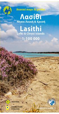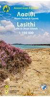
Wegenkaart - landkaart 92 Kreta oost - Lasithi | Anavasi

0
Gebaseerd op topografische kaarten, GPS compatible, gedrukt op watervast en scheurvast papier. Hoogtelijnen met 100 m interval, schaduwkleuren en punten met hoogte geven de topografie van het landschap aan. De kaart kent een UTM grid. Het wegennet wordt aangeduid met verschillende gradaties: grote en kleine wegen, verhard en onverhard. Toeristisch...

Verkopers met dit product

Verkoper
Bezorging
Prijs
DeZwerver.nl logo
DeZwerver.nl
2,95
11,95

Anderen bekeken ook

Nieuw
Wandelgids Eastern Crete - Kreta oost | Sunflower books
Wandelgids voor het oosten van Kreta: vele dagtochten worden degelijk beschreven met openbaar vervoer informatie, goede routebeschrijvingen en kaartmateriaal. Tevens enkele autotochten. Deze gids staat goed bekend! Engelstalig, want Nederlandstalige is uitverkocht en niet meer leverbaar. Whether you walk, drive or picnic in eastern Crete, the mountains will be your constant companions, changing colour and mood from dawn to dusk, as you move through them, round them and over them. You cannot fail to feel their dramatic attraction. The stunning colours and heady scent of flowers and herbs, tucked into rough ground or splashed across a hillside, the warm-sounding buzz of hovering bees, and the massed band of a thousand cicadas will all leave a lasting impression – the ‘special effects’ of the total scene. You may share this rural bliss only with a solitary shepherd, his flocks and dogs, as you walk the hillsides of eastern Crete. Greeks, on the whole, don’t walk — unless they have to for…
23,50
Reisgids Mini Rough Guide Crete (Kreta) | Rough Guides
This pocket-sized travel guide to Crete is a convenient, quick-reference companion to discovering what to do, what to see and how to get around the destination. It covers top attractions like Hania, Moni Toploi, Gortys, as well as hidden gems, including Evraiki and Gavdos. Our Crete guide book will save you time and enhance your exploration of this fascinating region.   This Crete travel guide has been fully updated post-COVID-19. This Mini Rough Guide to CRETE covers: Iraklio, Central Crete, Eastern Crete, Western Crete, Excursion to Santorini. In this guide book to Crete you will find: RECOMMENDATIONS FOR EVERY TYPE OF TRAVELLER Experiences selected for every kind of trip to Crete, from cultural explorations in Rethymno to family activities in child-friendly places, like Agia Pelagia or chilled-out breaks in popular tourist areas, like Knossos.   TOP TEN ATTRACTIONSThis Crete travel guide covers the destination's top ten attractions not to miss, including Agios Nikolaos, Archaeologi…
12,50
Nieuw
Wegenkaart - landkaart 6 Crete - Kreta | Anavasi
Handige kleine wegenkaart van Kreta.   Crete is a big island, and a general map is necessary to plan your travel. But to better discover Crete you need to leave the car behind, and go hiking in the wild side of the island. There are here 7 hiking destinations with pictures, map and descriptions, to inspire you to explore the Cretan countryside. Crete R6 is a simple and inexpensive road map, ideal for short visits or planning long routes.   Printed on plain paper.
7,95
Nieuw
Wegenkaart - landkaart 8 Kreta - Oostelijk deel | Road Editions
On a scale of 1:100,000, which is the most detailed scale available for a map of Crete, you will find the most detailed road network ever to have appeared on a map of Crete, a precise geophysical background (in cooperation with the Hellenic Military Geographic Service), all the island's hydrography and the greatest wealth of information of interest to the traveller: All the archaeological sites, monasteries, country chapels and castles. Nature lovers and hikers will be overjoyed by the mapping of E4 trail and all its side trails, the mountain refuges, the mountain peaks, the canyons and the gorges.
10,95
Nieuw
Wandelkaart - Fietskaart - Wegenkaart - landkaart 450 Eastern Crete - Kreta Oost | Terrain maps
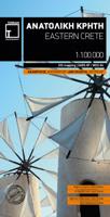
Gedetailleerde wegenkaart en wandelkaart met alle kleine wegen, wandelpaden, hoogtelijnen en toeristische informatie aangegeven. Alle tekst is tweetalig in Engels en Grieks en de waterproof kaart is geschikt voor gebruik met GPS. Terrain’s map of Eastern Crete provides travelers with everything they need:  Scale of 100.000, which attributes all the information with clarity and in detail.  Map data processed within a GIS environment, resulting in great accuracy.  Double coordinate system, WGS 84 and ΕΓΣΑ 87, completely compatible with GPS.  It is printed on Polyart material, making it totally waterproof and rip-proof. You can fold it and unfold it a hundred times, fold it in irregular ways, dunk it in the sea or leave it out in the rain. This map is indestructible!  Clear symbols, easily readable fonts, rich colors and excellent arrangement of every element make the map extremely friendly to the user.  Unique wealth of information. Every village, every road (including their dista…
12,50
Wandelatlas Adventure Atlas Crete - Kreta | Anavasi
Gedetailleerde atlas van heel Kreta: topografische kaarten met alle noodzakelijke details als hoogtelijnen, kleurschakeringen en bergtoppen. Naast deze kenmerken is ook de E4 ingetekend, een lange afstand wandeling op Kreta van west naar oost. Met symbolen zijn cultuur-historische hoogtepunten ingetekend. Achterin een uitgebreid register. Uitgevoerd in een atlas, harde kaft, A4 formaat. The new ADVENTURE ATLAS of Crete by ANAVASI is the ultimate tool to discover the island. Find all the information you need to go hiking, canyoning, climbing, swimming on beautiful beaches, explore abandoned villages, minoan peak sanctuaries, cave-churches, byzantine and ottoman castles. Whatever you want to visit in Crete you will find it in the 52 plates of this Atlas.  
34,95
Wandelkaart Tour & Trail Western Crete - West Kreta | Discovery Walking Guides
Goede, scheur- en watervaste, wandelkaart van west Kreta, met name het wandelgebied rond Lefka Ori en de Samaria Kloof. For your best adventures, use the best map. Water-proof, split-proof, tear-proof. Western Crete Tour & Trail Super-Durable Map is simply the toughest, most accurate, easy to read, easy to use map that you can buy at any price. A large 960mm by 694mm double sided map sheet at 1:40,000 scale covers area of over 1600km2, from Paleochora in the west to Preveli beach in the east. The map covers the most important hiking regions in the western Crete, including the famous Samaria Gorge, Lefka Ori (White Mountains) and much more. Our legendary 'Tour & Trail' level of detail ranges from major roads to secondary roads to minor roads to streets and narrow country roads, plus dirt roads, tracks and walking trails. Place names are in English and Greek to aid your navigation. Altitude shading is designed to clearly show the altitude range when travelling across the island by car o…
15,95
Nieuw
Reisgids Crete - Kreta | Rough Guides
Zeer goede reisgids voor zowel de georganiseerde maar vooral voor de zelfstandige reiziger. Boordevol informatie over reizen, slapen, eten, maar ook musea en cultuur. Voor Europese landen meestal completer en beter dan de Lonely Planet ! Discover Crete with this comprehensive, entertaining, 'tell it like it is' Rough Guide, packed with exhaustive practical information and our experts' honest independent recommendations. Whether you plan to trek down the Samariá Gorge, while away the hours on Crete's idyllic beaches or explore its many off-shore islands, The Rough Guide to Crete will show you the perfect places to explore, sleep, eat, drink and shop along the way.   Features of The Rough Guide to Crete: Detailed regional coverage: provides in-depth practical information for every step of every kind of trip, from intrepid off-the-beaten-track adventures, to chilled-out breaks in popular tourist areas. Regions covered include: Iráklio, Lasíthi, Réthymno and Haniá. Honest independent revi…
23,95
Nieuw
Wegenkaart - landkaart Kreta | Marco Polo
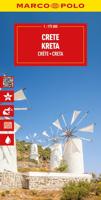
Goede wegenkaart voorzien van alle noodzakelijke aanduidingen. Daarnaast bijvoorbeeld ook campings, mooie wegen e.d. Crete on a double-sided, indexed map in MairDumont's Marco Polo series, with four street plans, plus special features to make route planning and navigating easier: a fold-out flap in the jacket shows the whole island highlighting popular locations, with the grid reference system in the margins making it easier to find various places on the main map.  Road network shows main and secondary roads with driving distances and highlights scenic routes. Smaller country roads or tracks, presented in white on a background with relief shading, are perhaps less clear to see than on maps with altitude colouring. In addition to the shading, topography is presented by numerous peaks and names of mountain ranges. E4 long-distance hiking route is marked, both the section across the central mountains and the variant along the south coast. Picturesque towns, places of interest and landsca…
14,95
Wegenkaart - landkaart Nunavut - Northwest Territories | ITMB
The far north of Canada, north of 60 degrees, consists of three territories; the Yukon, the Northwest Territories, and Nunavut. Until now, there has never been a proper map of the territory that was carved off from the NWT a quarter century ago. With only 30,000 people and a scattering of settlements, Nunavut is larger than western Europe in area. This map took us years to prepare, using 1:250,000 government topo maps as a base and tracing thousands of little lakes. The traditional passageway of the fabled Northwest Passage is also shown. The most northerly civilian community in the world is on the map – Grise Bay, as well as Alert, the most remote place on earth. Originally, the NWT covered all of northwestern North America west of the Louisiana Purchase and the Loyalist colonies, and north of the Spanish provinces (essentially north of current day Sactamento). Political changes have reduced its size over the past century and a half to the region of Canada north of the 60th parallel …
13,95

Klanten-reviews van Wegenkaart - landkaart 92 Kreta oost - Lasithi | Anavasi

Er zijn nog geen beoordelingen voor dit productBen jij de eerste die een review plaatst?

Meer over Wegenkaart - landkaart 92 Kreta oost - Lasithi | Anavasi

Productomschrijving

Gebaseerd op topografische kaarten, GPS compatible, gedrukt op watervast en scheurvast papier. Hoogtelijnen met 100 m interval, schaduwkleuren en punten met hoogte geven de topografie van het landschap aan. De kaart kent een UTM grid.

Het wegennet wordt aangeduid met verschillende gradaties: grote en kleine wegen, verhard en onverhard. Toeristische bezienswaardigheden staan als zodanig aangeduid zoals thermen, kloosters, berghutten, grotten etc. Namen van steden zowel in het normale schrift als in het Grieks, met een legenda die ook in het Engels is.

Van de uitgever

This map includes all the information a traveler needs to discover Eastern Crete. It includes the entire road network from the biggest arteries to the smallest dirt roads, paths and trails, all the towns and villages, beaches and toponyms. In addition to the above, you will find the E4 route from Dikti to Zakros that crosses the entire inland of Eastern Crete. On the reverse side you will find sections of the E4 route with elevation profiles as well as an index of settlements so you can easily locate them on the map. It also contains a city plan of Aghios Nikolaos, the capital of Lasithi.   Printed on waterproof & tear resistant polyart paper.

Verken gerelateerde categorieën

Webshop.nl maakt gebruik van cookies. Ga je verder op onze website, ga dan akkoord met het plaatsen van cookies en de verwerking van deze data door ons en vermelde partners.