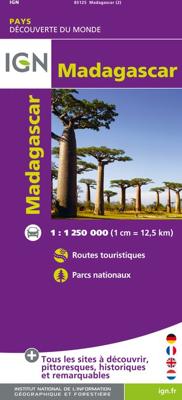
Wegenkaart - landkaart 85125 Madagascar | IGN - Institut Géographique National

0
Goede overzichtskaart van het Franse Cartografisch Instituut. Met autoroutes en toeristische informatie. Detailed map of Madagascar published by IGN. This road map of Madagascar includes roads and tourist information (national parks, etc.). Terrain mapping. Scale 1 : 1,250,000 (1 cm = 12.5 km)....

Verkopers met dit product

Verkoper
Bezorging
Prijs
DeZwerver.nl logo
DeZwerver.nl
2,95
11,75

Anderen bekeken ook

Wegenkaart - landkaart Burkina Faso | IGN - Institut Géographique National
Goede overzichtskaart van het Franse Cartografisch Instituut. Met autoroutes en stadsplattegronden van de belangrijkste steden. General map of the country with relief shading, showing a large number of small villages and settlements. Roads are classified according to their usability in wet conditions. Towns with accommodation are marked, as are fuelling stations. Nature reserves and rivers, both permanent and intermittent, are also shown. Latitude and logitude at intervals of 1 degree are marked in the margins and indicated by ticks on the map itself. Four insets show simple street plans of Ouagadougou and Bobo-Dioulasso, administrative divisions of the country, and the distribution of its ethnic groups. The legend is in French only.  
11,75
Wegenkaart - landkaart 85001 Mauritius - île Maurice | IGN - Institut Géographique National
Duidelijke wegenkaart van Mauritius met een gedetailleerde schaal van 1:85.000 waardoor veel detail zichtbaar is. Alle gehuchten en bewoningen staan vermeld, maar ook met symbolen aangegeven bezienswaardigheden en bijvoorbeeld mooie stranden en nationale parken.  With this range IGN produces all purpose maps for many overseas countries, many of which have been under French rule in the past. Maps in this range are printed at scales which vary according to coverage area. These are ideal for touring and are suitable as a reference for those driving hire-cars. The up-to-date mapping provides a wealth of coloured road and track information plus place names, railway line routes etc. Many map symbols are used to locate and quickly identify points of interest, and the multilingual legend has English, French, German and Italian translations.Laminated:This laminated weatherproof map is the last word in durability and will outlast many other apparently similar products. The map is covered in tou…
11,95
Wegenkaart - landkaart 19 Corsica mini region | IGN - Institut Géographique National
Goed leesbare wegenkaart van Corsica. Anders dan de gewone kaart is deze in klein formaat gevouwen, past makkelijk in je jaszak.   Regionale kaart 1:200.000 van Frankrijk, IGN: Wegenkaart met afstandsaanduiding, toeristische informatie en spoorwegen met stations, nationale en regionale parken zijn duidelijk aangegeven. De kaart bevat ook kaartjes van het centrum van de grote steden in de regio, met straatnaamregister. De legenda is ook in Engels.   Corsica is part of IGN's 1:200 000 Regional Road & Tourist series. The map features super clear road detail, showing everything from major motorways to small secondary roads. Toll sections are marked along with the location of the toll gates, the location of the fixed speed cameras is given, service areas and rest areas are shown and junction numbers are clearly marked. All of the bigger roads indicate intermediate road distances.   The map is aimed at the tourist and, as such, shows the location of many places of interest including town…
7,95
Wegenkaart - landkaart Madagascar | ITMB
Een degelijke kaart met aanduidingen van o.a. nationale parken, vliegveld, benzinepomp, dirt-roads en kleine plattegrond van hoofdstad. Als overzichtskaart goed te gebruiken. Tweezijdig! IThe large island off the east coast of Africa is Madagascar. The actual name of the country is the Malagasy Republic, but the public is much more likely to know the country by its island name, so we call our map by the island’s name, rather than using the country name. Makes sense to us! Regardless, this is a major touristic destination. The double-sided map covers the island in great detail, with an inset map of the capital city, Antananarivo. As with other ITMB maps, this one includes a listing of ‘must see’ attractions, such as Tsingy National Park and the famous Lemur’s Park. The island also has a regular surface route to the Comoro Islands, which are also included on this map. Legend Includes: Railroads, Forest, Mational Park, International Airport, Domestic Airport, Fort, holtel, Cave, Museum, …
13,95
Wegenkaart - landkaart Madagascar - Madagaskar | Freytag & Berndt
Uitstekende, dubbelzijdige kaart van Madagascar. Met index, Nationale parken en afstanden in kilometers. Met Mauritius en Réunion er ook nog op. Explore Madagascar with this Freytag & Berndt double-sided road map. The best way to plan your trip, prepare your itinerary, and to travel independently in this country. As with all Freytag & Berndt maps the cartography is clear and detailed with the topography shown by relief shading with plenty of spot heights.   The map also includes an inset showing the Comoros Islands and Mayotte at the same scale as the main map.   Tourist information and places of interest are clearly marked by a range of icons, including:    railways, local airports and ferry routes campsites beaches diving and windsurfing sites UNESCO sites spas, wells and caves   Distances between points are shown as well as indications of steep gradients, all distances are in kilometres. The legend is in several languages inlcuding English.    
14,95
Wegenkaart - landkaart 85203 Quebec | IGN - Institut Géographique National
A topographical map of Quebec, Canada in colour, with tourist routes, city details, and national parks clearly outlined.  Certaines régions du monde présentent une richesse touristique et culturelle extraordinaire et demeurent des destinations mythiques. Pour vous accompagner dans votre voyage vers ces contrées extraordinaires, l’IGN met à votre disposition 24 cartes, aux échelles allant du 1 :50 000ème au 1 :750 000ème. Les cartes du Québec, de la Toscane, de la Californie, tout comme celles de la Costa Del Sol, de la Floride ou des Cyclades - et bien d’autres destinations encore ! - vous attendent pour le voyage de vos rêves.
11,75
Wegenkaart - landkaart Canada | ITMB
Een degelijke kaart met aanduidingen van o.a. nationale parken, vliegveld, benzinepomp, dirt-roads en kleine plattegrond van hoofdstad. Well, it’s about time, eh?!? ITMB, after only thirty years on the go, finally gets around to publishing a map of Canada. When we first started mapping, there was a pressing need for good maps of Central and South America, then of Africa, then etc etc and we never found time to concentrate on our own country until fairly recently. This map was prepared by Natural Resources Canada and is, as a result, as accurate a map as one could hope to have. We are very proud of it, and very pleased to be able to use such top-rate cartography. The map covers all of the land mass of Canada, from its southernmost point to the top of Ellesmere Island and from the Atlantic coast to the Pacific. It’s an excellent map, but I’m going to give one proviso. Canada is the second-largest country on the face of the planet and there is no way that a single-sided sheet can portray…
13,95
Wegenkaart - landkaart - Wandelkaart 84974 La Reunion | IGN - Institut Géographique National
Goede en overzichtelijke wegenkaart van La Reunion met toeristische informatie (onder andere GR routes) en afstanden tabel. IGN (Institut Geographique National) is de autoriteit op het gebied van kaarten in Frankrijk. Of het nu gaat om wegenkaarten, wandelkaarten, fietskaarten of klimkaarten, IGN heeft het in het assortiment. De kaarten worden wereldwijd geroemd om de goede leesbaarheid en het aantrekkelijke kleur- en schaduwgebruik. Naast de gedetailleerde kaarten van Frankrijk, levert IGN ook kaarten van bestemmingen over de hele wereld, of speciale themakaarten.
12,95
Wegenkaart - landkaart Siberia - Siberië | ITMB
Een degelijke kaart met aanduidingen van o.a. nationale parken, vliegveld, benzinepomp, dirt-roads en kleine plattegrond van hoofdstad. Als overzichtskaart goed te gebruiken. Can you name anyone who has published a detailed map of Siberia? I cannot! This is one of the largest geographical regions on earth, comparable in magnitude to the Sahara or Gobi desert areas, or the vast Prairie regions of Canada, but it has never had a travel map. Well, now it does and the last frontier of mapping the world has been breached. The part of Russia east of the Ural Mountains is vast; there is no other word to describe the enormity of this region of grassland and tundra. Technically, it does not extend all the way to the Pacific Ocean, but it does go from the Arctic Ocean to the Chinese and Mongolian borders. This is not a part of the world well travelled, but it could become so with a good, detailed map. We start in the west at Omsk on the Irtysh River, where the northern and southern branches of t…
13,95

Klanten-reviews van Wegenkaart - landkaart 85125 Madagascar | IGN - Institut Géographique National

Er zijn nog geen beoordelingen voor dit productBen jij de eerste die een review plaatst?

Meer over Wegenkaart - landkaart 85125 Madagascar | IGN - Institut Géographique National

Productomschrijving

Goede overzichtskaart van het Franse Cartografisch Instituut. Met autoroutes en toeristische informatie.

Detailed map of Madagascar published by IGN. This road map of Madagascar includes roads and tourist information (national parks, etc.). Terrain mapping. Scale 1 : 1,250,000 (1 cm = 12.5 km).

Productinformatie

    Verken gerelateerde categorieën

    Webshop.nl maakt gebruik van cookies. Ga je verder op onze website, ga dan akkoord met het plaatsen van cookies en de verwerking van deze data door ons en vermelde partners.