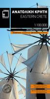
Wegenkaart - landkaart 8 Kreta - Oostelijk deel | Road Editions

0
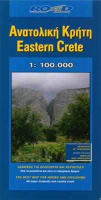
On a scale of 1:100,000, which is the most detailed scale available for a map of Crete, you will find the most detailed road network ever to have appeared on a map of Crete, a precise geophysical background (in cooperation with the Hellenic Military Geographic Service), all the island's hydrography and the greatest wealth of information of interes...

Verkopers met dit product

Verkoper
Bezorging
Prijs
DeZwerver.nl logo
DeZwerver.nl
2,95
10,95

Anderen bekeken ook

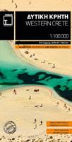
Wandelkaart - Fietskaart - Wegenkaart - landkaart 448 Western Crete - Kreta West | Terrain maps
Gedetailleerde wegenkaart en wandelkaart met alle kleine wegen, wandelpaden, hoogtelijnen en toeristische informatie aangegeven. Alle tekst is tweetalig in Engels en Grieks en de waterproof kaart is geschikt voor gebruik met GPS. Terrain’s map of Western Crete provides travelers with everything they need:    Scale of 100.000, which attributes all the information with clarity and in detail.  Map data processed within a GIS environment, resulting in great accuracy.  Double coordinate system, WGS 84 and ΕΓΣΑ 87, completely compatible with GPS.  It is printed on Polyart material, making it totally waterproof and rip-proof. You can fold it and unfold it a hundred times, fold it in irregular ways, dunk it in the sea or leave it out in the rain. This map is indestructible!  Clear symbols, easily readable fonts, rich colors and excellent arrangement of every element make the map extremely friendly to the user.  Unique wealth of information. Every village, every road (including their dis…
12,50
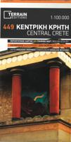
Wandelkaart - Fietskaart - Wegenkaart - landkaart 449 Central Crete - Kreta centraal | Terrain maps
Gedetailleerde wegenkaart en wandelkaart met alle kleine wegen, wandelpaden, hoogtelijnen en toeristische informatie aangegeven. Alle tekst is tweetalig in Engels en Grieks en de waterproof kaart is geschikt voor gebruik met GPS. Terrain’s map of Central Crete provides travelers with everything they need:  Scale of 100.000, which attributes all the information with clarity and in detail.  Map data processed within a GIS environment, resulting in great accuracy.  Double coordinate system, WGS 84 and ΕΓΣΑ 87, completely compatible with GPS.  It is printed on Polyart material, making it totally waterproof and rip-proof. You can fold it and unfold it a hundred times, fold it in irregular ways, dunk it in the sea or leave it out in the rain. This map is indestructible!  Clear symbols, easily readable fonts, rich colors and excellent arrangement of every element make the map extremely friendly to the user.  Unique wealth of information. Every village, every road (including their dista…
12,50
Wandelkaart - Fietskaart - Wegenkaart - landkaart 450 Eastern Crete - Kreta Oost | Terrain maps
Gedetailleerde wegenkaart en wandelkaart met alle kleine wegen, wandelpaden, hoogtelijnen en toeristische informatie aangegeven. Alle tekst is tweetalig in Engels en Grieks en de waterproof kaart is geschikt voor gebruik met GPS. Terrain’s map of Eastern Crete provides travelers with everything they need:  Scale of 100.000, which attributes all the information with clarity and in detail.  Map data processed within a GIS environment, resulting in great accuracy.  Double coordinate system, WGS 84 and ΕΓΣΑ 87, completely compatible with GPS.  It is printed on Polyart material, making it totally waterproof and rip-proof. You can fold it and unfold it a hundred times, fold it in irregular ways, dunk it in the sea or leave it out in the rain. This map is indestructible!  Clear symbols, easily readable fonts, rich colors and excellent arrangement of every element make the map extremely friendly to the user.  Unique wealth of information. Every village, every road (including their dista…
12,50
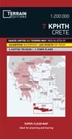
Wegenkaart - landkaart - Fietskaart 7 Crete - Kreta | Terrain maps
Gedetailleerde wegenkaart en wandelkaart met alle kleine wegen, wandelpaden, hoogtelijnen en toeristische informatie aangegeven. Alle tekst is tweetalig in Engels en Grieks en de waterproof kaart is geschikt voor gebruik met GPS.   The ideal map for planning your trip, as well as the journey itself – if you belong to the 99% of the island’s visitors, who have no intention whatsoever to take the narrowest dirt path leading to the remotest beach of the island! This map is very practical, at a scale of 1:200.000 which allows for a detailed presentation of the road network and sights without the exhaustive detail only the travelers – explorers are interested in.    We made this map based on our archival series of 1:100.00 Crete maps. We omitted all secondary dirt roads and loads of other unnecessary little roads, magnified the symbols and width of the roads for better visibility, and made colors more vibrant. All this makes for the best general map of Crete on the market!    Naturally, we…
13,50
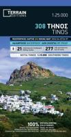
Wandelkaart - Wegenkaart - landkaart 308 Tinos | Terrain maps
Gedetailleerde wegenkaart en wandelkaart met alle kleine wegen, wandelpaden, hoogtelijnen en toeristische informatie aangegeven. Alle tekst is tweetalig in Engels en Grieks en de waterproof kaart is geschikt voor gebruik met GPS. This is a great map of Tinos because:   •    It is waterproof and rip-proof. You can fold and unfold it a thousand times, fold it in irregular ways, dunk it in the sea or leave it out in the rain. This map is indestructible!    •    It is the first time the island’s entire coastline is mapped. Cartography was done with TERRAIN’s specially equipped and staffed cartographic vessel. This means that you can locate all beaches of the island, down to the tiniest cove! In fact, the special features of every single beach are recorded: whether it is sandy or pebbled, whether it features natural tree shade, water, a beach bar or organized water sports, whether the seabed in front of the beach is sandy or rocky (so that you will know where to anchor).    •    It feature…
12,50
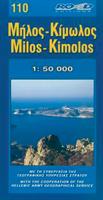
Wegenkaart - landkaart 110 Milos Kimolos | Road Editions
Gedetailleerde wegenkaart met aanduiding van de wandelwegen, lijst van hotels en toeristische informatie. Voor alle doeleinden een zeer geschikte kaart. Though not among the top ten most popular destinations in the Aegean, these are two beautiful islands with a unique character, ideal for quiet family holidays, and nature touring, as well as for the young crowd looking for exciting summer fun. This is the best, most updated and easy to read map available of Milos and Kimolos. As all ROAD maps, it was designed following careful and exhaustive onsite research. We used the most advanced technology to precisely map the entire road networks of these two islands, we measured the distances in kilometers from intersection to intersection with precision instruments, marked all country churches, monasteries, archaeological sites and castles on these islands, as we did the beaches and the roads leading to them, the altitudes of mountain peaks, the footpaths we were able to locate and record, the…
9,95
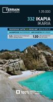
Wandelkaart - Wegenkaart - landkaart 332 Ikaria | Terrain maps
Gedetailleerde wegenkaart en wandelkaart met alle kleine wegen, wandelpaden, hoogtelijnen en toeristische informatie aangegeven. Alle tekst is tweetalig in Engels en Grieks en de waterproof kaart is geschikt voor gebruik met GPS. THIS IS THE BEST MAP OF IKARIA BECAUSE: • It is the only map of Ikaria made with data collected 100% through field survey. • It comes in a more detailed scale than other map in the market. • For the first time, the entire trail network of Ikaria is shown with absolute accuracy. All trails have been measured in kilometers, so you can estimate the duration of your hike. On the back side you ‘ll find detailed descriptions of 11 of the best hikes in Ikaria. These are distinctly labeled on the map, so you can easily locate them. • It features the most complete road network, with scenic routes marked in green. • It is printed on Polyart plastic “paper”, making it totally waterproof and rip-proof. You can fold it and unfold it a hundred times, fold it in irregular w…
12,50
Wandelkaart Tour & Trail Western Crete - West Kreta | Discovery Walking Guides
Goede, scheur- en watervaste, wandelkaart van west Kreta, met name het wandelgebied rond Lefka Ori en de Samaria Kloof. For your best adventures, use the best map. Water-proof, split-proof, tear-proof. Western Crete Tour & Trail Super-Durable Map is simply the toughest, most accurate, easy to read, easy to use map that you can buy at any price. A large 960mm by 694mm double sided map sheet at 1:40,000 scale covers area of over 1600km2, from Paleochora in the west to Preveli beach in the east. The map covers the most important hiking regions in the western Crete, including the famous Samaria Gorge, Lefka Ori (White Mountains) and much more. Our legendary 'Tour & Trail' level of detail ranges from major roads to secondary roads to minor roads to streets and narrow country roads, plus dirt roads, tracks and walking trails. Place names are in English and Greek to aid your navigation. Altitude shading is designed to clearly show the altitude range when travelling across the island by car o…
15,95
Wegenkaart - landkaart Wales & south of England - Zuid Engeland | ITMB
Een degelijke kaart met aanduidingen van o.a. nationale parken, vliegveld, benzinepompen. We are gradually increasing the scales for our data of Great Britain and this is our latest effort. Most visitors to the UK fly into one of London's four airports and combine a visit to the city with an opportunity to travel to various destinations within striking distance of London. England is so incredibly rich in heritage and scenic attractions that it is extremely difficult to portray the country as a map of the entire entity. As a result, England lends itself nicely to be divided into a central/northern portion and a southern portion. To fit areas as diverse as Cornwall and Norwich on one sheet, one needs to have a vertical frame, with Devon/Cornwall up to the top of Wales on one side and Wiltshire to Kent up to York (admittedly, not normally considered to be part of 'southern', but vertically, that's what happens. At this scale, all of southern England and all of Wales can be shown in good …
13,95
Wegenkaart - landkaart 04 Icefields Parkway | Gem Trek Maps
Whether you have a day or a week to spend exploring the sights along the spectacular Icefields Parkway highway, Gem Trek's ICEFIELDS PAKRWAY MAP, a combination map and guide, will help you make the most of your time. Like our much-loved hiking maps, our Icefields Parkway map features detailed cartography and is printed on waterproof and tear-resistant paper.   The Icefields Parkway Map shows all viewpoints, picnic areas, trailheads, campgrounds, hostels, lodges and other services along the Icefields Parkway, while the descriptions in the guide point you to the best of these - the best viewpoints of mountains and lakes, the most interesting points of interest and exhibits, and the best bets for spotting wildlife such as moose, bighorn sheep and mountain goats.   Also included are short descriptions of the ten best walks and day hikes along the Icefields Parkway—from the short stroll to Peyto Lake Viewpoint to the rewarding hike through alpine meadows to Helen Lake.   To make it easier …
13,95

Klanten-reviews van Wegenkaart - landkaart 8 Kreta - Oostelijk deel | Road Editions

Er zijn nog geen beoordelingen voor dit productBen jij de eerste die een review plaatst?

Meer over Wegenkaart - landkaart 8 Kreta - Oostelijk deel | Road Editions

Productomschrijving

On a scale of 1:100,000, which is the most detailed scale available for a map of Crete, you will find the most detailed road network ever to have appeared on a map of Crete, a precise geophysical background (in cooperation with the Hellenic Military Geographic Service), all the island's hydrography and the greatest wealth of information of interest to the traveller: All the archaeological sites, monasteries, country chapels and castles. Nature lovers and hikers will be overjoyed by the mapping of E4 trail and all its side trails, the mountain refuges, the mountain peaks, the canyons and the gorges.

Verken gerelateerde categorieën

Webshop.nl maakt gebruik van cookies. Ga je verder op onze website, ga dan akkoord met het plaatsen van cookies en de verwerking van deze data door ons en vermelde partners.