webshop.nl
Categorieën
  Sluiten

Meer Freytag & Berndt

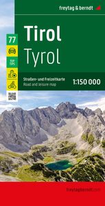
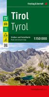
Wegenkaart - landkaart 77 Tirol | Freytag & Berndt

Gedetailleerde wegenkaart van een deel van Oostenrijk. Deze kaart is bijzonder duidelijk leesbaar en door de schaal met veel details als campings, berghutten, hoofdwandelroutes en alle berijdbare wegen en plaatsen. Met register This is  a series of detailed road maps at 1:150,000 from Freytag & Berndt   The road and leisure map of Tyrol on a scale...
14,95

Webshops met dit product

Webshop
Bezorging
Prijs

Anderen bekeken ook

Wegenkaart - landkaart 77 Tirol | Freytag & Berndt
Gedetailleerde wegenkaart van een deel van Oostenrijk. Deze kaart is bijzonder duidelijk leesbaar en door de schaal met veel details als campings, berghutten, hoofdwandelroutes en alle berijdbare wegen en plaatsen. Met register This is  a series of detailed road maps at 1:150,000 from Freytag & Berndt   The road and leisure map of Tyrol on a scale of 1:150,000 contains a lot of information that is useful and helpful for a trip to the west of Austria. The complex road and rail network is shown in detail and many regional cycle paths and long-distance cycle paths are shown on the map. Tourist roads and scenic roads are highlighted in color and many attractive destinations are visible.   The Top Tips series offers a brief summary of the ten most attractive places in Tyrol and their sights. All texts are also translated into English. Popular tourist attractions include Innsbruck's old town, the Kufstein Fortress or Landeck Castle. Nature lovers can visit the Karwendel Nature Park and f…
14,95
Wegenkaart - landkaart Vorarlberg | Freytag & Berndt
Gedetailleerde wegenkaart van een deel van Oostenrijk. Deze kaart is bijzonder duidelijk leesbaar en door de schaal met veel details als campings, berghutten, hoofdwandelroutes en alle berijdbare wegen en plaatsen. Met register. Top 10 Tips" Map in a series of detailed road maps at 1:150,000 from Freytag & Berndt, covering popular tourist regions of Italy and highlighting each area's top 10 sights, all with brief descriptions in the accompanying booklets which also provide street plan(s) of main town(s) in the region.   Relief is portrayed by hill-shading without distracting from other detail. Road network shows minor roads and selected cart tracks, and includes information indispensable for happy holiday driving: motorway service stations and motels, gradients on steep roads, restricted entry for cars or caravans and seasonal closures, routes not recommended for caravans, scenic roads and special tourist routes, etc. Railways, cable cars, and ferry connections also shown, as well as s…
14,95
Wegenkaart - landkaart Niederösterreich | Freytag & Berndt
Uitstekende overzichtskaart, tweezijdig, met register, met veel details, alle berijdbare wegen etc.    Top 10 Tips" Map in a series of detailed road maps at 1:150,000 from Freytag & Berndt, covering popular tourist regions of Italy and highlighting each area's top 10 sights, all with brief descriptions in the accompanying booklets which also provide street plan(s) of main town(s) in the region.   Relief is portrayed by hill-shading without distracting from other detail. Road network shows minor roads and selected cart tracks, and includes information indispensable for happy holiday driving: motorway service stations and motels, gradients on steep roads, restricted entry for cars or caravans and seasonal closures, routes not recommended for caravans, scenic roads and special tourist routes, etc. Railways, cable cars, and ferry connections also shown, as well as selected long--distance hiking trails.   Picturesque towns are highlighted and 10 selected places of interest are prominently m…
14,95
Wegenkaart - landkaart Kärnten - Karinthië | Freytag & Berndt
Gedetailleerde wegenkaart van een deel van Oostenrijk. Deze kaart is bijzonder duidelijk leesbaar en door de schaal met veel details als campings, berghutten, hoofdwandelroutes en alle berijdbare wegen en plaatsen. Met register. Uitstekende overzichtskaart, tweezijdig, met register, met veel details, alle berijdbare wegen etc.    Top 10 Tips" Map in a series of detailed road maps at 1:150,000 from Freytag & Berndt, covering popular tourist regions of Italy and highlighting each area's top 10 sights, all with brief descriptions in the accompanying booklets which also provide street plan(s) of main town(s) in the region.   Relief is portrayed by hill-shading without distracting from other detail. Road network shows minor roads and selected cart tracks, and includes information indispensable for happy holiday driving: motorway service stations and motels, gradients on steep roads, restricted entry for cars or caravans and seasonal closures, routes not recommended for caravans, scenic road…
14,95
Wegenkaart - landkaart Salzburg - Salzburgerland | Freytag & Berndt
Uitstekende overzichtskaart, tweezijdig, met register, met veel details, alle berijdbare wegen etc.    Top 10 Tips" Map in a series of detailed road maps at 1:150,000 from Freytag & Berndt, covering popular tourist regions and highlighting each area's top 10 sights, all with brief descriptions in the accompanying booklets which also provide street plan(s) of main town(s) in the region.   Relief is portrayed by hill-shading without distracting from other detail. Road network shows minor roads and selected cart tracks, and includes information indispensable for happy holiday driving: motorway service stations and motels, gradients on steep roads, restricted entry for cars or caravans and seasonal closures, routes not recommended for caravans, scenic roads and special tourist routes, etc. Railways, cable cars, and ferry connections also shown, as well as selected long--distance hiking trails.   Picturesque towns are highlighted and 10 selected places of interest are prominently marked and…
14,95
Wegenkaart - landkaart 33 Burgenland - Oostenrijk | Freytag & Berndt
Uitstekende overzichtskaart, tweezijdig, met register, met veel details, alle berijdbare wegen etc.    Top 10 Tips" Map in a series of detailed road maps at 1:150,000 from Freytag & Berndt, covering popular tourist regions of Italy and highlighting each area's top 10 sights, all with brief descriptions in the accompanying booklets which also provide street plan(s) of main town(s) in the region.   Relief is portrayed by hill-shading without distracting from other detail. Road network shows minor roads and selected cart tracks, and includes information indispensable for happy holiday driving: motorway service stations and motels, gradients on steep roads, restricted entry for cars or caravans and seasonal closures, routes not recommended for caravans, scenic roads and special tourist routes, etc. Railways, cable cars, and ferry connections also shown, as well as selected long--distance hiking trails.   Picturesque towns are highlighted and 10 selected places of interest are prominently m…
14,95
Wegenkaart - landkaart Kärnten - Karinthië | Freytag & Berndt
Gedetailleerde wegenkaart van een deel van Oostenrijk. Deze kaart is bijzonder duidelijk leesbaar en door de schaal met veel details als campings, berghutten, hoofdwandelroutes en alle berijdbare wegen en plaatsen. Met register. Uitstekende overzichtskaart, tweezijdig, met register, met veel details, alle berijdbare wegen etc.    Top 10 Tips" Map in a series of detailed road maps at 1:150,000 from Freytag & Berndt, covering popular tourist regions of Italy and highlighting each area's top 10 sights, all with brief descriptions in the accompanying booklets which also provide street plan(s) of main town(s) in the region.   Relief is portrayed by hill-shading without distracting from other detail. Road network shows minor roads and selected cart tracks, and includes information indispensable for happy holiday driving: motorway service stations and motels, gradients on steep roads, restricted entry for cars or caravans and seasonal closures, routes not recommended for caravans, scenic road…
14,95
Wegenkaart - landkaart Salzburg - Salzburgerland | Freytag & Berndt
Uitstekende overzichtskaart, tweezijdig, met register, met veel details, alle berijdbare wegen etc.    Top 10 Tips" Map in a series of detailed road maps at 1:150,000 from Freytag & Berndt, covering popular tourist regions and highlighting each area's top 10 sights, all with brief descriptions in the accompanying booklets which also provide street plan(s) of main town(s) in the region.   Relief is portrayed by hill-shading without distracting from other detail. Road network shows minor roads and selected cart tracks, and includes information indispensable for happy holiday driving: motorway service stations and motels, gradients on steep roads, restricted entry for cars or caravans and seasonal closures, routes not recommended for caravans, scenic roads and special tourist routes, etc. Railways, cable cars, and ferry connections also shown, as well as selected long--distance hiking trails.   Picturesque towns are highlighted and 10 selected places of interest are prominently marked and…
14,95

Klanten-reviews van Wegenkaart - landkaart 77 Tirol | Freytag & Berndt

Er zijn nog geen beoordelingen voor dit productBen jij de eerste die een review plaatst?

Meer over Wegenkaart - landkaart 77 Tirol | Freytag & Berndt

Productomschrijving

Gedetailleerde wegenkaart van een deel van Oostenrijk. Deze kaart is bijzonder duidelijk leesbaar en door de schaal met veel details als campings, berghutten, hoofdwandelroutes en alle berijdbare wegen en plaatsen. Met register This is  a series of detailed road maps at 1:150,000 from Freytag & Berndt   The road and leisure map of Tyrol on a scale of 1:150,000 contains a lot of information that is useful and helpful for a trip to the west of Austria. The complex road and rail network is shown in detail and many regional cycle paths and long-distance cycle paths are shown on the map. Tourist roads and scenic roads are highlighted in color and many attractive destinations are visible.   The Top Tips series offers a brief summary of the ten most attractive places in Tyrol and their sights. All texts are also translated into English. Popular tourist attractions include Innsbruck's old town, the Kufstein Fortress or Landeck Castle. Nature lovers can visit the Karwendel Nature Park and families can spend entertaining hours in the Schwaz silver mine or the Otzi village of Umhausen.   Anyone who likes to travel by car or motorbike will be impressed by the Silvretta High Alpine Road, the Sisi Road or the Zillertaler Hohenstrabe. They are among the highlights among the most scenic tourist roads in Tyrol.

Productspecificaties

Artikelnummer(s)
Brand
Freytag & Berndt
Webshop.nl maakt gebruik van cookies. Ga je verder op onze website, ga dan akkoord met het plaatsen van cookies en de verwerking van deze data door ons en vermelde partners.